Articles
New technologies for permanent reservoir monitoring - the CaMI Field Research Station
Don Lawton
The Containment and Monitoring Institute (CaMI) of CMC Research Institutes, Inc. and the University of Calgary have constructed a Field Research Station (FRS) near Brooks, Alberta, for research into monitoring technologies for containment and conformance of fluids injected into the subsurface. The FRS is a platform for development and performance…
The (Geo)Science of Safety: How Geoscientists are Making Potash Mines Safer
Craig Funk
Potash, a mineral used primarily in fertilizers, has been mined in the province of Saskatchewan, Canada for some fifty years. When geological disturbances or anomalies are encountered during mining, mining crews exercise extra vigilance because the integrity of the roof can become compromised introducing the potential for exposure to falling rock.…

Introduction to September Focus: Value of the Integration of Geophysics
Paul Hausmanis, Louis Chabot and Elwyn Galloway
The focus of this September issue of the RECORDER magazine is VIG, the Value of the Integration of Geophysics. It is very exciting for the VIG Committee, as part of the CSEG, to host this issue, and we would like to thank the RECORDER Committee for offering us this opportunity.
...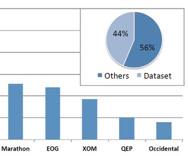
Geoscientific Data Adds Value in Unconventional Reservoirs: Statistically Quantified
Fernando Alvarado Blohm
A dataset of 25 metrics collected from the annual investment reports of 9 public operators in the Bakken Formation is used for statistical analysis of the value of geoscientific data. According to results of this analysis, for each million dollars invested in the geosciences, P90 reserves increase, on average, by…
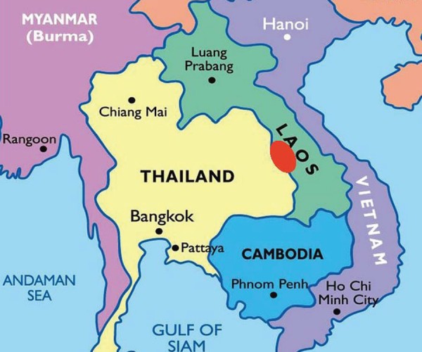
Creating Economic Independence in Southeast Asia
Kathleen Dorey
Considering the challenging times in the Canadian oil and gas industry for the geophysical profession, this article will demonstrate the successful and value-added application of geophysics by a Canadian oil and gas company in Laos, Southeast Asia. The value added by geophysics is quantified by calculation of the oil and…
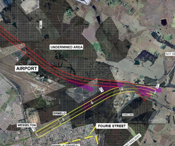
Assessing Risk to the Ermelo Ring Road from Historical Coal Undermining Using Helicopter TDEM and Ground Geophysics
Jean M. Legault, Karl C.H. Kwan, Zihao Han, Geoffrey Plastow, Robert Wilson, Pierre Roux, C.J. Stoffel Fourie
The South African National Roads Agency Ltd (SANRAL) appointed AECOM SA (PTY) Ltd (AECOM) in August 2014 to investigate the viability of constructing a proposed ring road around the town of Ermelo, in the Mpumalanga Province, South Africa. Coal mines have been operational in Ermelo since the mid-1800s, the majority…
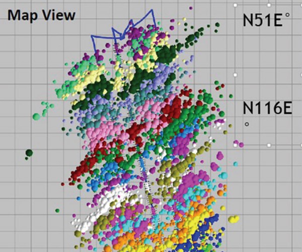
Hydraulic Fracturing Data Integration – What Should I Be Asking My Engineer and What Are They Trying to Tell Me?
Dr. Jennifer L. Miskimins
Communication between technical disciplines in the oil and gas industry is always a challenge. Different definitions, varied nomenclature, diverse cultures and backgrounds all make for challenges when working in the multidisciplinary world of petroleum extraction. This paper is an abridged version of the November 2016 Keynote Luncheon Presentation entitled “Integrating…
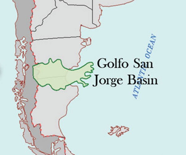
Improving Seismic Data Quality by Reprocessing and Redesign of a 3D Survey in an Area of Chaotically-scattered Source-generated Noise
Norman Cooper, Yajaira Herrera-Cooper, Eduardo Trinchero, Luis Vernengo, Raúl Stolarza
The purpose of this paper is to propose a two-fold solution to a complex noise problem in the Gulf of San Jorge Basin in Argentina. Irregularly shaped intrusive bodies scattered at shallow depths over large areas above the reservoir generate a severe signalto- noise problem that masks deeper reflection signals…

Introduction to June Focus: Western Canadian Mineral Exploration Geophysics
Jean M. Legault and Oliver Kuhn
Western Canada is well known for its oil and gas sector, but the minerals sector is also an important part of the resource extraction economy. For CSEG readers not familiar with the minerals sector, a closer look will reveal many parallels with the oil and gas world: dramatic up and…
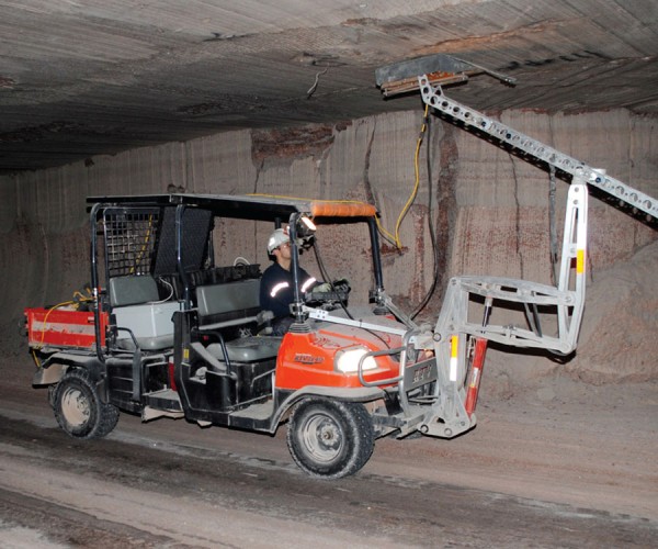
How Geoscientists are Making Potash Mines Safer
Craig Funk, Janelle Appleyard, Jennifer Braun, Jodi Derkach
Within the vicinity of Saskatoon, Saskatchewan, potash is conventionally mined by three operating companies at five different mines. Continuous boring machines (borers) cut the potash out of the seams at about one kilometer depth. The stratigraphy of the roof above the mined-out rooms (salt-beam) in the Saskatoon area mines consists of…
Geophysics on Fission Uranium’s Patterson Lake South Uranium Deposit
David Bingham
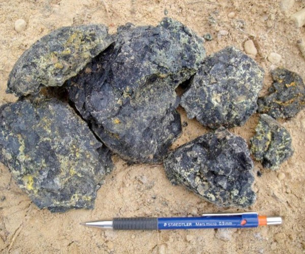
The Triple R deposit on Fission Uranium Corporation’s Patterson Lake South (PLS) property is located in Canada’s Athabasca Basin, home to the world’s richest uranium mines. The deposit is accessible by all-weather Highway 955 which continues north to the UEX-AREVA Shea Creek deposit and former AREVA Cluff Lake uranium mine.…
ORION 3D Deep Resistivity Imaging at the Phoenix Uranium Deposit
Roger Sharpe, Larry Petrie and Jimmy Stephen
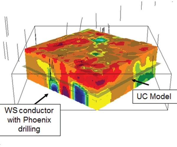
An ORION 3D DC/IP survey was conducted over the Denison Mines Phoenix Uranium Deposit at the Wheeler River Project in Northern Saskatchewan. The survey results provided 3D models that successfully delineated the known deposit at a depth of 400 m and provided an enhanced understanding of the three-dimensional geometry of…
Case Study of Mineral Deposits in the Yukon Using High Resolution Resistivity Induced Polarization Techniques
Melvyn E. Best and Isaac Fage
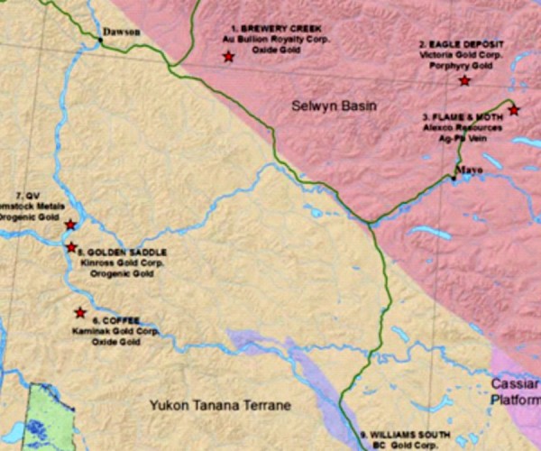
During 2013 and early 2014 a test program was carried out to evaluate a multi-electrode, High Resolution Resistivity/ Induced Polarization (HRRIP) system over 9 mineral deposits within the non-glaciated region of the Yukon. The HRRIP system was chosen over conventional resistivity/IP systems used in the mining industry for the following…

Value of Integrated Geophysics (VIG) Short List Underway
The VIG Committee
The VIG Committee is in the process of putting together an online listing, which we’re calling the VIG Short List, aimed at helping CSEG members teach others about the value of integrating geophysics into their corporate business plans. By “others”, we’re referring to engineers, geologists, upper management, investors, and other…
Marcellus & Utica Shale PSDM Case Study – Improved Structural Imaging and Rock Properties
Morgan Brown, David Waibel, Scott Schapper and Joel Starr
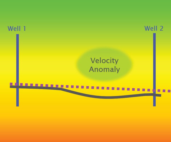
In this abstract, we highlight the performance of PreStack Depth Migration (PSDM) on an ION GeoVentures multi-client survey from northwest Pennsylvania, the GroundhogSCAN 3D.
...
Data Interpretation and Integration from a Seismic Perspective – The Excitement of Innovation
Laurie Weston Bellman
It’s a little cliché to say, but technology is changing so fast that it’s difficult to keep up. Computer storage, processing speeds and visualization capabilities continue to grow exponentially; “integration” (however difficult it is to define) is the dream of most geoscience departments and generic “big data” analysis techniques are…

Introduction To April Focus: Greenhouse Gas & Environmental Geoscience
Omid Aghaei and Ruth Peach
Advances in the environmental sciences continue to be made by Canadians on such topics as CO2 emissions reduction, solar technologies, and water investigations. These topics are the focus of this month’s RECORDER.
...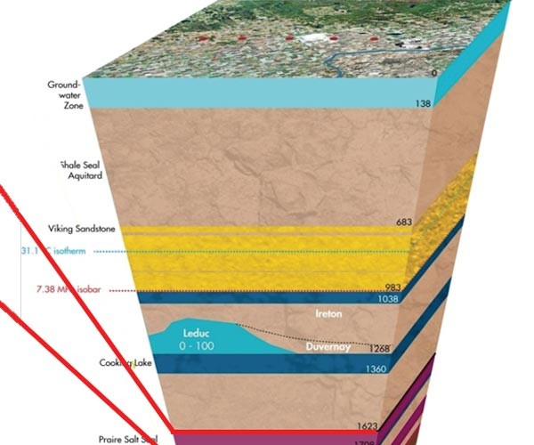
Using a Walk-away DAS Time-lapse VSP for CO2 Plume Monitoring at the Quest CCS Project
Vicente Oropeza Bacci, Simon O’Brien, Jordan Frank, Mark Anderson
hell Canada operates the Quest project, which is the first commercial scale and fully integrated carbon capture and storage (CCS) project related to the oil sands. The project is part of a joint venture between Shell Canada Energy, Chevron Canada Limited and Marathon Oil Canada Corporation. CO2 injection at Quest began…
Techno-economic Assessment of Solar Technologies in Canadian Housing Stock
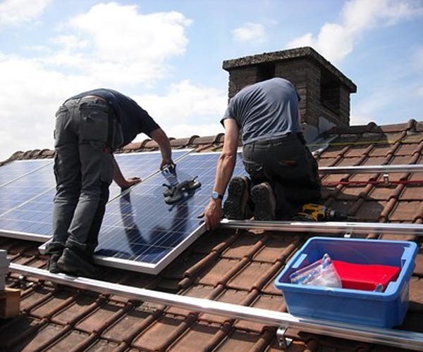
Sara Nikoofard
Being one of the least densely populated countries in the world, Canada’s rigorous climate, the energy intensive nature of the country’s industries, and the large distances between population centers result in a relatively high per capita energy consumption. In 2013, for example, Canadians consumed 7.2 tonnes of oil equivalent per…
Scanning Calgary’s ‘Water Towers’: Applications of Hydrogeophysics in Challenging Mountain Terrain
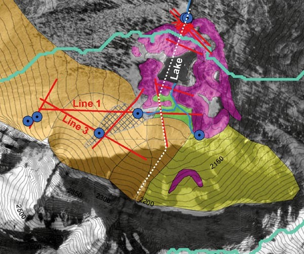
Craig W. Christensen, Masaki Hayashi, Laurence R. Bentley
Among hydrologists, mountains are popularly referred to as the “water towers of the world.” Though only covering approximately 25% of the world’s land surface, they account for anywhere between 32% (Meybeck et al. 2001) and 60% (Bandyopadhyay et al. 1997) of water flow in all rivers. Moreover, a disproportionate number…


