Articles
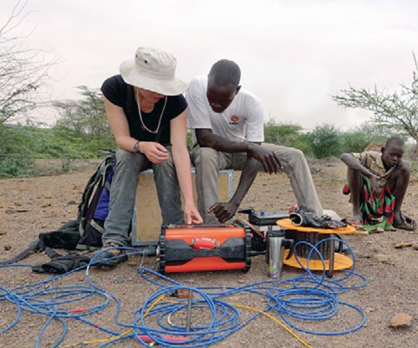
Surface Geophysical Exploration for Groundwater at the Kakuma Refugee Camp in Turkana County, Kenya
Paul Bauman, Erin Ernst, Landon Woods
The Kakuma Refugee Camp is located in the semi-arid Turkana County of Northwestern Kenya and was home to 184,966 refugees at the time of our survey. Kakuma is entirely dependent for drinking water on groundwater pumped from 12 wells. Drilling success is variable.
...
GeoConvention 2017
GeoConvention Committee
In the rapidly changing landscape of the oil and gas industry, both regionally and globally, it is more crucial than ever to share ideas about technical innovations and business strategies to help shape our future. GeoConvention 2017 will provide learning, networking, and promotional opportunities for geoscientists and executives from E&P…
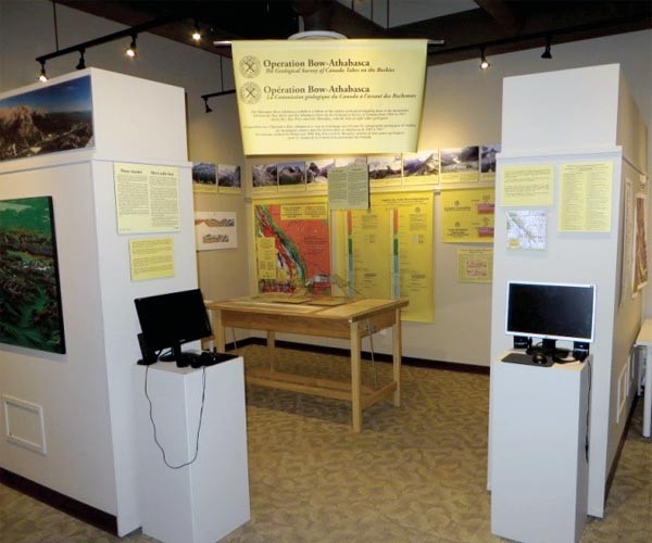
Canadian Rockies Earth Science Resource Centre
Rick Green
The Canadian Rockies Earth Science Resource Centre (CRESRC) is a new geoscience facility located in Canmore, AB created to give geoscience information about the Canadian Rockies and to do geoscience outreach and programming for students, new industry employees and the general public.
...
Sayer’s Outlook for 2017 Oil & Natural Gas Mergers & Acquisitions Activity
Alan W. Tambosso
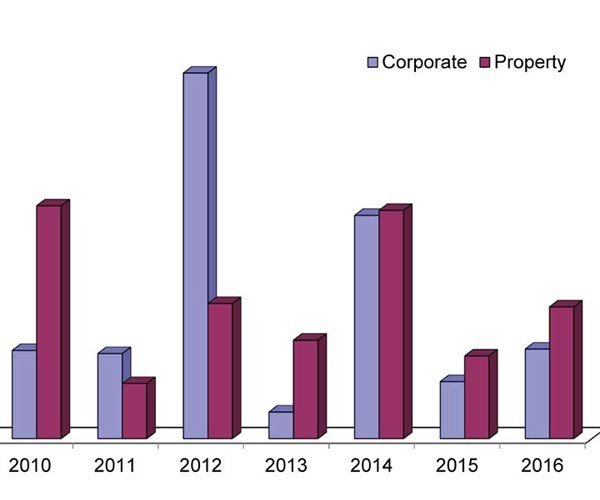
In spite of prolonged low commodity prices, 2016 turned out to be an average year for mergers and acquisitions activity (“M&A”) in the Canadian oil patch. While the nature of transactions may change somewhat, with the worst of the price onslaught apparently behind us, 2017 could end up being a…
APEGA Legislative Review: Summary of Consultations
Neda Boroumand, Rachel Newrick and Ken Mitchell
The APEGA Legislative review was an initiative that began in 2015 and was prompted by the Government of Alberta (GOA) in 2014. The objective of the review was to update the Engineering and Geoscience Professions Act (EGP Act) and General Regulation to reflect today’s industry practice and ensure that the…
Introduction To March Focus: Back to Basics
Nicole Willson
The idea for this FOCUS came from a member who replied to one of the CSEG’s member surveys concerning the RECORDER. So, thanks to that member who let us know, and who gave us the great title “Back to Basics.” Many other members also asked for technical content that was…
Datums, Projections and Coordinate Systems
Adam Thomas
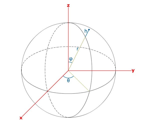
Accurately describing locations on Earth is essential to exploration geophysics. The interpretation of fault zones, the surface and bottom locations of a well, and the position and orientation of seismic ground control points and receivers are all dependent on being able to accurately describe where they are. Unfortunately the latitude…
Discovering A Supermodel – A Rock-Physics Tutorial
Carl Reine
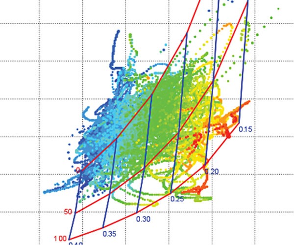
Quantitative interpretation (QI) involves making predictions of rock and fluid properties from seismic amplitudes. Within the QI workflow, a number of components can greatly benefit from rock physics, which itself is an incredibly diverse field. Rock physics covers the measurement of rock properties in the lab, the empirical and theoretical…

Knowledge True and False: Scientific Logic and Climate Change
Henry Lyatsky
This scientific “truth” was drilled into me, a young geology undergrad in Calgary, by esteemed professors in basic courses at the beginning of the 1980s. In the 1970s the media were abuzz with global-cooling scares. Cooling was supposedly a scientific fact. Thankfully, the old fears of an impending new ice…
Marcellus/Utica Shale PSDM Case Study – Improved Structural Imaging and Rock Properties
Morgan Brown
In this presentation, we highlight the performance of PreStack Depth Migration (PSDM) on an ION GeoVentures multiclient survey from northwest Pennsylvania, the GroundhogSCAN 3D.
...
Two Workflows for Image-Based Near-Surface Modeling for Statics Corrections and for Circumventing Velocity Uncertainty in Subsurface Imaging of Complex Structures
Öz Yilmaz
In exploration seismology, the most common type of the near-surface is defined as the depth interval below the topography, composed of a low-velocity, unconsolidated, heterogeneous soil column and weathered rock layer. As such, raypaths are close to vertical incidence within the near-surface – a requirement for statics corrections to be…

Introduction To January Focus: Geostatistics. Big Data. Analytics.
Neda Boroumand
The branch of statistics, “Geostatistics”, the term “Big Data” and the scientific process of “Analytics” have been around for a while. However, their application on data acquired for subsurface evaluation and resource development is becoming increasingly important. The present day Geophysicist/ Geoscientist is having to make sense of more and…
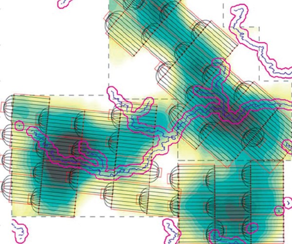
Incorporating Big Data in Geostatistical Modeling for Making Bigger Decisions in the Face of Even Bigger Uncertainty
Jeff B. Boisvert and Clayton V. Deutsch
The main purpose of generating geostatistical models of reservoir properties is to use them to calculate quantities of hydrocarbons or make decisions on how/if to produce the resource. In today’s data rich environment there is increasing data available for building these models; however, it is often difficult to convert this…
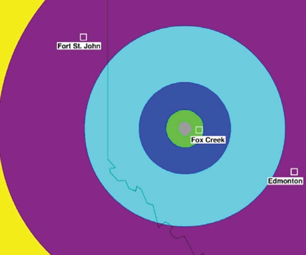
Data Analysis of Induced Seismicity in Western Canada
Hoda Rashedi and Alireza Babaie Mahani
Due to the recent increase in the rate of seismicity in western Canada and central eastern US from oil and gas activities, there is a high demand for data from seismographic networks to understand ground motion variability and assessment of seismic hazard to the critical infrastructure. In western Canada, efforts…

Discussion: Let Geologists Do the Geology!
Robert Pickering
If the seismic tool is intrinsically unaware of geology, why do we depend so heavily on the seismic tool to provide geological answers?
The seismic tool, sonic tool, and the check-shot survey are tools designed to record interval transit times. Geologists do geology. Geology is an observational process from which…
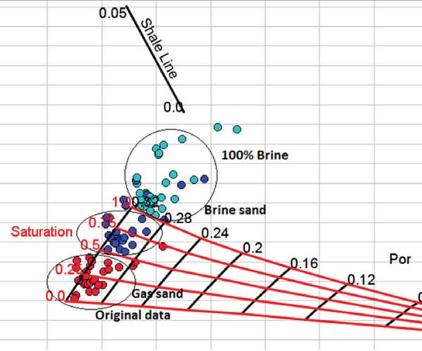
Rock Physics Template (RPT) Technology for Reservoir Characterization and 4D Seismic Monitoring
Albert Kabanda
This paper describes the use of Rock Physics Templates (Avseth et al. 2005) in both reservoir characterization and 4D seismic reservoir monitoring. A major challenge in seismic exploration is the mapping of type, location and extent of hydrocarbon fluids. During reservoir production monitoring, the aim is to follow the temporal…
Three Years of Doing ISM in Western Canada: What Have We Learned?
Dario Baturan
Earthquakes can be induced by human activities such as mining, reservoir or dam impoundment, geothermal reservoir stimulation, wastewater injection, hydraulic fracturing or CO2 sequestration. Such events are predominantly small in magnitude, and are rarely felt locally or detected regionally. However, 16 induced earthquakes of magnitude M3.5 or larger have been recorded…

Introduction to December Focus: Microseismic User Group
Paige Mamer
The Microseismic User Group (MUG) has been active for nearly five years, providing an avenue for those interested in learning more about microseismic topics in an open and educational setting. Since its inception, MUG has brought together geoscientists, engineers and microseismic enthusiasts from oil and gas operating companies, service companies,…

An Analytical Approach to Hydraulic Fracturing and Induced Seismicity Monitoring
John L. J. Duhault
The public’s fears about hydraulic fracturing and subsequent potential for induced seismicity are a growing concern, even in tried and true oil fields of Alberta. The stakeholders need to be shown that a well thought out approach to understanding hydraulic fracturing and potential induced seismicity can be done following a…


