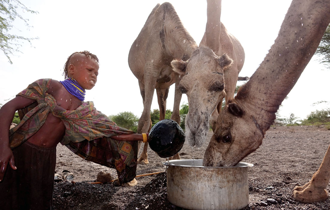
The Kakuma Refugee Camp is located in the semi-arid Turkana County of Northwestern Kenya. The Camp was home to 184,966 refugees (reliefweb, 11 Jan, 2016) at the time of our survey. Kakuma is entirely dependent for drinking water on groundwater pumped from 12 wells. Drilling success is variable. Usually, successful wells with significant yields (> 5 m3/hour) are completed in close proximity to the Laga Tarach river bed. As one moves further from the ephemeral river, drilling success is sporadic with dry holes and brackish groundwater being common. High naturally occurring fluoride concentrations occur in all wells. From January 10 through January 22, 2016, a geophysical water exploration program primarily funded by the Society of Exploration Geophysicists (SEG) Geoscientists Without Borders Program (GWB) was carried out in the Kakuma Refugee Camp and nearby areas. The overall goals of this program included providing drilling targets for new water wells, introducing an improved geophysical approach to water exploration, training of refugees and Kakuma WASH (Water, Sanitation, and Hygiene) staff, and adding to the knowledge of the hydrogeology of the area.
ERT (electrical resistivity tomography) was used to differentiate granular overburden from clay, weathered rock from fractured rock, fresh water from saline water, and to delineate faults. Seismic refraction clearly delineated the top of rock. The combination of ERT and seismic refraction are a vast improvement over the typically run one dimensional (1-D) vertical electrical soundings (VES) which assume perfectly flat lying geology. Nevertheless, confident identification of high production, low salinity and low fluoride aquifers is challenging. The results of this program revealed the geology and hydrogeology of Kakuma and Kalobeyei to be far more complex than previously believed. Nevertheless, in May 2016, two months after the completion of the geophysical program, three high yielding wells testing at sustainable yields of 29 m3/hr, 40 m3/hr, and 45 m3/hr were drilled and completed in what we have termed the Northern Well Field. Given UNHCR’s (United Nations High Commissioner for Refugees) practice of pumping wells for 10 hours per day, with a target water supply of 20 litres per person per day, these first three wells can provide water to 57,000 refugees. Water chemistry analysed from the only one of these wells drilled directly on a geophysical section indicates low salinity and a low fluoride concentration.
Generally, water exploration methods in East Africa have changed little since the 1960s. This program demonstrates that modern approaches can result in significantly improved water well drilling success rates, improved water quality, and a dramatically improved overall understanding of the geology and hydrogeology of a given area.
Introduction to Kakuma and Kalobeyei
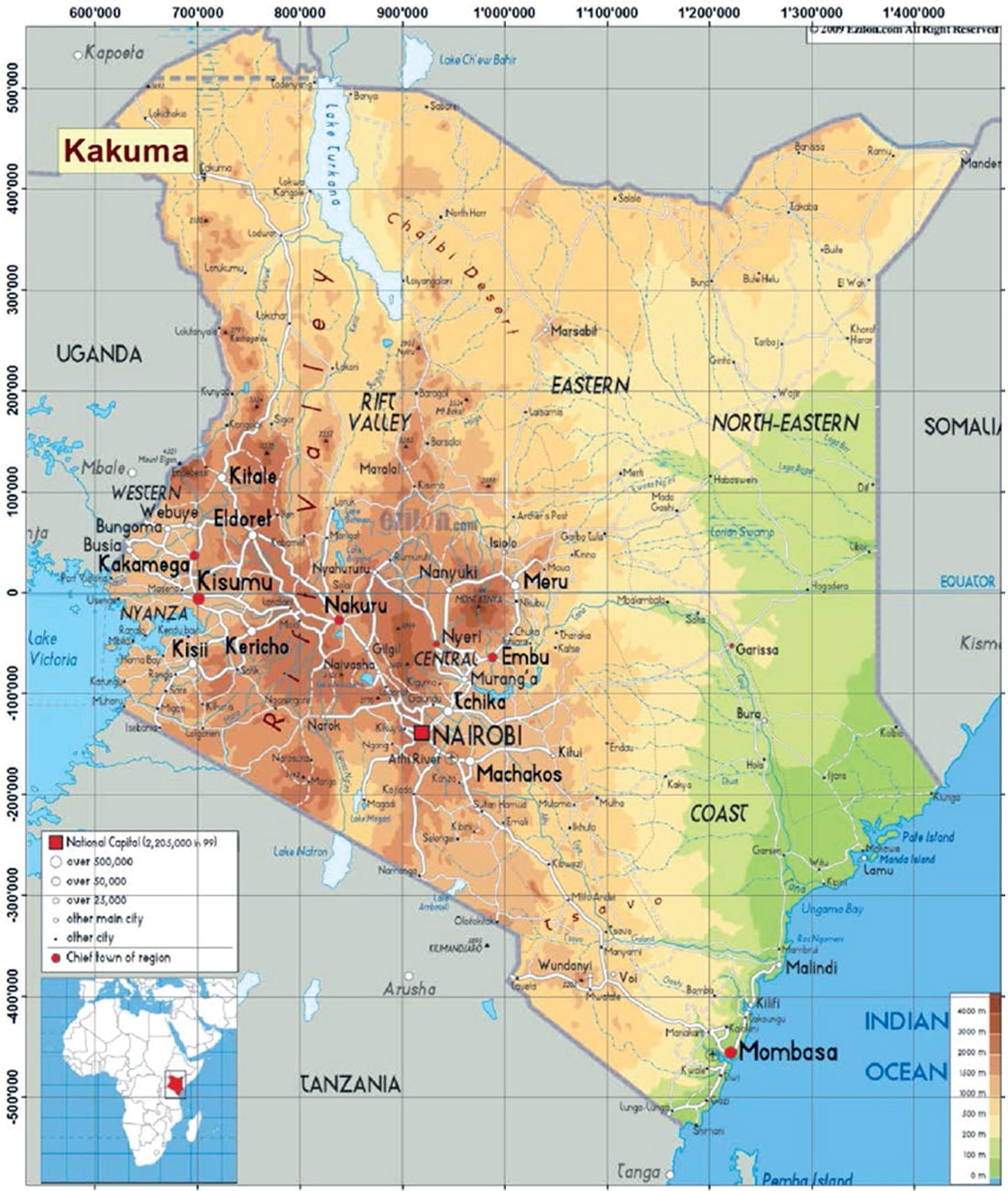
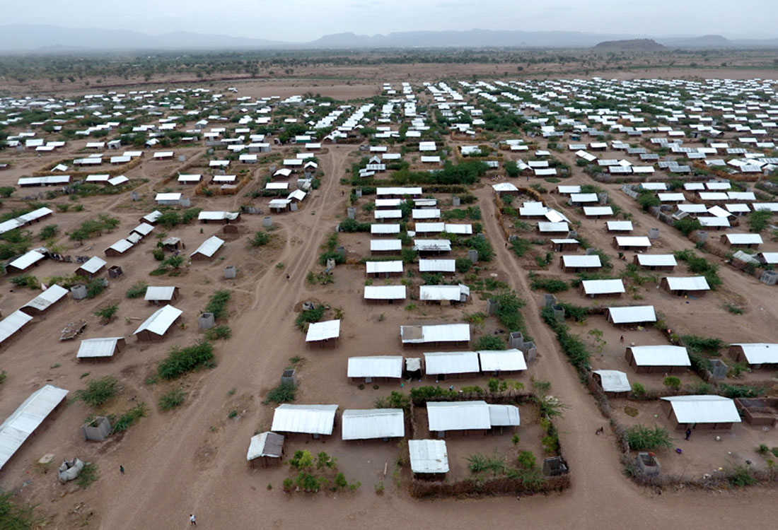
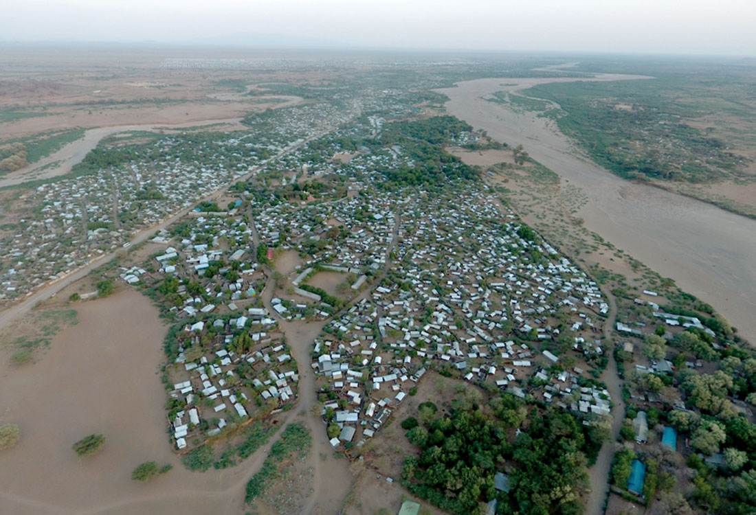
The Kakuma Refugee Camp is located in the Turkana Desert of northwestern Kenya (Figure 1), at an elevation of approximately 600 m above mean sea level (amsl). The Camp is jointly managed by the Office of the United Nations High Commissioner for Refugees (UNHCR) and the Kenyan Government. The Camp was originally opened in 1992 to receive the “Lost Boys of Sudan,” who were refugees from the Second Sudanese Civil War, which ended in 2005. The plight and flight of the Lost Boys of Sudan has been the subject of many popular books and movies including "What is the What", by Dave Eggers, and "The Good Lie", starring Kakuma refugees and with Reese Witherspoon. The Camp (Figure 2), which presently provides asylum to about 163,000 refugees (Data.UNHCR.org) from about 16 countries in East Africa, was designed for a maximum Camp population of 100,000. After the declaration of a new state in South Sudan in 2013, it was hoped that the Sudanese population of the Camp would be repatriated. However, ensuing conflict in South Sudan resulted in more than 46,000 Nuer and Dinka refugees coming to Kakuma since December, 2013. As well, the Camp continues to host refugees from other countries who are fleeing from famine, drought, “cattle wars,” political turmoil, and other conflicts in East Africa.
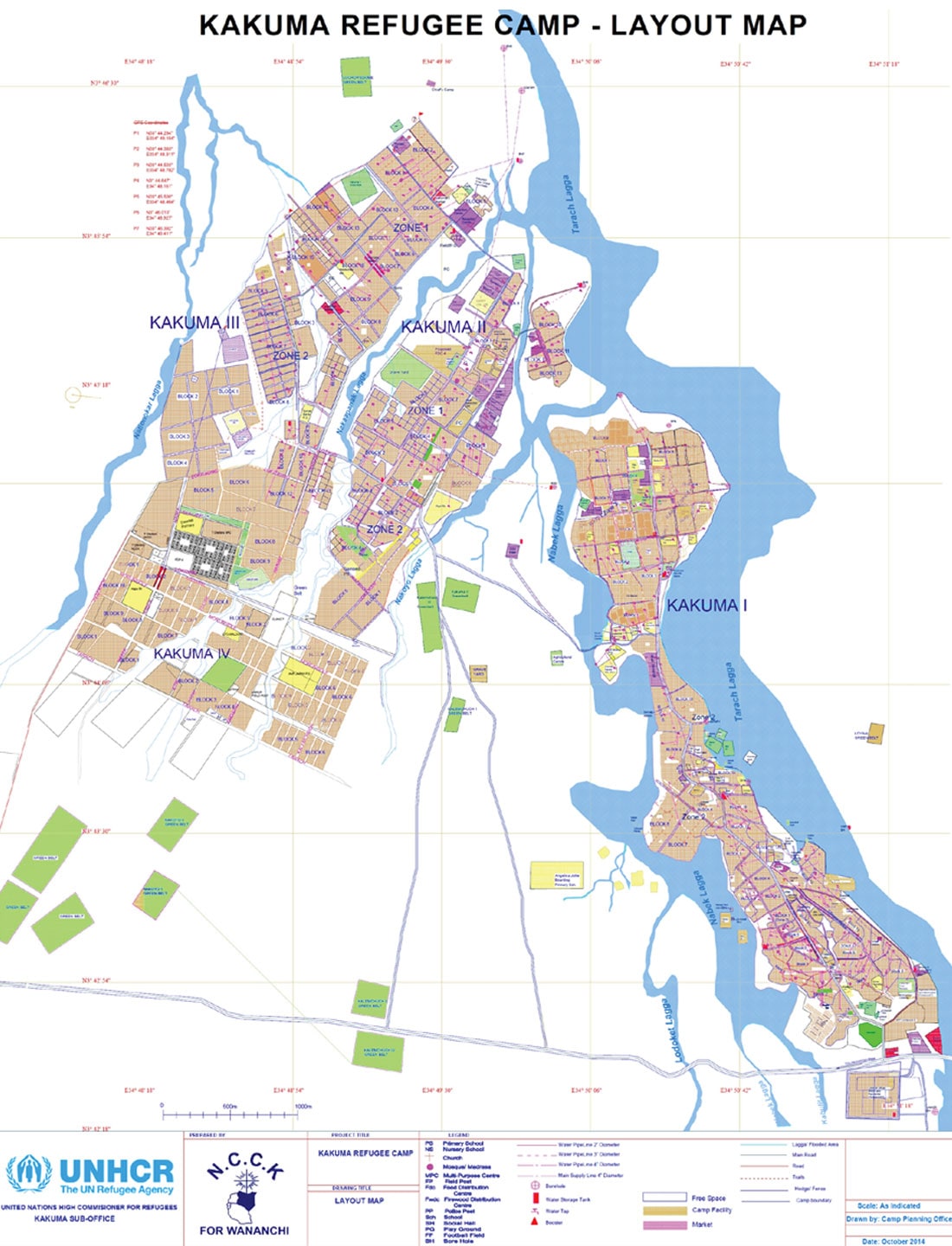
The Camp is divided into four residential sections (Figure 3), with Kakuma 1 being the original area where the Lost Boys settled, and Kakuma 4 being the living area of the most recent arrivals. As of January 2016, UNHCR was preparing to receive an additional 60,000 refugees (UNHCR.org/ke), more than doubling the initial design capacity of the Camp. The plan is for many of these new arrivals to live in a newly constructed Camp about 20 kilometres west of Kakuma, called Kalobeyei (Figure 4). Kalobeyei will be unique among presently operating UNHCR camps in that residents will be encouraged to practice agriculture rather than to simply rely on UNHCR rations. In addition, significant interaction with the host community (i.e. the semi-nomadic Turkana) will be facilitated rather than avoided.
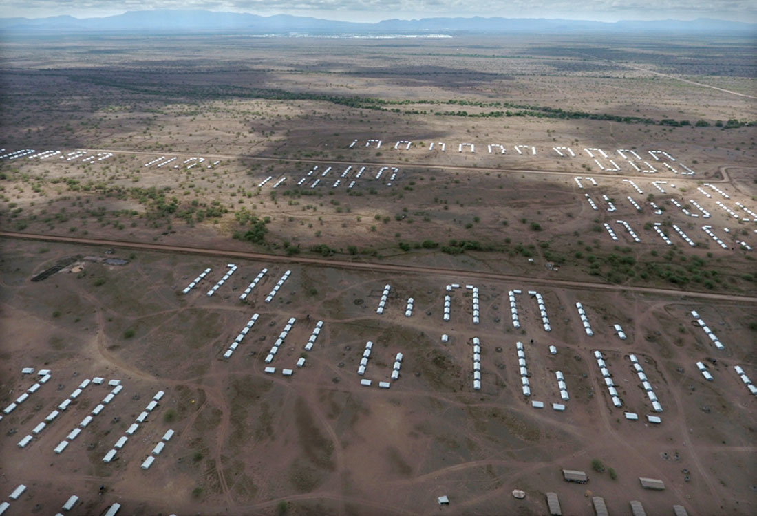
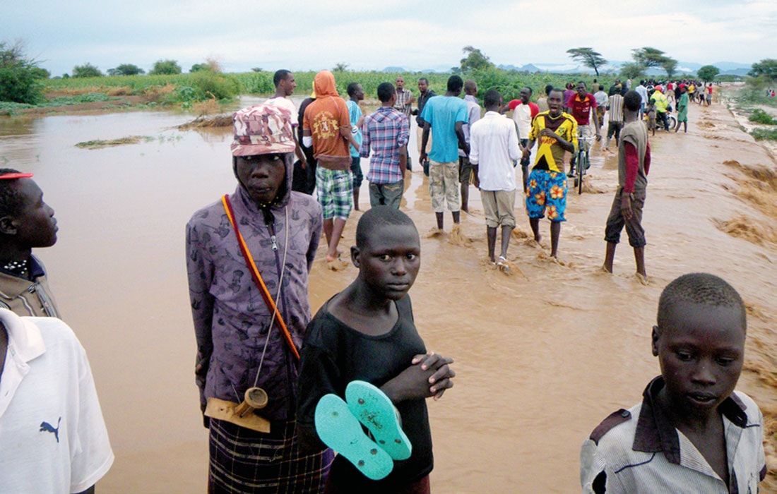
Turkana County is Kenya’s largest county, with an area of about 71,598 km2, and a population of 855,399 (2009), both statistics being very similar to those of the Canadian Province of New Brunswick. The climate and landscape of Kakuma is semi-arid, essentially desert (Figure 5). The average annual temperature in Kakuma is 28°C, with temperatures very rarely dropping below 21°C. Annual precipitation averages 32 cm, the same as Calgary’s average yearly rainfall (Global News, 2016). Most precipitation in Kakuma falls as a few intense rain events in April and November (Figure 6).
Geological and Hydrogeological Setting
Kakuma is located in the northwestern extent of the Kenyan Rift. The Kenyan Rift is the eastern branch of a much larger feature, the East African Rift System. The most pronounced geographic feature of the Kenyan Rift is the broad valley of the Turkana depression and Lake Turkana lying on the axis of the Kenyan Rift (Morley et al. 1999).
The area around Kakuma is called the Lotikipi Plains. Sottas (2013) describes the Lotikipi Plains as a saucer-shaped depression bordered to the east and west by volcanic ranges. The “saucer” itself is filled with volcanic derived, fluvial sediments from Middle Miocene (5.5 Ma) to present, reaching a maximum thickness of 300 m. Underlying the sediments are Middle to Early Miocene (5.5 23.7 Ma) rhyolites, then Oligocene age (23.7–36.6 Ma) basalts underlain by sub-volcanic sedimentary rocks of Paleocene to Cretaceous age (57.8–144 Ma), and finally Precambrian basement consisting mainly of gneisses and schists. The Lotikipi Basin is heavily faulted in a horst and graben structure.
As the Kakuma Refugee Camp is on the southern edge of the Lotikipi Basin, numerous rhyolite outcrops occur in the exploration area. Available drilling data indicate that the sediment overburden in Kakuma reaches a maximum of approximately 40 m in thickness. Generally, underlying the overburden, various drilling campaigns encountered volcanic rock, though sedimentary and igneous rock has also been encountered. The possible interfingering of volcanic rock and unconsolidated sediment require that one use the term “bedrock” with caution.
Presently, groundwater is the only available water source for the Kakuma Refugee Camp and the surrounding area. The vast majority of successful water wells drilled in Turkana County are located along the lagas (wadis, UNICEF 2006). Kakuma is no exception, as the estimated 15 wells that are presently pumping are all located in, or in close proximity to Laga Tarach (Figure 7), which flows perhaps a few days each year. Sottas (2013), as well as available drilling data, suggests that both the overlying sediments and underlying, weathered (or fractured) rock serve as aquifers. The common practice of screening (i.e. installing slotted pipe for water intake and filtering sediment) over multiple aquifers (rather than the preferred practice of screening a single aquifer), and interconnecting screened intervals with permeable backfill material, make it very difficult to determine the relative contribution of the bedrock aquifer versus the overburden sediment aquifer. In addition, drilling information from abandoned boreholes is rarely archived, and information that is archived is often confusing or contradictory. Sottas concluded that most boreholes draw from both the volcanic rock and overburden alluvial aquifers.
The shallow, alluvial aquifer is generally associated with higher yields and greater storage, with lower fluoride concentrations, but with greater vulnerability to bacterial contamination. The deeper volcanic rock aquifer is associated with lower yields, high naturally occurring fluoride concentrations, and lower vulnerability to bacterial contamination. Many water wells in the area are brackish. Increasing salinity in water wells has been observed during prolonged periods of drought (UNHCR, personal communication). As no borehole geophysical information is available, and a general practice in East Africa is the screening of any and all zones of water production, more confident and detailed descriptions of the water quality of the individual aquifer systems is challenging.
The main geochemical constraints on water potability are elevated salinities and elevated fluoride concentrations. Elevated fluoride concentrations in groundwater are common in rift valley environments (Essentials of Medical Geology, 2005). Sottas concluded that the high concentrations of fluoride are likely associated with the weathered volcanic rock aquifer system. Of the 15 Kakuma pumping wells tested in July of 2016, fluoride concentrations ranged from 1.5 mg/l to 8.4 mg/l. Milnes (UNHCR, personal communication) has observed that fluoride concentrations often rise with increasing salinity. Milnes has suggested that where both the alluvial and volcanic aquifers are screened (i.e., producing water), dropping water levels in the alluvial aquifer, and an increasing contribution from the volcanic aquifer will result in an increasing fluoride and salt concentration.
Aquifer recharge at the Kakuma Refugee Camp is likely associated with direct recharge from Wadi Tarach during flooding events (i.e. the laga fills in flash floods, and aquifers are recharged from the lagas). Rainwater acts as a secondary but direct source of recharge.
Very little area specific information is available regarding our Kalobeyei exploration area, located 30 km to the west of Kakuma. The report Hydrogeological and Geophysical Investigations, Kalobeyei (2015) describes the geology and hydrogeology of the Kalobeyei area as being very similar to Kakuma, with clayey alluvium overlying Tertiary lavas, with sand lenses being present in proximity to the major lagas. Gicheruh suspected that weathered rhyolites underlay most areas of alluvium. Underlying the Tertiary, rhyolitic lavas, are interbedded basalts and sedimentary rocks, and Precambrian basement.
1-D resistivity soundings and water “witching” have been used extensively in Turkana County (Oxfam Gb, 2009), including in the Kakuma Refugee Camp and in Kalobeyei (Gicheruh, 2015), as part of earlier and ongoing water exploration programs. The nature of the Rift Valley geology, as well as the results presented here, indicate the geology and hydrogeology are far too complex and variable to be addressed by 1 D geoelectrical methods. Past efforts by other researchers to use ERT (Sottas, 2013) in Kakuma had concluded that the results were uninterpretable. In reviewing previously collected resistivity sections, we concluded that collecting companion seismic refraction data would likely provide unambiguous delineation of the top of rock. The interpretation of earlier resistivity surveys likely suffered from an ambiguity of an electrical properties contrast between overburden lithologies and underlying volcanic rock exhibiting various degrees of weathering. Additionally, given what we now know, earlier surveys failed to investigate deep enough and over enough line length to recognize variability within both the bedrock and the overburden, that is, to see the proverbial “forest through the trees.” Despite shortcomings of previous 1-D and two-dimensional (2-D) geoelectrical surveys, this program tremendously benefitted from results compiled in available reports and studies.
Both past and these current surface geophysical surveys were handicapped by a complete absence of borehole geophysical data. Borehole geophysical data has been of great value in previous geoelectrical water exploration programs in East Africa (Kellett and Bauman, 2004). Unlike most of East Africa, existing water wells in Kakuma were completed with steel casings, eliminating the possibility of carrying out borehole induction conductivity logging.
Field Methods
ERT is a technique for mapping the distribution of subsurface electrical resistivity in cross-section (Figure 8). The main objectives of the ERT survey were to identify resistive, fresh water saturated sands and gravels. Resistivity data are collected through a linear array of electrodes coupled to a direct current (DC) resistivity transmitter and receiver, and an electronic switching box. The spacing between electrodes largely controls the horizontal and vertical resolution of the data (smaller spacing results in higher horizontal and vertical resolution). Similarly, the length of the array controls the depth of investigation (longer arrays yield greater investigation depths). Data collection is carried out in a sequential and automated fashion that takes advantage of all possible combinations of current injection and potential measurement electrodes. Data were modeled as 2-D geoelectric sections with 2-D finite difference or finite element inversion software (Loke and Barker, 1996). In this program, electrode spacings varied from 5 m to 10 m, with corresponding depths of investigation varying from 70 metres below ground surface (mbgs) to 140 mbgs. Line lengths varied from 400 m to 1600 m. 16 ERT sections were collected for a total of 11.4 km of line. The Schlumberger gradient array was used for current injection and voltage measurements as this array is a good compromise of optimizing both horizontal and vertical resolution, and can take advantage of the multichannel ABEM LS receiver.
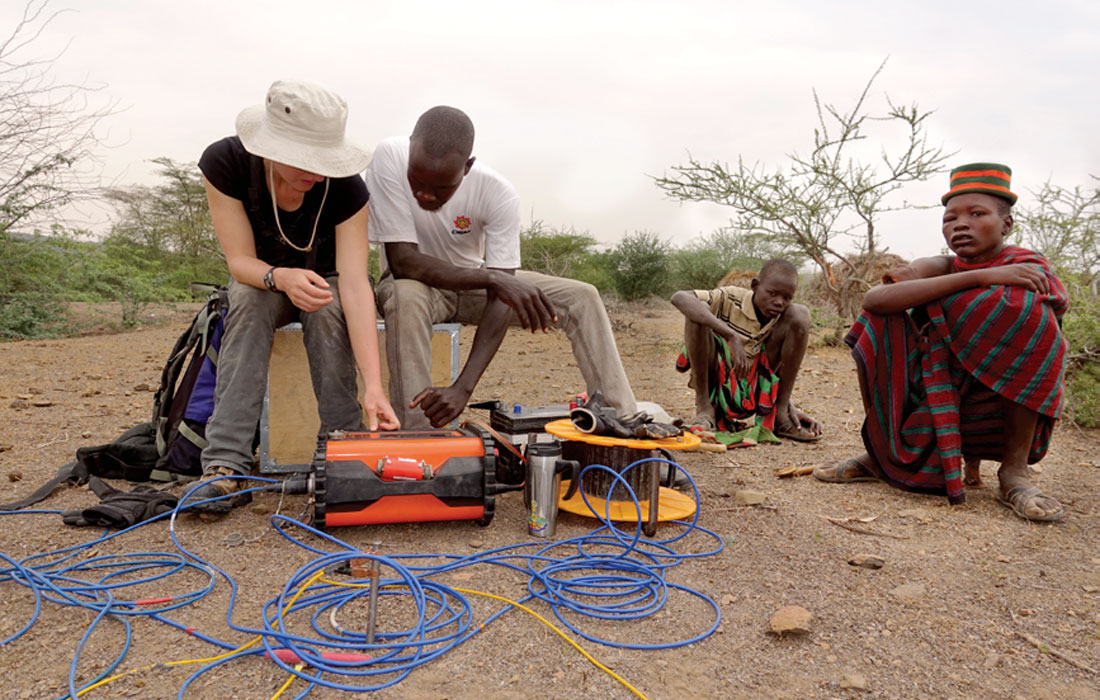
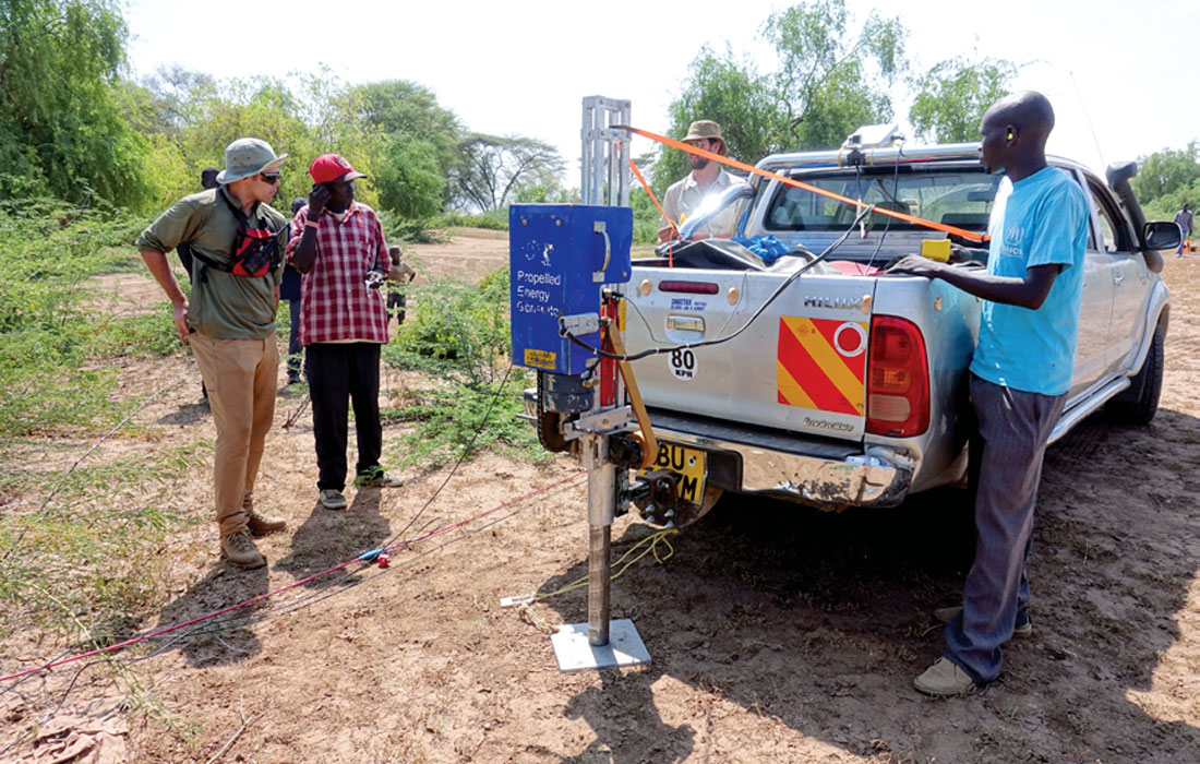
The main objective of the seismic refraction survey was to confidently delineate the top of rock, as even weathered volcanic rock will typically have significantly faster compressional wave (P-wave) velocity than overburden materials. The seismic refraction survey mainly utilized an elastic weight drop with a 40 kg beam (PEG-40) as a compressional wave source (Figure 9), though a 16 pound sledge hammer was used in areas without vehicle access. All lines were shot with 40 Hz vertical component geophones, with a single geophone in each group, and with a 5 m geophone spacing. Geometrics Geode 24-channel networked seismographs were used for all surveys. Most lines were shot with 144 channels (6 networked seismographs), though some lines used fewer channels due to space constraints. Ten seismic refraction lines were collected for a total of 5.8 km of line length. Individual sections ranged in length from 355 m to 720 m. The P-wave velocity models were solved using seismic inversion software.
Field Surveys
The geophysical field program was executed over the period from January 10 through January 22, 2016. Field work was carried out by ERT and seismic refraction crews working simultaneously, usually in different areas separated by several kilometres. All positioning was carried out with Trimble Geo7X Handheld GPS units and a base station.
For organizational purposes of discussion, the investigation areas have been grouped into five arbitrarily named areas (Figures 10 and 11):
- Laga Tarach South;
- Northern Well Field;
- Central Well Field;
- West of Kakuma 1; and
- Kalobeyei.
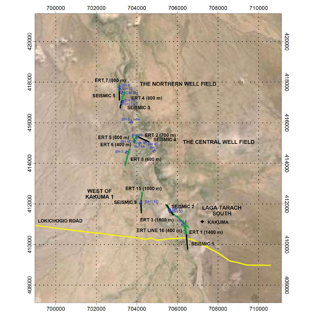
Laga Tarach South is an area with some borehole control, has wells of variable yield and water quality, and is in, or close to the main channel of Laga Tarach. Laga Tarach South is immediately south and east of the longest inhabited (since 1992) portion of Kakuma 1. Survey objectives here included overall testing of the survey approach, and locating potential drilling sites with possible superior yields and lower fluoride concentrations, as compared to existing wells.
The Northern Well Field is the area of the highest yielding wells, has some borehole control, and is also close to Laga Tarach, which likely functions as the primary source of groundwater recharge (Sottas, 2013). The Northern Well Field is of particular interest as its location makes it a possible source of water for both Kalobeyei and Kakuma, as well as for local Turkana villages and family compounds in the immediate surroundings. Survey objectives here included locating potential drilling sites with possible superior yields and lower fluoride concentrations as compared to existing wells.
The Central Well Field is approximately midway between Laga Tarach South and The Northern Well Field, and is also in close proximity to Laga Tarach. There are a number of wells in this area; however, well control is poor as most wells are hand dug or have very limited accompanying geological and hydrogeological descriptions. The Central Well Field is on the northern edge of densely populated Kakuma 1. Survey objectives here included locating potential drilling sites with superior yields.
The area West of Kakuma 1 has no producing water wells. However, numerous abandoned wells have been drilled in this area, including the “Kakuma 1 VES 1 Borehole” which tested at 110 m3/hr, though with elevated salinity and a very high fluoride concentration. Limited geologic control exists in this area due to an absence of available archived information. The high tested yield from the noted borehole makes this an interesting area for exploration. Also, as there are no producing wells in this area, a successful water well in the area West of Kakuma 1 would bring a water source considerably closer to the settlements of Kakuma 3 and 4, and possibly avoid water delivery disruptions during flooding in the lagas. (Buried pipelines are often damaged by flood waters.)
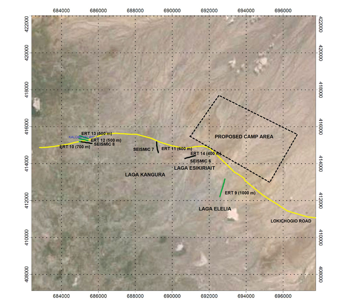
The Kalobeyei area has only a single producing water well which has been tested at 5 m3/hr. The surficial geology appears considerably different in the Kalobeyei exploration area as compared to Kakuma, as in Kalobeyei there is considerable rock outcrop, and the nearby lagas are much smaller than Laga Tarach. Exploration in the Kalobeyei area occurred in proximity to the existing Kalobeyei borehole, and in three small lagas near the proposed new Kalobeyei Refugee Camp, lagas Elelia, Esikiriait, and Kangura.
Field Based Physical Properties Observations
Though limited, all available borehole data were used for correlation purposes. Water chemistry information is of uncertain value, as most existing water wells are screened across multiple zones, spanning both overburden and bedrock aquifers. No borehole geophysical logs exist. Interpretations of physical properties were made through a combination of well ties to the resistivity and P-wave velocity sections, and some interpretive assumptions of measured physical properties. Physical property interpretations included:
- depth to competent bedrock, as derived from the P-wave refraction results, generally correlates with the 2000 m/s velocity contour;
- the delineation of more massive bedrock with lower groundwater yield potential, is based on relatively higher bedrock resistivities (greater than approximately 60 ohm-m);
- the delineation of fractured to highly weathered bedrock with higher groundwater yield potential, is based on relatively lower bedrock resistivities (less than approximately 60 ohm-m);
- saline and/or clay overburden, is based on very low resistivities (less than approximately 10 ohm-m);
- fresh water saturated or partially saturated granular overburden is interpreted as being between approximately 30 ohm-m and 100 ohm-m;
- saturated overburden, with a significant percentage of clays or elevated salinity, is between 10 and 20 ohm-m;
- saturated saprolite (very highly weathered bedrock) is between 10 ohm-m and 30 ohm-m; and
- granular, dry overburden is greater than 100 ohm-m.
Field Results and Interpretations by Investigation Area
On its most practical level, this geophysical program was designed to site new water wells. As such, a table of possible drilling targets in each of the five investigation areas was delivered to UNHCR as part of the project reporting. This table included the investigation area, the referenced geophysical surveys, georeferenced coordinates (in both UTM and latitude/longitude), and the interpreted nature of the targeted aquifers. This latter category included thick, saturated, granular alluvial overburden; weathered volcanic rocks; fault blocks; and fractured rock in proximity to faults. As well, zones of high salinity, thick clays, unsaturated overburden, massive bedrock, very shallow bedrock, and intensively weathered volcanics were noted as to be avoided.
In Laga Tarach South, potential aquifers included areas of thicker overburden and weathered rock. Of note is that the original UNHCR Borehole drilled in this area is the only Kakuma well screened entirely in bedrock. The fluoride concentration in the UNHCR Borehole is 8 mg/l (UNHCR, 2014), more than five times the World Health Organization (WHO) and Kenyan drinking water guideline, and greater than the 4 mg/l concentration above which skeletal fluorosis is believed to occur (Essentials of Medical Geology, 2005).
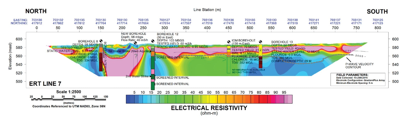
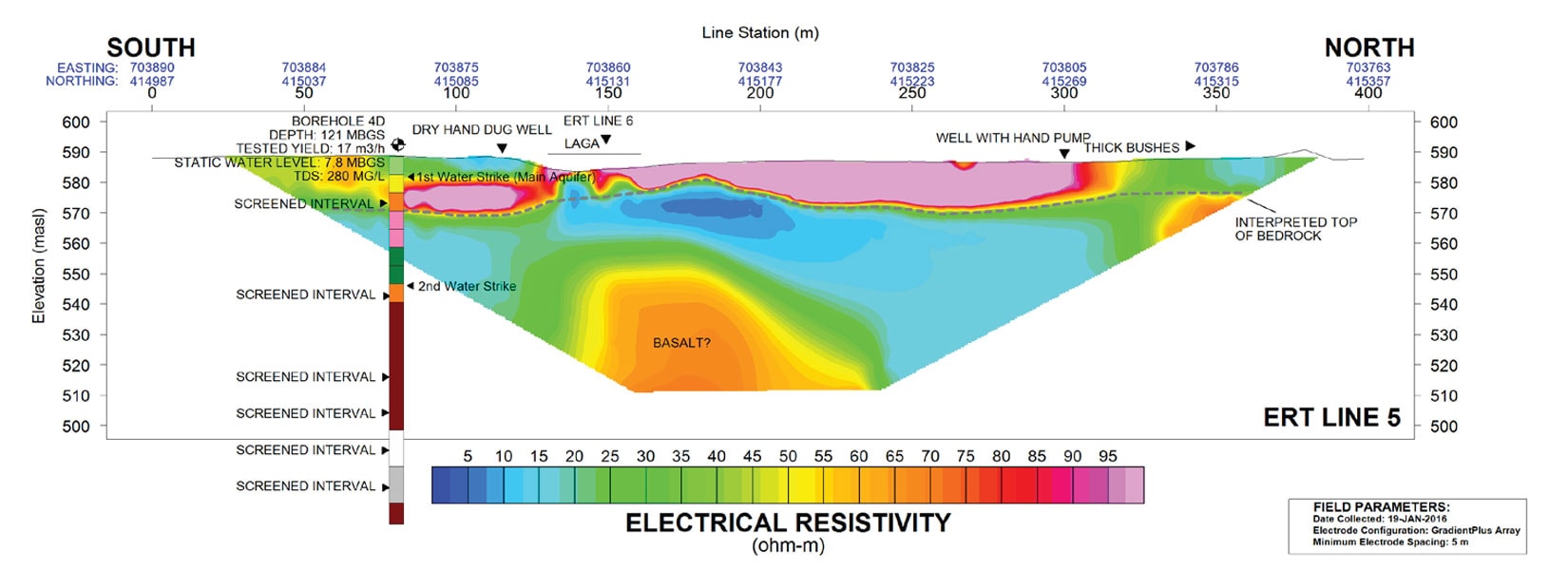
In the Northern Well Field, resistivity and P-wave velocity sections, supported by ties to existing water wells, clearly delineated thick, laterally extensive, saturated sands and gravels (Figure 12). Extensive zones of weathered bedrock were also interpreted. However, the extensive granular aquifer, as well as the close proximity of the Northern Well Field to Laga Tarach, a source of secondary recharge, elevated this area as being highly prospective for further exploration and development.
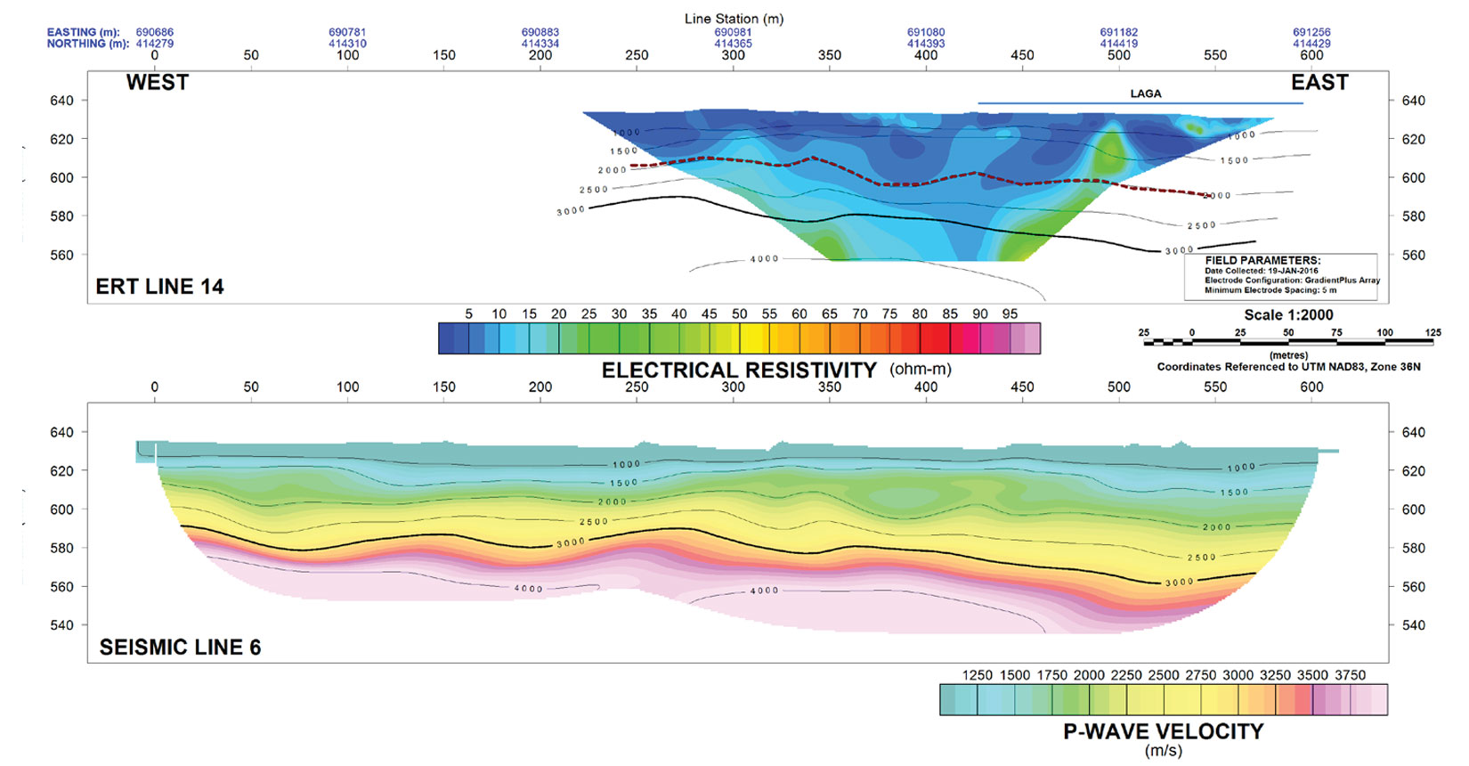
The hydrostratigraphy of the Central Well Field is difficult to confidently determine as all existing water wells are either poorly documented, or are screened across multiple zones, spanning overburden and bedrock. Zones of thick, saturated granular material are present (Figure 13), along with extensive zones of likely weathered volcanics. The possibility of increasing the groundwater yields of numerous hand dug wells in this area is likely very limited due to a geophysically interpreted underlying, shallow aquitard.
The survey area West of Kakuma 1 is highly prospective for high groundwater yields. At 90 mbgs, P wave velocities indicate that competent rock is deeper here than anywhere else in either Kakuma or Kalobeyei. While no completed wells exist in this area, drilling records of an abandoned well show tested yields of 110 m3/hr, sediments to 66 mbgs, and a contact of sedimentary rock overlying volcanics at 84 mbgs. The well was abandoned due to high salinity (4377 mg/l) and very high fluoride concentrations of 10.2 mg/l. However, drilling records indicate that elevated salinities were encountered at a depth of 78 mbgs. Carefully monitored drilling, accompanying borehole geophysical logging, and well construction specifically screening low salinity aquifers could result in a high yielding well in this strategically important area.
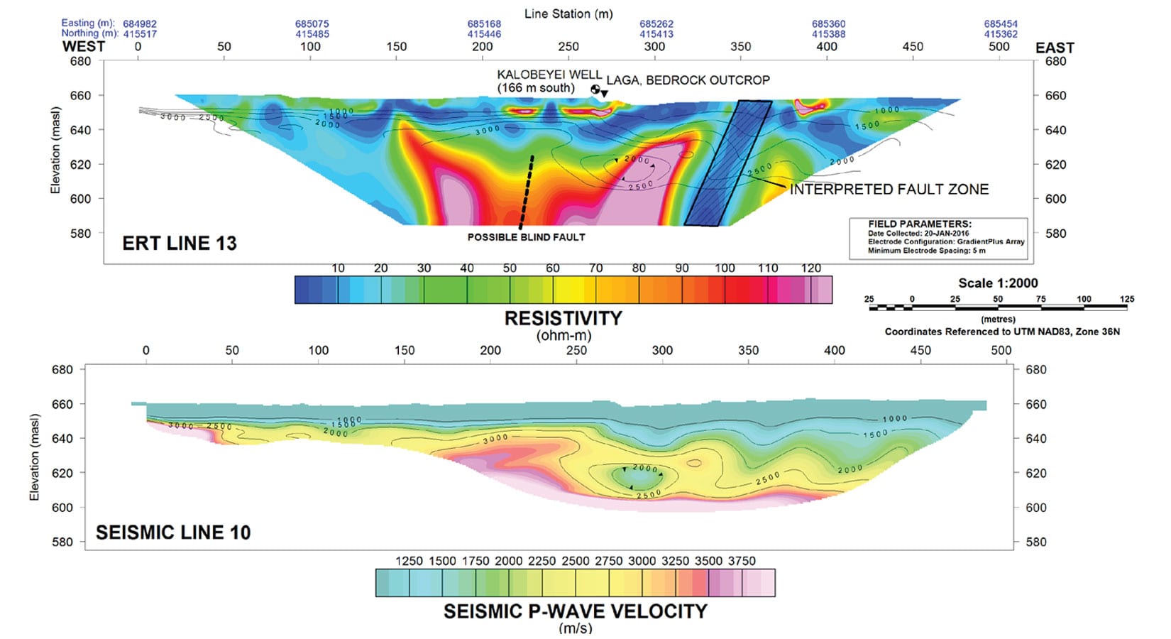
In the investigation area of Kalobeyei, in lagas Elelia and Esikiriait, the ERT and seismic refraction surveys, along with visual observation of outcrop, clearly indicate saline or clayey overburden overlying shallow bedrock (Figure 14). West of these lagas, in Laga Kangura and in proximity to the only existing well in the area (Kalobeyei Well, tested yield of 5 m3/hr from Gicheruh, 2015), four ERT sections spectacularly imaged at least two, and possibly three steeply dipping, but electrically conductive faults (Figure 15). Seismic refraction data indicate bedrock is very shallow. Drilling targets have been suggested in close proximity to the faults where rock is predicted to be fractured (Figure 16), and on the flank of the faults closest to lagas where possible fractured rock aquifers could benefit from secondary recharge during flood events.
Conclusion
Given the laterally extensive, saturated sands geophysically mapped in the Northern Well Field, the results and interpretations of this 2016 geophysical program were used to site Borehole 13 (525 m along line ERT7) in May, 2016 (UNHCR, personal communication; see Figure 12). A relatively shallow well was screened through sand to a depth of 28 m, avoiding the weathered volcanic aquifer seismically delineated at a depth of 30 m. Borehole 13 tested for a sustainable yield of 40 m3/hr, a fluid conductivity of 592 uS/cm (about 380 mg/l) and a fluoride concentration of 0.9 mg/l (well below the WHO and Kenyan drinking water guideline of 1.5 mg/l). The water chemistry from Borehole 13 strongly supports the hypothesis that elevated fluoride concentrations are largely associated with the weathered volcanic aquifer. UNHCR drilled two additional wells in the northward extension of the Northern Well Field. These two wells tested for sustainable yields of 29 m3/hr and 45 m3/hr (UNHCR 2017). As of March 2017, a 13 km pipeline will have been completed between these boreholes and the Kalobeyei refugee settlement, which will be capable of delivering approximately 1,200,000 litres of water per day to the refugees and local Turkana living there. There are currently 22,000 refugees settled in the Kalobeyei refugee settlement, with plans to expand that to 60,000 people, all of whom will be dependent on the water from these boreholes (UNHCR Operational Update 2017). This geophysical program has delineated other thick, alluvial, likely low fluoride and high productivity aquifers, with West of Kakuma 1 being the most notable.
In contrast, previous to this 2016 (UNHCR Water Well Data, February 2015) exploration program, sustainable yield tests had been carried out on 20 producing wells in Kakuma and Kalobeyei; the average tested yield of these 20 wells was 22 m3/hr. Only one of those wells tested for a yield of greater than 40 m3/hr. Also noteworthy is that many dry, brackish, low productivity, or very high fluoride concentration wells were drilled in the process of completing the existing successful wells. Besides improving the drilling success rate, the combination of electrical resistivity tomography and seismic refraction has given a much improved overall understanding of the hydrostratigraphy in both Kakuma and in the Kalobeyei area. In Kakuma, 2-D imaging is essential to interpret the rapidly changing spatial distribution of salinity, bedrock relief, interfingering volcanic and sediment contacts, and the precise lateral extent of important alluvial laga (i.e. wadi) deposits. In the newly developing Kalobeyei area, seismic refraction has shown that the area intended to house 60,000 refugees and 23,000 (UNHCR.org/ke) host community Turkana may be significantly more challenged for water resources than previously understood due to very shallow bedrock. Meanwhile, ERT surveys in Kalobeyei have identified extensive areas of high salinity, along with a number of well-defined faults that may be the most prospective drilling targets.
Improved geophysical programs will improve drilling success rates. Also of note, improved geological observations during drilling, borehole geophysical logging of PVC cased wells, screening and hydraulic isolation of selective aquifers, maximizing information from abandoned wells, improved archiving of data, reliable hydrochemical sampling, and installing dedicated monitoring wells will all greatly assist in interpreting surface geophysical data. 25 years after the Lost Boys of Sudan walked to Kenya, water exploration in such water-stressed areas, like Kakuma, would benefit by being carried out in a methodical rather than in the more haphazard manner that typically characterizes the early stages of water supply in a crisis situation. While more sophisticated exploration programs will also be more costly than 1-D vertical electric soundings and water witching, resulting improved drilling success rates can provide compensating budgetary benefits.

Acknowledgements
This program was funded largely by the Society of Exploration Geophysicists (SEG) Geoscientists Without Borders Program (GWB). UNHCR provided access to the Camp, access to their groundwater data base, and direction toward the issues of concern. Administrative and logistical support for this survey was provided by the small NGO IsraAID, whose mission statement is “…helping people all over the world overcome extreme crises….” Dr. Ellen Milnes, from UNHCR and the University of Neuchatel, provided a very helpful content review of this paper. All of the geophysical equipment and equipment repairs were provided for this program, at no cost to the program, by Paul Bauman Geophysics Ltd. The Canadian geophysicists below received no remuneration for their services, and participated in this field portion of this project during their “vacation” time. The field program was carried out by six geophysicists from Advisian WorleyParsons. Advisian WorleyParsons staff included Paul Bauman, Erin Ernst, Doug MacLean, Colin Miazga, Randy Shinduke, and Landon Woods. Franklin Koch, who was also a student intern at Advisian WorleyParsons, participated from the University of Calgary. Dr. Alastair McClymont, from Advisian WorleyParsons, assisted in planning and data processing. The field crew was staffed by 28 refugee and Turkana students from the IsraAID water and sanitation training program. The refugee and Turkana field crew received remuneration to the full extent as allowed by UNHCR’s work incentive payments.
Related Reading


Join the Conversation
Interested in starting, or contributing to a conversation about an article or issue of the RECORDER? Join our CSEG LinkedIn Group.
Share This Article