The rapid development of deep learning has prompted researchers across disciplines to consider learning-based approaches as alternatives to conventional methods. In this study, we apply a deep residual convolutional neural network to the problem of simultaneous-source deblending.
Machine learning algorithms are increasingly being used in understanding subsurface data. CSEG ‘s digital committee has approached me to start a blog initiative to showcase articles in data analysis and machine learning. Articles from groups in the subsurface industry and academia will be solicited and posted on the blog. The aim of the blog will be to give a flavor of the types of models or data flows that have been explored. A secondary aim is to provide a tutorial on various data analysis and learning methods. In this article, I will provide a broad introduction to data analysis and machine learning and discuss their potential uses in learning subsurface data.
Geology and geophysics are each different geoscientific processes that, when combined, become key components in the search for hydrocarbon resources. Geology is an observational process whilst geophysics is a digital process. Geology proactively predicts potential reservoir locations. Geophysics massages digital data to provide a platform for the geologic depth model and the supporting maps that verify the integrity of the geologic depth model. As all drilling targets are relevant to geological depth, all final depth maps must be presented in terms of geologic depth.
CGG Smart Data Solutions, like many other service providers in the E&P sector, has seen a transformation of data management from a support function to a value generator for our clients. Companies are expecting service providers to deliver solutions to enable their E&P digitalization strategies, as they move towards adopting emerging digital technologies, such as machine learning and public cloud services.
Geophysical data compliancy means only using data you are entitled to use for an implicitly defined purpose and timeframe. Geophysical / seismic data is complex, as it is an image of a defined position on the earth. That representation is multi-dimensional, multi-faceted and geographically based consisting of raw and interpretation data.
Attenuation refers to the degradation of signal strength as it decays over time, across distance, or through interference. Working out what causes attenuation takes lots of time and patience. But it’s worth the effort to solve the problem, because doing so strengthens customer trust and loyalty.
E&P companies are looking at data differently than they did in the past. The reason why they are doing this is because data drives big economical decisions including the sanctioning of a new play which is when the board decides to create a budget to buy data and land to enter a new play. E&P companies are also moving away from the Geoscientists and Engineers working as individuals on the data creating their own maps and analysis towards working together collaboratively and using a geomodel as the repository of the data across the area.
Although there is an exponential increase in data collection within oil and gas companies, access to the data for meaningful subsurface interpretation is constrained by the limited toolkits many geoscientists have at their disposal.
It’s 1965, and a new standard is being rolled out in the Canadian Petroleum industry. Designed by industry, for industry and adopted as a standard by the Canadian Petroleum Association (CPA), it became know as the CPA UWI (unique well identifier). The CPA UWI has stood the test of time for 54 years, that is a major accomplishment.
The demonstrated applications of DFOS data, coupled with the accelerating value offered by Artificial Intelligence (AI) and Machine Learning (ML) developments, DFOS acquisition platforms are capable of not only optimizing a single well and its completions design, but the entire field asset and its production as a whole. DFOS data is actively used to increase the field’s annual revenue, while simultaneously reducing completions, operations, workover and abandonment expenses.
To de-risk a frontier area properly requires establishing the geological framework, and this is where seismic data can provide important controls on the basin framework by helping to understand features such as stratigraphic thicknesses, large-scale structural features such as faults and folds, and vertical and lateral velocity variations. To help reduce the risk in unexplored environments this paper presents an approach that can be adopted to model pore pressure in deep-water settings, with Labrador as the main case study area featured, but also discussing other global examples such as the Vøring Basin, Mid-Norway.
Exploration in frontier basins is challenging; subtle targets, large seismic datasets, sparse well penetrations, and many unknowns. There is an obvious requirement for interpretations to be robust, but also delivered on a commercial timeframe.
Exploration initiatives over the past decade have led to renewed interest in exploration in the slope and deep-water regions of offshore Newfoundland and Labrador, Canada. New multi-client regional 2D seismic surveys (2011-2018), guided initially by satellite slick mapping, have provided approximately 170,000 line kms of long offset, broadband 2D seismic data, and over 22,000 km2 of long offset, broadband 3D seismic data. The data was acquired in areas where possible hydrocarbon seepage and new exploration leads suggested that a working petroleum system existed in these under-explored frontier basins.
Located in Canada’s easternmost province of Newfoundland and Labrador, researchers at Memorial University are ideally positioned to undertake geophysical research along the country’s Atlantic margins where offshore exploration is still very much at the frontier stage, spurred on by world-class discoveries and production in the Jeanne d’Arc and surrounding basins.
Canada belongs to an elite club of a handful of countries that successfully developed and used autonomous ocean-bottom seismometers (OBSs). Yet, with the decommissioning of the Canadian short period OBS pool in 2015 due to old age and retirement of researchers with OBS knowledge, Canada was on the verge of losing this hard-earned expertise gained over almost half a century.
Since the acquisition of seismic data in the 1960’s, impact structures have been seen in seismic data. These are structures that were created earlier in the Earth’s history from a meteorite impact and have since been buried underground. While many of these unique structures are known to be located in the Western Canadian Sedimentary Basin, we also find these buried impact craters around the world with many well-known astroblemes located in the US.
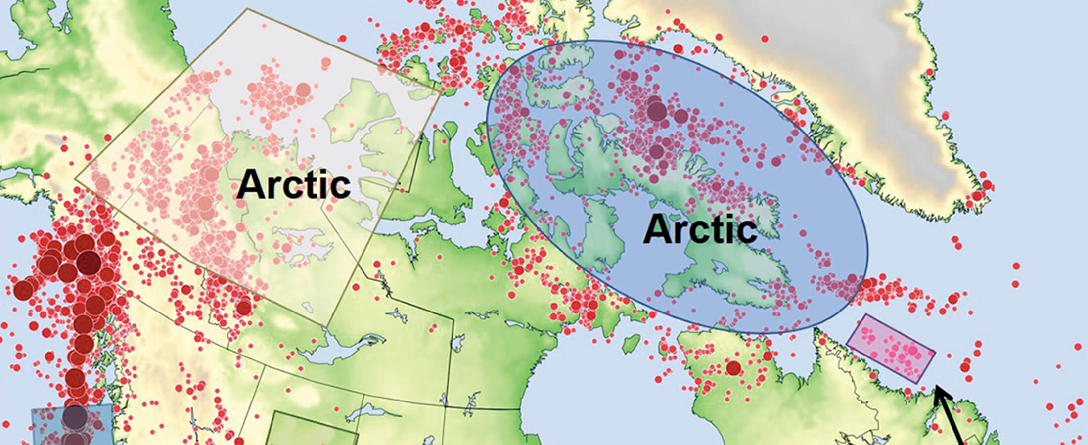
The Canadian Cordillera - the mountainous regions of western Canada - represents a world-class natural laboratory for exploring the interconnected Earth systems that are critical to our understanding of major scientific grand challenges. The Canadian Cordillera Array (CCArray) is a proposed international scientific initiative, spearheaded by the creation of a tectonic plate-boundary scale, open-data observational network, that will enable trans-disciplinary research focused on Earth systems processes and boundaries - from Earth’s core to the magnetosphere.
Seismic-wave attenuation and dispersion are studied in most geophysical curricular and broadly used in both academic and applied research. Applications of these concepts include identification of gas reservoirs and chimneys from frequency-dependent seismic amplitudes, analysis of frequency dependent P-and S-wave velocities, interpretation of the effects of porosity and fluid saturation using laboratory experiments with rock samples, amplitude- and Q-variation with offset studies, time-lapse data analysis and reservoir monitoring, and Q-compensation increasing the resolution of reflection seismic sections.
The volumes of modern gridded data collected by the geophysical exploration industry are often large and can benefit from methods for image decomposition, pattern analysis, and interpretation. Automated pattern-recognition methods can be useful for both seismic and potential-field images. In both of these cases, it is important to extract quantitative attributes useful for further data analysis and inversion for the subsurface structure.
GeoConvention offers some of the best local and international insights to efficient energy exploration and production, critical to the success of the industry and provides an opportunity for delegates and exhibitors to benefit from and give back to the community, through Technical Sessions, Posters, the Showcase Stage and the Exhibition floor.
There was a range of reactions from support to disbelief from friends and colleagues. Why had I left my full-time job to return to University? I had wanted to do my M.Sc. for a while. I even have the high school journal entry where getting a Master’s degree is in a list of goals. I’m confident my father was a significant influence on that goal, but it was also nurtured over the years through the excellent counsel from family, friends, mentors, and bosses. My story is about completing school while working for three different companies and growing my family.
The Montney formation in British Columbia and Alberta has gained prominence in recent years due to the exploration and production boom which has yielded more than 3.5 bcf/d in production output and in excess of 440 TCF of reserves. It is one of the largest unconventional plays in North America, covering 130,000 km2 with 5600 wells drilled to date.
Practical management of induced seismicity risk and effective mitigation approaches are crucial to oil and gas operations. Effective risk management procedures benefit from an accurate forecast of the largest potential magnitude event in near real-time, allowing the adjustment of operational parameters to reduce the probability of a felt or damaging event. Many models have been proposed to estimate the magnitude of the strongest possible event. Some of these models rely solely on statistics of recorded seismicity while others account for the relation of event size with operational parameters.
The Banff 2018 Induced Seismicity Workshop, hosted by the Canadian Induced Seismicity Collaboration and the Canadian Society for Unconventional Resources, brought together academics, industry and regulators, from around the world, to discuss learnings about induced seismicity. The theme of the workshop was “bridging and integrating knowledge” across sectors, and across different induced seismicity settings and types.
Water is integral to our economy, the health of our environment, and a necessity for all life forms and human development. Most water is accessed from surface sources, primarily rivers, which are now under increased threat due to over use and growing hydro-political forces. Still, groundwater exists as a viable option in many countries facing these mounting challenges.
Shallow and deep groundwater can be a major environmental obstacle for any geophysical surveying technique, especially radio waves. Ground penetrating radar (GPR) is a mature technology with applications in many areas; see Daniels (2004) for an overview. Almost all applications are restricted to imaging the subsurface to a rather shallow depth: large losses of signal occur when propagating through materials with free ions.
Shallow groundwater is often hosted in Quaternary sediments that are very complex in nature and challenging to map. Traditional mapping and exploration methods to delineate these features are often time consuming, costly, and provide uncertain results. Airborne electromagnetic (EM) techniques have proven effective in delineating these aquifers over extensive geographic areas in a very timely and cost effective manner.
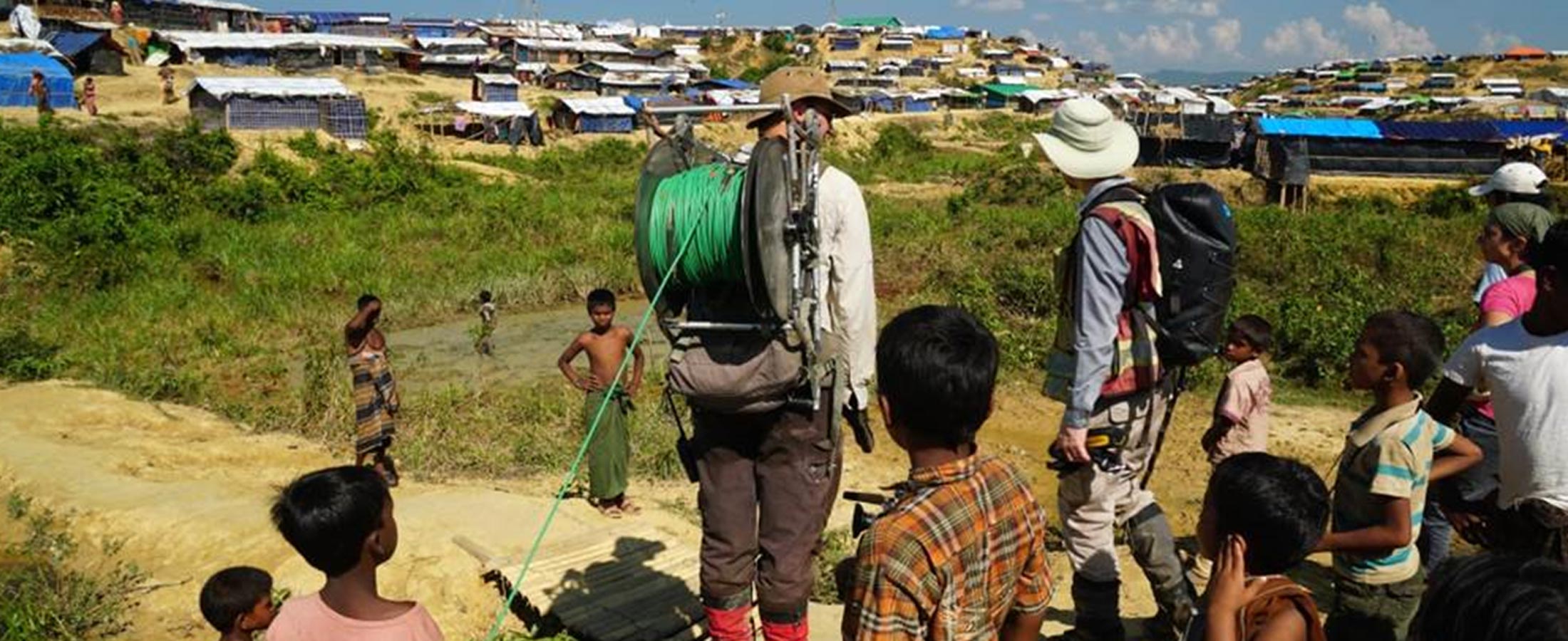
As geoscientists and engineers, and like most other professionals, we take pride in using our education and experience for the betterment of society. In developed countries, the value of such work on water supply projects may not be so obvious, where we take for granted that our communities will always have access to a ready supply of safe drinking water, and that we have built enough resilience to avoid running out of water should catastrophe strike.
In the Athabasca oil sands, lithology and fluid composition are typically better correlated with density than with other elastic properties, such as P- and S-wave velocity. Therefore, improving the accuracy of density estimates in oil-sands reservoirs has become one of the most important goals in quantitative interpretation.
The Schlumberger brothers were the first to use the direct current (DC) resistivity method for exploration, in oil well boreholes in Russia during the 1920’s. A unique phenomenon, now referred to as induced polarization (IP) chargeability, was noticed at the time, but not understood until simultaneous developments in both Russia and North America in the 1950’s. This lead to the development of the time domain and frequency domain IP methods.


