Abstract: Exploration Initiatives, Offshore Regions, Newfoundland and Labrador, Canada
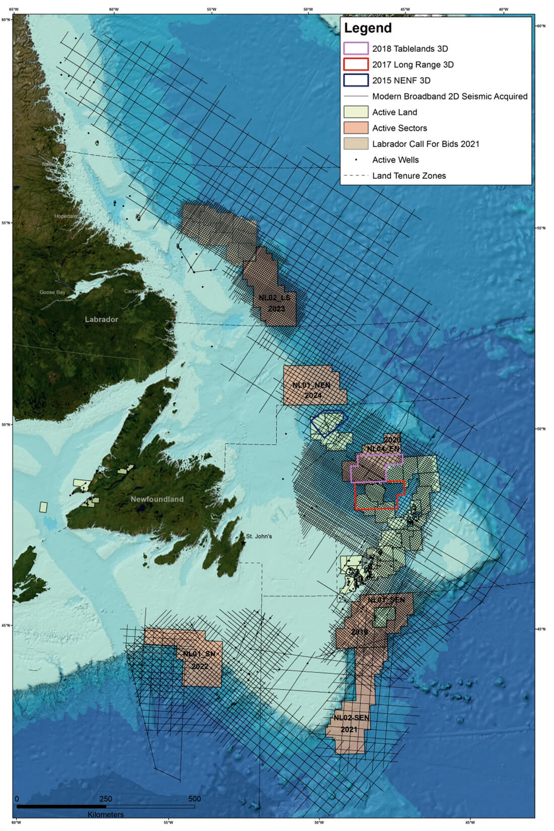
Exploration initiatives over the past decade have led to renewed interest in exploration in the slope and deep-water regions of offshore Newfoundland and Labrador, Canada. New multi-client regional 2D seismic surveys (2011-2018), guided initially by satellite slick mapping, have provided approximately 170,000 line kms of long offset, broadband 2D seismic data, and over 22,000 km2 of long offset, broadband 3D seismic data. The data was acquired in areas where possible hydrocarbon seepage and new exploration leads suggested that a working petroleum system existed in these under-explored frontier basins. Prior to 2011, the majority of offshore Newfoundland and Labrador sedimentary basins were defined on limited vintage seismic data, and in some cases gravity data where no seismic data coverage existed. With the initiation of modern regional 2D and 3D seismic programs, Nalcor Energy commenced the systematical mapping of the Newfoundland and Labrador offshore in order to assess the extent of the sedimentary basins and also to develop an understanding of the hydrocarbon potential in these frontier regions. In conjunction with seismic data acquisition, Nalcor Energy has initiated a number of scientific studies to build on this new knowledge base and help de-risk exploration in these areas. These regional studies include metocean, regional drilling metrics, biostratigraphy, seabed coring, CSEM, source rock geochemistry, fluid inclusion, geopressure, rock physics, high resolution digital capture and cataloguing of cuttings, core and thin section data, and resource assessment studies. These studies aim to assist in providing foundational insight to the region’s exploration potential and operational and subsea considerations. This integrated approach to regional exploration data collection will act as a template for future work in other Newfoundland and Labrador offshore areas.


