Abstract: Emergency Response Groundwater Exploration at Rohingya Refugee Camps in Bangladesh
As a preview to our upcoming October 2018 RECORDER, we present this abstract.
As geoscientists and engineers, and like most other professionals, we take pride in using our education and experience for the betterment of society. In developed countries, the value of such work on water supply projects may not be so obvious, where we take for granted that our communities will always have access to a ready supply of safe drinking water, and that we have built enough resilience to avoid running out of water should catastrophe strike. In Canada, we have some experience with these issues, including in some First Nations communities, where inadequate infrastructure and industrial contamination (e.g., Grassy Narrows) have led to shortages of safe drinking water. However, it is rare that we are tasked with finding water in the face of a large-scale humanitarian disaster. Yet, such a situation presented itself to our team of geophysicists in 2017, when the United Nations High Commission for Refugees (UNHCR) requested geophysical surveys for an emergency water supply project in southeastern Bangladesh. Here, upwards of 800 000 Rohingya people (ReliefWeb, 2018) are crammed into refugee camps and makeshift settlements and are enduring a worsening health crisis because they don’t have a reliable source of safe drinking water.
Source: https://www.aljazeera.com/indepth/interactive/2017/09/rohingya-crisis-explained-maps-170910140906580.html
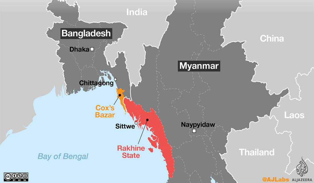
Since the 1970s, and because of ongoing persecution and ethnic violence, Rohingya (largely Muslims) have been forced from their native home in Northern Rakhine State in Myanmar. Most of those fleeing have crossed the border into Bangladesh and now reside in refugee camps and makeshift settlements close to Cox’s Bazar (Figure 1). The most recent exodus began on August 25, 2017, after the Myanmar military began a violent crackdown and clearance operations of Rohingya villages. Since that time, approximately 693 000 Rohingya people have arrived in Bangladesh (OCHA, 2018), flooding the existing camps near Cox’s Bazar and creating their own makeshift settlements. The majority of the new arrivals are concentrated around the Kutupalong and Balukhali makeshift settlements, although tens of thousands more have settled in and around the Nayapara refugee camp and Leda makeshift settlement further to the south. Most of those who fled the violence travelled for several days on foot, while others were forced to make dangerous water crossings in overcrowded boats, across the Naf River that separates Myanmar from Bangladesh’s Teknaf Peninsula (Figure 2). They came with the barest of possessions and arrived requiring immediate access to the basic necessities of life: security, food, shelter, and water.
Together with the Government of Bangladesh, the International Organization of Migration (IOM), and various international NGOs, UNHCR has been tasked with delivering emergency aid to the hundreds of thousands of Rohingya displaced into Bangladesh. This includes the supply of emergency shelter kits, food rations, the construction of latrines, and the installation of new water wells to meet the drastic increase in demand for drinking water.
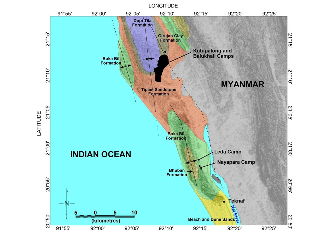
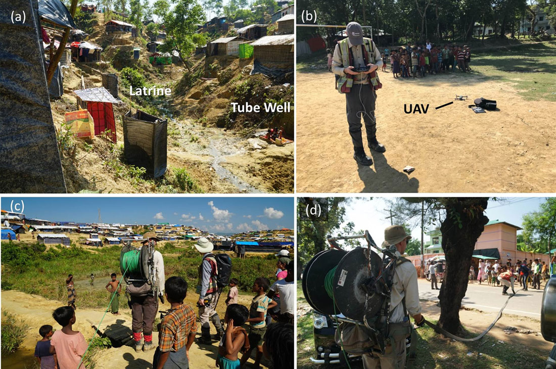
Most of us think of Bangladesh as a densely populated, low-lying country that is periodically subject to flooding during seasonal monsoons. It is hard to imagine water scarcity being an issue in such a place. Yet, in the vicinity of the Nayapara and Leda camps on the southern Teknaf Peninsula (Figure 2 and 3a), a combination of unfavorable hydrogeological conditions and inadequate infrastructure means that there is insufficient surface water or groundwater storage to meet the demands of the camps during the pronounced dry season, when rainfall is rare. In order to supplement the dwindling water supply from the existing water reservoirs and shallow hand-pumped water wells, the IOM and UNHCR’s Water Sanitation and Hygiene (WASH) sectors have proposed the siting of new water wells that will hopefully tap deeper, high-yielding aquifers. Because the local geology is complex and poorly understood, geophysical investigations were proposed to help locate and map potential aquifers.
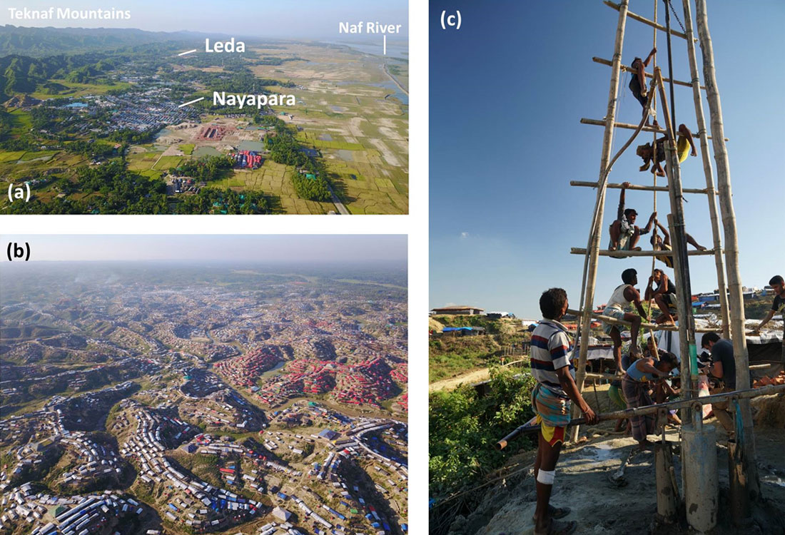
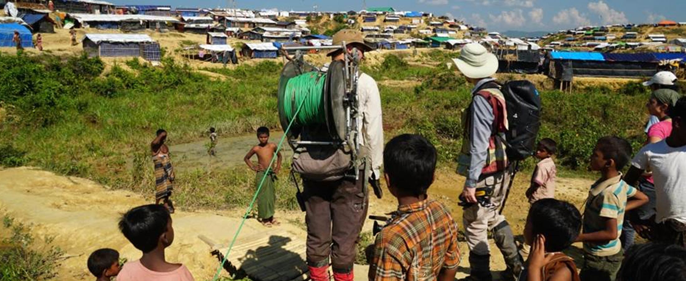
Further to the north, relatively extensive shallow aquifers have been exploited for the immediate water supply needs of the Kutupalong and Balukhali “mega camps”, as they have been termed, and thousands of shallow (< 10 m depth) hand pumps have been installed by well-meaning NGOs (Figures 3b and 3c). Unfortunately, in the rush and chaos of the emergency relief action, and due to the cramped and squalid conditions in the camps (space is as low as 8 square metres per person; UNHCRa, 2018), the majority of the water wells have become contaminated by human and animal waste. Where they are in use, many of the latrines and “sludge disposal pits” are overflowing, and waste is leaching downgradient to hand pumps or into groundwater recharge areas (e.g., Figure 4a). Compounding the problem is that many Rohingya are reluctant to use the available latrines, and open defecation is rife throughout the camps.
With the widespread contamination of the shallow wells, and consequent impending threat of waterborne diseases like typhus, dysentery, and cholera, aid agencies have been instructed to develop water wells into deeper aquifers that are less susceptible to surface contamination. In support of these efforts, our team was requested to undertake a geophysical survey within areas of the Kutupalong and Balukhali settlements to help image and map deeper aquifers.
So we found ourselves, in October of 2017, and at the behest of UNHCR and Oxfam (our in-country NGO facilitator in Bangladesh), scrambling at short notice to pull together a team and geophysical equipment for a three week field groundwater exploration program in Bangladesh. Despite the usual logistical challenges associated with working in another country on an accelerated timeline, somehow our crew of 5 field staff arrived with 19 of our 23 pieces of checked luggage in Cox’s Bazar by the end of October.
The use of geophysics in groundwater exploration programs is well documented (e.g., Goldman and Neubauer, 1994), including for water supply to refugee camps (e.g., Bauman et al., 2017). In this article, we will focus on the unique challenges of data acquisition within and around the densely populated Rohingya refugee camps, and show how the results of our survey were rapidly analyzed and disseminated to the various stakeholders who were tasked with developing new water wells within the camps.


Comments
Share your thoughts with us! Comments are moderated. Spam, inappropriate or abusive comments will be removed.


