Articles
Introduction to December Focus: The Banff 2018 International Induced Seismicity Workshop
Paige Mamer
The Banff 2018 International Induced Seismicity Workshop took place October 24-27, 2018 and was hosted jointly by the Canadian Induced Seismicity Collaboration and the Canadian Society for Unconventional Resources. It featured an international and diverse audience consisting of members of government and academia as well as attendees from the oil…
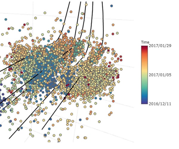
Real-time Induced Seismicity Forecasting and Risk Management Utilizing Research-grade Seismic Catalogs
Sepideh Karimi and Dario Baturan
Practical management of induced seismicity risk and effective mitigation approaches are crucial to oil and gas operations. Effective risk management procedures benefit from an accurate forecast of the largest potential magnitude event in near real-time, allowing the adjustment of operational parameters to reduce the probability of a felt or damaging…
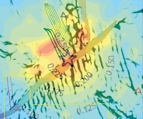
Managing Induced Seismicity in Canbriam’s Altares Field in the Montney Formation, N.E. British Columbia – An Update
John Nieto, Brad Bialowas, Bogdan Batlai, and Graham Janega
The Montney formation in British Columbia and Alberta has gained prominence in recent years due to the exploration and production boom which has yielded more than 3.5 bcf/d in production output and in excess of 440 TCF of reserves. It is one of the largest unconventional plays in North America,…

Roy Oliver Lindseth
To many of us, Roy Lindseth was our geophysical father. He was a scientific visionary, entrepreneur, respected advisor, and kind mentor to many geophysicists, both young and experienced. He encouraged us to do great things while taking care of small details. Roy worked tirelessly for the science, application, and people…
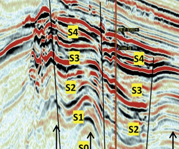
Analyzing a Seismic Pitfall – Pliocene Superdeep High Amplitude Anomaly, Offshore, Bay of Bengal, India
Niranjan C. Nanda
A wildcat was drilled on a Pliocene superdeep seismic high amplitude anomaly in 1050 m of water to explore the hydrocarbon potential in the bathyal zone of Bay of Bengal. The well penetrated a thick monotonous section of 1400 m of siliciclastic mudrocks without encountering the prognosticated hydrocarbon sands, resulting…
Applied Geoscience in Academia – Quo Vadis?
Larry Lines
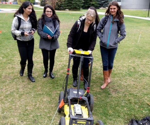
The following article is based on a talk that I gave to a group of geoscientists at the 2017 Geoconvention in Calgary, Alberta. It included a series of observations that I have made regarding the state of applied geoscience at Canadian universities. While the talk was apparently not controversial nor…

Introduction to October Focus: Hydrogeophysics: The Past, Present & Future
Jon Fennell
The ability to detect and image things that are hidden from our sight has always been a fascination of humans. This applies to geoscience as much as any other field. With the ability to sense objects and materials beneath the earth’s surface, the discipline of exploration geophysics has been instrumental…
Emergency Response Groundwater Exploration at Rohingya Refugee Camps in Bangladesh
Alastair McClymont, Paul Bauman, Colin Miazga, Eric Johnson, and Chris Slater
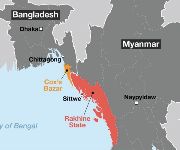
As geoscientists and engineers, and like most other professionals, we take pride in using our education and experience for the betterment of society. In developed countries, the value of such work on water supply projects may not be so obvious, where we take for granted that our communities will always…
A Cost Effective Approach to Regional and Site-specific Aquifer Exploration Using Combined Airborne and Ground Electromagnetics
Jane Dawson, Robert Perrin and Jim Henderson
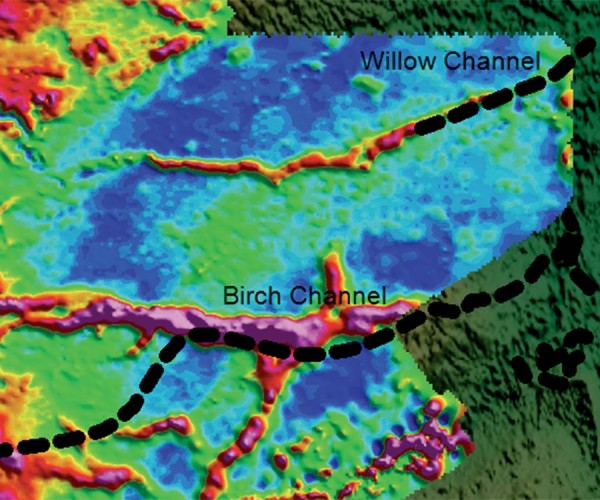
Shallow groundwater is often hosted in Quaternary sediments that are very complex in nature and challenging to map. Traditional mapping and exploration methods to delineate these features are often time consuming, costly, and provide uncertain results. Airborne electromagnetic (EM) techniques have proven effective in delineating these aquifers over extensive geographic…
Extending the Reach of Radio Waves for Subsurface Water Detection
Gordon D.C. Stove
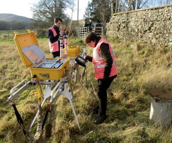
Shallow and deep groundwater can be a major environmental obstacle for any geophysical surveying technique, especially radio waves. Ground penetrating radar (GPR) is a mature technology with applications in many areas; see Daniels (2004) for an overview. Almost all applications are restricted to imaging the subsurface to a rather shallow…
Advances in the Realm of Hydrogeophysics: The Emerging Role of Quantum Geoelectrophysics in Aquifer Exploration
Richard Hatala, Jon Fennell, and Gerald Gurba
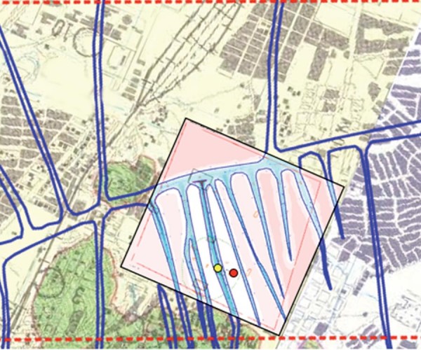
Water is integral to our economy, the health of our environment, and a necessity for all life forms and human development. Most water is accessed from surface sources, primarily rivers, which are now under increased threat due to over use and growing hydro-political forces. Still, groundwater exists as a viable…

Introduction to September Focus: Emerging Methods and Technologies
Oliver Kuhn and Neda Boroumand
The original vision for this RECORDER edition’s theme was that we would feature a collection of articles that focused on new, leading edge geophysical technologies in applied use. We fell short of that goal, and that is probably because entirely new geophysical technologies are rare, and most of what is…
Muon Geotomography: A Novel, Field-Proven 3D Density Imaging Technique for Mineral Exploration and Resource Monitoring
Doug Schouten
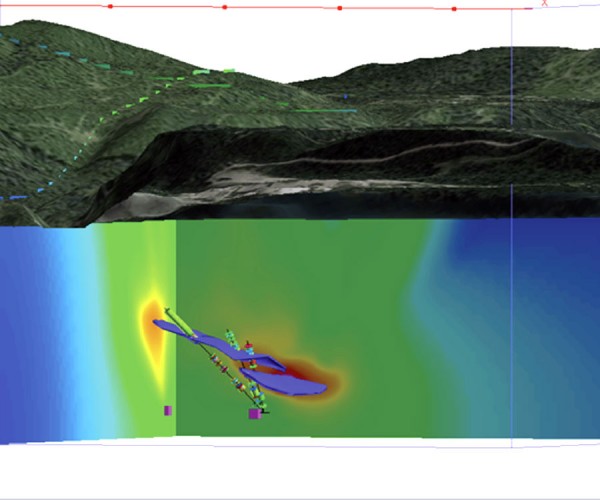
Muon geotomography is a novel density measurement technique based on the absorption of cosmic ray muons in the ground. Naturally occurring cosmic ray muons emanating from the upper atmosphere lose energy as they penetrate the earth. These muons are absorbed at a rate that is proportional to the density of…
Seismic Acquisition Innovations Applied in Canada
Andrea Crook
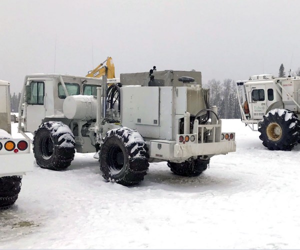
Over the past 10 years, land seismic acquisition has changed significantly. Nodal/cable-less systems have broadly replaced cabled systems, vibroseis sources have replaced explosive sources even in areas with difficult terrain, and high-density seismic programs are becoming commonplace. This article, based on the Chief Geophysicists Forum presentation “Top 5 Innovations in…
Applications of DC Resistivity and Magnetotelluric Methods in Exploration
Robert Hearst
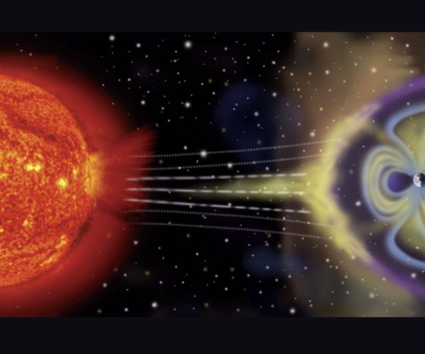
The Schlumberger brothers were the first to use the direct current (DC) resistivity method for exploration in oil well boreholes in Russia during the 1920’s. A unique phenomenon, now referred to as induced polarization (IP) chargeability, was noticed at the time, but not understood until simultaneous developments in both Russia…
Quantitative Comparison of Inversion Methods for Estimating Density from Seismic Data
Jinling Zhang, Kyle McMillan
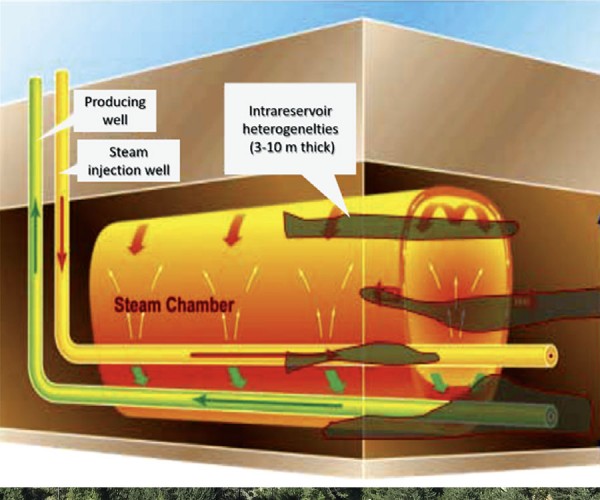
In the Athabasca oil sands, lithology and fluid composition are typically better correlated with density than with other elastic properties, such as P- or S-wave velocity. Therefore, improving the accuracy of density estimates in oil-sands reservoirs has become one of the most important goals in quantitative interpretation, which integrates seismic,…
Sedimentary Geology and Implications for Carbon Sequestration: A Field Course in Ainsa, Spain through Project Carbeor
Adriana Gordon, Scott Keating, and Tyler Spackman
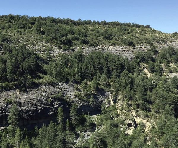
A course organized by the Geoscience Department of NTNU (Norway) took place in mid-June in Aínsa, Spain. Graduate students from NTNU, TUDelft (Netherlands) and the University of Calgary participated. Geological outcrops were used to provide an introduction to deep marine, shallow marine and fluvial sedimentary systems. Implications of these sedimentary…

Introduction to June Focus: New Insights into Canadian Unconventional Resources
Ruth Peach
The ingenuity of today’s geoscientists equals that of our pioneers, who explored Canada on horse, drilled the first wildcat (exploration) wells, and built the major industry that we now call the Canadian Oil Patch.
...
Changes in the Oil & Gas Industry – Unconventional Plays (Engineering Fused with Geoscience)
Brian Wm. Schulte
Stacked tight sands and unconventional plays tend to be found together in what has been termed as deep basin environments also known as continuous basin-centered gas accumulations (BCGAs) which tend to be found predominately in foreland and intracratonic basins but are not restricted to these basins.
...
From X-Ray Fluorescence (XRF) to Mechanical Profiling for Better Well Completion. Valuable Analytics for the Exploration Toolbox!
Raphael A.J. Wust and Xiaojun Cui
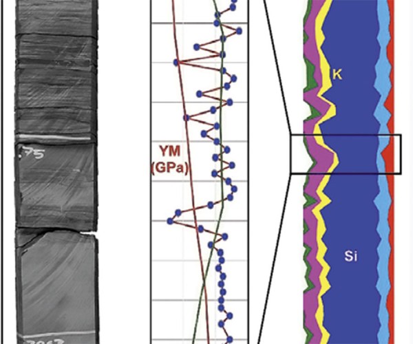
The fast pace of drilling and completion of unconventional reservoirs in North America is challenging engineers, geoscientists and petrophysicists who have to make prompt and reasonable plans for drilling and completion strategies. One of the main issues is understanding the physical rock properties, such as clay and organic content, and…


