Articles
Aftershock Decay Rate of Large Injection-Induced Earthquakes in Northeast British Columbia: A Case Study for Two sequences in the Montney Play
Amir Mansour Farahbod and Honn Kao
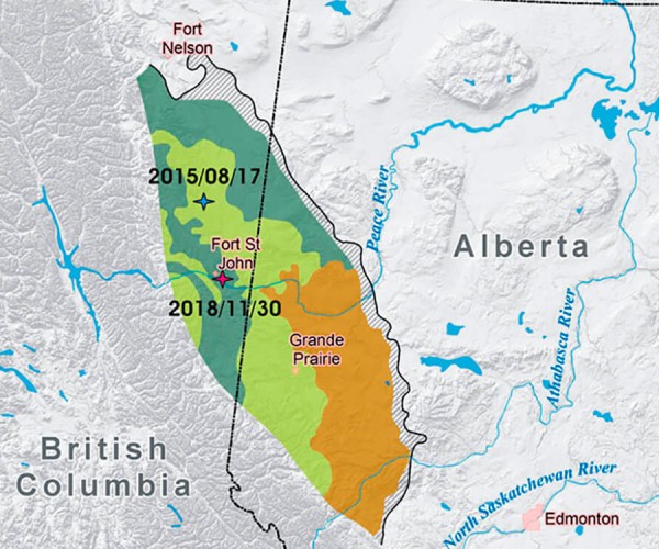
We investigated the aftershock decay rate of the two largest injection-induced earthquakes (IIEs) ever recorded in northeast British Columbia that occurred on August 17, 2015 (MW (moment magnitude) 4.6, ML (local magnitude) 4.9) and November 30, 2018 (MW 4.5, ML 4.7). These earthquakes are temporally and spatially correlated with hydraulic…
Seismic Attenuation in Northeast British Columbia Using the Coda Q Method
Amir Mansour Farahbod, John F. Cassidy, Honn Kao
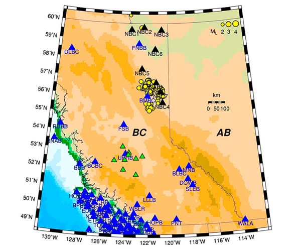
Coda-wave attenuation is an important criterion for the study of elastic properties of the lithosphere. In this article, attenuation is measured in northeast British Columbia using records from 9 new stations of the Canadian National Seismic Network (CNSN). Our dataset is comprised of 402 earthquakes recorded between August 2013 and…
Mapping the Distribution of Permafrost using the Resolve Airborne EM System: Klondike Highway, Yukon, Canada
Mel Best, Isaac Fage and Shawn Ryan
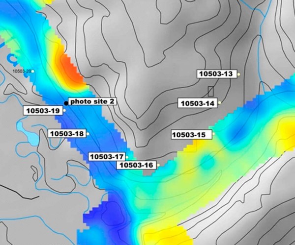
Changes in permafrost distribution in northern regions of North America are related to hydrogeological processes, climate, and ecosystems. In particular, increased thawing due to warmer temperatures alters the permafrost distribution. This can lead to enhancement of surface-groundwater interactions that contribute to surface flow which leads to differential melting of the…
Mapping How Geophysics Is Used To Understand Geohazards In Potash Mines
Craig Funk, James Isbister, Todd Leblanc, Randy Brehm
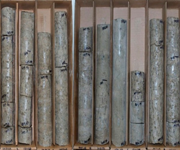
The Saskatchewan potash industry is over 60 years old now and has survived and been profitable thanks in part to geophysics. The potash deposits in Saskatchewan are globally unique, in that they are very large, flat and relatively unaltered, which permits productive low-cost mining. However, water inflows are a serious…
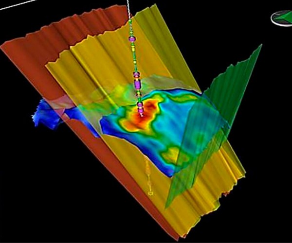
Squeezing more from seismic data: Application of prestack simultaneous impedance inversion to a stratigraphic and structurally complex productive field in Argentina
Eduardo Trinchero and Luis Vernengo
The need to revitalize conventional productive old fields led the geology and geophysics groups to consider the implementation of accurate methodologies and analysis for arriving at static geomodels. An example at hand is the Golfo San Jorge Basin in Argentina with the complexity of its productive zones. Careful reprocessing of…

Practical insights and techniques in seismic velocity estimation
John T. Etgen
The estimation of seismic wave speeds plays one of the most important and critical roles in seismic data processing. As we explore more complex and previously unexplorable provinces, as well as demanding ever-higher quality images from seismic reflection data everywhere, accurate velocity models are of paramount importance.
...
Advanced Seismic Inversion for Engineering Applications in Unconventional Reservoirs
Colin Sayers
Because of their low permeability, economic production from unconventional reservoirs requires increasing the surface area in contact with the reservoir via hydraulic fracturing. Important to the design of efficient hydraulic fractures is an understanding of pore pressure, the orientation and magnitude of principal stresses, the geomechanical properties of the rock,…

Introduction to September Focus: Prairie Provinces
Draga Talinga and Germán Rodríguez Pradilla
Nothing has contributed more to the accelerated advancement of Canada over the past several decades, than the exploration and mining of primary resources. And beneath the rich soil of the Prairies Provinces lie some of the greatest natural resources of our country - vast mineral deposits and oil and gas…
Geoscience Across Canada – Resource Exploration in the Prairie Provinces
Brad Hayes
The exploration history of the discovery of two deposits beneath the Phanerozoic cover of the Flin Flon – Snow Lake volcanogenic massive sulphide (VMS) Belt in Manitoba and Saskatchewan is presented. Due to a lack of outcrops of the host rocks, geophysical exploration techniques were key to the discoveries. Both…
Methods of fault detection with geophysical data and surface geology
Brian Wm Schulte PG, Dane Bridge, Henry Lyatsky
Horizontal wells and fracking are commonly used to increase hydrocarbon production while at the same time lowering the costs. This practice is helped by pad drilling, where multiple lateral horizontal wells can be drilled from a single location, reducing land use and cutting the need to move the rig.
...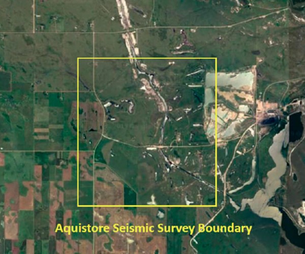
Application of Full Zoeppritz AVO Inversion for Delineating Porous Sand Geobodies Over Aquistore Seismic Survey
Homayoun Gerami
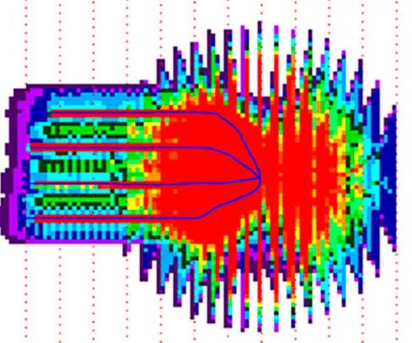
We used 3D seismic data from the Aquistore deep saline CO2 storage project survey, southwest of Estevan, Saskatchewan, Canada, using seismic amplitude variation with offset (AVO) inversion and lithology prediction workflows to delineate the porous sand units across the survey.
...
What is the value of a VSP and why it should be modeled?
Jason Schweigert and Brian Wm. Schulte
In today’s era of tight commodity prices, there is a push to minimize the breakeven price (BEP) for resource plays and maximize their production. To lower BEP, exploration and production (E&P) companies have been drilling multiple horizontal wells off a single pad therefore reducing the environmental impact and minimizing the…

Introduction to June Focus: Central Canada
Oliver Kuhn and Jean Legault
Mining and near surface applications dominate the exploration geophysics sector in Central Canada. In our search for articles, rather than just focusing in those two areas, we also looked for other geophysical applications that would provide readers a broader and more interesting range of topics. Therefore in addition to a…
Ambient noise surface wave tomography at the Marathon PGM-Cu deposit, Ontario, Canada
Dan Hollis, John Mcbride, Sophie Beaupretre, Aurélien Mordret, Florent Brenguier, Nicholas Arndt, Dave Good
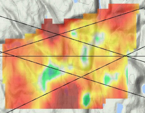
In this paper we report the results of tests of the ambient-noise surface wave seismic tomography method at Stillwater Canada Inc.’s Platinum Group Element-Copper (PGE-Cu) deposit at Marathon in Ontario. This survey demonstrated the potential of the technique to help determine the geological setting of the deposit and, in addition,…
The Metal Earth project: Crustal scale reflection seismic study of the Archean Superior Province of Canada
Mostafa Naghizadeh
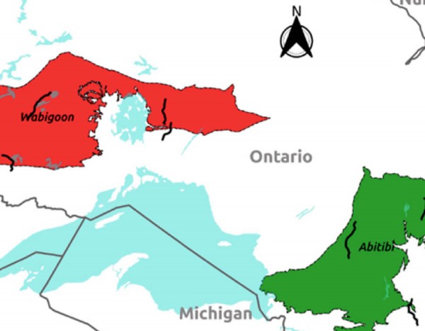
Metal Earth is an applied research and development program led by Laurentian University with $104 million funding from the Canada First Research Excellence Fund and federal/provincial/industry partners. Metal Earth aims to profoundly enhance our knowledge about the origin and evolution of base and precious metal deposits during Earth’s history. By…
The Industrial Wind Turbine Seismic Source
Michael West
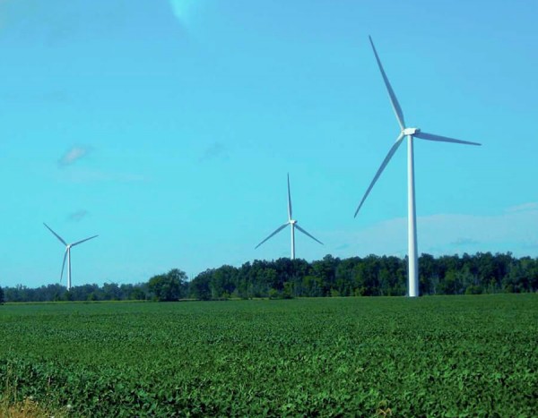
Despite their generally positive reputation as sources of clean, safe energy, Industrial Wind Turbines (IWTs) do have their critics. For years, residents living in the vicinity of IWT clusters have reported a variety of physical ailments which they attribute to the sounds and vibrations emanating from wind turbines (Kelley, 1985;…
Pre-competitive geophysics in Ontario – attracting investment with data
Desmond R.B. Rainsford
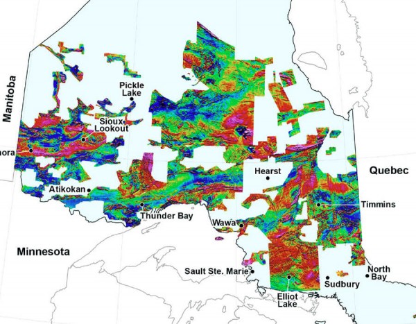
The Ontario Geological Survey (OGS), in collaboration with the Geological Survey of Canada, was one of the first jurisdictions to collect and distribute pre-competitive, regional-scale, geophysical data. Following the completion of province-wide coverage with low-resolution geophysical surveys, the Ontario Geological Survey is accumulating detailed data over much of the province.…
Geophysical Exploration Beneath the Phanerozoic Cover of the Flin Flon – Snow Lake VMS Belt
Bob Lo
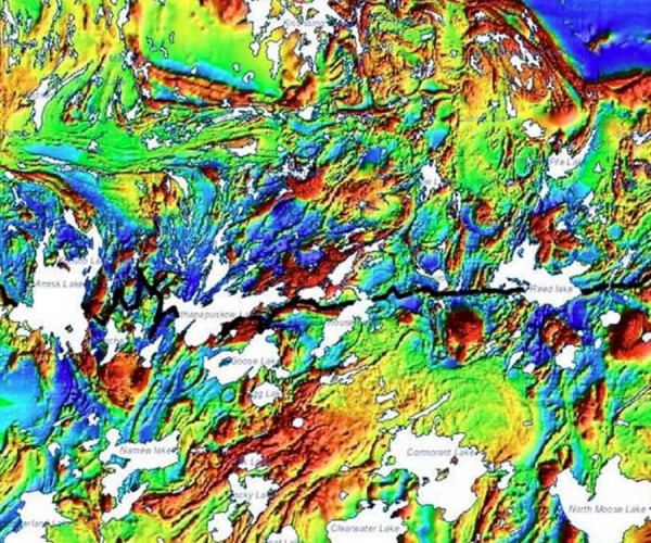
The exploration history of the discovery of two deposits beneath the Phanerozoic cover of the Flin Flon – Snow Lake volcanogenic massive sulphide (VMS) Belt in Manitoba and Saskatchewan is presented. Due to a lack of outcrops of the host rocks, geophysical exploration techniques were key to the discoveries. Both…
Comparisons of Geophysical and Medical Imaging
Larry Lines and Joan Embleton
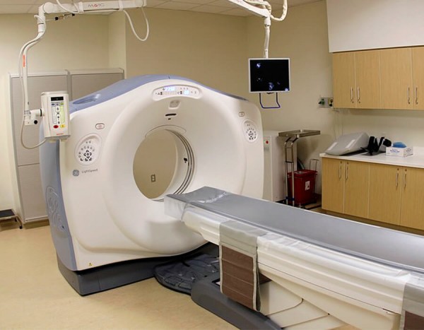
Geophysical and medical imaging are of great importance to society. In the case of geophysical imaging, we record waves passing through the Earth to image the Earth’s interior in search of anomalies to help in the exploration for petroleum and minerals. In the case of medical imaging, we image the…

Introduction to April Focus: Data & Data Management
Brian Schulte
Welcome to the printed GeoConvention edition of the RECORDER. The focus is “Data and Data Management”. It is amazing how many articles were gathered by Special Coordinator Trudy Curtis and Technical Editor Kristy Manchul. Trudy and Kristy began gathering material for this back in October. As with all our editions,…


