
Geophysical Research and Petroleum Geoscience at McMaster University
The School of Geography and Earth Sciences (SGES) at McMaster University offers undergraduate and graduate degree (M.Sc., Ph.D) programs in Earth and Environmental Sciences. SGES currently has about 150 full-time undergraduates and about 90 graduate students in M.Sc. and Ph.D. programs. Undergraduate training in applied geophysics is offered through 3rd and 4th level courses in environmental (near-surface) geophysics, exploration geophysics, and basin analysis. Graduate courses are currently offered in exploration seismology (2D/3D seismic acquisition, processing), advanced exploration geophysics (gravity, magnetics, radiometrics, geophysical inversion modeling), geophysical basin analysis techniques (seismic stratigraphy, petrophysical interpretation), and petroleum exploration. The School has a broad array of geophysical field equipment for undergraduate and graduate instruction, including ground-penetrating radar, 24-channel seismograph, gravimeter, Overhauser magnetometer, EM conductivity and gamma spectrometer (Figure 1). Classroom training is conducted in a state-of-the-art computing laboratory with 50 PC workstations equipped with industry standard geophysical software (Geosoft Oasis, Kingdom Suite, Petrel, Vista 2D/3D) for processing, interpretation and modeling of potential field and seismic data. The laboratory also provides access to a suite of GIS and remote sensing software packages. Through support from the Imperial Oil Foundation SGES has installed a 3D visualization system, which is employed in the teaching of many undergraduate courses.
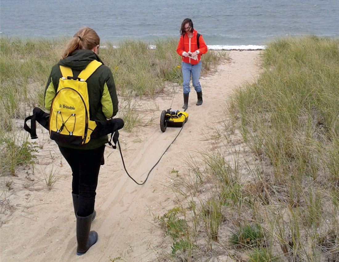
Three SGES faculty (Joe Boyce, Janok Bhattacharya, Bill Morris) employ geophysical methods in their research work, with specializations in environmental geophysics, petroleum geoscience, and exploration (resource) geophysics.
Environmental and archaeological geophysics – JOE BOYCE (BOYCEJ@MCMASTER.CA)
Joe Boyce and his research group apply near-surface geophysical methods (GPR, high-resolution magnetic surveys, shallow seismic, EM conductivity) to discover and investigate coastal and underwater archaeological sites and to monitor human impacts on lakes and coastal environments. This work often involves ‘data-fusing’ of two or more geophysical data types with stratigraphic information from sediment cores to document changes in Holocene environmental conditions over time. Using these techniques, Boyce and team have discovered new prehistoric (Paleo-Indian) underwater archaeological sites in the Great Lakes, documented the environmental impacts of European settlement, and developed new methods for identifying contaminants in lake sediments based in their magnetic properties. Overseas, Boyce and graduate students are employing geophysics and sedimentary archives to document changes in sea level and paleoshoreline positions to guide exploration of archaeological sites in the Mediterranean. To aid in this work, the team is currently evaluating autonomous underwater vehicles (AUV) as a new geophysical survey platform for high-resolution magnetic and multi-beam mapping of underwater archaeological sites and submerged ancient harbours.
In other recent work in Ontario, Boyce and his team are evaluating the application of multi-channel 3-D GPR for mapping and quantifying tree root biomass. GPR biomass estimates provide a new method for measuring changes in carbon sequestration in forests over time, providing important baseline information for climate models.
Petroleum geoscience – JANOK BHATTACHARYA (BHATTAJ@MCMASTER.CA)
Janok P. Bhattacharya has recently moved to McMaster from the University of Houston, where he served as the Robert Sheriff Professor of Sequence Stratigraphy. He now serves as the Susan Cunningham Research Chair in Geology. His research team is focused on sequence stratigraphy and reservoir characterization of fluvio-deltaic systems (Figure 2). Bhattacharya is the director of the industry-funded Quantitative Sedimentology Laboratories, which are run jointly with his colleagues at the University of Houston. Supporters include BP, Inpex, and Ecopetrol. Geophysical aspects of the program include remote sensing of unique plan-view exposures of fluvial channel belts, GPR imaging of bars and channel fills in deltaic and fluvial reservoir analogs, hyper spectral imaging of thin-bedded reservoir analogs, and seismic modeling of fluvio-deltaic systems. Bhattacharya’s present McMaster research team is focused largely on fluvio-deltaic outcrop analogs in Utah and an NSERC funded project in New Mexico, but he has also supervised 3D seismic interpretation projects in the Gulf of Mexico, Caspian Sea, and Gulf of Thailand. The New Mexico outcrop work will also be linked to an extensive subsurface database of cores, well logs and seismic data. Bhattacharya’s team is also working on the origin of thin-bedded prodeltaic reservoirs and shales.
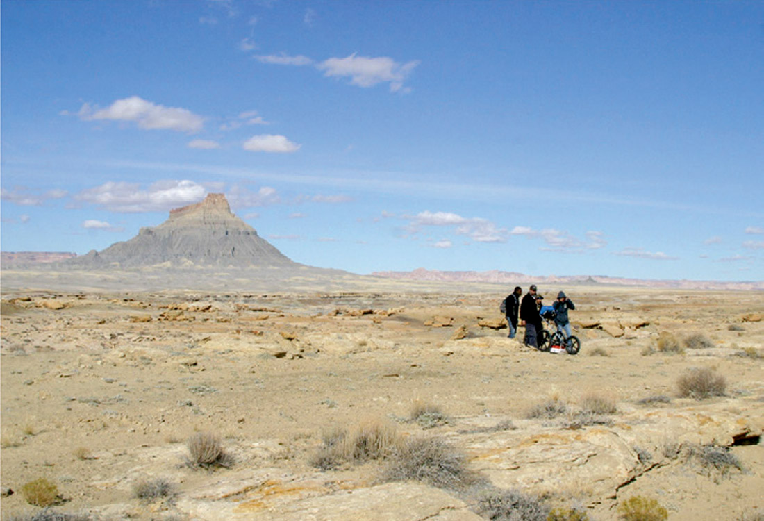
Bhattacharya is also serving as faculty advisor for a newly formed AAPG Student Chapter and is President-elect for SEPM. In the spring of 2014, Bhattacharya led a team of McMaster graduate students to compete in the AAPG Imperial Barrel Award, which typically requires integration of geological exploration concepts in the interpretation of 2D and 3D seismic, and well-log data.
Exploration (resource) geophysics – BILL MORRIS (MORRISWA@MCMASTER.CA)
Bill Morris and his MAGGIC team employ gravity, magnetic and radiometric data to investigate aspects of mineral and oil resource deposits. A key element of this research involves integration of geophysical data with information derived from other data sets including: object classified imagery from various satellite systems, geomorphometric attributes from topographic data sets, contacts recorded in prior geological maps and borehole physical property variations. All of these elements are combined in the development of constrained geophysical models which are used to investigate aspects of mineral and oil deposit systems. Confirmation of the validity of the computer derived models is supported by an extensive suite of physical rock property measurements.
Morris and his group have applied these techniques of remote predictive mapping (RPM) in a number of mining camps. Work in the Bathurst, New Brunswick area have produced papers: detailing a new method for regional / residual separation of aeromagnetic data and the direct detection of zones that are remanently magnetized; a spatially variable density approach to gravity gradiometry terrain corrections; and an improved procedure for defining the edges of petrophysically defined source bodies. Studies in the Thelon basin have produced: a new map of the geology underlying the Thelon unconformity; an estimate of the location and displacement of faults that have modified the unconformity surface; and a geologically and geophysically constrained model of a doubly plunging fold structure.
In more recent work Morris is working on the NSERC funded CMIC Footprints project looking at the geophysical, geological and geochemical signatures associated with Cu porphyry, Ur unconformity and epithermal Au mineral systems. Through the development of new approaches to data integration, analysis, model construction and interrogation it is hoped will lead to new methods of mineral prospectivity.




Join the Conversation
Interested in starting, or contributing to a conversation about an article or issue of the RECORDER? Join our CSEG LinkedIn Group.
Share This Article