
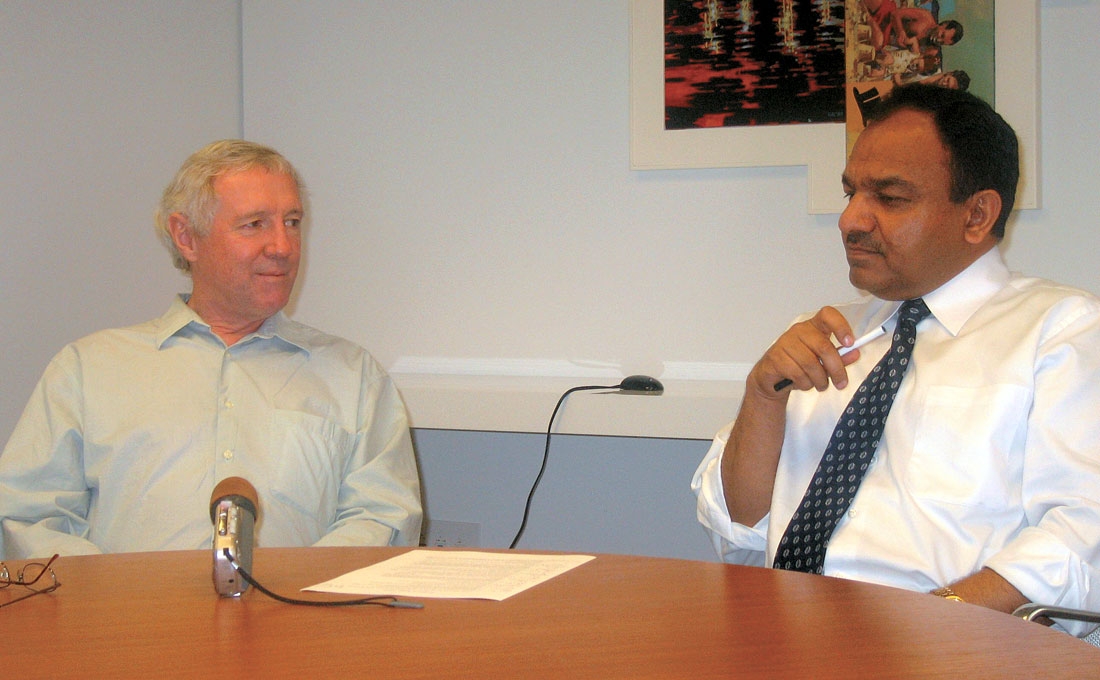
Rodney Calvert of Shell International Exploration and Production presented the SEG/EAGE 2005 Distinguished Instructor Short Course on 'Insights and Methods for 4D Reservoir Monitoring and Characterization', at Calgary on September 27, 2005. An experienced geoscientist, Rodney has worked in various Shell Centres including Canada. This interview was conducted the day following his DISC course, and Rodney was very responsive and provided his opinions on a wide range of topics. Following are excerpts from the interview.
Rodney, let’s begin by asking you about your educational qualifications and your work experience.
I got a B.A. in Physics at Oxford University, which was most enjoyable, and I think that persuaded me to pursue geophysics. I didn’t want to have a career in the laboratory in a white coat. I really liked the outdoors. So I then went on to do a geophysics course at Imperial College in London and I liked that so much I stayed on and did a Ph.D. and it turned out by chance that it was almost time lapse, because I was trying to measure the crustal growth, plate tectonic growth across Iceland. So measuring that, I had a nice outdoors PhD and then Shell, in fact gave me a Scholarship, sponsored me for that work, so I almost naturally joined Shell after that.
So you have been with Shell ever since?
Yes, pretty well. That’s been exciting, lots of places, many different jobs.
What do you have to say about how your career has shaped up?
I feel it was a lot of chance. I always took opportunities for interesting things. Way, way back in 1969, I started off in the Seismic Processing Centre at Shell, and that was really at the beginning of digital processing work. And that was great fun. Then I got into software development and after that I was assigned, for a year, in Dallas, in Texas Instruments. They were building the first multi-pipeline supercomputer and there was going to be eight of these in the world – two for U.S. missile defense, one for General Motors, one for the predicting the weather, (they were trying to model the atmosphere) and I think the rest were going to be used for seismic processing. That was going to be done with GSI and Shell working together. I was developing software for that, which was very interesting at the time.
That project didn’t really take off for Shell. Shell didn’t start using that super computer internally. What we used were only the input terminals for the supercomputer. A lot of my software was on them. We used those terminals as a small mini computer processing system around Shell. That was the beginning of Shell’s decentralized in-house seismic processing system and I was involved in writing some of the early software for that.
Then I had a series of management jobs: manager of seismic processing in Malaysia, then manager of geophysics in the North Sea, which was interesting. That was just at the start of 3D.
That was the late 70s?
Yes, after doing the manager of geophysics job in the UK, they moved me to manage the geophysical research in the Shell Laboratory, in Rijwijk, Netherlands, just by The Hague, and there we started 3D interpretation.
We were working with Landmark, and GSI on the very early 3D interpretation work-stations. That was exciting because, for the first time, geologists could see the earth and structures in 3D. If you think about it, they can only see geology in 2D, they can see a cliff exposure or a horizontal exposure, but to see how the folds join and everything else in 3D, that was new. And yes, Shell took a very strong stance on 3D with these capabilities. So in the North Sea it was a default. Every field had to be 3D surveyed before we would enter into detailed production planning.
And then after that I had the great fortune of coming to Canada in 1989. I was manager of Geophysical Technology, I think that was the title here at Shell Canada.
That was introducing 3D into Shell Canada really because it was quite challenging doing 3D in the Foothills. We had to do this using helicopters so obviously getting efficient geometry was important. Here in Canada I loved the outdoors and nature and was very pleased to be able to be involved with changing the seismic methodology so that we could do what we call “stealth seismic”. We could shoot seismic and no one could tell we’d been there, so we weren’t cutting down trees to make shot lines any more, we were using barometers for elevation and we were going around the trees. So that ended up being safer and cheaper and much more environmentally sensitive. Also the processing of data in the Foothills was a great challenge, so we developed some new techniques for handling the mountain terrain and doing pre-stack depth migration in the Foothills. So that was another exciting time. I was here for about two and a half years. Then I was sent down to Houston to manage a software development project that was to make a new Shell in-house seismic processing scheme and that really fell through. I didn’t believe it could deliver what we were hoping. So I was then moved to a multidisciplinary research project involving reservoir engineering, reservoir geology, petrophysics, and seismic. So we had all these different people to try and see how we could develop new techniques using multi-disciplinary approaches and that was very interesting experience. That really broadened my horizons and I found the key to getting these people to work together was to really work on a concrete problem. We were looking at unitization and negotiations on some of the deep water plays we had. There we had to model these situations and try to predict what different scenarios, what different interpretations, would mean financially and we could help the financial negotiations with the technical back-up. That really made us develop quick, effective modeling techniques covering all the disciplines, geological, seismic reservoir engineering, modeling were all put together and that was a very interesting time.
You have been in Houston for almost 12, 13 years now?
No, that didn’t last very long. I was there probably 2 or 3 years and then in 1995 Shell went into a big reorganization and I was sent back to the Head Office in the Hague and told there was a very interesting, exciting job for me and that was to manage the Shell world-wide seismic acquisition operations. I thought that would be fun, but it lasted about a month and the reorganization did away with the Head Office technical advice altogether. So I was pulled back across the Atlantic for this important job, that only lasted a month and then they scrapped it. From there I moved to the research lab in Rijswijk and I was in charge of the static reservoir modeling, using the seismic inversion and geological knowledge to come up with the best fine scale reservoir models. Managing in a company that’s continuously changing, I found pretty frustrating. So while managing change I was moonlighting on 4D which I thought was interesting. Shell didn’t have a big 4D activity there, but I managed to get a few enthusiasts together and we would look at 4D and we tried to work with our Norwegian Operating Company as Norway was clearly the leader in 4D at that time, I got so enamored with 4D, that I asked to get out of management and got back to technical work trying to push 4D activity. I did that for 4 or 5 years and probably am still doing it.
What personal attributes do you think helped you achieve the professional status that you have today? Was it a tremendous amount of hard work, or self-belief, or something else?
A bit of luck. I mean I haven’t had a prestigious career, I’ve been lucky. I’ve done a lot of interesting things that I have enjoyed and I always feel that the journey is more important than the destination in a career. I’ve had a lot of good bosses who let me have fairly free rein. I have never in a job asked, “What’s my job description?”, “What should I do?” I like to have a look around and see what I think needs doing. I guess why I have ended up doing some of the things I have done is really through questioning and a desire to really understand how things work. When you do that, you find that things don’t work as very many people expect and you end up going down new paths. So yes, I have always enjoyed looking at new ways of doing things and so I am a researcher at heart, and not really going after a great career.
Was there any specific strategy that you had in mind when you were pursuing your career or did it just happen?
I like to see ideas and inventions actually coming to fruition and doing something useful. I like to think I moved into management to help make things happen. In the early days of 3D surveys I wanted to be in charge of seismic operations, so I could get those done nicely. I shouldn’t say this, but you know in those days I was able to take one of our seismic vessels off for a day to do experiments and try things. That’s much harder today with all the accountants booking every hour of activity. I have always tried to have a situation where I have freedom to try ideas and some of them work and some of them don’t.
Now that you are teaching this DISC course, did you ever contemplate getting into teaching or something like that before?
No, I really didn’t. I mean I have always enjoyed coaching. I love when we get, new bright people into the company, sort of working with them and trying to teach them and steer them into interesting directions. I have enjoyed that and I think they have too. So, yes, I think I like teaching and it wasn’t until the DISC course that I really recognized that I enjoy it.
Can you share with us one or two of your most exciting successes?
Well, in the very early days when I first started with Shell in the seismic processing centre, I was appointed as the world focal point on Shell’s synthetic seismograms. So I would get jobs from around the world, they would send in well logs and I would digitize these by hand and then make synthetic seismograms and send them back. And I did this for a short while and then thought, well, you know they are taking these well logs and trying to make them look like seismic so they can compare the well logs with the seismic, why don’t I try to make the seismic look like a well log and so I think that was one of my first successes. So what I was doing was making impedance sections by transforming the data and deconvolving it properly so I could make seismic traces that looked like well logs. We added the low frequency velocity information and that must have been way back in maybe 1970 or something. That was my first technical success I think.
In Borneo I was manager of seismic processing and it was interesting out there, because it was tectonically very complex. We had what we thought were shale diapirs and these were difficult to image. I developed a pre-stack half time, half depth migration. I could handle a certain degree of velocity complexity and was able to image steep dips up to 80 degrees and so forth. So we could start to see into some of the structures that we had never seen internally before and what was nice was that there was a lot of oil in them. That was a useful success and great fun. In fact, that probably impacted Shell. Shell was, I think with a lot of other companies, moving towards Claerbout wave equation migrations and the work I had done with steep dips was really using Kirchoff migration and controlling the operator. I think that work moved Shell into the Kirchoff direction rather than the finite difference wave equation work. That was significant because I think that helped us build velocity models better because it was sort of natural to look at the migration gathers. So, I think that was quite an important direction for Shell.
What else? The start of 3D, that was fun because our first attempt was way, way under sampled and when we got the results in they looked absolutely terrible, and were much worse than 2D. If we had stopped there I think Shell wouldn’t have jumped into 3D. But I think again, luckily because of my experience with steep dip migration in Borneo, I was used to handling under sampled data sets and we were able to migrate this first marine 3D and make something of it and recognize the problems. So then on our next survey we sampled better and we got hooked on 3D because we could see things that we actually couldn’t see on 2D and we had the support of our development engineers. They put out the mandate that we would do 3D on every field before we went into development planning and that sort of backing really made the difference that allowed us to get into 3D in a big way. That was very beneficial.
This impedance stuff that you mentioned in the early 70s; in the international arena we see the papers by Levergne and Roy Lindseth around 1975, 76, so this was already being done within Shell before that?
Yes, I think so. It was interesting, Shell’s in-house seismic processing; I think has been a nice success. One of the reasons for justifying that was that we would like the seismic processing to be near the interpreters. One of the things that support that indeed was being able to tie our well and seismic data properly, closely with the interpreter and display data as impedance sections. So we in the early 70s, were putting these mini computers around the world in Shell Operations, and yes, that was nice.
So this type of work was being done within Shell but was not breathed out to the geophysical community outside.
Oh, well, yes, I mean I have been with Shell a long time and sometimes we’re open to publishing and other times we are not, it just depends who is in charge.
I had asked Peter McGillvary a similar question when I interviewed him a couple weeks ago and he said well, Shell spends a lot of money on R&D so they don’t like to give it all away; they would like to have a competitive edge. And that’s fine.
Now, would you like to talk about any disappointment also?
Yes, when I joined Shell those old managers were strange technical beasts, but they had great expertise. So whenever you wanted to do something, you could go to one of these senior people and they would understand what you were talking about. Later, and I think I am seeing this in many companies, the accountants or bean counters have come more and more into play and then it’s very frustrating to try and get ideas cultivated. You can’t demonstrate the value of something new till you’ve done it, and you can’t do it until you get proof of value. These people don’t understand the technology, they sort of sit and pass it to committees and things and I find that disappointing and frustrating. So, you know in 4D there are several companies, Shell is now very heavily committed to 4D and so is BP, but other companies are having trouble just getting over this threshold. You know, “Why do we have to spend this extra money to do this technique?” So I think I am disappointed that the industry has gone through a patch of not appreciating technology, or not pushing the envelope as it should. Trying to push something new is harder than it used to be. Maybe I have to get back into management again, or something, because if you are a manager and you’ve got a technology you want to push you can do it. So at the moment I am sort of more of a technical advisor, consultant and that can be frustrating.
Several case studies on time-lapse or 4D seismic have been presented and the importance of this field can also be gauged from the fact that 2 DISC courses have been presented on the topic. Could you briefly explain the promise of 4D seismic?
Yes. This won’t be the last 4D DISC course I think. It’s not a mature subject but it’s made huge strides. Really, the essence is, the reason we need 4D is that sparse well measurements and the static structural velocity picture we get from 3D is not enough to evaluate and predict how a field is going to behave. This is because there is no seismic information that really relates to permeability and fault transmittability and so forth. So really to understand how a field is going to flow, we actually have to flow it and look at what’s happening. 4D is giving us that ability to see how pressure and fluids are changing with production and that really constrains the flow models, and that’s very important. That is really the vital thing we need if you realise the industry is on average leaving about 75% of the reserves in the ground. We are just sort of creaming off the easy oil, leaving 75% in the ground and then moving on to another field. If you look at the energy supply/demand situation at the moment that's not good. So we have to do better, and 4D I think, is the technology at the moment that can improve our recovery factors. By seeing what’s happening in a field, we can then take intervention action to improve things. We can manage the sweeps, we can put wells in the right place, we can see bypassed oil and we can go after that.
What is the present 4D state-of-the-art; what can we do with it?
We can see water sweeps. Water sweeping oil, water sweeping gas, we can see phase changes. If a field goes through bubble point, we can see that. That’s really giving us a nice pressure indicator. We can see when we inject fluids into a field; we see both where they go and the pressure increase effect if the fluid pressure softens the rock. The hard thing that we are finding is when we deplete a reservoir, we take the pressure down, that response is small and hard to determine. At the moment we are going after that indirectly by looking at the stress arch above the reservoir caused by the compaction. Being able to see where it’s compacting and where the fluid fronts are moving, that already in many, many fields is giving us vital information to improve recoveries.
Technically we are changing from traditional 3D. 4D started off as a repeat surveys of 3D and we are finding that those 3Ds are not really repeatable if performed in a standard fashion. In a heterogeneous earth it’s absolutely vital to repeat the shot and receiver geometry almost exactly. That means that we have to start using things like fixed receivers, and if we want more sensitivity those fixed receivers have to go down wells, in observation wells and be under some of the near surface which is changing. If a near surface changes and you are shooting on the surface, your data won’t be as repeatable.
That is part of my next question – about repeatability, what are the mandatory requirements that are necessary for getting good results? Is there anything more you would like to add?
If the acquisition is done, the way we should, by repeating the geometry, then I think the seismic processor has a relatively easy job in matching wavelets and repeating the data. A key thing is to avoid some of the adaptive processes which will give different results depending on noise, or anything.
Legacy data may not allow one to reap benefits of subtle time-lapse effects. This is the gist of the course, so what sort of processing is required or used?
Yes, absolutely. A lot of time and effort has been wasted on legacy data and the problem there is that the acquisition probably was not controlled to exactly repeat. So if you do a proper dedicated repeat survey or you set up a system that is exactly repeating, so you’ve got fixed source positions, and you’ve got fixed receivers that are permanent, then in fact the processing scheme is very, very easy. It’s just a matter of machine time, all the parameters are fixed, you just load the data and repeat it and then you look at the differences. So once you’ve set up what you want to do, then repetition is simple and you shouldn’t mess around or change it.
Yes, that makes sense. We get an improved understanding of reservoirs without actually having to drill them. Can you see in a 3D sense the migration of fluids through the reservoir? You have showed some animation — in modeling but how much confidence do people have in these sort of models you derive from time-lapse?
The models without time-lapse, we’ve lost a lot of confidence in. Seeing the time-lapse results, usually, they are very unambiguous. If you have a good 4D pair and then you difference them, you difference away all the fixed geology that dominates your 3D picture. All that background is subtracted away and then you just see what is changing at the location of your reservoir. These distinct changes, seen just at the reservoir, gives you huge confidence. You absolutely know that you are looking at reservoir changes. We can see fluid fronts and they are often very easy to interpret and with great confidence. With 3D you can look at a volume or section and you can’t really judge its quality, but with a 4D pair and we difference away the unchanged parts, you have an objective judge of quality, it can give you confidence, you know you’ve got a good result.
You showed some good examples yesterday from the different sections showing stronger amplitudes at levels away from the reservoir. What causes the observed 4D acoustic response? Was it the pressure or the saturation or is it something else?
Well, it is a combination of all the rock physics changes. The easiest to see is probably a fluid change. So if you’ve got water replacing light oil or gas, that can be a noticeable change. Probably the biggest is if you see gas coming out of solution, you know just a small amount of gas coming out of solution, that is a big acoustic velocity change, so that shows up well.
Pressure is more subtle, it doesn’t have such a big effect unless you really inflate the reservoir. If you put the pressure above the virgin reservoir pressure, you will crack the rock and that will show up dramatically.
For a target reservoir containing a gas condensate fluid under primary depletion, pressure rather than saturation changes would create the observed 4D acoustic response. Tell us how the fluid composition impacts the observed changes? The initial dense gas change would lighten as condensate drops out below the dew point.
There is quite a mix of phenomena there. So we’ve got a light oil field and we are taking the pressure down, is that right?
That’s right.
So often we will see gas caps forming and so that will tell you, if the field starts above bubble point as we take it down through bubble point, when the bubbles come out of solution your bed lights up dramatically. That is, I believe, very underexploited, so any field going through bubble point, I would recommend that we really should take a serious attempt at doing rapid 4Ds to monitor that bubble point change going through the field, because that can really tell us about the connectivity and the pressure, and the rate of the pressure advance. That can give you very quick important information on connectivity, permeability, so that’s really an opportunity not to be missed.
Is there any modeling information that can be derived out of 4D?
Well, it’s sort of indirect, so by trying to match a simulation model to fit the 4D changes we can constrain permeability models.
Do you use the porosity as a main factor?
Well, I have seen relationships between porosity and permeability, and seismically we can get out the porosity just by acoustic impedance measurement. But there is not a good relationship. I mean permeability is a pore scale phenomenon and it varies within a given reservoir by orders of magnitude, whereas porosity will often vary only a few percent. The permeability is far more variable. You may have little, 1mm permeability barriers, or little zones of open fractures which will have huge permeability extremes and they are important for a field. We can’t image those. So with 4D we can look at their consequences. So there are people like Don Vasco and Akil Datta-Gupta formerly making inversions. They will take 4D data and a reservoir simulator and then they will, by inversion, update the permeability model to match the 4D. The nice logic there, which is very good for seismologists to understand, is that the fluid flow lines are all nicely behaved like ray paths for the fluid. Fluid flows along pressure gradients just as our rays go along minimum time paths. By looking at the timing of the fluid front along these flow lines, you can update the permeability along the flow line. So you can have this complex 3D problem recast as a whole lot of simple 1D problems and update the model that way. That can be done both with the monitoring of the fluid fronts and also the pressure fronts and that would be much faster.
The observed changes that we see on 4D maps, these should be considered as absolute or relative?
From some of the work I have done on repeatability I really have serious doubts about our ability to make absolute prognoses about seismic attributes. I think we can make good relative attributes. So if you have 2 conformable reflectors that are close together, you can say what their relative amplitude is but not the absolute amplitude of either, and I think 4D is very much the same. We can have a base survey and it will inevitably be distorted. It will have focusing and defocusing effects that we can’t take out in the imaging. We just don’t have the detail in our velocity model to undo all these small scale focusing effects, but we can repeat them. So we can have a distorted base survey and a distorted monitor survey and we can make a distorted difference. They all have the same distortion, so then when we look at the ratio of the difference to the base, we can get an absolute relative measure. And that’s really what we want.
So you call it absolute relative measure?
That’s really what we want to quantify change. I mean that’s what one would think of to describe change, so it’s not a problem, but you are right, I think we can only make good relative measurements.
Are geophysicists able to answer some of the questions that petroleum engineers expect them to? Of course, I am referring to time-lapse.
Yes. One of the issues may be a cultural divide. I mean we have been working in completely different arenas and now we are seeing an awful lot of commonality, but the work methods and timing of everything, they are completely different. The reservoir engineer is used to looking at his pressure gauges and daily production figures, so he is used to instant monitoring information even though it’s fairly local, just telling him what’s happening in his well and not in the field. The seismologist is used to having seismic acquisition seasons so he’s got to plan for his acquisition a year ahead then he shoots for several months and then the processor processes for a few months, and then the interpretation takes time.
And that doesn’t fit the reservoir engineering timing culture at all. So although we can look at a field and we do a survey 5 years after initial production, we can make very important, definite statements about the field. That’s not really getting into real time field management. It’s really doing a status check. But with future 4D, if we put in fixed receivers and we go into some of these sparser geometries, we can get into the real time domain. We can shoot a survey probably in a day and get results in another day, so we really can get close to real time answers and then I think we really will be welcomed in to help operate and manage a field. At the moment we are still a bit on a slow time scale. But it’s happening. I mean when we’ve got down hole geophones, we are getting micro seismic information in real time and we can do very quick repeat surveys for very little cost and so we are seeing, in some operations, repeat surveys every 3 months, and that’s getting into new domains.
Since the early 90s we’ve been hearing people say, “Well, timelapse is difficult to conduct and changes are difficult to believe.” In your course yesterday you mentioned and convinced us that this picture is no longer true because we are able to see and use better repeated data. Would you elaborate a little more on that?
Okay, I think what happened in the past – we were trying to treat 4D as two 3Ds and really we had surprises. We had to learn what constituted repeatable, and what did we have to really repeat to make good 4D pairs. Initially we thought we should be using the same source wavelet and we should be using the same types of receivers and worried about coupling. Now it turns out that we can correct those things in the processing. What really matters is that we repeat the ray paths through this complicated earth. You know the earth is heterogeneous and the ray paths are not ray paths, they are complex multi beam transmission zones and our processing just cannot resolve that. So we have to repeat it, so it’s a problem we can’t solve but we can repeat the conditions and then we can make good, relative differences. So in the early days I don’t think that was really appreciated, so people were trying to repeat some of the wrong aspects of the acquisition, really what they had to repeat was the ray path.
How many 4D projects have been done within Shell to date and where have these been done?
Wow! One time, when I was in the 4D group, I am not any more, we had something like 70 projects on our books. Now some of those were feasibility studies, a lot were acquisition planning, so you know we’ve got a lot under our belt. The North Sea has been the centre of gravity, so we have done a lot with our U.K., Norwegian and Netherlands operating companies. But we’ve done it in other places around the world. We’ve got some in the Gulf of Mexico, in Canada, we’ve got some very nice results. We are also starting a bit in the Far East and in Africa, we are in the Middle East as well. So I don’t think there is anywhere, where 4D is not applicable. There are some places that are harder than others, some surprisingly so.
The majority of all the 4D time lapse projects have been conducted in offshore reservoirs, passive margins and rifts and largely in the North Sea. A number of questions come: (a) why only clastics? (b) why only North Sea? (c) how much of the 3D seismic conducted in the North Sea is time lapse work?
I don’t have an exact figure for that. That sounds right though. That’s where most of the activity is. Yes, there are questions. I think it’s a mix of reasons, like everything in this world. I think it’s a mix of the local environment, where it is the easiest place to do 4D and the people involved. In the North Sea, I think the activity has evolved and a lot has to do with the encouragement and push of the Norwegian Government to want to make sure that their assets are managed as well as possible. They want the best technology applied and there were people there who could pick it up and run with it. Why mostly marine? That’s the cheapest and easiest place to do 3D and I think it was considered that marine data was less noisy, better signal to noise, and probably easier to repeat. In fact now I don’t necessarily believe that’s the case. Marine data in fact is acquired in quite a noisy environment compared with many on- shore environments. What we think of as noise on 3D, is it additive noise or is it wavelet perturbation or is it the overburden scattering effects we see? So, I think from many aspects, 4D will be better and easier on-shore because you can exactly relocate sources to within better than a meter and you can have geophones permanently installed at relatively little cost. Those are the ingredients we really need for good quality. So I think now we understand this, on-shore 4D will become more and more common. That’s certainly one of my missions in this DISC course—to try to encourage on-shore companies where a lot of the world reserves are still sitting. Those should be monitored.
You also had a question about clastics and carbonates. Just like in quantitative interpretation, we’ve got nice 4D results in carbonates. Carbonates are probably considered difficult for quantitative 3D fluid interpretation because they are dominated by the porosity response. There is a large porosity difference between the tight carbonate and the porous carbonate, that almost overwhelms any fluid effect you might see, but in 4D if you can difference away the porosity signal, you may still see the fluid changes. So again, once we get the repeatability solved, carbonate reservoir monitoring is feasible.
How much of the world’s total seismic market does time-lapse represent?
I wouldn’t know. Over half now I would think. But there are quite a lot of places where 4D is not yet standard, so yes, you’d have to weight that. Indeed in the North Sea as you suggested, maybe 75% of the activity is 4D, but in a lot of places, like the Middle East and Far East, there is very little 4D done.
In your experience, how big should the field be, I mean in a cost or economic sense, for a time-lapse seismic technique to be applicable?
That’s a tricky question. Obviously, you know there are bigger rewards on a bigger field. If you can increase the recovery a few percent on a big field, that’s worth a lot of money. When fields get down to marginal size with only say one or two wells, there comes the question, if you get the 4D information, can you afford to do something about it? Can you still afford to drill another well or put in sophisticated valve capability? So indeed, that has to be in the economic modeling. You have to have appreciation of what your field could be and what the benefits could be. As the oil price goes up, we can now start to look at smaller and smaller fields for benefit, and I think if we make the geometry of our wells nice, we can use some of the wells with geophones in them to do very sensitive monitoring without a lot of extra expense. So, yes, once we’ve proven all our fixed geometry techniques, I think the cost of observation wells will come down and then it will be feasible to look at smaller and smaller targets with bigger and bigger gain. So it’s evolving.
You have some kind of figures for some of the case studies, several million dollars, yesterday you were showing some—
Yes, I think that Valhalla example is nice, where what looked like a very expensive survey, 45 million dollars, laid out on the sea bed looks as though the cost can be recovered in three months.
If I say that time-lapse seismic is particularly applicable in situations where AVO techniques have proven effective, would you agree with me?
Yes, where AVO is giving nice fluid indicators, that means that it is pretty easy to look at these fluid changes. I think there will be other places, like carbonates, that have rather a poor AVO response, but still we can see things. So where AVO is really working, you should find 4D easy. Because AVO has the problem of all the distortions, whereas in 4D you can repeat them and difference them out, 4D can give fluid indications in places where AVO is challenged. So it’s even more widely applicable. And I think that is a surprise to people. When you first think of 4D, you think, you know, if I can’t see my fluids on 3D, how am I going to see them on 4D where I’ve got two noisy sections and obviously when I look at differences, my noise difference is going to be bigger than the noise on either section. So how does 4D work? And you know I think that was a mystery and for people it’s hard to understand that you can have a very noisy section where you can’t see the reservoir and you can’t see fluid effects, but you can still do 4D here by having two of these horrible sections. The real answer is that we can repeat most of that noise and difference it away and then see what we are after. So, that I think is a nice surprise, a kick I’ve got out of geophysics is being able to see things that couldn’t be seen before.
Do you think enough of R&D work is being carried out to keep the industry viable in the future?
I think the industry has gone through a bad patch. All the oil companies used to have bigger and better funded research departments in the past and all but a few have given that up. These bean counters, when they do that, they always say, “ Okay, we’ll move this research money somewhere else, say to Universities where we can use it more efficiently,” but it just doesn’t happen. I think the Universities haven’t been well served by industrial research money either, with maybe a few exceptions. So, no, I think if I compare our industry with others, the amount of turn-over we have, we put a very small fraction back into research and it’s beginning to hurt. We’ve got a supply/demand really going out of balance and we are not in as good a technical position as we should be. Now I think there are lots of things we can do to improve that. We can go after some of these big Tar Sands and heavy oil reserves and there again, I think 4D will have a huge impact. When you start to do enhanced oil recovery and you are injecting steam and CO2 and things into the ground, you really want to know where those are going, to be able to do it in an economically viable manner. I think there are lots of enhanced recovery methods where we could benefit from research and the same with new exploration techniques. For example, an electromagnetic approach (seabed logging) is just starting to take off. The industry, at current oil prices, should have what we need to do a lot more in investing in research.
Rodney, what are your other interests?
Oh, I like looking at all sorts of things. I love the outdoors. When I was in Canada I loved the mountains, hiking, skiing and back country skiing. I loved that, and camping, and windsurfing. I did windsurfing when I was here in Canada and the water was very cold. In Texas it’s a lot warmer. Skiing isn’t good in Texas though. I like traveling, seeing new things.
What words of advice would you give young people?
Well the industry has been very good to me. I found it technically interesting, I have been moved around the world to very interesting places, met interesting people and I really don’t see why that should change. I think it is an exciting industry. It seems to go up and down, with cycles, they can be distressing. You know when you find that 25% of your colleagues had to be laid off, that’s terrible. But, it’s always exciting and, yes, I think geophysicists are lucky people. All around the world you meet geophysicists. Immediately you can have nice, really good discussions, swapping stories. So the key to having a successful technical career is I think to really go after basic understanding of how things work. Always be questioning, is this the best way to do it, what is the problem here, what if I could do this better? Always looking to improve things, that’s fun.
Is there any aspect that I didn’t go over, that you expected me to?
No, you’ve been thorough! You’ve done a complete brain drain! (laughter)
Thank you Rodney for giving us this opportunity to sit down with you and talk to you about your experiences. It has been a pleasure.
No, my pleasure.


Editors' Picks
- Science Break: Heart Attacks – “From the Archives”
Oliver Kuhn - The New Reservoir Characterization
John Pendrel - AVO Modeling in Seismic Processing and Interpretation Part 1. Fundamentals
Yongyi Li, Jonathan Downton, and Yong Xu - Improved AVO fluid detection and lithology discrimination using Lamé petrophysical parameters: "λp", "µp", and "λ/µ fluid stack": from P and S inversions
Bill Goodway, T. Chen and J. Downton - The wedge model revisited
Joanna Cooper, Don Lawton and Gary Margrave - Seismic Attributes – a promising aid for geologic prediction
Satinder Chopra and Kurt Marfurt - Scanning Calgary's Water Towers: Applications of Hydrogeophysics in Challenging Mountain Terrain
Craig Christensen et al. - AVO analysis in the presence of NMO stretch and offset dependent tuning
Jonathan Downton


Share This Interview