
Mike Hall is a well-respected, well-known geophysicist in seismic acquisition and processing, with over 50 years of experience. He has been at the forefront of innovation and has many new seismic applications to his credit.
Mike’s professional success can be attributed to his passion for the science and his dedication to exploring ways in which he can find solutions to the geophysical problems he encounters. He is keen on ensuring integration between acquisition, processing and interpretation, while incorporating external information for calibration and control.
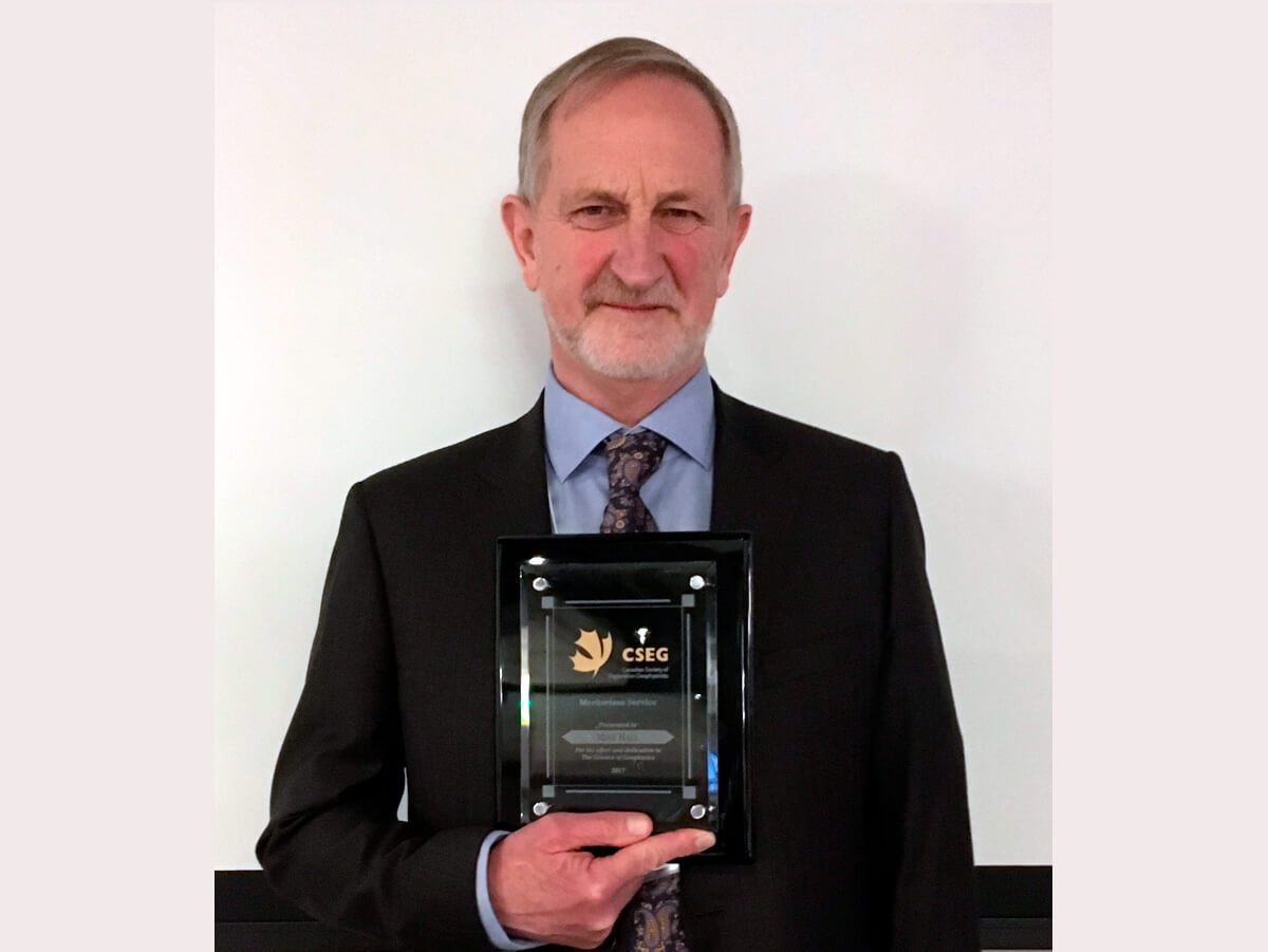
Mike has been volunteering his time for the CSEG for many years in different roles, as a member of the DoodleTrain Committee, the VIG Committee, and as a mentor, to name a few. He is the recipient of the 2017 CSEG Meritorious Service Award.
Our request for an interview was accepted by Mike, and the following are excerpts therefrom.
Tell us about your educational background, work experience, and what you are engaged in these days.
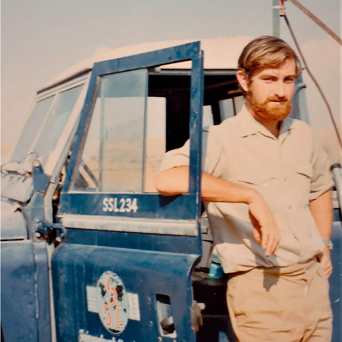
After school, I started in telecommunications and electronics with a B.Sc. in electrical and electronic engineering in London. On graduating, and being bored by the engineering job I was offered, I was lured by SSL’s slogan of, “A life of science and adventure”, so started my life as a geophysicist – actually, Field Seismologist, which is what the job title was. I discovered I liked the job, became quite good at it, and am still in the field over 50 years later.
I have worked for several companies, in roles involving acquisition and processing, and spent much time in research, from acquisition to seismic imaging and inversion, in various positions, including senior management. Currently, I am President and CEO of GeoVectra Ltd., where we are involved in processing surface 2D and 3D seismic data, from land through transition zone and ocean bottom cable (OBC), to towed streamer marine data, vertical seismic profile (VSP) data (including fiber optic distributed acoustic sensing (DAS) cables), plus aiding in the R&D efforts related to acquisition, such as Total’s revolutionary Metis® project and the development of a shallow water marine Vibrator.
You have spent over 50 years in the industry. What is it you love about our industry that has kept you going?
I love real challenges, and geophysics has plenty of them. Over time, I have applied geophysics, more precisely seismic, to oil and gas projects, as well as to projects involving mining, shallow engineering (including tunnels, rocket launching sites and nuclear power station sites), long- and shorter-term storage sites for nuclear waste, and in-seam seismic for coal and potash mines. In addition, I have been involved with non-seismic techniques, such as ground penetrating radar (GPR), magnetotellurics (MT), electromagnetism (EM), micro-gravity, and shallow hole logging, frequently integrating these with seismic data.
I especially like solving problems, first defining what the issues are and then devising techniques, be they acquisition or processing related, or both, to create solutions and then follow the process through to a solution that suits the purpose.
Over the years, I have enjoyed working with some extraordinary minds and professionals, and have a number of friends in the industry scattered all over the world. This camaraderie is something that I very much appreciate, and it is great to catch up with people.
After working for four years with SSL in Kent, UK, you picked up a field job in Calgary, then decided to go in for post-graduate studies at the University of Calgary. How did you decide on doing that?
I had had some great experiences on field crews in Sharjah and the Northern Emirates, Nigeria, and field crews in England, with a spell in data processing, but it was time to settle down and start a family. SSL offered me a good position at their Holwood House HQ in Kent, but I discovered that, after paying for rent and food, there would be almost nothing left, so I wrote to several companies in Calgary and took the best offer I got, from Vibro-X. I was supervising field acquisition, from the electronics and geophysical aspects. It was very interesting and gave me opportunities to learn a lot. In 1977, there was one of the regular oil patch downturns, and I decided I would rather broaden my education and experience by moving into processing, and perhaps research, which is what I really wanted to do. I wanted to do an M.Sc. in geophysics but the University of Calgary wouldn’t allow this unless I took a B.Sc. in geophysics first, so I did an M.Sc. in electronics instead, with a thesis on sign bit Vibroseis. It was very topical at the time and useful later on, as well.
On completing your M.Sc. and some short job stints, you spent the next 15 years at SPT Geophysical Services. What was that experience like?
It was an excellent experience. I actually joined Horizon Exploration, which morphed into SPT after a few years. I joined as a Research Geophysicist, leaving a similar position with Teknica in Calgary to do so. I moved through several positions, from Manager of Geophysical Training, Manager of Technical Services, Director of Integrated Geophysics, to Technical Director.
This was a highly active time in the business, with 3D just beginning to get a hold. I designed and worked on the acquisition and processing of the first land 3D survey in the UK, and was heavily involved in expanding the marine operations from single streamer, single source to multiple streamers and sources, which included the granting of a patent on positioning multiple streamers at sea through the use of an acoustic network.
The company had both land and marine acquisition crews plus processing centres in Swanley (near London), Houston, Buenos Aires, Rio de Janeiro, Manaus, Perth (Australia) Jakarta, Calgary and Abu Dhabi, and an interpretation group in Swanley. I was involved with the land acquisition crews in the UK, France, Spain, Argentina, Brazil, and Australia, and with the marine crews pretty much anywhere on the globe. This involved survey designs, in-field testing and QC, plus follow-up supervision of processing. On the marine side, I was involved in designing and supporting the on-board processing, which, at that time, was a pioneering effort and gave the marine operations a competitive advantage. I also pioneered the use of sleeve guns in close enough proximity for coalescence of the bubbles, a source that was used to great effect in acquiring much higher resolution data in the North Sea than was possible with the regular air guns in use at the time.
On the processing side, amongst other things, I worked to develop what we termed interpretive processing, incorporating the use of well log data to guide the processing of the data through to data ready for quantitative interpretation, a procedure we use today at GeoVectra. In this, I was also a very early developer and user of pre-stack inversion, using variations of the Smith/Gidlow and Fatti techniques, and a partner in the SPT worldwide AVO project. I appeared on the video for this, getting me recognized in places I had never even visited.
You have worked in seismic data acquisition, processing, interpretive processing, R and D, training, survey design, acquisition equipment design, technical and research management, supervisory, and senior management. Which of these roles did you find the most satisfying?
If I must choose a role, it would probably be technical and research management, though I have always remained very hands-on, even in senior management positions. I think acquisition related topics bring the most satisfaction because it is here that the biggest gains can be made. Combining these with specific processing approaches that maximize the gains brings the most satisfaction. Being in management has been satisfying because it allows the possibility to be in some control as to how things are done. In such roles, I also took pleasure in mentoring others to excel at what they were interested and excited in, and seeing them achieve success.
What problems in geophysics particularly fascinated you in your heydays, and inspired you to pursue them vigorously?
There were quite a few heyday periods in different companies, and hopefully I have not lost it yet. Anyway, as previously mentioned, I spent a lot of time on acquisition technology and techniques, from source design to acquisition equipment design, being involved in Fairfield’s Box and ION’s Firefly systems and Commander Vibrator. On the source side, I was heavily involved in assessing a variety of sources: applying mixed sources onshore to accommodate environmental constraints, Vibrator, and marine sources, including combining the S80 water gun with air guns in a dual source operation termed Gemini.
One thing that particularly fascinated me was performing feasibility studies for complex surveys, firstly determining and agreeing on the requirements with the operator, then designing an appropriate survey design, with processing and interpretation requirements in mind, following through with technical input to the project contract, and subsequent assistance with the actual acquisition and processing. A notable example of this was an OBC survey over the Zakum Field offshore Abu Dhabi, which at the time was the largest such survey and the first to use perpendicular source and receiver lines.
Give us, “A Day in the Life of Mike Hall” in, say, the 1980s and 2020.
In the 1980s, I was largely involved in research related activities, from practicing to managing, at Horizon Exploration/SPT. As this company had operations and offices around the globe, each day could bring unexpected events requiring attention, and the need to address these issues would often take precedence over the ongoing development work. Despite ups and downs in the oil and gas business, these were generally optimistic times, with technologies such as 3D and AVO making rapid progress. I was heavily involved in both.
Fast forward, which is how it feels, to 2020. Some things have changed, but not the dynamic nature of the work. Helping GeoVectra to flourish in today’s market involves being open to opportunities of all sorts, from processing 2D and 3D land and marine data, and VSP data, through analyzing acquisition trials and performing on-crew processing, to working on Total’s Metis® project. With my business partner, Svetlana Bidikhova, we have successfully completed several complex projects to the satisfaction of our clients, and are grateful to them for giving us their trust and the opportunity to work on their data, which we have thoroughly enjoyed.
Today’s environment, for seismic, is not as positive as it was before the turn of the century. However, there are still opportunities out there, problems looking for solutions, and it is quite remarkable how these opportunities can manifest themselves, seemingly out of the blue but often as a result of a conversation or meeting some considerable time before. We are looking forward to what the future brings, and ready for the challenges, whatever they may be.
When you look back at the last 50 years of your professional life, what is one narration that comes to mind? I request you to please share it.
There are a few, but probably the most notable is, “Success is getting up once oftener than you fall down.” The grammar doesn’t appeal to me, but the essential sentiment does. It implies having the capability to fail, learn from it, and proceed to greater success - a concept that is often touted these days.
Roy Lindseth also provided me with a useful saying, “Your ability is your security.” Hopefully this is still true today.
At the risk of taking too much freedom with this topic, another narration I like to follow is, “Start with the end in mind and keep it in mind.”
Having achieved so much in terms of name and experience, what is it that motivates you now?
I am still interested in seismic acquisition and processing and, as mentioned, am involved in Total’s exciting and futuristic Metis® project, using drones deploying ultimately biodegradable sensors, and real-time processing to ensure that sufficient data of adequate quality has been acquired before demobilization. I have always been keen on pushing the envelope to improve things, and still am.
Over the last few years, I have also been an active volunteer for the CSEG in education, through the DoodleTrain, getting visibility for geophysics though the VIG Committee, and mentoring young people wishing to get into the business.
Through GeoVectra, we are looking not only to apply our knowledge and skills in oil and gas, but to expand into areas such as carbon capture utilization and storage (CCUS), geothermal, mining, and other areas where the seismic method can add value.
A few times, you have been in situations where the company you worked for was taken over by another company. Tell us how difficult or easy it is to adapt to a different style of functioning or practices. How did you cope with those changes?
Sometimes it was quite easy to adapt without too much changing, but it was more difficult when there was a big culture change. Having quite a broad range of skills, I have managed to avoid being pigeonholed, and have found suitable roles within all the companies I have worked for.
Based on many of your presentations/publications, the topics that stand out are seismic survey design, refraction statics, seismic imaging and its issues, low-frequency seismic data acquisition, and unconventional resource characterization. Could you briefly tell us what aspects you focused on and contributed to, in each of these areas?
With survey design, I was VP at Seismic Image Software and involved in the development of the OMNI 3D survey design software. I gave training classes in using OMNI and designed numerous land, OBC, transition zone (Tz) and towed streamer surveys. With refraction statics, I worked on designing a very effective software system at Horizon Exploration that used relative statics with occasional control points. I have used several software packages in processing projects for this procedure, including the interferometric approach. On the acquisition side, I developed an interactive system for analyzing low velocity layer (LVL) surveys in the field.
I have been involved in pre-stack depth imaging as a practitioner and advisor since 1999, moving with the industry in terms of technology, applying it offshore and onshore, and including depth imaging of converted wave data.
With low frequency seismic data acquisition, I have been involved on the source side for both marine and land, designing source arrays on the marine side, and working with colleagues at INOVA on Vibrator technology and sweep design on the land side. More energy at low frequencies also means more source generated noise, so I have also been involved in ways to recover the signal better, through both survey design and processing algorithms. Whilst working on low frequencies, it occurred to me that, especially onshore, it could be beneficial to split the frequency range for sources, for example, with more frequent higher frequency sweeps and less frequent (by about an order of magnitude) low frequency sweeps. Geokinetics, where I was working at the time, applied for a patent for this technique, and it has been used successfully by them and continues to be used by SAE (the company who recently bought them) as a technique called Symphony.
The main focus of my work with characterizing unconventional reservoirs has been with the use of converted wave data to obtain additional rock properties, and what should likely be more reliable fracture characteristics from the shear wave splitting.
The attraction for the acquisition of seismic data with very low frequencies is to reduce or dispel the use of well log data when performing impedance inversion. The challenge is to reduce the low-frequency noise during processing. What is your impression about the extent to which such efforts have resulted in value-addition to the goal?
I’m not sure dispensing with well log data should be an ultimate goal. It still has applications, and not just with using the sonic logs. It is certainly advantageous to be able to get as low frequency as possible from the seismic data, reducing both the bandwidth gap and the reliance on low frequency velocity data, be it from sonic log data or seismic velocities. It is definitely easier in the marine environment than land, where source generated noise becomes even more of an issue. In both environments, the use of lower frequency data has resulted in more accurate inversion results.
Beyond the application of low frequencies to inversion is full waveform inversion (FWI), which is, again, harder with land data. This holds great promise though most effort is currently aimed at velocity refinement, rather than actual inversion, with solving for density still being a problem. The velocity refinements have definitely resulted in more structurally accurate images in depth, enabling more precise drilling with less wasted effort.
How do you advocate the use of seismic data in unconventional shale resource plays? A couple of years ago, there was an SEG workshop on the use of geophysics for characterization of shale plays, and experts from three participating oil and gas companies said they do not use seismic data for this purpose. Of course, there are other companies that utilize seismic data for help with optimized drilling. Your take on this, please?
My impression is that seismic can be of use, but is better used when combined with other data, sources, and so requires calibration in specific plays. Shales are complicated and highly variable, and some are more amenable to seismic applications than others. One of the problems is the time it takes to get useful results from seismic data. I am in favour of getting as much information as possible from the seismic data. Even though most such plays are not structurally complex, pre-stack depth migration can be used to obtain the additional indicative anisotropic parameters, as well as a reliable image. Similarly, using converted wave data can add information. On the other hand, such processing adds time and cost, as does the acquisition of converted wave data, thus the benefits need to be evaluated against these in specific situations.
The use of sophisticated algorithms (least squares, reverse time migration (RTM), etc.), accounting for anisotropy, faster computations, full-waveform inversion, etc., have significantly helped the accuracy with which seismic data are being imaged these days. What are some of the challenges that still need to be addressed in seismic imaging?
Currently, FWI is used primarily for refining velocity models, and developing better ways of incorporating density information is one avenue for improvement. What I would like to see is the application of artificial intelligence (AI) and machine learning (M/L) in imaging, along with interpretation being an integral part of the imaging. This would involve an interpreter, working within a team, bringing local geological knowledge, and maybe dynamic information from drilling, production, etc., to play in the model building and inversion process, for targeted imaging and inversion. This could be some way off, as it would require large compute capability, and the ability to visualize and interact with complex 3D models of the subsurface that could, and probably should, extend beyond the seismic data. Computer technology is continuing to develop fast, as are the algorithms used in imaging, so this may not be all that far off. As with many such developments, one should not be daunted by the current technology; it will be there when the algorithms and systems are ready.
Some people opine that, “Development of something extraordinary begins at the end of your comfort zone.” You have made many contributions by way of smart ideas, and you are also a holder of three patents. How would you react to the above statement?
There is some truth in this statement. It requires a vision of what the outcome could be. The steps on the path will most likely involve new concepts or learning new or different technologies or methods that stretch the comfort zone. Being open to ideas from outside sources and colleagues and putting things together to create something new is rewarding. One such example from my career was the creative idea of taking the software used in transmitting mammogram images from Saudi Arabia to a Boston hospital, to create a seismic data compression system that could be used to transmit seismic data from remote land crews and seismic vessels to a central processing system for QC and analysis.
You volunteer for the CSEG in different roles and have done so for many years. What keeps you going in fulfilling the duties you take on?
I have had an interesting and at times exciting career, including travelling the world, and wish to give something back to the profession that has given me such opportunities. I feel that it is important to aid in continuing education so that geophysicists can keep up-to-date and perhaps broaden their space. I also to try to promote the use of geophysics wherever it can bring value to society.
Outside of the work that keeps you busy, what other interests do you have?
I have been a keen cyclist for many years, and still ride, though not as often, and watch events throughout the racing calendar. I also enjoy reading outside of geophysics and science, mostly classic English and Russian authors, watching old movies, attending live cultural events when possible such as classical music, opera, ballet and plays. Spending time with my wife is a great pleasure, whatever we are doing. Seeing my sons and grandchildren, when I can, is very enjoyable, though this is mostly through Skype, as they are not in Calgary. I enjoy walking or hiking outdoors, especially in beautiful clean environments, and travelling to new places when the opportunities occur. I sing in Calgary’s Cool Choir, where my lack of singing talent is fortunately drowned out by a couple of hundred other voices, and was, until Covid struck, having fun stepping on my wife’s toes during dance lessons.
What would be your message for youngsters who have joined our industry recently?
First of all, you need to love this profession and know that what you do is important for society. There will be downs as well as ups, and this passion will keep you going through the downs.
There are still many challenges that present opportunities, not only in oil and gas applications but also in such areas as CCUS, geothermal, engineering and anything that involves obtaining accurate images of the subsurface - be these shallow or deep. As a geophysicist, you will know a lot about the earth and how to take care of it.
There is also a big world out there, and many problems needing solutions in many locations. Do not limit your horizons and be prepared to leave your comfort zone. Situations will most probably change many times during your career. Keep learning, stay flexible, think broadly and globally, and you should be able to forge your own path to a successful career and a fruitful life.


Editors' Picks
- Science Break: Heart Attacks – “From the Archives”
Oliver Kuhn - The New Reservoir Characterization
John Pendrel - AVO Modeling in Seismic Processing and Interpretation Part 1. Fundamentals
Yongyi Li, Jonathan Downton, and Yong Xu - Improved AVO fluid detection and lithology discrimination using Lamé petrophysical parameters: "λp", "µp", and "λ/µ fluid stack": from P and S inversions
Bill Goodway, T. Chen and J. Downton - The wedge model revisited
Joanna Cooper, Don Lawton and Gary Margrave - Seismic Attributes – a promising aid for geologic prediction
Satinder Chopra and Kurt Marfurt - Scanning Calgary's Water Towers: Applications of Hydrogeophysics in Challenging Mountain Terrain
Craig Christensen et al. - AVO analysis in the presence of NMO stretch and offset dependent tuning
Jonathan Downton


Share This Interview