It is surprising that many Calgary-based earth scientists have never heard of the so-called Spokane Flood, although a recent PBS Nova TV special on the topic has probably changed that. The Spokane Flood, which occurred just a few hours drive south of Calgary, is extremely interesting for two main reasons. Not only is it a natural catastrophe of massive proportions, well documented in a geological sense, it also provoked a debate central in the struggle between the two geological schools of thought, uniformitarianism and catastrophism.
The Spokane Flood would have occurred about 14,000 years ago, towards the end of the last ice age. Simply put, an ice dam at the southern edge of the Cordilleran Ice Sheet blocked the Clark Fork River, creating a huge glacial lake in the vicinity of Missoula, Montana (Fig. 1). This ice dam then ruptured, and the subsequent flood scoured out the Spokane Basin leaving behind dramatic geological evidence of its occurrence.
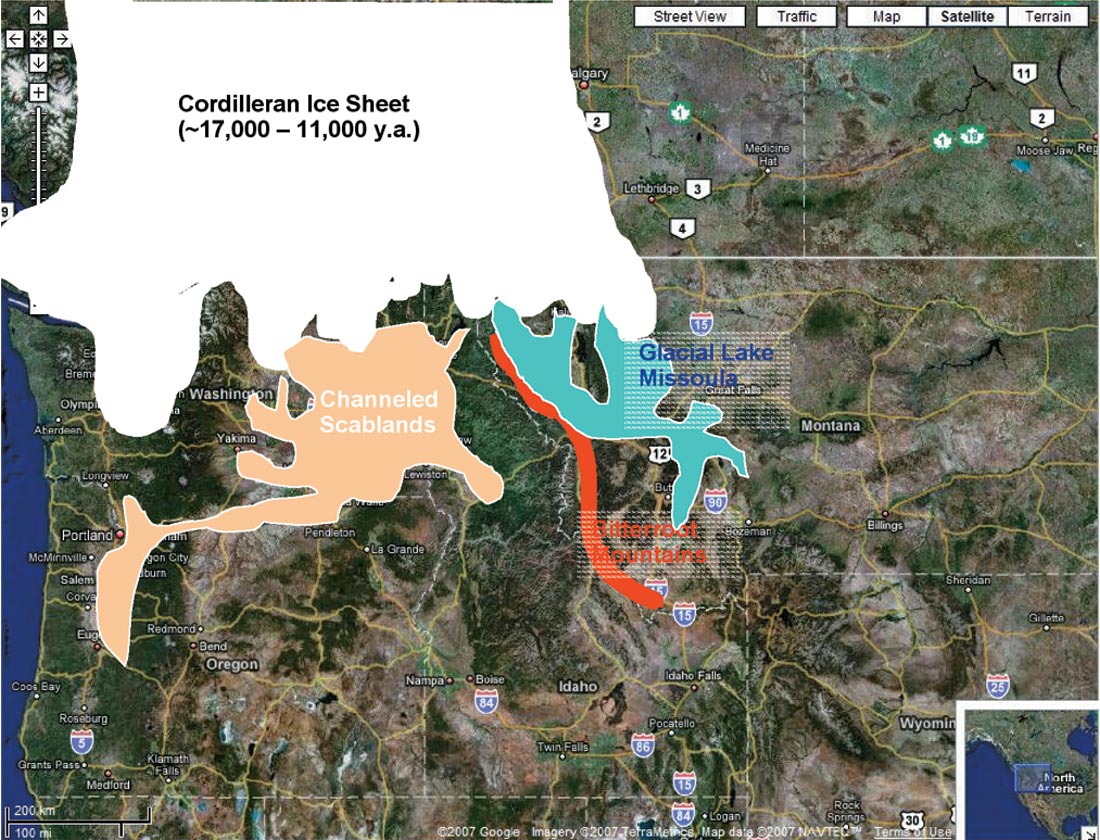
It is possible that humans witnessed this event. Early North Americans are known to have lived in the area – the remains of an early human, known as Kennewick Man, were found near the Wallula Gap, and some historians have connected elements of local tribes’ oral histories with the Spokane Flood. Radiocarbon dates for Kennewick Man place him from ~ 9,300 years ago, but other evidence suggests a date perhaps 1,500 years more recent than that – both thousands of years after the Spokane Flood occurred. However, as recently reported in Science magazine, analysis of human coprolites from some Oregon caves is giving dates of 14,000 years ago, the right time and place for humans to have witnessed the great flood. But let’s leave that line of speculation for another time, and fast forward to more recent history.
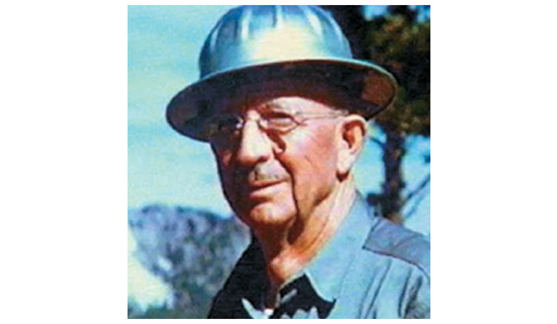
J Harlan Bretz (Fig.2) began his career as a high school teacher in Seattle, but was drawn to geology. He pursued his passion, eventually earning a Ph.D. at the University of Chicago in 1913. Still intrigued by the surface features he had observed in Eastern Washington as early as 1910, in 1922 he returned to do seven year’s of field work in that area. By 1923 he was convinced that features throughout the Columbia River Plateau could only have been formed by water movement of an unimaginable scale – in other words a massive flood, of biblical proportions as has been said.
Geology in the 1920s was far different from the heady days one hundred years earlier, when the theories of Hutton and Lyell were at the forefront of the battle between church and science. In the 1920s uniformitarianism was so firmly entrenched that any geological theories that did not conform to uniformitarian principles were considered heretical by the geological community. Ironically, the scientists had become dogmatic and inflexible in their thinking, just as they had accused the church of being one hundred years earlier. When Bretz published a paper in 1923 that explained the East Washington landscape as being formed by a massive flood (the term Channeled Scablands comes from this paper), a flood of catastrophic proportions such as the one in the Bible, he was ridiculed, and his theories shot down. “Bretz’ flood theory was so despicable that even circular reasoning could be employed to erect an alternative hypothesis. ...One cannot but be amazed at the spectacle of otherwise objective scientists twisting hypotheses to give a uniformitarian explanation to the Channeled Scabland. Undoubtedly these men thought they were upholding the very framework of geology as it had been established in the writings of Hutton, Lyell, and Agassiz.” (V.R. Baker)

Down but not out, Bretz doggedly returned to Washington for further field work. The body of work he put together documenting the geology of the Spokane Flood is impressive, but it lacked one major component – he never explained where or how the huge volumes of water required by his theory would have existed. In other words, his theory was like a murder case lacking a weapon and a motive. Beginning in 1925 another geologist, Joseph Pardee (Fig. 3), began working on the theory of the ice dam, and Glacial Lake Missoula. The work of these two men, along with an increasingly better understanding of the last Ice Age and its processes, resulted in the basically unanimous acceptance of Bretz’s Spokane Flood theory by the 1950s. Bretz died in 1981, so he did enjoy the sweet taste of vindication. The geological debate surrounding this great flood has resulted in earth scientists understanding that both uniformitarian and catastrophic forces have shaped our earth, and will continue to do so.
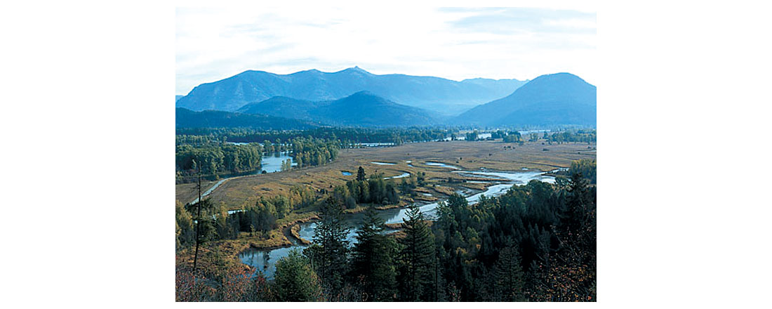
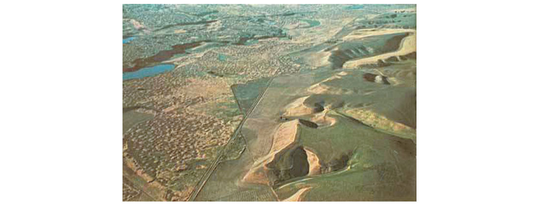
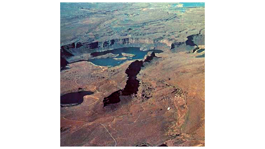
Numerical estimates attached to Glacial Lake Missoula and the Spokane Flood are staggering. The lake is thought to have been ~ 10,000 km2 in area, with a water volume of ~ 2,100km3, approximately equal to the combined volumes of Lakes Erie and Ontario, all held back by ice. At the point of the dam, near Sand Point (Fig. 4), the depth of the lake would have been ~ 650m, 350m at Flathead, and 200m at Missoula. When the dam burst, the flow of water at its peak was ~ 40-60 km3 / hour (or up to ten times the current flow rate of all the world’s rivers combined), with water flowing at a speed of up to 120 km / hour. Simple math gives the duration of the flood as only 3 to 5 days, yet in this brief period the flood waters removed some 210 km3 of sediment further to the west. Prior to the flood the Spokane Basin contained approximately 75m of loess overlying basalt sheets; after the flood the loose sediment had mostly been scoured away. Figure 5 shows a view from the air with exposed basalt on the left where the flood waters roared through, and to the right loess untouched by the torrent.
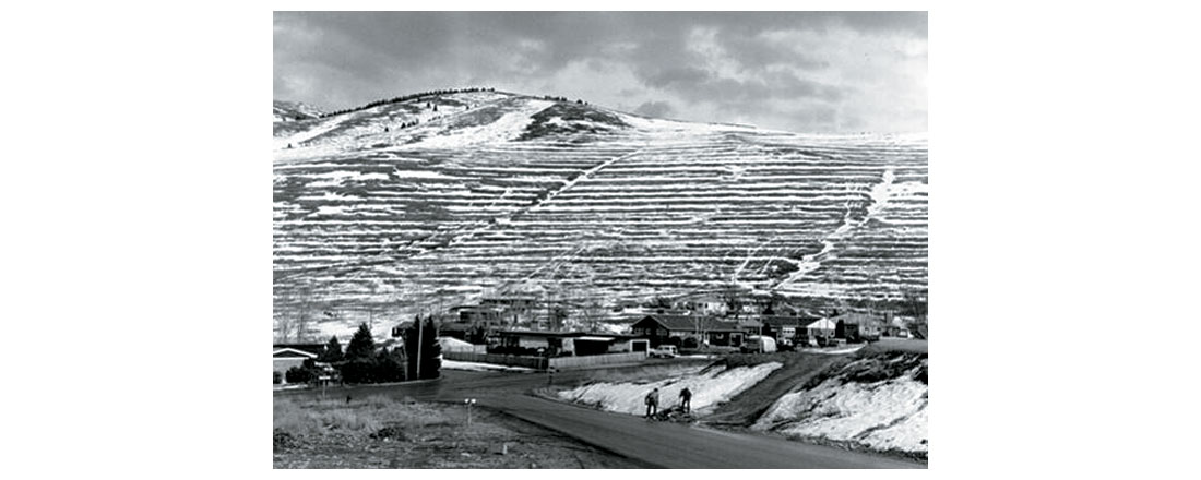
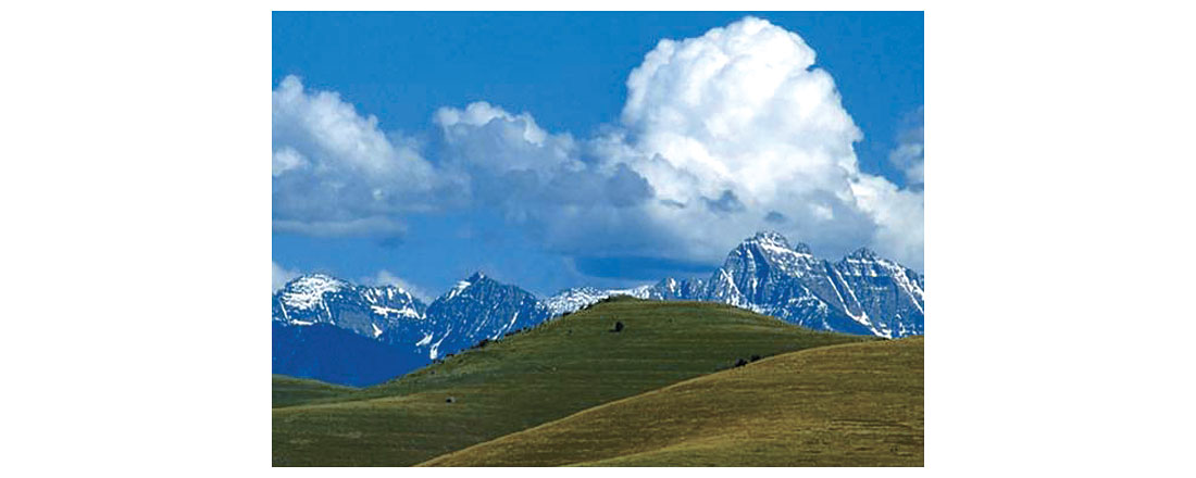
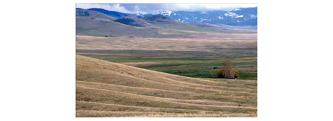
The geological evidence is extensive, but here are just a few examples. Figures 6 and 7 show ancient shorelines high above Missoula and Flathead Lake respectively. Figures 8, 9, and 10 show giant ripple marks left behind on the bottom of Glacial Lake Missoula as it emptied. These ripple marks are so big, 15m high and 200m apart, that people weren’t really aware of what they were until the advent of crop dusting from airplanes became popular in this region, and a bird’s eye view was possible.


Figures 11, 12 and 13 show a variety of boulders lifted and moved west by the flood. Really big boulders such as in Figure 11 were most likely rafted along in big chunks of ice, while the smaller ones were pushed directly by the flood waters. Tests and models using the size and weight of these boulders, and the amplitude and period of the ripple marks, have been used to come up with presumably accurate estimates of the water flow rates.
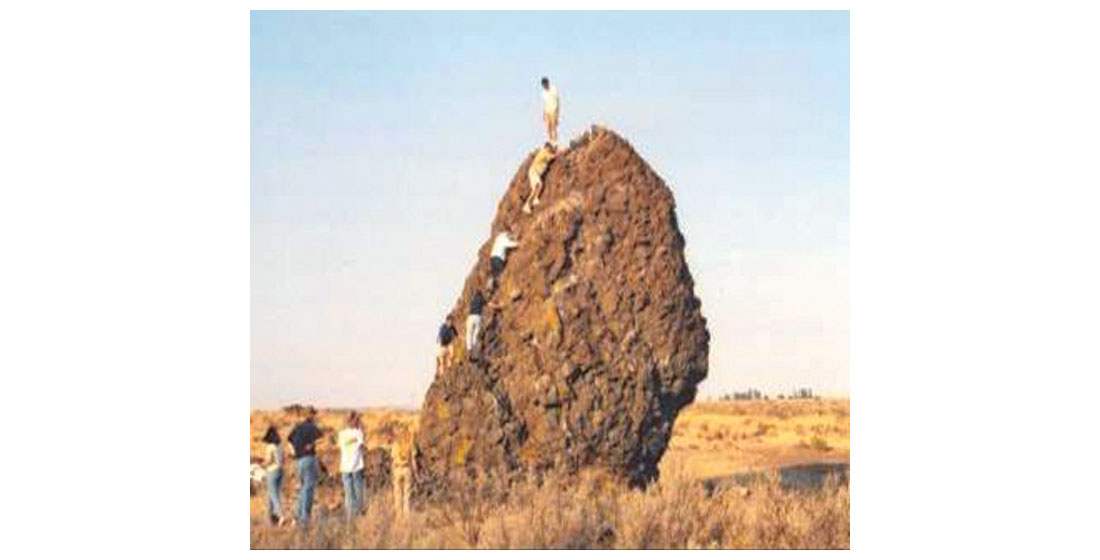
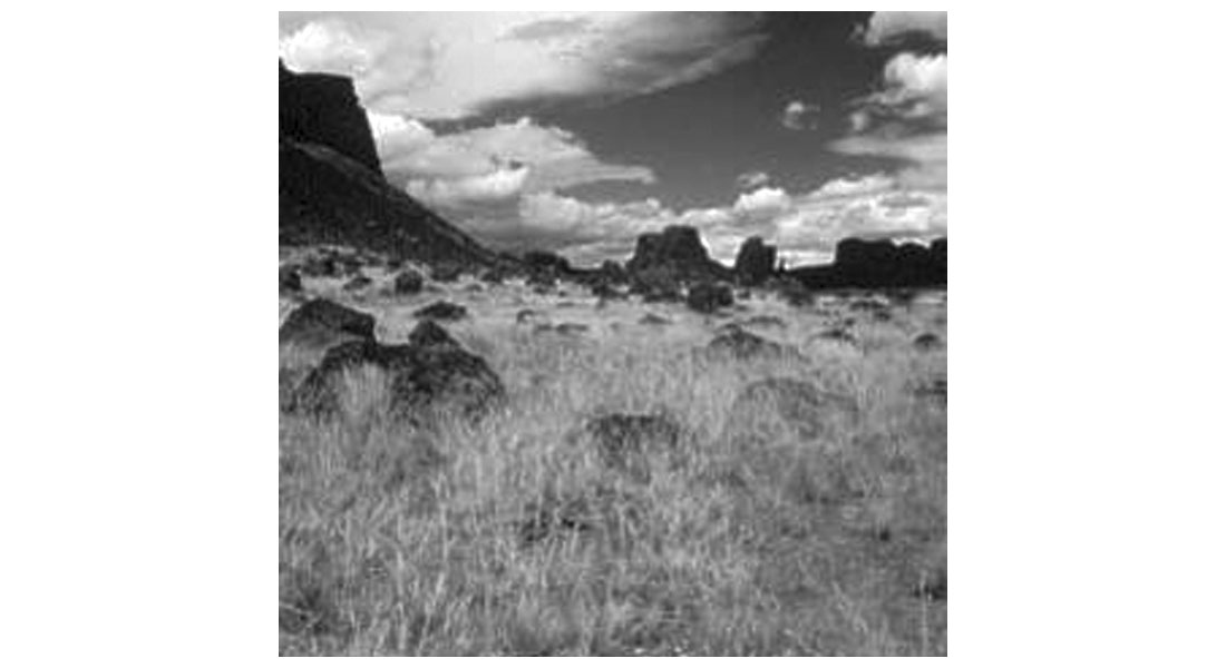
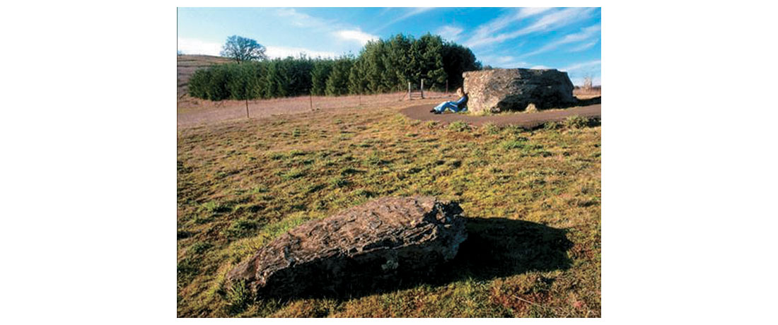
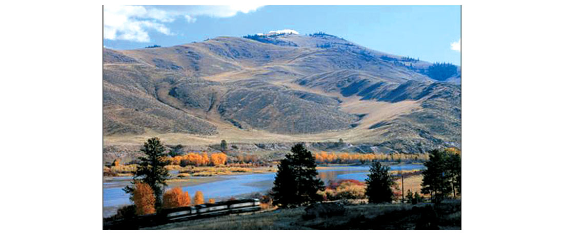
Figure 14 is a picture of a coulee in Eastern Washington, a typical feature in a post-glacial landscape, but it is the size and scale of these features in the scablands that is impressive. Figure 15 shows Dry Falls, which is northwest of Spokane. When the water briefly flowed through this area it carved out this feature, water exploding over the escarpment, then pounding down and drilling out this canyon, only to be left high and dry. It is 5.6km wide, 122 m high; in comparison, Niagara Falls is 1.6km wide, 50m high. Figure 16 is a view of the Flathead River, and shows an interesting feature known as gulch fillings. The water would have roared in over the ridge from the right, and the mound of sediment in the centre would have been dumped in the zone of turbulence created in the shadow of the ridge.

But what exactly happened when the ice dam burst, and how and why did it burst? Contemporary answers can be found in Iceland, where the sudden draining of a glacial lake, known as a jökulhlaup, occurs occasionally. Usually the Icelandic ice dams rupture due to sub-glacial volcanic activity melting the ice above, but sometimes another mechanism is at play. Essentially, as the ice making up the dam is subjected to greater and greater pressure from the weight of the water and ice above it, its melt temperature is lowered. Small cracks due to melting begin to form, and as these cracks connect to form networks, water begins to move through the ice. The friction of the water against the ice further enlarges the passages, and so on. Suddenly, a point is reached where there is a catastrophic failure in the structural integrity of the dam at its base, and the dam collapses.
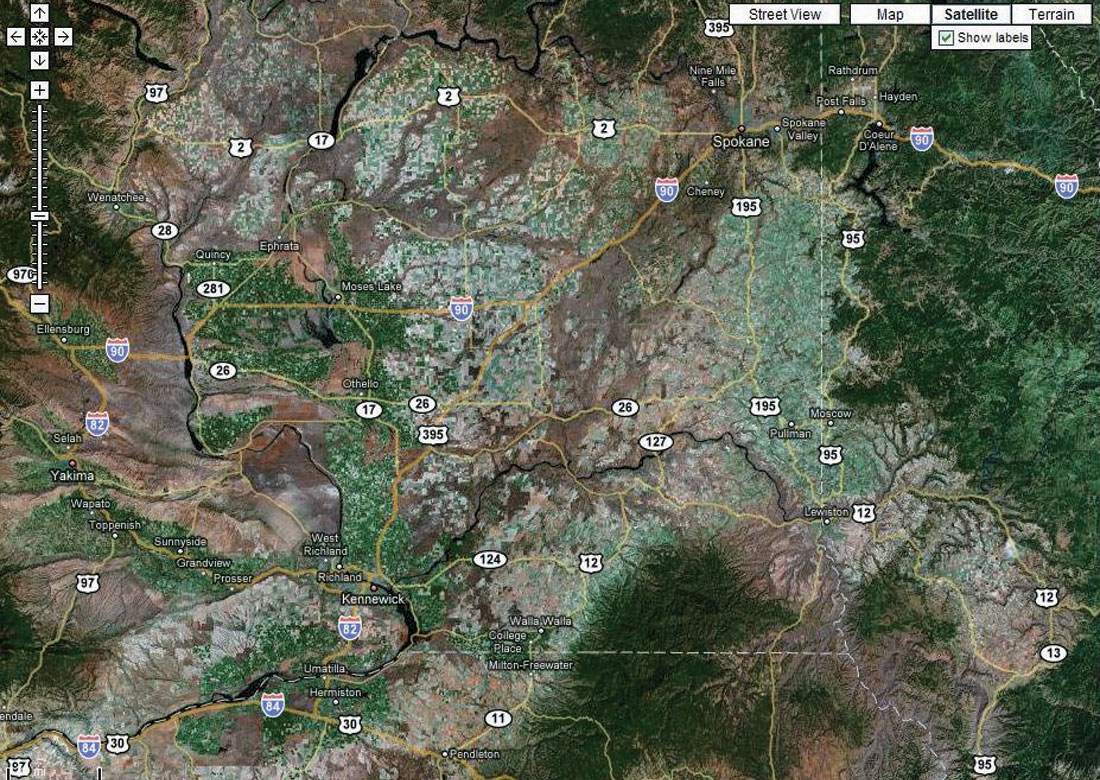
When the ice dam holding back Glacial Lake Missoula ruptured, 2,100 km3 of water exploded out to the west and southwest. The water blasted through channels of least resistance, taking boulders, earth and everything else with it. A look at a Google satellite view of Washington State (Fig. 17) plainly shows the many routes the water took as it scoured its way through the Spokane Basin – these scoured channels can’t support agriculture, so they show up as a purplish brown. But this was not a case of the water draining towards the Pacific in a well behaved fashion; the huge volume of water forcing itself onto the landscape meant that walls of water flowed violently backwards up river valleys such as the Palouse Canyon, then finding no way out, slopped back down the direction they came from." The Wallula Gap just southeast of Kennewick represented a bottleneck. Water backed up at this point, and as it blasted out the other side, it created the windsurfing mecca now known as the Columbia Gorge. At Portland some water headed north to the sea, while some was forced south, up the Willamette Valley all the way to Eugene, Oregon. The rich fertility of the soil in this valley, some of the best farmland in the U.S.A., is thanks to the Spokane Flood.
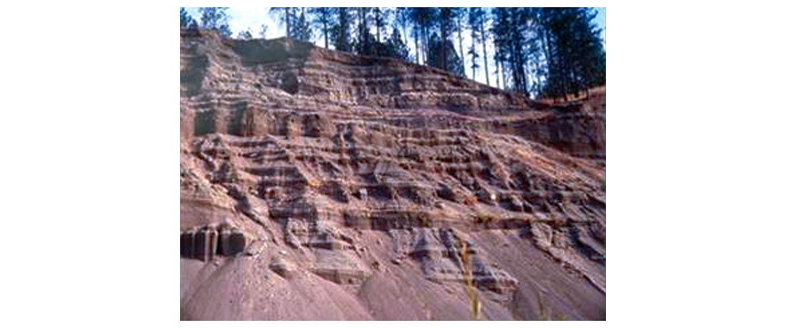
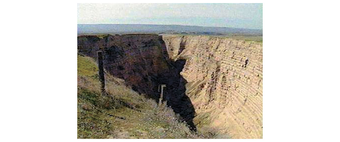
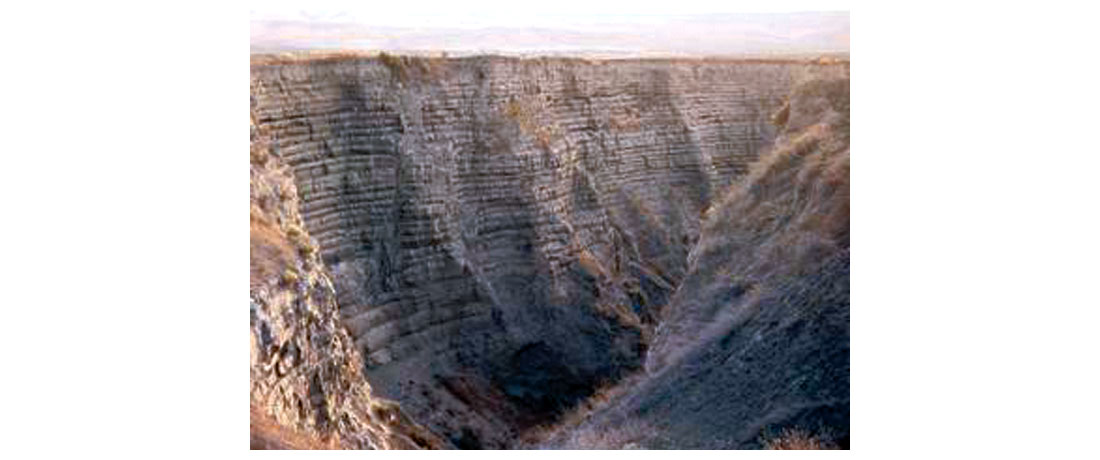
Figures 18, 19 and 20 show thick deposits from the flood. These banded deposits, known as rhythmites, are currently the focus of debate among geologists. None of them doubt that the Spokane Flood happened, the discussion now is whether there was one flood, or many. Some geologists feel that each layer in these rhythmite sequences came from one flood episode, and that the Sand Point ice dam formed and ruptured many times. Other geologists believe that one flood could easily create many, many layers, as water sloshed up and down valleys while the Spokane Basin system struggled to disgorge the huge volume of water through the Wallula Gap and other bottlenecks. A 1996 jökulhlaup in Iceland, with a flow rate less than 0.5% of the Spokane Flood, in places left 15m of deposits made up of 200-300 rhythmite layers in 36 hours. Although a single flood could explain the surface geology, most likely there was more than one Spokane Flood episode, as the Purcell Trench and Bitterroot Mountains create such a perfect location for an ice dam. And perhaps there were even floods originating from other river systems being blocked by other ice dams further to the north and west.
The size and power of the Spokane Flood is exciting, and can get a person thinking whether other similar episodes of varying scales could have occurred throughout the last glacial period. Look around Calgary – there are many features, for example the small but sharp-sided gorge by Big Hill Springs near Cochrane, that perhaps can be better explained by the sudden release of water from behind an ice dam, rather than gradual erosion from glacial meltwaters. But to see the footprint of the mother of floods, all that is required is a drive down to Missoula and Spokane! There you can see first hand the results of one of the world’s biggest and most terrifying floods ever, and see proof that geological forces can be both uniform and catastrophic in nature.


Share This Column