The largest seismic survey to date in Canada was acquired during the summer of 1997 in the Jeanne d'Arc Basin, off Newfoundland. Over 70,000 CDP km. distributed in an area of approximately 2000 sq. km. was collected on behalf of 10 oil companies active in the area. This survey covers older discoveries such as the Terra Nova, White Rose, Hebron, Ben Nevis and North Ben Nevis oil fields and new exploration areas located South of Hibernia (Gander). Acquisition was done using the Ramform Explorer seismic ship by towing eight streamers an d two sources in a 4050mx25mx16 lines acquisition configuration (Figure 1).
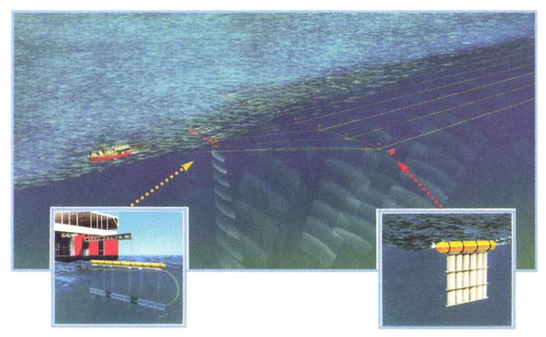
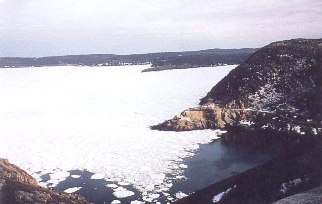
During the survey, new Canadian records for marine acquisition were set due to the vessel's capability of recording 16 seismic lines at a pass (30-40 km. long swath) and its prolonged, continuous sea deployment (over 5 weeks at a time). Other improvements in acquisition included: 1) sharp, constant air gun array signature; 2) 24 bit streamer technology and 3) precise in-water positioning of the spread using DGPS in conjunction with other radio and acoustic devices. Despite being a very successful acquisition season, operating a seismic boat offshore Newfoundland, in the cold Atlantic waters, proved once again to be a challenging endeavor. Ice floats, iced harbors, icebergs, heavy storms, thick fog and other 'events' were encountered during the acquisition program (Figure 2).
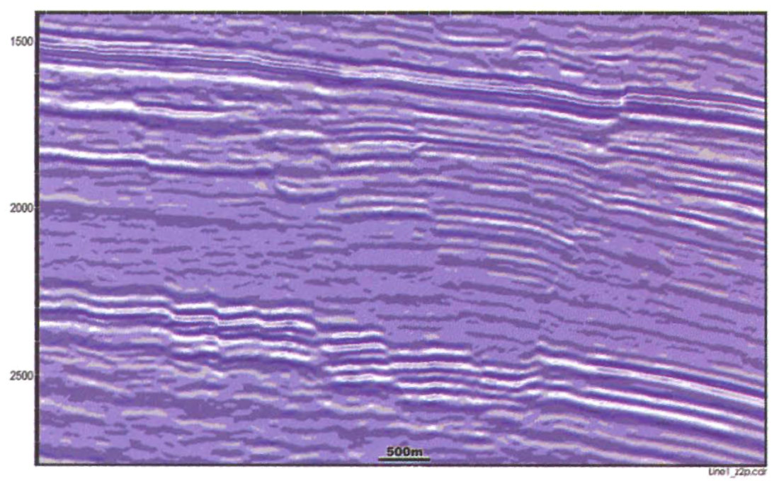
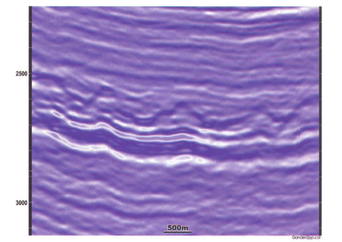
With the Hibernia oil field already on-stream and producing at almost 100,000 barrels a day, the Jeanne d 'Arc Basin, located on the Grand Banks of Newfoundland, is Canada 's youngest petroleum province. This basin was shaped by three successive rifting episodes and underwent significant salt tectonics. Inter-rifting sag events and a final thermal subsidence deepened the basin and allowed for a thick accumulation of sedimentary layers that includes source and reservoir rocks. Complex fault patterns, salt features and stratigraphic complications exist both in the White Rose field and Gander exploration areas. Recording and preserving the highest possible seismic frequency/amplitude ranges, careful seismic velocity field selection and correct application of migration algorithms are required in such a geologically complex area. Seismic processors, seismic interpreters and exploration geologists must work together during data processing to simultaneously address regional structural processing and local targeting of potential reservoir intervals. This collaboration is particularly essential for imaging reservoirs under or above major unconformities in the presence of dense, intersecting fault systems.
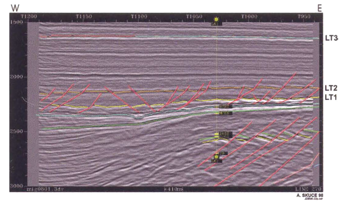
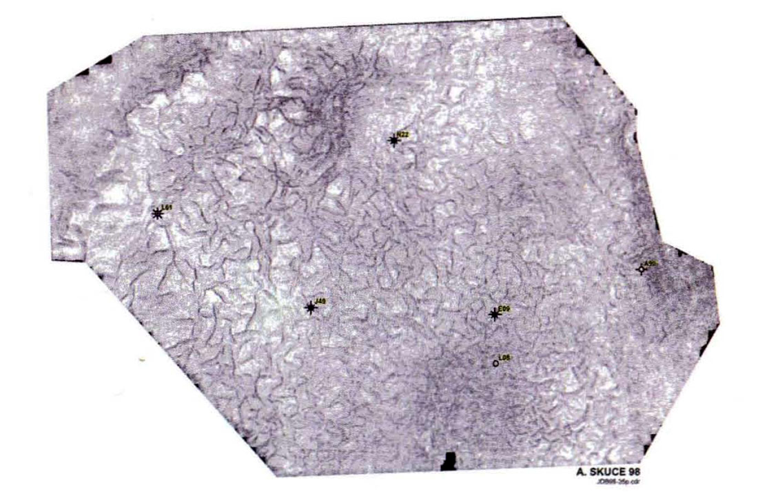
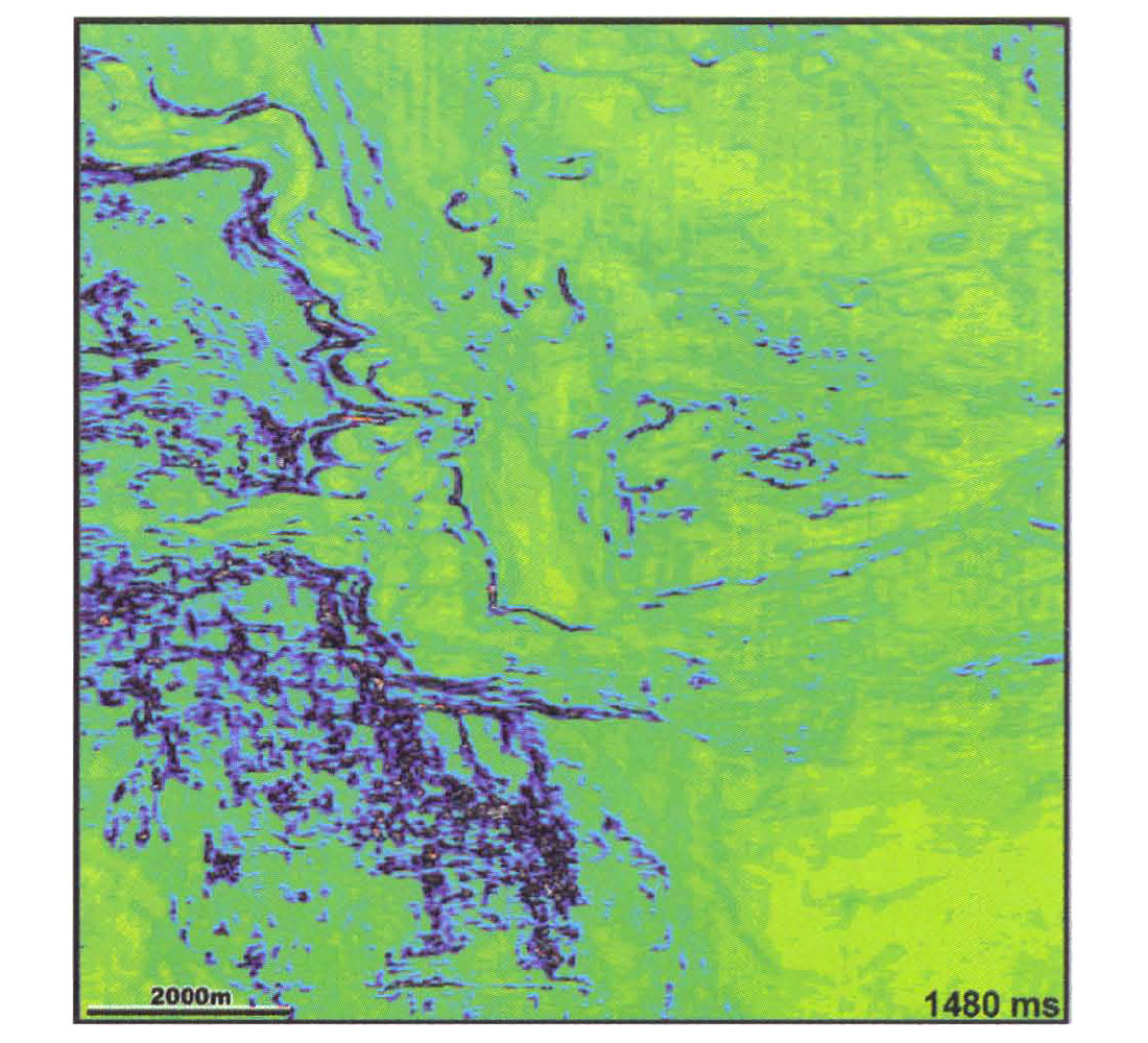
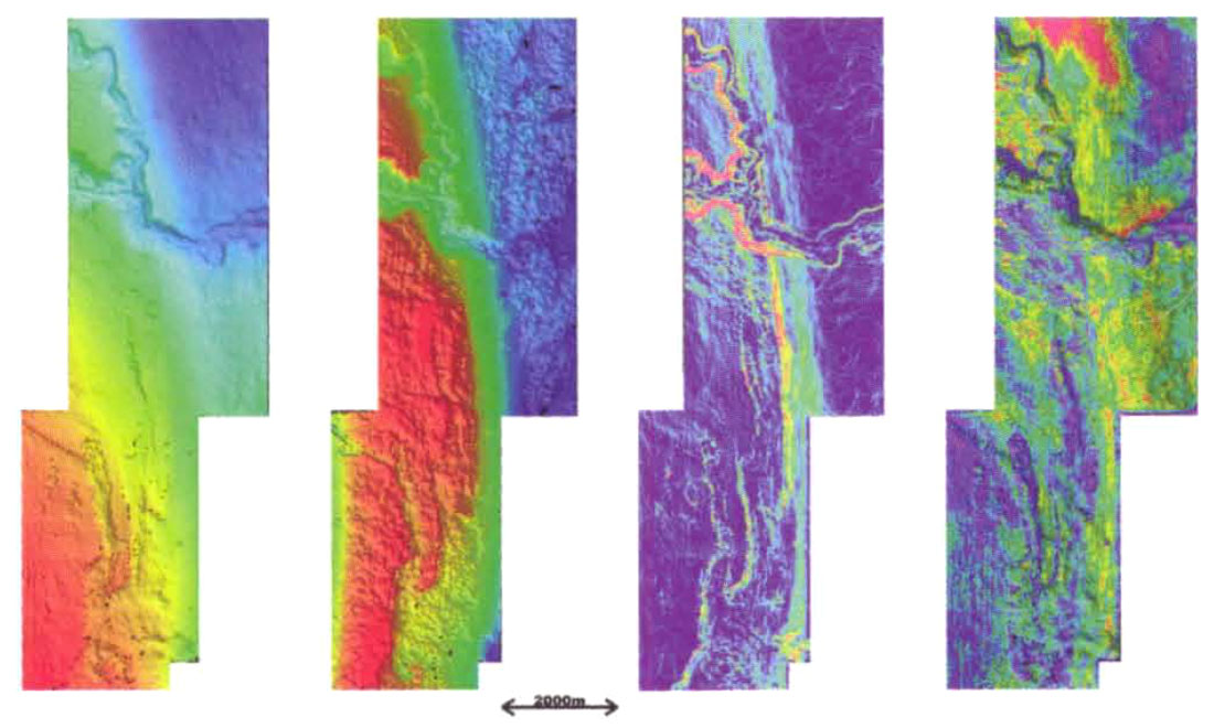
The final Jeanne d'Arc 1997 3-D migrated data volumes show a fair increase in the higher frequency range in comparison with the area's older surveys. Nevertheless, the dramatic increase in the high frequency content expected by interpreters, especially in the potential reservoir section, was not achieved. In our opinion, high frequency loss is caused primarily by geological factors such as the presence of: a local hard bottom; unconsolidated Late Tertiary sediments; a honeycomb pattern of fluid expulsion faults in the Tertiary (Figures 3 and 4); several erosional unconformities and complex, intersecting fault systems (Figures 5, 6 and 10). However, the approximately 30% increase in the frequency content allows for slightly better vertical and lateral resolution of the Jeanne d'Arc, Hibernia, Avalon and Ben Nevis sandstone and complex, intersecting fault systems (Figures 5, 6 and 10). However, the approximately 30% increase in the frequency content allows for slightly better vertical and lateral resolution of the Jeanne d'Arc, Hibernia, Avalon and Ben Nevis sandstone reservoirs and more accurate fault throw estimation. Depth migration performed on some of the subsets further increased our ability to map subtle tectonic and structural features. Spectacularly imaged is an "en echelon" extensional fault pattern located in the Trans-Basin Fault Zone area and previously interpreted as a continuous, major fault.
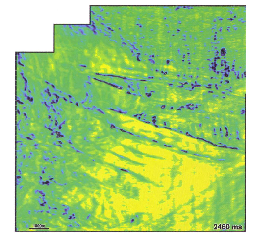
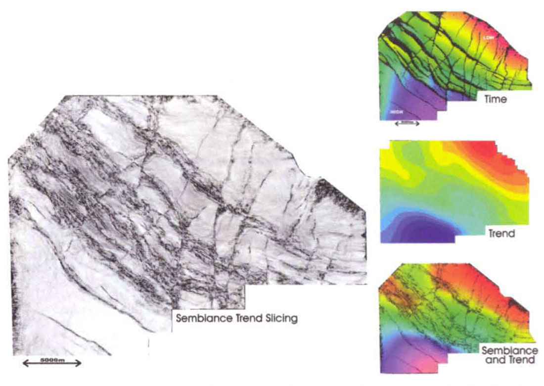
The main accomplishments of the 1997 marine 3-D survey are: 1) overall increase in the dynamic range and signal to noise ratio; 2) removal of bothersome water bottom multiples, peg legs and other unusable coherent events; 3) sharper solutions for fault planes; 4) elimination of fault aliasing problems; 5) identification of the hexagonal fault pattern in Tertiary and 6) better delineation of drilling locations. Vertical sections, time slices, continuity (coherency) slices, time structure maps, attribute maps and other special displays illustrate the amount of geological detail, unseen in the past, but present in the 1997 data sets covering the Terra Nova field, Hebron-Ben Nevis, Cape Race-North Ben Nevis, Gander and White Rose field area s (Figures 4 to 10). The most useful tools for tectonic interpretation are coherency, continuity or semblance trend maps, that can be used in combination with time structural maps for refining mapping (Figure 10). Avoiding the drilling of exploration or delineation wells too close to a fault plane is an important challenge in a severely fractured area.
Despite low oil prices, an exiting future is envisaged for the Grand Banks petroleum province. Large 3-D data surveys now cover most of the licensed part of the Jeanne d 'Arc Basin. Seismic interpretation will be followed this year by a series of exploratory drill holes or field delineation and development wells (at Hebron, White Rose, Terra Nova, etc.). A 4 C, 2-D or 3-D seismic experiment in the basin was recently proposed by a group of organizations lead by the Department of Geophysics at the University of Calgary. Industry deep water drilling may be carried out in the Flemish Pass Basin in the early 2000s, while scientific deep ocean drilling of the East Newfoundland Basin (ODP) may follow toward the end of the next decade. This should open up a new exploration frontier in the deep (> 1000m) Atlantic water off Newfoundland.


Join the Conversation
Interested in starting, or contributing to a conversation about an article or issue of the RECORDER? Join our CSEG LinkedIn Group.
Share This Article