Marine Gas Hydrates in New Zealand
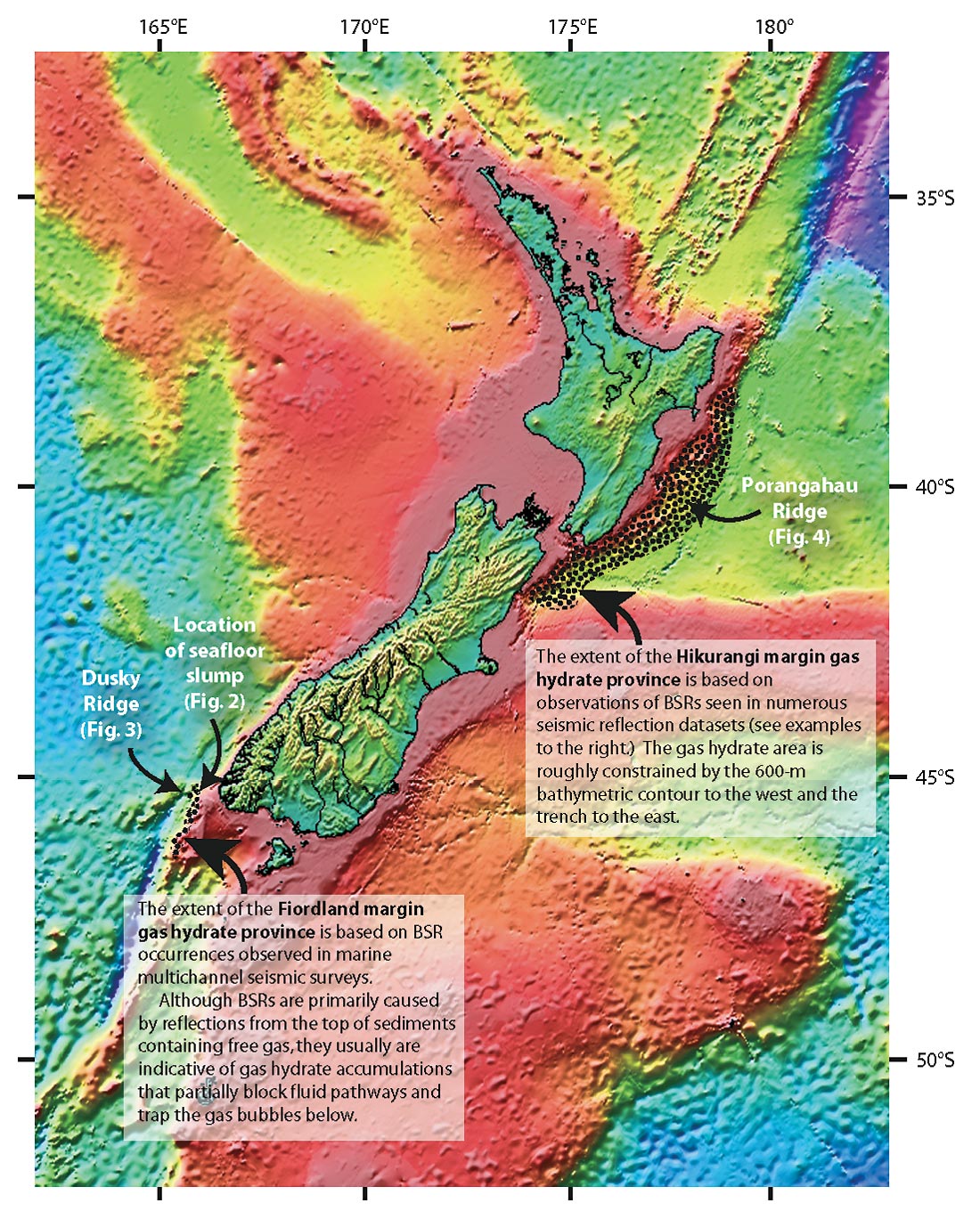
Methane hydrates are abundant on the two active continental margin regions of offshore New Zealand. The New Zealand crust consists of a rifted fragment of Gondwana that now straddles the Pacific / Australian plate boundary. Along the east coast of the North Island, oceanic Pacific crust subducts under a continental block of the Australian Plate along the Hikurangi margin; to the west of Fiordland on the South Island, oceanic Australian crust subducts under a continental block on the Pacific Plate (Figure 1). Gas hydrate accumulations along these margins occur over well-constrained pressure and temperature ranges in the upper 500 m or so of seafloor sediments and in water depths of at least 600 m. Over the past few years, researchers at the University of Otago and GNS Science (New Zealand’s geologically oriented crown research institute) have made use of existing industry and government seismic data sets to assess the extent of gas hydrates on New Zealand’s margins and to estimate volumes of methane associated with them. This has primarily been done by the identification and analysis of bottom simulating reflections (BSRs) in the seismic data.

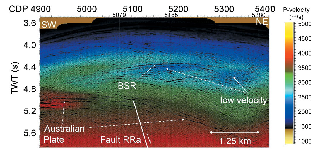
A BSR is generally produced by seismic energy reflecting from the top of gas-filled sediments lying below the zone of hydrate stability. In active margins, such as the subduction related Hikurangi and Fiordland margins, high fluid flux often results in the maintenance of a free-gas reservoir under any significant hydrate accumulation. As a result, regions of high concentrations of hydrate will often correspond to zones of significant BSRs. Such features currently are the targets of several energy-related gas hydrate research projects around the world.
Fiordland Margin
BSRs have been observed on seismic data from the Fiordland Margin for over 20 years (Townend 1997). Systematic study of the data in this region has identified a small hydrate province covering 2200 km2 and containing an estimated volume of 1110 km3 of solid hydrate (Fohrmann et al. 2007) – which would contain the equivalent of ~ 6400 TCF of methane at standard temperatures and pressures (STP). Our knowledge of the Fiordland gas hydrate province is limited by the sparse dataset here – and our lack of supporting geological information on seafloor geology. There are few samples of sediment from this region and no wells. Hydrate accumulations in this region appear to be associated with failures of the slope. One particular submarine landslide appears to correspond to a location where the BSR appears to outcrop on the seafloor (Figure 2) (Crutchley et al. 2007). Seismic inversion methods have been used to constrain our quantifications of hydrate in Fiordland (Figure 3) (Fohrmann et al. in review). These analyses depend on assumptions of sediment properties, but confirm that significant accumulations of natural gas are present in the hydrate and underlying free gas reservoirs.


Hikurangi Margin
A comparative abundance of seismic and geologic data off the east coast of New Zealand has led to a better understanding of the hydrate system in this region (Henrys et al. 2003). The hydrate province in this area is over 20 times the size of the Fiordland province at 50,000 km2, possibly containing as much as 23,000 km3 of solid hydrate (~133,000 TCF of methane at STP). Such huge quantities of methane deserve attention for their resource potential, and current research is examining methods to high-grade sweet-spots in the hydrate system at optimal locations (e.g., Figure 4) where geological structures and active fluid flow result in a dynamic system where hydrates and associated free gas can be concentrated (Pecher et al. 2004; Henrys et al. 2007; Crutchley et al. in prep). Other significant effort is examining the relationship between seafloor stability and hydrate occurrences on the Hikurangi Margin (Pecher et al. 2005; Faure et al. 2006) which may have ramifications for global climate studies if a mechanism can be found for the cycling of methane between the shallow seafloor and atmosphere.

Non-seismic gas hydrates
Recent analyses of several European and North American offshore hydrocarbon provinces, have shown significant quantities of methane hydrate – without a corresponding BSR signal. In these cases, hydrates are often detected by wireline logs in locations where strata are oriented parallel to the seafloor – and would therefore mask a BSR character. In these low-fluid-flux passive margin settings, high concentrations of hydrate are often detected without a corresponding free-gas zone underlying them (Senger et al. in prep). In fact, if the lithology of the sediments in such an environment is suitable, economically significant deposits of hydrate are possible. Current work is aimed at the analysis of well logs from the Canterbury and Great South Basin petroleum provinces to determine the potential of these regions for hydrate deposits.

Acknowledgements
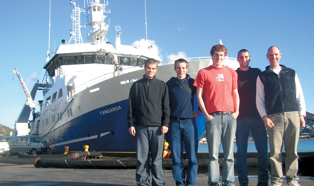
Ingo Pecher (now at Heriot-Watt University), Stuart Henrys, and the management of GNS Science have facilitated much of the gas hydrate research undertaken in recent years. Funding (e.g. for the acquisition of the TAN0607 data shown in Fig. 4) has come from the New Zealand Foundation for Research, Science and Technology, and Marsden Fund grants to the gas hydrate team led by scientists at GNS Science. Additional funding has come from the University of Otago Research Committee. Seismic lines from the Fiordland margin shown in this abstract have been made available through the generosity of the New Zealand Ministry for Economic Development. Seismic processing has made use of an academic license for Globe Claritas. This work would not have been possible without the dedication of my students, particularly Miko Fohrmann, Gareth Crutchley and Kim Senger.


Join the Conversation
Interested in starting, or contributing to a conversation about an article or issue of the RECORDER? Join our CSEG LinkedIn Group.
Share This Article