Introduction
The Department of Geology and Geophysics at the University of Calgary has recently purchased leading-edge seismic and other geophysical equipment for research programs and for the education and training of undergraduate and graduate students. Purchase of this equipment was made possible through a grant of $1.2 million from the Provincial Government (Alberta Innovation and Science) a $1 million donation from Nexen Inc., and deep discounts provided by equipment vendors.
The equipment includes a new 600-channel ARAM Aries seismic system to be used for a wide range of research projects; e.g. time-lapse monitoring of reservoirs for improved oil and gas recovery, monitoring and verification of geological storage of CO2, monitoring in-situ processes associated with production of oilsands, and shallow seismic surveys for groundwater exploration and for environmental applications. Both single-component and three-component (3-C) cables and geophones are included with the system, allowing for up to 200 3-C stations to be recorded simultaneously. In addition to the Aries system, a 120-channel Geometrics Geode system has been purchased for portable applications and to be used for downhole geophone monitoring at sites where time-lapse experiments will be undertaken. A single-level, 3-C clampable geophone, made by Geostuff, has also been purchased for recording in shallow wells. The seismic source purchased for the recording system is an IVI Envirovibe with a peak force of 17,000 lb. To provide more information on the properties of the shallow subsurface and as part of the research set with an environmental focus, a 72- electrode resistivity system was included in the infrastructure purchase. To support these systems, a high-end GPS system consisting of 3 receivers with radio modules for RTK corrections for accurate location information has been obtained. Four trucks, three trailers and a quad have been purchased for housing instruments and for field program deployment.
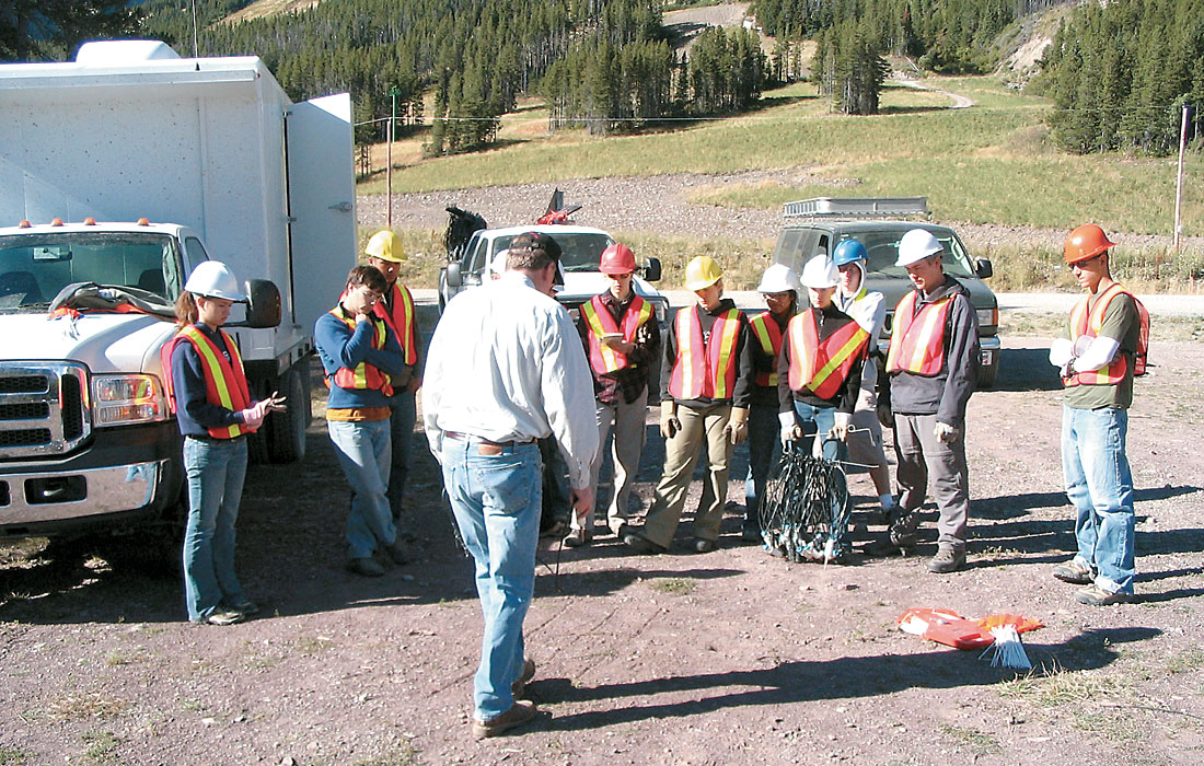
An important role for the new infrastructure will be advanced training of undergraduate and graduate students in the acquisition and analysis of geophysical data. Much of the equipment has already been used in Geophysics Field School at the UofC and several field research programs have also already been started. It is anticipated that training programs for industry professionals will also be developed.
The seismic equipment
ARAM Aries seismic system
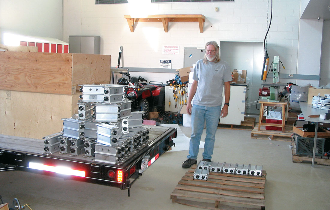
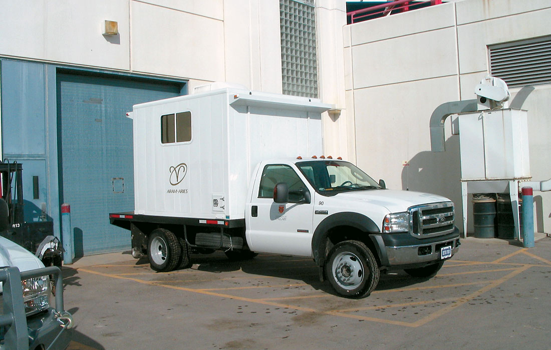
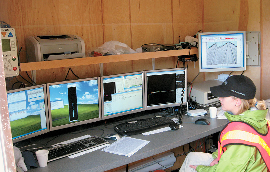
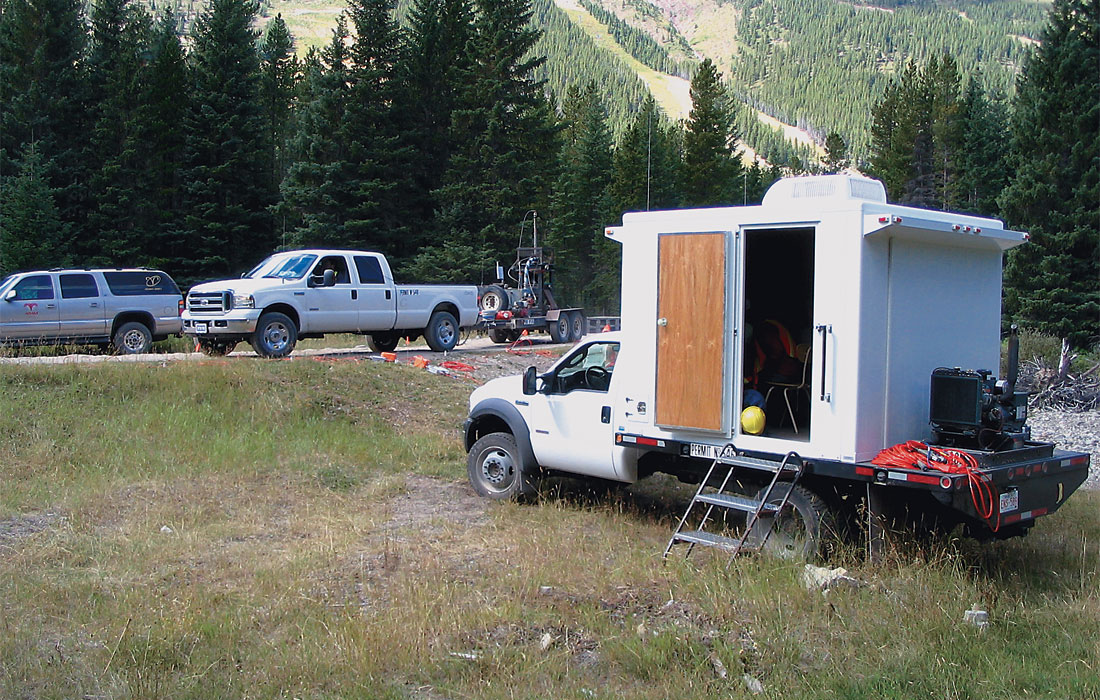
The main components of the 600-channel ARAM Aries system system are the SPMLite Aries seismic recording unit, 75 Aries remote acquisition module (RAM) boxes, 75 single-component cables, 20 three-component cables, 10 Aries line tap boxes, 120 batteries, 650 SM24 single geophones (from I/O Sensor) and 210 SM24 3-C geophones (from I/O Sensor). Figure 1 shows the exciting day when the ARAM system was delivered to the University of Calgary. In addition to the main recording system, assorted baseline cables, jumper cables and splitters are available to provide either 2D or 3D (or 3C-3D) seismic spread configurations. All other support equipment necessary to maintain the system was also purchased. The SPMLite is housed in a new truck-mounted field recording laboratory with both battery and generator power available (Figure 2). For massive data storage and in-field processing, a Pentium computer with 1.25TB of disk is also installed in the recording truck (Figure 3).
Geode seismic system
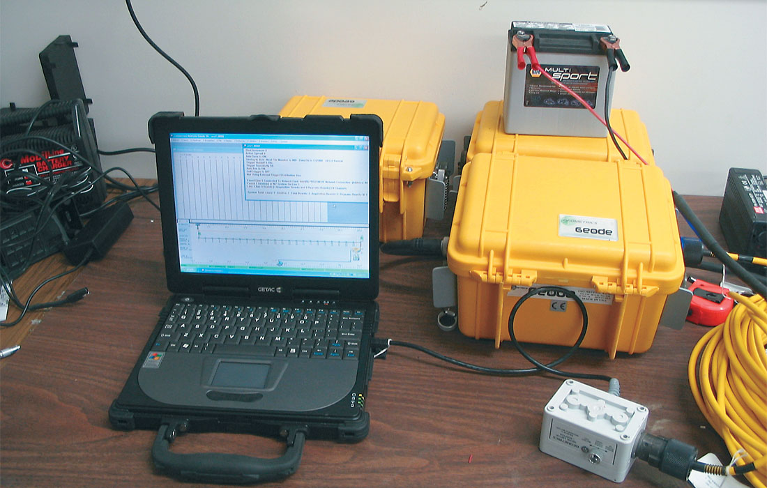
The Geode system was purchased from Geometrics to provide a more compact package to record borehole surveys during the time-lapse studies, and for shallow applications such as geotechnical engineering and geoarcheological studies where portability of equipment is essential. At one current experimental research site there are 24 channels (8 levels of three component geophones) and at another site there will be 120 channels (40 levels) in wells to be recorded during surface seismic surveys. This technology will provide a more complete image of the target. The Geode system consists of five 24-channel boxes with a ruggedized laptop computer for control and data recording, with connecting cables and batteries. One Geode 24-channel box and the control laptop computer are shown in Figure 4.
Seismic source
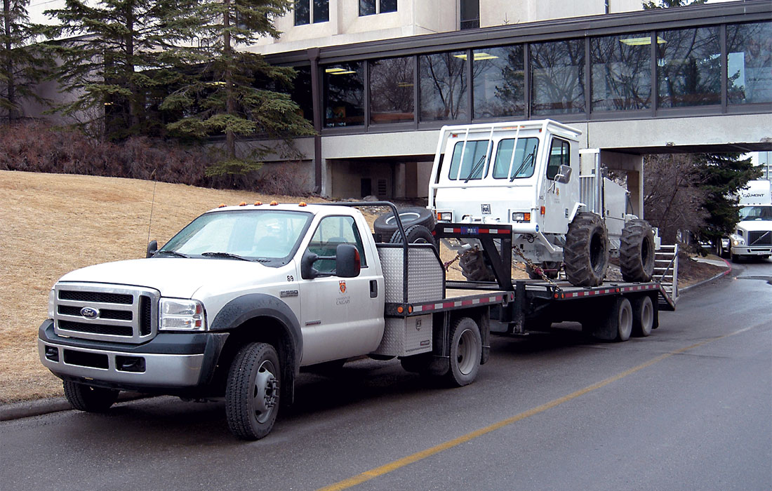
For seismic surveys of the type for which this equipment was purchased, a high- bandwidth vibrator source was chosen. This provides the best repeatability both in source signature and location between successive surveys. The particular model selected was the Envirovibe made by Industrial Vehicles International (Figure 5), with custom-build trailer and tender for transport and field maintenance (Figure 6).
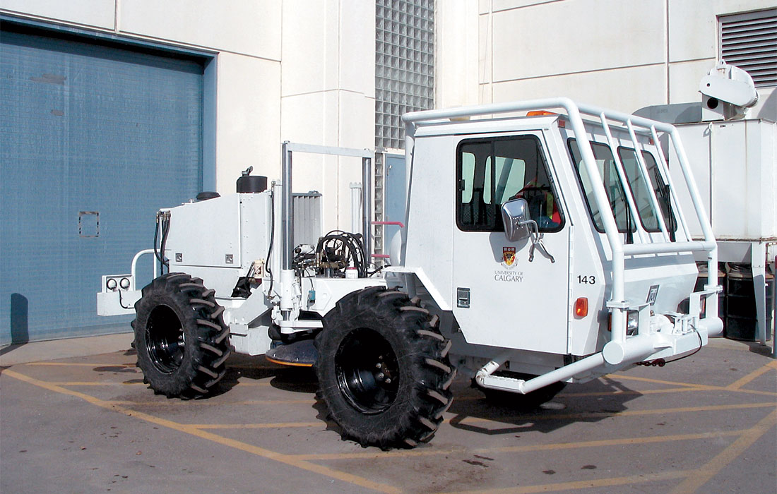
The Envirovibe has a hold-down mass of 15,000 Pounds (66,000 N) and a frequency range of 8Hz to 300Hz. The trailer and tender enable the the Envirovibe to be transported to field locations and to provide in-field support and maintenance. For source control, the VibPro system from Pelton was chosen, as it provides compatibility with most of the companies using vibrators for seismic acquisition, thus making it simple to use multiple larger vibrators for more standard seismic surveys. The VibPro controller also provides an interface for the ShotPro blaster for dynamite shooting.
VSP tool
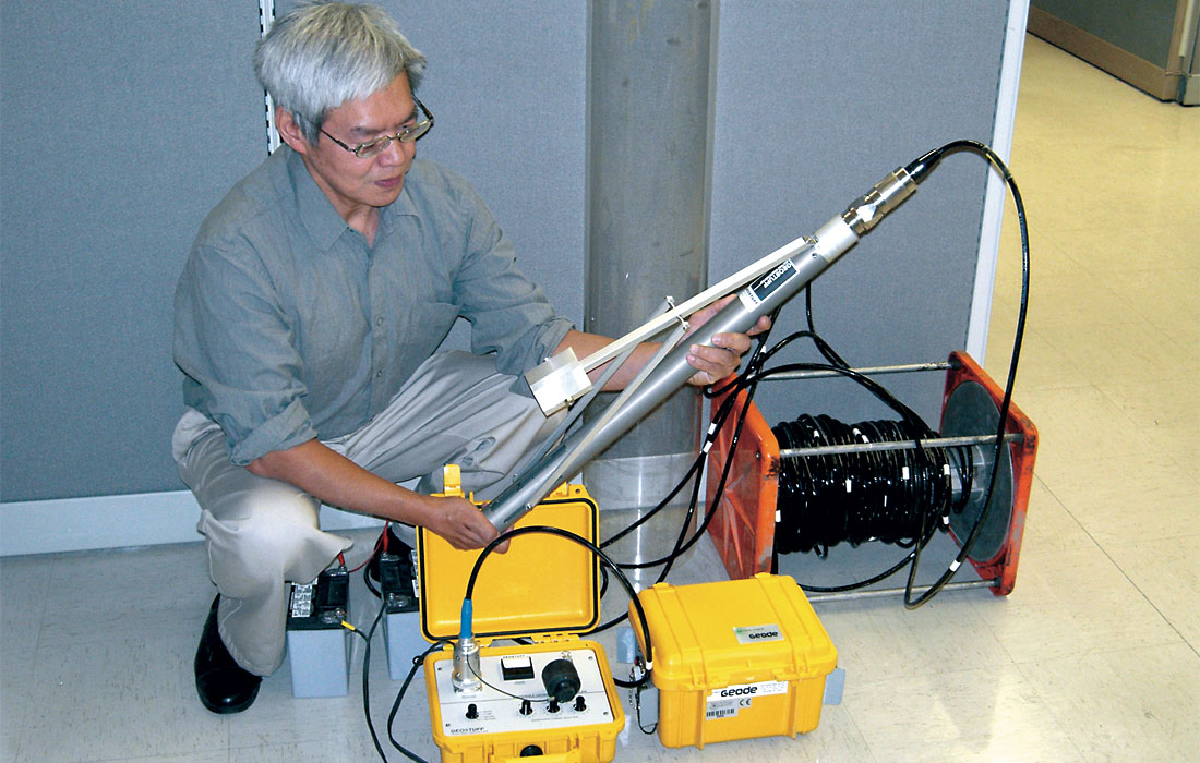
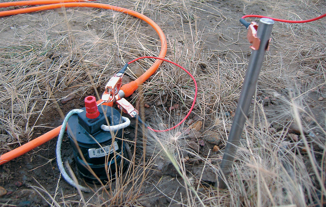
For vertical seismic profiles in shallow (< 500 m) boreholes, a Geostuff single-level 3-C geophone assembly was purchased (Figure 7). It has an electrically-driven bowspring clamp, a length-calibrated cable and an interface/control box; data are recorded with one of the Geodes.
Field support and surveying equipment
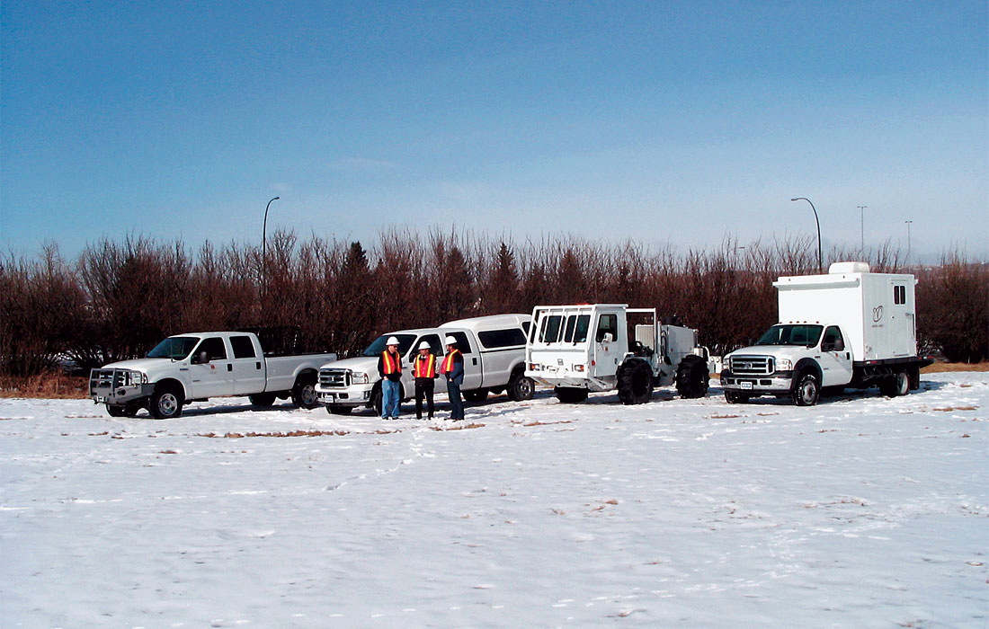
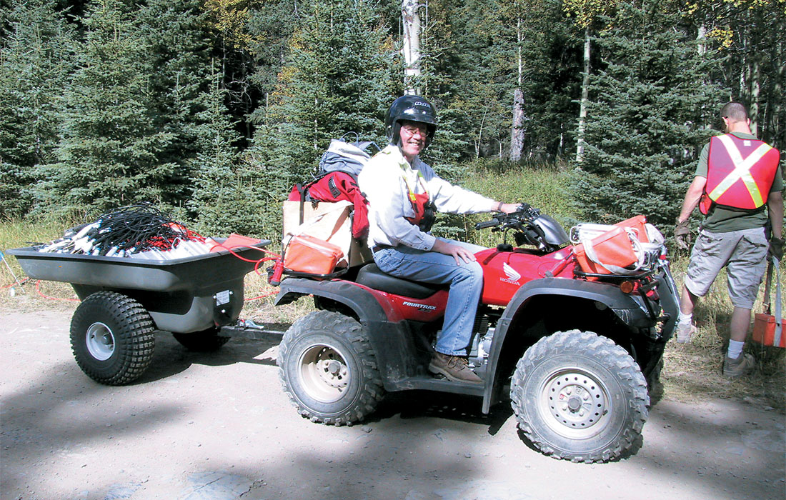
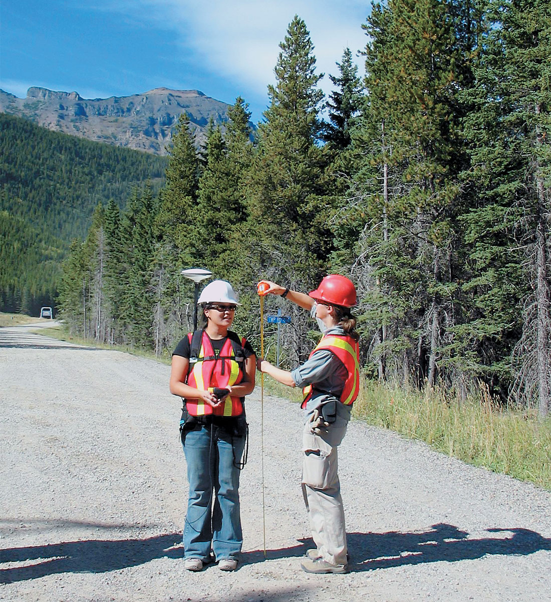
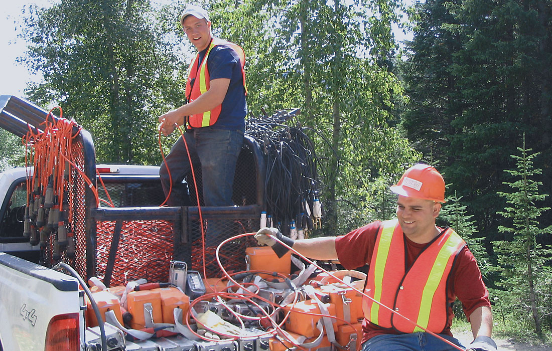
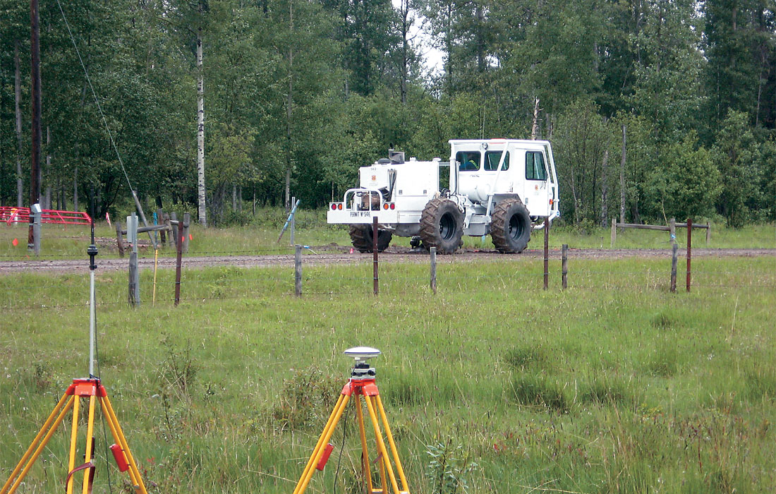
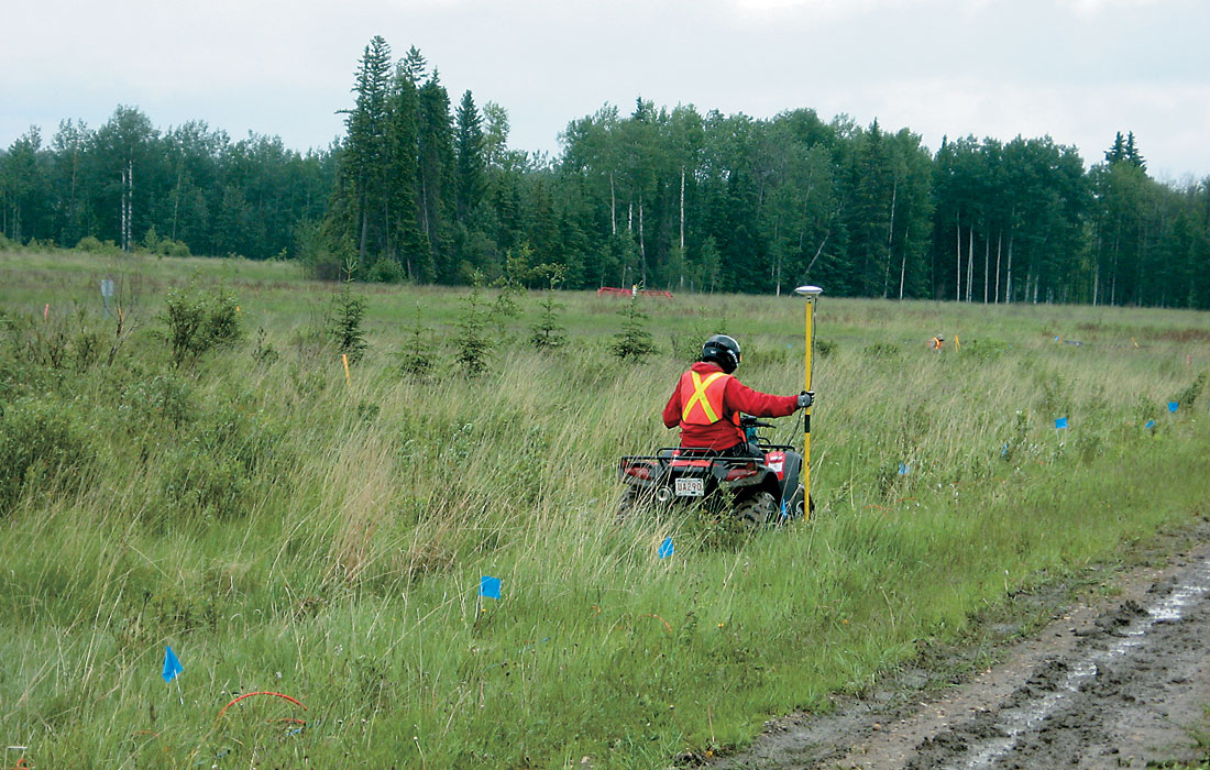
To transport seismic cables and geophones to field sites and to deploy them in the field, two dual-cab cable trucks were purchased to optimize transportation of students and staff to the field sites. Figure 8 shows the full field equipment setup. In addition to the larger cable trucks, a Honda quad and trailer were also purchased (Figure 9) to enable deployment of field equipment in sensitive areas or where access for larger vehicles is restricted. For any geophysical survey, accurate surveying and positioning information is essential. For our needs, a high-end Global Positioning System (GPS) using RTK (real time kinematics) was purchased (Figure 10). The system chosen was the Sokia receiver made by Novatel. This system can provide rapid position accuracy to within a few centimeters. One deciding factor for this choice is the ability of this receiver to give sub-meter accuracy in a single receiver stand-alone mode using the new CDGPS correction information. For most surveys, three receivers are used: one at the RTK base location, the second as the survey rover for geophone locations, the third on the Envirovibe for precise source location during surveys.
Resistivity and IP Equipment
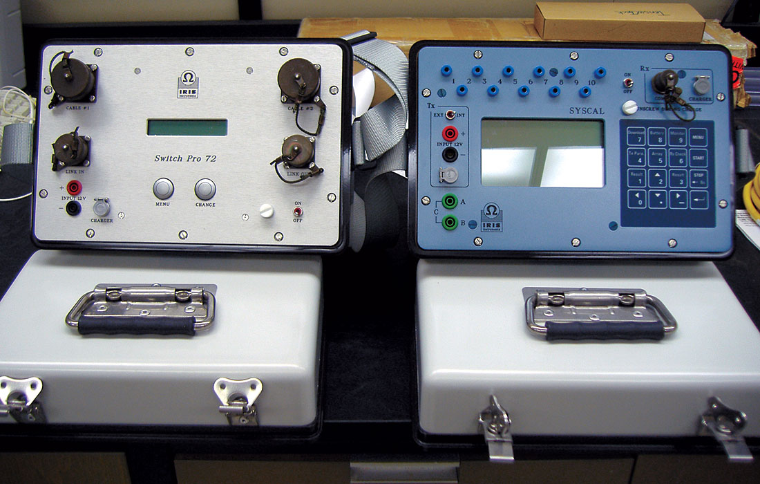
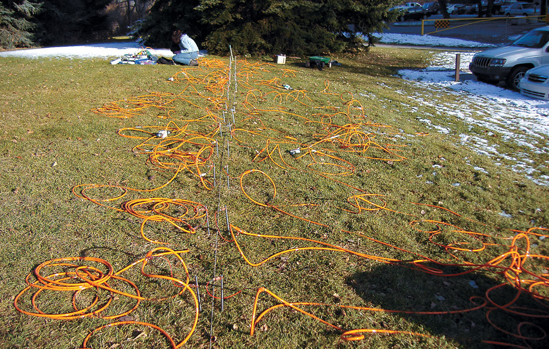
A 72-electrode resistivity system was purchased to provide apparent resistivity and induced polarization (IP) data for subsurface characterization, particularly for environmental surveys. The transmitter unit is a VIP-3000 time and frequency domain IP transmitter which can provide up to 5KW of output. The receiver is a Syscal Pro unit with expansion to 96 channel capability, shown in Figure 11. This unit is a resistivity-meter designed by IRIS instruments with capability of conducting full scale resistivity as well as Induced Polarization (IP) surveys. The configuration allows conducting automatic switching between 72 electrodes along a survey line, as shown, for example, in Figure 12. Electrical contact with the ground is provided through steel electrodes for current supply and non-polarizing electrodes for measuring potential differences (Figure 13). The instrument is powered by two internal batteries although the operator also has the option to use 5KW external power supply which is essential for IP surveys. The unit also measures chargeability over 20 slices to increase the accuracy of the IP measurements. The system was first used in a test survey in the University of Calgary Campus for training purpose and functionality control as well as to compare four different types of non-polarizing electrodes to be used in IP surveys. In October 2005, the system was used in a full-scale field survey including electrical resistivity (ERI) and IP measurements at a site contaminated by hydrocarbons at Lloydminster, Alberta.
Systems In Operation
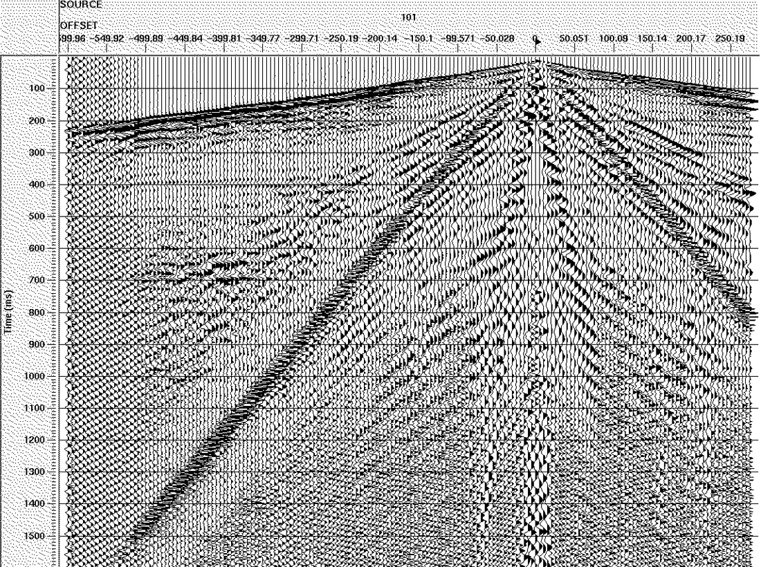
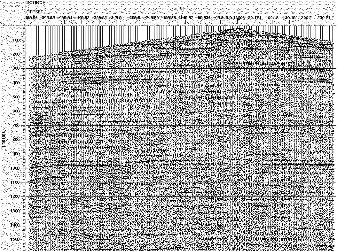
The ARAM recording system was used in the Fall of 2005 for teaching the University of Calgary Geophysics Field School, and the full seismic system (including the Envirovibe) was commissioned in the early spring of 2006. It has also already been used in three research field experiments. Figures 14 through 18 show some scenes from these programs and Figure 19 shows data collected using the Envirovibe and the ARAM recording system.

Acknowledgements
We gratefully acknowledge funding for this infrastructure that was provided by Nexen ($1m) and Alberta Innovation and Science ($1.2 m), as well as significant discounts provided by the equipment suppliers. We thank the University of Calgary Development Office for their assistance in the fundraising for this project, and we acknowledge contributions of the Department of Geology and Geophysics, the Consortium for Research in Elastic Wave Exploration Seismology (CREWES) and the Hydrology Research Group at the University of Calgary for technical support during procurement and commissioning of the equipment, particularly Eric Gallant, Henry Bland and Mehran Gharibi.


Join the Conversation
Interested in starting, or contributing to a conversation about an article or issue of the RECORDER? Join our CSEG LinkedIn Group.
Share This Article