On April 29th, 2003, during the Centennial remembrance ceremony for the disastrous Frank Slide, Premier Ralph Klein announced that the Province of Alberta would commit to implementing a state-of-the-art monitoring system for Turtle Mountain at a cost of $1 million dollars. AGS is providing geological technical expertise towards implementing this monitoring system.
AGS provided geological background data for a new documentary produced for the Frank Slide Interpretive Centre called ‘On the Edge of Destruction,’ as well as for a book with the same title. The documentary was shown on Access TV in April 2003.
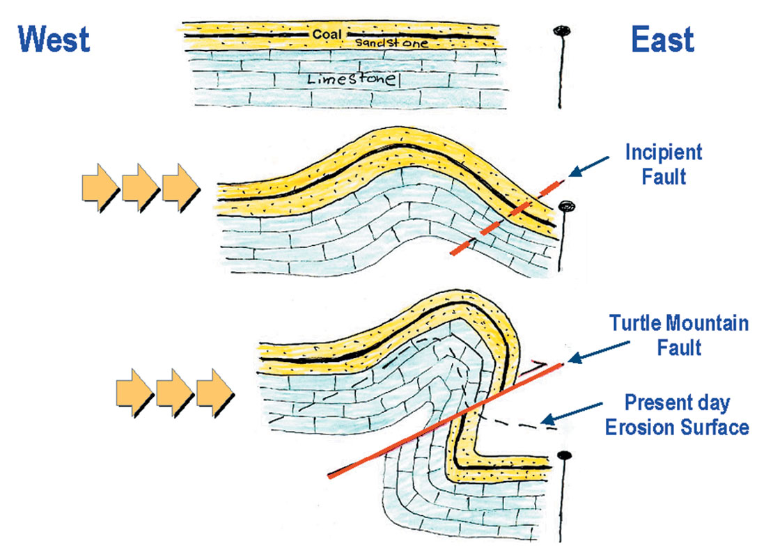
Three hundred million years ago, the area that is now the Crowsnest Pass lay at the bottom of a shallow ocean. Sea creatures lived and died in the warm water. Their bodies drifted to the bottom, building thick layers of calcium carbonate that compressed into limestone. Geologists named these rocks the Livingstone and Banff formations, where the Banff is distinguished from the Livingstone Formation by consisting of shaly limestone instead of pure limestone.
Gradually the sea dried up, exposing a vast area with rivers draining into huge deltas. Vegetation grew and died, sinking into the swamps and creating layers of organic material that gradually compressed into coal. Wind and water laid down still more layers of sand, silt and mud, each to be buried and compressed in their turn, forming sandstone, siltstone and shale. Geologists named these rocks (including coal) the Kootenay Formation.
Sixty million years ago the land began to shift and buckle, resulting from the movement of plates that constitute the Earth’s crust. These immense compressing forces caused the layers of limestone, sandstone, shale and coal to fold and break, and raise these rocks to form the Rocky Mountains.
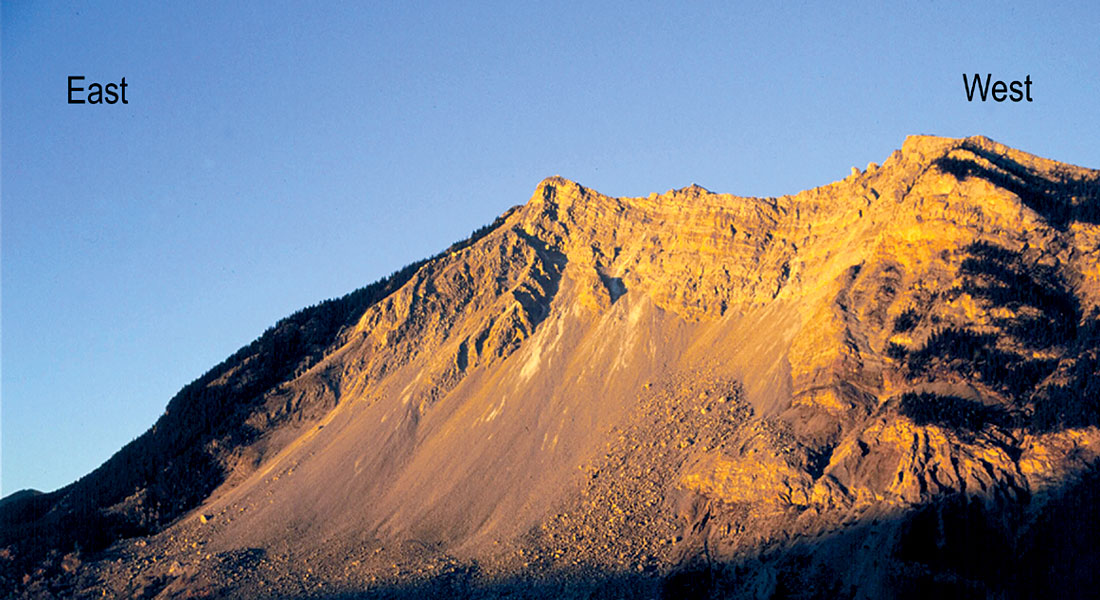
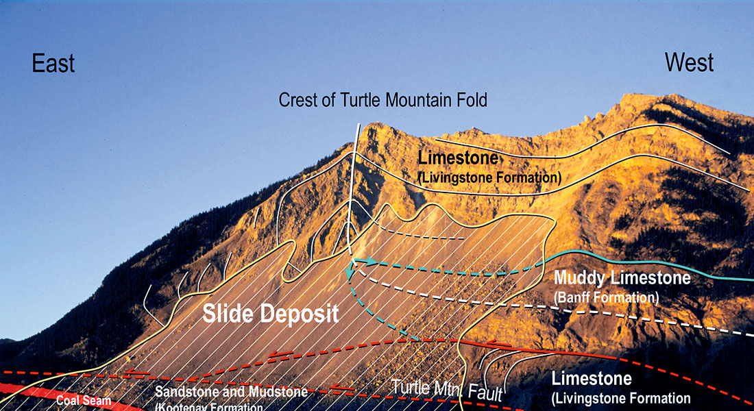
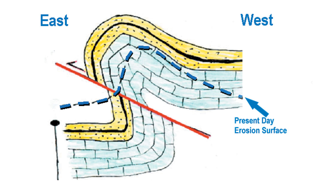
The layers of limestone, sandstone, shale and coal that would become Turtle Mountain were folded upward into an arched “A-frame” shape. At first, the layers were squeezed into a gentle fold (called the Turtle Mountain Anticline). The pushing increased and a fault (breakage of rocks) developed under the fold. This fault is called the Turtle Mountain Fault. The part of the folded layers above the fault separated from the rocks beneath, and slid eastward on the fault surface. Eventually folded limestone layers rode over top of almost vertical sandstone, shale and coal layers. This structure can be viewed from the Frank Slide Interpretive Centre.
The layers on the east side of the steeply sloped mountain are like slippery playing cards stacked one atop another; and as a result, they are prone to sliding down the mountain. The 1903 Frank Slide event was a result of this instability.

Acknowledgements
This article first appeared in the Fall/Winter 2003 issue of ‘RockChips’ newsletter published by Alberta Geological Survey. (www.ags.gov.ab.ca)


Join the Conversation
Interested in starting, or contributing to a conversation about an article or issue of the RECORDER? Join our CSEG LinkedIn Group.
Share This Article