Seismic data has been utilized in oil and gas exploration since around 1928, with early efforts directed at revealing the gross structural and trap configuration in what was then the frontier areas.
However, over the intervening time the technique has been continually refined and improved upon with modern 3D prestack depth migrated data providing a highly detailed definition of the structural and fault geometries of exploration targets. That said, defining a trap is just one of the elements that have to be addressed in predicting the presence a commercial hydrocarbon pool. Often of more significance is, geologically speaking, what is in the structure in terms of reservoir section, intervening shales, viable cap rocks, and where in this complexity that is the sub-surface, should we focus our drilling activity. In the deep water offshore arena a single well runs at over $100MM a shot!
This Presentation will draw from a variety of depositional environments, and geologic periods, and offer examples of the level of detail that is starting to emerge from one of Husky's offshore projects. Paleo depositional environments presented range from modern deep marine to continental Mesozoic and are explored in a multidisciplinary holistic manner, and then benchmarked to modern analogues. The material presented will be of interest to practitioners of geophysics, geology and geosciences. Deep water offshore or Alberta heavy oil – geology is geology and the more we can understand pre-drill the better the outcome for a project.
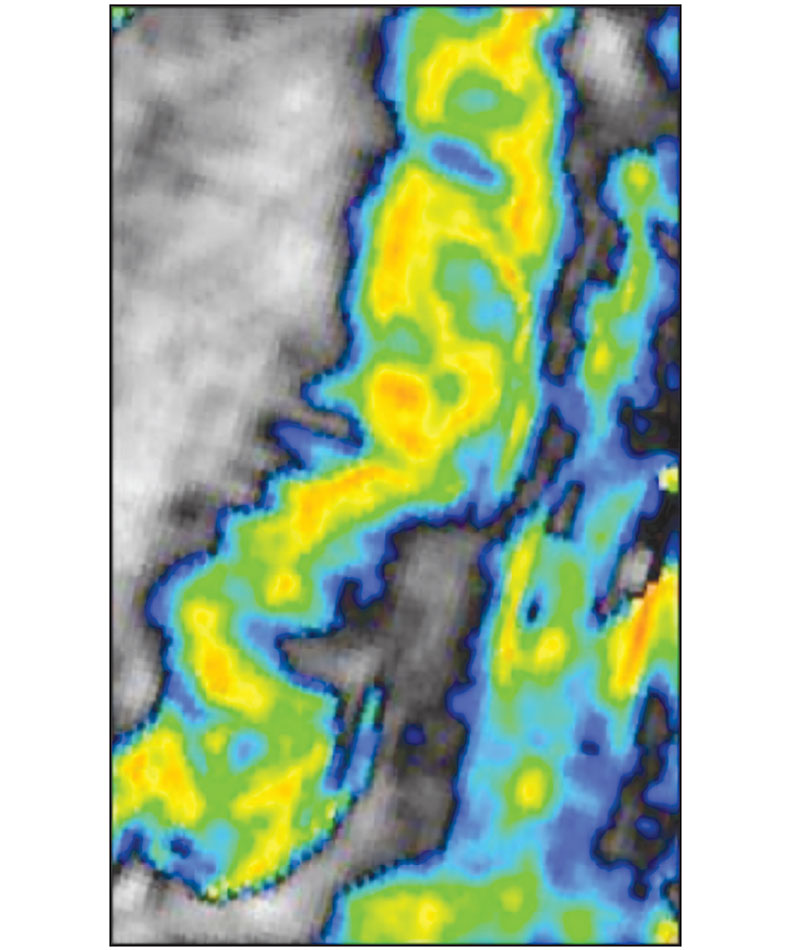
As a teaser, what is the image to the left – detailed definition of a Mesozoic depositional system, or a bit of fancy Photoshop work on a Google Earth image of a modern river – come and find out?
About the Author(s)
A native of England Trevor Johnson left high school equivalent with no intention of ever going on to further education. However, after a short time exploring one or two career options he enrolled in an Environmental Sciences B.Sc. programme at the University of East Anglia in the UK. This course provided the opportunity to study literally anything you could see out of the window with topics ranging from ecology, environmental protection, urban planning, geology, geophysics, quaternary geology, sedimentology, oceanography and geochemistry to name just a few. Focussing on a broad but complementary selection of earth science related subjects Trevor graduated in 1987 during a slump in both oil prices and employment opportunities in the industry that started to attract his attention – the oil patch. Having been identified by one of his lecturers as a student that asked a lot of questions it was suggested that he enrol in a Masters programme which he did, graduating with Distinction with a M.Sc. in Marine Geology and Geophysics from University College London.
Once in the industry he has worked for a number of companies starting as a Technical Assistant with Amerada Hess in London where he recalls an ‘early project’ was to transform a very large black and white gravity map into a work of art with a box of coloured pencils. Moving on through Bow Valley and Murphy Oil, also in London he cut his teeth working in the big E exploration multi play setting of the North Sea. Transferred to Canada in 1997 with Murphy Oil he commenced working projects on the East Coast of Canada primarily in the Frontier Exploration arena. To stay in the world of Big E exploration, and to avoid the realm of unconventional resource plays, Trevor moved to Husky Energy’s Canadian Frontier Exploration group in 2008 where he remains today working on the Big E projects he enjoys.
Over the last few years Trevor’s interest has focussed on trying to extract as much depositional information as possible from 3D seismic volumes, with a selection of what can be seen been the subject of today’s presentation.
References
Appendices
Join the Conversation
Interested in starting, or contributing to a conversation about an article or issue of the RECORDER? Join our CSEG LinkedIn Group.
A large volume of data is being converted to make this online archive. If you notice any problems with an article (examples: incorrect or missing figures, issue with rendering of formulas etc.) please let us know by emailing:
admin@csegrecorder.com


Join the Conversation
Interested in starting, or contributing to a conversation about an article or issue of the RECORDER? Join our CSEG LinkedIn Group.
Share This Article