The results and experiences from a 3D survey recently carried out by Ecopetrol and its partner Talisman, in the Llanos Basin of Colombia, are presented. More than 8000 channels patch on land were used for the first time in Colombia using cableless technology.
Introduction
It is well known that the use of cableless systems, benefits the acquisition of broadband full azimuths. One of the advantages of cable less system is that they allow exploration geophysicists to obtain better wave sampling. In this way the acquisition parameter design improves the cost benefit relationship.
In this paper, we present the results and experiences from a 3D survey recently carried out by Ecopetrol and its partner Talisman, in the Llanos Basin of Colombia. We used more than 8000 channels patch on land using cableless technology.
The Llanos Basin is one of the most prolific basins and it is located in East Central Colombia. The objective is to improve the imaging of sand channels and subtle faults at levels of formations T1 to T2 and K1 over the basin. The results confirmed that a dense full azimuth acquisition image target zones with much better quality than previous surveys over the area. The doubts regarding shooting with a cableless system and not “seeing” the data in real time were overcome with this technique. The survey was a success in terms of quality and turnaround time. Acquisition productivity planning was a key factor due to the restrictions over the area. We present details of the data quality obtained and lessons learned of this key project for Llanos Basin exploration in Colombia. The great quality obtained will allow interpreting the geology of the area in a better way.
Acquisition Parameters
As stated earlier, this survey is the first one to use cableless technology with more than 8000 channels live, among Latin American land seismic operations. A detailed set of options were analyzed to acquire orthogonal design using cableless equipment. The final acquisition parameters were decided: 36 lines with 224 channels conforming a wide azimuth survey, source line interval (SLI) of 560 meters, receiver line interval of 240 meters, and a 20 by 40 meter bin size. A better effort in reducing the SLI was not possible, due to the high costs of seismic in Colombia. We knew from the beginning that it was an issue but we relied on the high sampling with high count channels. The charge of dynamite was 3.6 kilograms and was located in single holes at 12 meters depth.
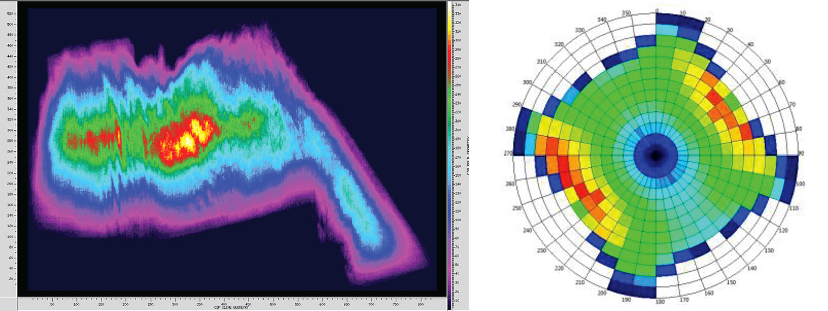
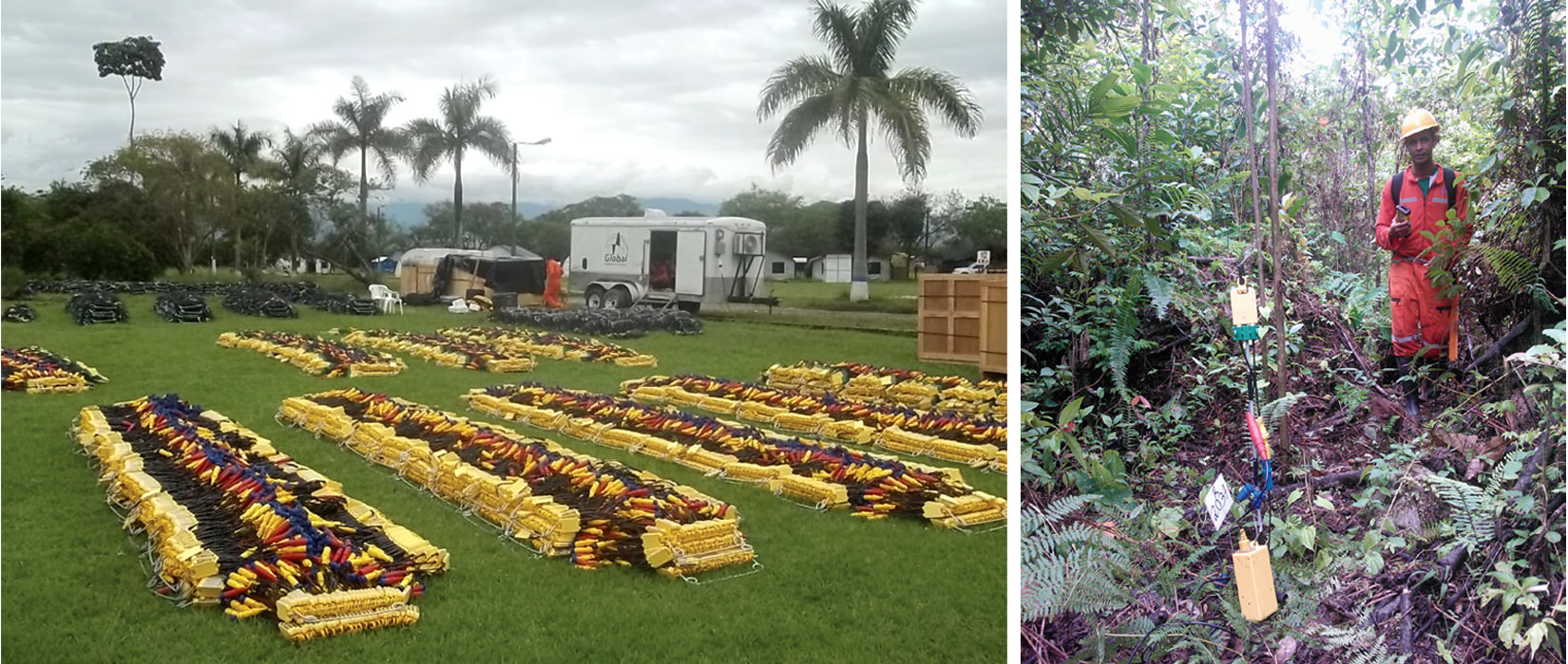
Some of the records were shot with 10000 channels live with 46 receiver lines. Average fold was 144, but because of some rearrangements on some sources due to permits and environmental issues, the fold was close to 350 on several areas. See fold diagram on Figure 1. Figure 2 shows equipment in the field.
The high-density acquisition geometry provides good attribute distribution. Despite the long interval between source lines, not much footprint was detected on the data.
Operations and Logistics
The program started with 12780 units of Autoseis HDR 1C to cover an area of 214 square kilometers. Regarding the recording phase, the average production per day was 341 shots; and it took only 14 days to complete the survey, which is also a record for any 3D previously shot in Colombia. A total of 4780 shot points were recorded.
Regarding receivers, the process took 21 days to deploy 22000 stations on the field. This is a big difference with productions obtained through conventional cable technology over most of the areas in Colombian basins.
Data quality and imaging
In order to come up with the most accurate refractor model, the near surface problem was solved with tomography. In general, the tests were quite similar to average refractor static solutions, but improvements in foothills warranted going with tomography. This is a key part for processing over Llanos Basin.
Through the application of surface consistent amplitudes compensation, we estimated and adjusted the relative amplitudes of sources, receivers, CDPs and offset bins, on a surface consistent basis. The analysis was done on all 4 of these components to create scalars. When applying scalars any combination of the components can be utilized. In this case, we applied the calculated source and receiver scalars.
A significant testing was done to ensure noise attenuation. The trace statistical editing was done based on seismic attributes, like Average Amplitude, Amplitude Decay, Frequency Deviation and Spikiness. Also, emphasis was made on intermediate steps on noise attenuation. Several tests of before and after difference plots were generated, in order to analyze the coherent noise (mainly ground roll and some aliased ground roll) and also residual noise attenuation, which was treated with median filtering in common shot; common receiver and common midpoint domains.
Regularization previous to PSTM with Common Offset Vector (COV) approach was used. A COV gather is a selection of traces with common inline-offset and common cross-line offset (Cary, 1999; Li, 2008).
All traces are assigned a COV bin. The COV bin, assigned to each trace, is defined by the source/receiver offset projected onto the inline and xline directions (OFFILN and OFFXLN distances). Hence, traces with similar offset and azimuth fall into the same COV bin. At each CDP bin, all traces that share a common COV bin assignment are summed into one trace, yielding single fold COV offset/azimuth volumes. Any missing traces (cdp’s) within a COV volume, caused by surface skips, are then interpolated to produce single fold, fully populated COV volumes. Migration artifacts caused by holes in offset coverage are then reduced or eliminated by the COV.
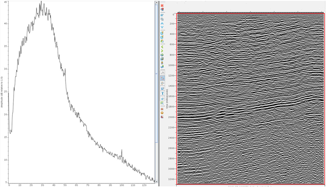
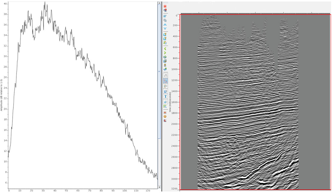
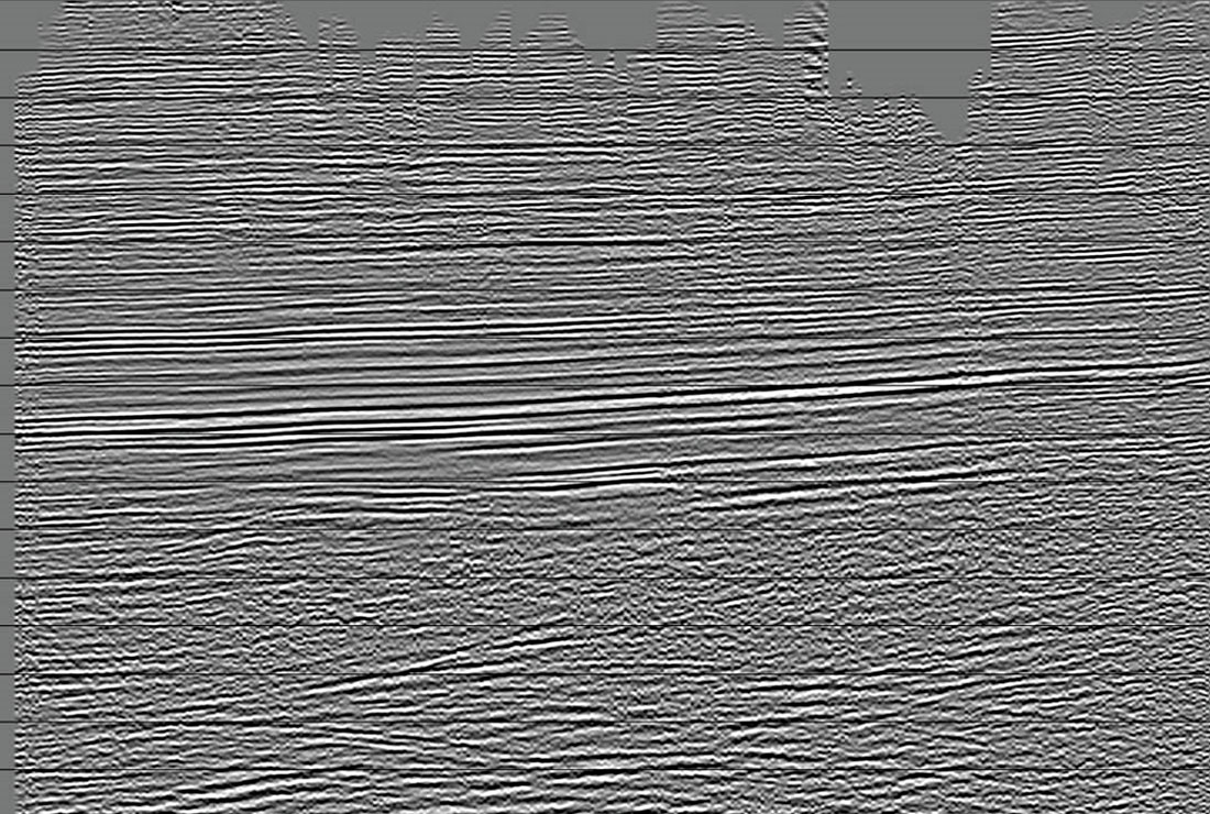
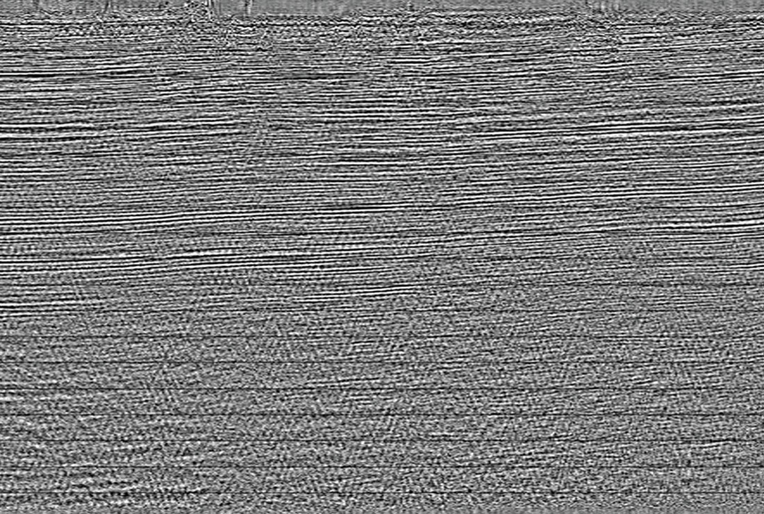
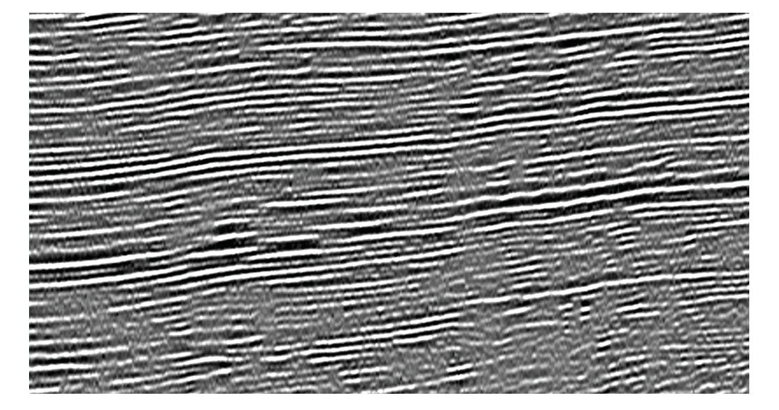
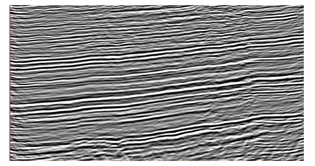
The data obtained was quite clean and only few parts of the survey depicted higher level of random noise, due to acquisition over transition zones between foreland and the foothills. See Figures 3 to 6.

Conclusions
We presented a study in Colombia that resembles the successful application of the latest technology in cableless systems.
It is important to remark on the flexibility of the cableless system provided during the survey design process, the increased productivity in the field, the reduced environmental and HSE footprint, and the increased resolution in terms of bin size, azimuth, offset contribution, and fold coverage. Acquisition with more channels benefits the sampling in all aspects, especially with the statistics obtained on fold and azimuths.
It is clear that with this new technology exploration geophysicists can design better geometries and be able to image tectonic complex environments successfully. The data set has exceeded any previously acquired data in the area.

Acknowledgements
I want to thank the operations geophysical group (SOE) from Ecopetrol on making the project a great success, and partners at Talisman, specially David D’amico for his input on the seismic processing and Tim Hult; Joe fuller at Weinman Geoscience, and finally to all the team involved from Global Geophysical for the great effort and quality they obtained acquiring this data.


Join the Conversation
Interested in starting, or contributing to a conversation about an article or issue of the RECORDER? Join our CSEG LinkedIn Group.
Share This Article