
John Pendrel is a well-known and respected name in the geophysical world, especially in the field of seismic inversion. Like many in our industry, he had his academic start in Physics, and this evolved into Geophysics when he was hired by Gulf Oil’s research arm. After a long and successful career with Gulf, John entered into an equally successful phase with Jason Geosystems, now part of Fugro.
Throughout his career John has worked in some leading edge areas of Geophysics, and this broad technical background makes his comments and viewpoints on the business and the science extremely interesting. A true son of the prairies, John finds his work life balance by playing on a hockey team, and volunteering with the Calgary Exhibition and Stampede where he serves on the Executive Committee of the Calgary Stampede Showband.
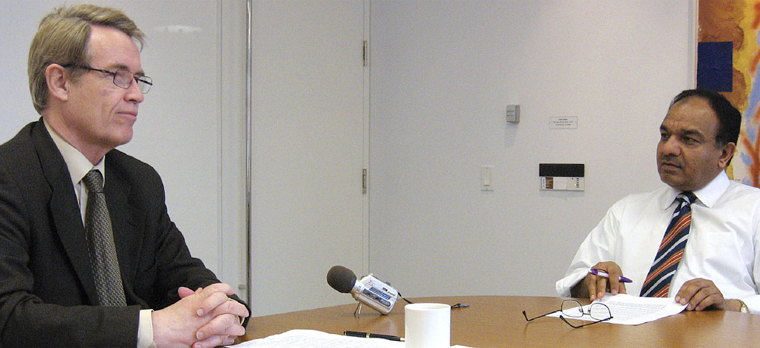
With John’s busy work and travel schedule, it has taken the RECORDER some time to conduct the following interview, but it was worth the wait!
(Photos courtesy: Joyce Au)
John, let us begin by asking you about your educational qualifications and your work experience.
You are starting with the hard questions first. Actually I don’t have any Geophysics or Geology classes to speak of. I sort of fell into that – I did a Bachelor of Science degree at the University of Saskatchewan Regina Campus as it was known back then, graduating in 1968. I completed a Masters in the Physics of the Upper Atmosphere in Saskatoon, at the University of Saskatchewan in 1972 and then went on to do a Ph.D. in what was called Experimental Space Science at York University in Toronto.
Along the way I worked for the Saskatchewan Research Council for a summer and the Canadian Imperial Bank of Commerce for two summers, at one time considering a career in banking, I was also a high school physics teacher for the best part of a year in the early seventies.
You’ve been in the Industry for how long?
I had my first job in the Industry I guess in 1977 but that was after the Ph.D. There was a long academic career which raised eyebrows on both sides of our families as to whether I would actually get around to supporting a family or not.
So you carried through with Physics in your B.Sc. and then you did your Ph.D. in Spectral Analysis?
Yes, how I got into that is interesting because I was at the University of Saskatchewan, finishing up the Masters and doing research into magnetic fields in the Aurora. I discovered (this would have been 1971), that there were perilously few jobs for those in this field. I determined that remote sensing might be a better option. By this time my wife was about seven months pregnant and I was faced with supporting a family. Several professors had gone from the University of Saskatchewan to York University in Toronto to set up a Remote Sensing Department and there I went too. I went to York with the purpose of doing a remote sensing degree and the hope of getting a job there afterward.
In the process of application, one had to interview all the professors that were doing research in the Department to ensure that one had the optimum match. There was one fellow there by the name of Doug Smylie who had come from Memorial University of Newfoundland. Doug was interested more in physics of the core and was probably one of the leading experts in the world in that field. Anyway, he had a project proposal which was somewhat time series related. The only thing I knew about time series was that during my Masters I had applied a five-point smoothing filter to my magnetic field data that somebody had given me. I didn’t know much else. The project involved two-dimensional spectral analysis, something which I knew even less about. However Doug said, “I will tell you one thing about this project,” and I said, “What’s that?” He replied, “Well, when you finish your Ph.D. I will guarantee that you will get a job with an oil company.” And I said, “Where do I sign?” So that project put food on the table and that was good enough for me at that age (27) and especially with a family on the way.
So I proceeded to try and learn time series and that involved getting some basic books like Jenkins and Watts, some early research by the likes of Enders Robinson and Ralph Wiggins. I read them cover to cover and then I read them cover to cover again and then cover to cover to cover again and by then thought that I was, in some way, beginning to understand what was happening in the field. I managed to come out with a Ph.D. in 1977. That was interesting too because like many students I was sort of floundering around a little bit with my research when my supervisor announced that he was going to take a one year sabbatical in Australia and that he’d see me in a year and review what I have done. So I was left alone for a year with just my colleagues and no direct supervision and that’s when the tough get going as they say. You have to learn to do things yourself because there is no one else to do it for you. That was actually a very good experience in the end. So with the generous support of my family, I graduated in 1977 with a Ph.D. but it wasn’t really a Geophysics degree. Along the way, I had taken a couple of Geophysics classes which were offered, mostly solid earth though, and one time series class and that is the extent of my academic geophysics career.
You joined Gulf in 1977 as a Research Geophysicist?
I worked just outside Pittsburgh at Gulf’s Research Facility. I was very surprised at that as I had thought if I was working for an oil company, I would be in Tulsa or Houston or Dallas but it turned out that the home of Gulf Oil was Pittsburgh because it was funded by the Mellon Bank, also in Pittsburgh. They had a wonderful Research facility up the Allegheny River – it was very much like doing a post doc. The lab was all by itself and had been a Research Centre for many years. It had done some proprietary work during the war because of its isolation and it was just a wonderful place for a young scientist to be.
Tell us about the type of work you did there and your experiences.
My first boss in the Industry was Ralph Shuey who your readers will probably recognize as the father of modern AVO work.
Yes, Shuey’s approximation to the Zoeppritz equations.
Yes, and we had privy to that work, of course, early on. Then as now, oil companies wanted to keep private what they researched, so although his classic paper wasn’t published until the early 80s, we had access to all that work and were doing in-house courses in AVO long before the work became known. Ralph was an interesting fellow to work with and was probably the most brilliant person I’ve ever met in my life. Down the hall was Gerry Gardner whose name we like to invoke whenever we don’t have a density log and need to make one from a sonic. He was a strong advocate for young people like me. Gulf also provided many in-house courses and programs to develop young managers. I have used the techniques which I learned there throughout my career.
When I arrived at Gulf, we were still in the punch card era, which only lasted a few months when the video terminals came in – we were just so thrilled that we didn’t have to carry punch cards around any more. Some of the first work which I did was in surface consistent amplitude analysis. I was pointed to a stack of print-outs over three feet high, and they said, “We want you to go through those,” and I began to wonder what the Ph.D. was all about at that point but never-theless I persevered. After that, I did some work on slant stack multiple suppression in the North Sea.
Gulf was the first major to get into the field of tomography in 1979. They brought in mathematical experts and consulted with various universities. I wasn’t directly involved in that project immediately but once they got the algorithms working it was realized that they needed data to feed into it and that someone was going to have to develop a way of picking event data before stack. They had several runs at it and then just sort of asked generally if anyone had any ideas and I said – well this sure sounds like the remote sensing class I took in pattern recognition back in my Ph.D. days. And sure enough we were able to turn that technology to good use generating inputs to tomography.
I spent only four years in Pittsburgh but I am still a Steelers Fan and have a great love for the city and its people.
So by 1981 you were pretty much decided that Geophysics was the career you wanted?
In 1981 we wanted to move our family closer to home and so I requested a transfer to Calgary and that happened in late 1980. I arrived in Calgary with Gulf Canada and yes, I had enjoyed the research work so much that it was going to be the career for me, although it was not going to be at a Research Lab. And in fact, Gulf Canada didn’t last very long because Chevron bought Gulf Corp within two years of arriving there.
So for the next 10 years you were catering to the seismic data processing of the company by way of in-house processing and working with contractors that were engaged from outside?
That’s right, I was in a technical support group. The Company was still called Gulf Canada even though Chevron had bought it but they had done so at arms-length so that they could sell it again. But yes, I was in a technical support group supporting interpretation. We were doing wavelet analysis and seismic inversion back in those days, but not with the rigor in which we do it now of course. I had the opportunity back then to work with Carl Nyberg who was head of the Department at the time and one of the old boys. I guess I am an old boy now, but back then I was a young guy and he was an old boy and so he took us young fellows under his wing and taught us some basic geophysics – probably that you would never get in any course. At one point, he even had us dragging out some of the old 100% data in which he claimed there was still information. He showed us how they did it in the old days. I really enjoyed that experience and also had started to get into management by that time. As the years progressed, I ended up supervising that technical group.
So that means by 1992 you were switching from processing to something more interpretational?
We were supporting interpreters in a more direct way and what I began to develop at Gulf was inhouse software which I guess would be described today as a geoscience work-bench. We had our own inversion and wavelet analysis packages which would provide us with the in-house tools that we needed. During this period I maintained an interest in new things coming along – migrations, deconvolutions, methods of filtering. I sort of had it in my head that I didn’t really understand it until I could code it up, so in this work-bench we had lots of frequency migrations and different kinds of decon and FK filters that we had built. But then, in-house processing and software development went the way of the dodo bird and now it is mostly all outsourced. Those were good times in that we were supporting interpreters directly and giving them the tools they needed to do their jobs.
So when did you join Jason Geosystems?
Throughout this whole process Gulf had been continually changing. Chevron had sold it within a couple of years of me joining in the early 80s to the Reichman Brothers, a Real Estate Company from Toronto. They had made their money investing in New York sky scrapers and found themselves now operating both an oil company and a distillery. They used those resources to finance Canary Wharf in England, eventually getting into financial trouble. Soon afterward, Gulf ended up in the hands of banks and after a few years of that it was sold to a pension fund from Houston. All in-house research was outsourced. Within a year of that, I was laid off, but the writing had been on the wall for some time and so it was no surprise.
Getting laid off is not pleasant, but at the same time I realized that it was a tremendous opportunity and within three days of that I had an offer from a Dutch Company, Jason Geosystems, to open an office in Calgary and offer their inversion product to local companies. I took a month to think about it but eventually I signed with them and my first day on the job in May, 1995 was, coincidentally, the first day of the CSEG convention. So there I was in the Jason booth, demonstrating Jason’s new inversion.
I spent nine of the first ten weeks with Jason on the road visiting their offices – at that time they were a company of fewer than 50 people. One week, I found myself at the Jason lab in Delft and at the end of that week the beer came out of the fridge and everyone sat around talking geophysics. I thought, wow, I haven’t done this since the early Gulf years – it had slowly disappeared and I hadn’t really noticed it. Now, all of a sudden, I was on the leading edge again. Being in on those conversations and being on the leading edge of what was happening in the industry was exciting. There was a lot of travel in those early days too – we are a much bigger company now.
John, tell us about your last 15 years at Jason Geosystems, and which is now Fugro-Jason.
Yes, Jason Geosystems became Fugro- Jason in 2001, although not many people noticed because the company name didn’t change until a couple of years later. When I started, I was a Project Geoscientist and was doing inversion projects. A sales person would fly into town every other month and get me some business and then I would do the work. Soon I became interested in getting my own projects and the sales person came less and less often. Slowly, the office grew and for the next few years I was doing geophysical projects and learning the new technology that was coming along.
The business managers changed from time to time and during one of those transitions we said – there was another technical fellow there and me – “Don’t send any more business managers, we are going to run it ourselves.” It was late in the year and they said, “Well, we’ll give it to you for the rest of the year and we will see how it goes.” That was exciting and scary at the same time because now we were running our own shop and as you know, there is plenty of competition for this type of business in town. We had to have a business plan and ours was to try and add value to every project and that was it. That was a techie business plan, but it kind of worked and we were able to grow the company and as the end of the year came, we were doing okay. So they kept us there and I remained the business manager for four years and we were slowly able to build the company.
Being so remote from the rest of the world – the world has grown a little smaller now – we were responsible for our own advertising and our own marketing and everything from soup to nuts including running the office. It was kind of exciting after being a technical person all those years, to take on that role and sort of, I guess, prove to yourself that you could do it. That lasted for four years, as I said, and when I turned 60 I decided to retire from that position and became the Regional Technical Manager for Fugro- Jason in North America. This meant that I had responsibilities in Houston, Mexico and Calgary, but that I could work out of my house. I do that to this day and visit the Calgary office for meetings and reviews of projects.
In the last year, my job has changed again and I do the Regional Technical Manager’s job half the time and am responsible for Fugro-Jason’s Worldwide Geo-Modelling initiative. We have a Geologic Modelling product now and my team and I are organizing its development and marketing. We have technical experts who know far more about this field than me but it’s kind of exciting to get in on the ground floor of this and to develop a new product. It’s also kind of scary, just like the business manager job was because it is something I don’t know a lot about but am learning quickly.
Is this the FFP technology?
No, that’s different, that’s actually a brand name – I don’t know if I am supposed to mention brand names or not, but anyway, I see that you dug it out of my resume! Early, in about 2002 I became interested in what happens after inversion. As one client from a Major said to me, “My company tells me I have to do inversions but they don’t tell me what I am supposed to do with them afterward.” We sort of took that comment to heart and said, “Where can we take the interpretation of inversions past simple body capturing?” We needed to arrive at facies and fluids and reservoir properties that were more of interest to a geologist and an engineer. We determined that what we really wanted to do was find out about the probabilities of occurrence of reservoir properties in order to be able to make statements like, “What is the probability of finding 10% or greater porosity,” and “What is the probability of finding sandstone as opposed to shale? What are all the facies which can be resolved in an AVO inversion and what probabilities could we assign to each of those?”
In Calgary, we set about to answer that question. We began to think about modelling property distributions with probability density functions and integrating under them to get to real probabilities. We had to add normalizing functions to make sure the sum of all the probabilities came out to be unity. What we came up with seemed to be very useful. We tried it with a few clients and they absolutely loved it. So we published a paper at the CSEG Convention – I think it was 2003 – and right away, people said, “Well, is this Bayesian or not?” We said, “We don’t know.”
So, we took a day or two to research Bayesian inference and discovered to our surprise that what we had really done is reinvented Bayes’ Theorem 250 years after it was discovered by a cleric in England! We were just applying Bayes’ theorem to the outputs of inversion data, so in the end it turned out not to be rocket science, but some good ideas are simple and it meant that any deterministic inversion could be analyzed in terms of the probability of occurrence, of facies and fluids or whatever you please.
So FFP stands for…
Facies fluids probabilities. There was already an FFT, so FFP sounded kind of cool and we went with that.
Ever since you started working at Jason you have been involved with some form of inversion and so, tell us what you see in the Fugro-Jason algorithms which make them unique.
I am happy to answer that. You are really throwing me a slow curve ball right over the plate here that I could hit out of the park! But let me make a few general comments. First, people who understand a little bit about inversion know that every inversion program has something in common, and that is how it addresses the idea of simplicity. It is a non-unique problem and out of the many solutions, which one are you going to choose? It is prudent to choose the simplest solution which explains the data. Every inversion algorithm goes down that road but how they invoke that simplicity assumption is different. Some would use a blocky type of assumption, restricting the number of layers, which obviously creates simplicity.
We do it by putting an L1 norm on the reflectivity which simply means that the reflectivities must be small in value and few in number. But that L1 norm sits right inside the math alongside an L2 norm which says, “Yes but the results do have to match the seismic data – if you make a synthetic from the inversion result then it should match the seismic.” Now you’ve got the L1 and the L2 norm sitting together inside the math where we can control their relative contributions to the overall solution. That idea operates in both our InverTraceTM post-stack and RockTraceTM AVO inversions.
The other major difference is that we are not a model-based inversion. I have nothing against model-based inversions as such. They start with a grey model and then morph it so that a synthetic made from the inversion agrees with the seismic data. We don’t start with a grey model or any kind of prior. The differences between the two come in their applications. With the non-model based inversion one can save all the wells as a blind comparison to the inversion at the end of the day. All wells become blind wells so the more wells the client gives us the harder it is for us to do the project in a sense.
With a model-based inversion that can still be true as long as one doesn’t throw switches that say that the end result shall look like the initial model to some degree. That constraint can be in the seismic band or in a higher frequency band. We invoke that type of constraint only for the very low frequencies below the seismic band. So nothing against model based inversions per se as long as they are not begging the question by using the log information too much. Most of them have such controls and one just has to be tempted not to turn them on too much.
And I guess the other unique thing which Fugro-Jason did was the introduction of our RockTraceTM Simultaneous AVO Inversion in 2000. The big deal with AVO inversion is stability at the low frequencies and our people have managed to develop a proprietary algorithm which doesn’t require an assumption of constant Gardner or mud rock relationships. The background trends can be completely flexible and rich in low frequency information. I think when the rocks vary quickly, vertically, that’s probably an advantage.
There is another product which your company offers – geostatistics. We have all been exposed to geostatistical inversion and simultaneous inversion but tell us a little more about these things, usages and advantages, because readers would really like to know from you.
Well the first point is that the word, simultaneous can be applied equally to geostatistics or deterministic inversion. Now we offer simultaneous geostatistical AVO inversion through our RockModTM product. Simultaneous simply means that all of the inputs, all of the seismic partial angle or offset stacks together with their wavelets and the low frequency models for P impedance, S impedance, and density are input at the very same time to the algorithm and simultaneously out comes P impedance, S impedance and density. Some people still call it simultaneous when not all those three things are output at the same time. Mysteriously, some seem to get lost. But that’s what simultaneous really means. So it can be equally applicable to geostatistics, thereby giving the potential for higher resolution in AVO inversions. Certainly the detail that comes out of geostatistics is much greater and you can trace that back to the lack really, of an L1 assumption. The simplicity assumption is relaxed in geostatistics. Simulation can take place at whatever sample rate you want – half a millisecond, if you like. So you can get glorious detail out of a geostatistical simulation. But you have to be careful not to use the word “resolution” – it’s detail. It only becomes resolution when there is consistency across multiple simulations or realizations.
Geostatistics doesn’t produce just one answer, it produces a collection of answers, all of which are possible and all of which agree with the input data. It is only by examining each of these realizations or simulations and looking for consistency from one to the other that you can call it resolution. It is not necessary for folks to actually examine in detail all those realizations. We have statistical methods for first averaging and then looking at the variability between the simulations. We can make statements about the probability of occurrence of facies, if one is simulating facies, or property values if one simulates properties. So you can come up with the probability volume of finding porosity say 10% or greater, or whatever range you want, whatever you happen to be simulating.
The real power there is the estimation of uncertainty
The other thing is that as beds become thinner and thinner, a deterministic inversion will eventually become biased. When the beds are thick enough we take great pains to ensure that the deterministic inversion is unbiased – we have strong quality control for that. But as the layers get thinner and thinner it will become biased because there is just not enough bandwidth. So that’s when geostatistics needs to be brought in to get beyond that bias. Now it turns out that the uncertainty involved may eat your lunch and you are right back where you started from, but that’s what you have to test. So geostatistics doesn’t offer a guarantee of improved resolution but it offers a possibility of improved resolution.
The big advance in geostatistics I think was when Jason introduced Geostatistical inversion to the industry in 1997. Classic geostatistics only uses well logs and variograms which are spatial mis-correlation estimates. Bringing in the seismic data and making the mathematical statement that each and every one of the realizations has to agree with the seismic data makes it possible to use far fewer wells and to get a much tighter set of simulations. And that really, I think, started to make geostatistics a useful product for exploration and production.
John, it seems that geostatistics is still considered a little bit difficult generally. We have seen quite a few geostatistics case studies that have been published, and presentations are made at the conventions. In your opinion, why do you think that the geostatistical approach would be more accurate than some conventional ones? You just alluded to that but can you say more about how geophysicists might overcome their reluctance to use it.
I think it’s an education thing. I know when Jason introduced geostatistics in 1997, I knew nothing about it. I had been to a lunch and learn across town and had been exposed to geostatistics for about one hour and that was it. When the new product came, we had directions for pushing the buttons, but we went back to the Research Lab in Delft and said, “Now you folks have got the math for this since you coded it up, and we would like to see it.“ And sure enough a thesis arrived in due course. I can’t remember who wrote it but it contained all the theory. So we took that theory and we read it through and took some of the basic equations and just started making assumptions. After we made all the truly valid simplifying assumptions, we started making some which were maybe a little on the shady side. But at the end of the day we had one simple equation in front of us and I said, “I recognize that, that’s the equation for spiking decon.”
Well it turned out that there was nothing to be really scared about – Geostatistics was just spiking decon on steroids and was allowing the possibility of varying correlations and different statistics on a zonal basis, and once we had made those identifications we were no longer afraid of it and thought we sort of had a basic understanding. I think there are ways around the education issue. In the Inversion Boot Camp course that we have been offering in the past few years we say that we are going to explain geostatistics without equations and without slides. I won’t go into all the details -you will have to take the course – but students months later may have forgotten the equations and slides, but they will never forget the fool at the front of the room with his bag of coloured candies.
So I really think you can bring it down to an intuitive level and that’s the job of the educator really to do that, to get the concept behind the math. I think if you are a half decent kind of educator you can do that. I think it’s a continuing job with educating and really not saying, “Here is your geostatistical result,” to clients but actually going in and explaining to them what it is that they are getting, what they are not getting and trying to understand what their misconceptions might be about what they are going to get out of the project.
Now besides the quality of the seismic data, the geostatistical analysis also includes some constraints in terms of boundary conditions. Is that correct?
Yes, sort of. I mean there are some basic statistics that one needs. If one is simulating porosity, one has to have an idea of the histogram of the values of porosity on a zone-by-zone basis across the project and it is required that those statistics be stationary within each zone. If one is doing sequential indicator simulation (simulating facies) one has to have a good understanding of just what those facies are.
If you are wrong in those initial assumptions then you are going to be essentially telling lies to the geostatistics. However, you can generally tell that because the geostatistics will have a devil of a time agreeing with the seismic data and you can watch and monitor the residuals to the seismic data and they should drop like a rock if everything is good. The other thing about the modern geostatistics to which we have evolved since our initial offering back in 1997 is the use of a Bayesian inference engine to generate the probability density functions for the possible solutions. And all the inputs to the process are now a series of belief systems. There is a belief in the seismic, a belief in the wavelet, a belief in the logs, a belief even in the variograms. If the seismic is noisy for instance, then one is going to assign a little bit more of a disbelief to it. This is input through the signal-tonoise ratio. That would mean that the seismic data would colour the result but it would not demand that the simulations rigorously match it. If the seismic data is truly believed and if the synthetics really do match the seismic data in your wave analysis tests, then you are going to assign a high degree of belief to that seismic. We tend to think of logs as ground truth but that is anything but the truth as you know. So we can assign a measure of belief or disbelief to those also.
Okay, now let me ask you this. Historically geostatistical development has been focused more or less in France. Olivier Dubrule came out with his course in 2003 or 2002 and he works for a French company. Geo-variances is another French company again, and in fact Clayton Deutsch at the University of Alberta has been focusing more on geostatistical research. So I was curious to know how Jason Geosystems saw value in bringing yet another geostatistics offering into their inversion package?
Yes, well first let me say that Fugro-Jason is a Dutch company so there was some research in geostatistics going on in Holland and the second generation development was being guided by an English fellow, and so I guess we could call it European at the least. But no, it is very simple. Back in the early days of geostatistics – I think that I have alluded to this already – one needed a lot of wells and one never used the seismic data. Jason, of course, was a company that made use of the seismic data for seismic inversion so the idea was – can you marry seismic data with geostatistics to some advantage? That was the little niche that Jason saw in the geostatistics market. There were geostatistics packages out there but none was really using the seismic data. Jason developed a method which would connect the geostatistical result to the seismic on a sample-by-sample basis. Surprisingly, with the sample-bysample strategy, twenty or thirty realizations were enough to achieve convergence. Mind you, it took forever to run in those days, but once you had those simulations, you had a set of solutions which was real tight to the seismic. No one else was doing it back then and it really set geostatistics loose on projects that only had a few wells – which is most of exploration. Geostatistics had been more of a production tool back in the old days where you didn’t want to go too far away from a well or go out of the range of wells, but this allowed it to do that. You could use just one well if you wanted along with some decent seismic. We have seen some outstanding examples of improved interpretation results right here in the Western Canadian Sedimentary Basin using that technique.
Okay John, tell us about research directions in the field of seismic inversion. How about the possibility of global optimization techniques that people have been talking about, waveform inversion and these things?
I’ve seen attempts at full-waveform methods mainly at universities and it has probably been discussed for over 20 years. We are starting to see a few more papers on that, and I think those of us who are interested in geostatistics are starting to look seriously at that type of product, although I don’t see it being offered routinely at this point in time. I do see other advances in object modeling. There was an interesting paper by Clayton Deutsch and one of his students at the CSEG this year where they were talking about modelling objects without formal grids. So I think there is a lot of research going on around the world and we are going to see geostatistics developed and evolving. Whether the full waveform methods will come along before some of the other things I don’t know. But it is exciting.
What I am personally interested in is getting the geostatistical result into the geo-modeling world. I presented a paper at the CSEG this year which explores the ideas of how one would transfer geostatistical information, which is, of course, on a rectangular grid, into geo-cellular corner point grids which are not sugar cubes but polygons. And it turns out that if you just throw the inversion results in there, you’ll get artifacts very much akin to sampling artifacts. So one has to understand how to do that and there are strategies to accomplish it. We are very interested about how we can carry the geostatistical work through to the geo-modeler and to the engineer who is doing reservoir simulation.
Now, a significant question to you. What is your most important contribution to geophysics or to your profession?
I don’t know how many people are reading my thesis, that I wrote in 1977, these days.
Is it on-line?
There was no on-line back then. I made two copies which are on my bookshelf but if you went back to York University you could probably find it – maybe it is on-line. I should check, I never even thought of that.
Nevertheless I am not sure how many people are interested in two dimensional spectral analysis. It was certainly a significant personal achievement for me. Along the way I have been able to contribute in a research way to the companies I have worked for and if there are any techies out there reading this they know that’s a turn-on – they know all about that.
I have probably been happiest with the educational component in my career. I was a high school teacher for a while and really got a kick out of helping young people come along and develop, both in and out of the industry. That is probably why I still give the Inversion Boot Camp Course. Every year I say I am not going to do it again but every year I do, and I am giving it this November once again.
When I was young you know, the Shueys and the Gardners and many other people helped me quite a bit so it’s kind of cool to pass that along to another generation. So that’s the kind of a thing that turns me on and keeps me going, helping to bring along new people. It gives me the greatest satisfaction.
Now you are a registered member of APEGGA, a Professional Geophysicist. Tell us from your experience how does becoming a member of APEGGA help in general.
I think the greatest service they provide is protecting our professional stature and that’s probably something that we who are members of APEGGA probably take too much for granted. We have reached a certain level in the Industry by virtue of our academic credentials and our professional experience. I have seen other industries, where there is not a strong organization and they are not protected. That becomes a disservice to clients because clients don’t know what level of expertise they are receiving. I think we have become probably rather jaded about that benefit, but if we think about it, I think it’s very important.
The other thing is that APEGGA is a strong supporter of youth and as I mentioned, that is important to me too.
You conduct your course Inversion Boot Camp via the CSEG platform, have you given any thought of conducting it through the SEG?
I have but I guess that someone has to make more hours in the day, first. I have two grandchildren now and I like to spend a lot of time with them and honestly that is most important to me these days. But that might happen and it is a good idea. I have been asked to write a book also, I’d say that’s a good retirement project.
That sounds like a good idea too – writing a book on inversion.
We’ll see.
John what are your other interests?
Well, I still like to play hockey. I’ve played since my 20s and now I’m in my 60s. I play in an old timer league with my son and we play on the same line together, so that’s just a whole lot of fun and if anyone takes liberties with the old man they have to answer to my son, so I feel like Gretzky out there in his old days with Edmonton. I try to keep active swimming a couple of times a week at the Talisman Centre.
For the last 20 years I have also been involved working with young people through the Calgary Stampede. I have made a decision years ago that my volunteer work would have absolutely nothing to do with geophysics or science or inversion. So I have been involved with the Calgary Stampede Showband of which my son was a member from 1989 to 1993. I have traveled the world with them, been on long bus rides and slept on gymnasium floors. I am going to be in it for two more years as the Chairman of the Stampede Committee which operates the Band. It is extremely rewarding to see those students progress and develop, and to help them in some small manner along the way. There is a geophysical connection too, as several Band members have gone into our industry. It has been great to be able to help them with that. And with the Band, we have been two-time World Champions – an honour that I am not likely to attain in the field of geophysics!
John, one last question – what would be your words of advice or inspiration for young geophysicists?
Well, of course, and many others have said this – I think you don’t want to focus on just geophysics or geology these days. You want to broaden your horizons and I am not the first person to say that. Certainly it comes home to me – I didn’t have many classes in either one of them. I do wish that I had more of a geology background. I am trying to get it, now that I am interested in geologic modeling.
The other thing I would say is that people, no matter how young they are in the industry, should be making science judgments for themselves and not relying on others to do it for them. It is the truth that there is a lot of bad science out there and you need to be critical of it and you can be critical of it. You don’t need to know all the equations, you just need to use common sense. You see bad science all the time.
You know, the best science experiment I ever did in my life was in a Physics 101 lab of Dr. Greenberg, at the University of Saskatchewan, Regina Campus in 1965. He had us do an experiment which was a total set-up.
He gave us a weight, a piece of string and a clock watch and told us to make a pendulum and to measure and graph the period of the pendulum as a function of the amplitude of its swing. He also gave us some background material, extracted from Galileo’s research wherein Galileo had pointed out that the period of a pendulum was independent of the amplitude of its swing. He had apparently measured it with his water clock and we were asked to check his measurements. Of course we did and we didn’t get quite a straight line graph. This was, of course, because Galileo was wrong. But we concluded that Galileo was right and that we had made some experimental errors. I got 2 out of 10 in that experiment, about the class mean. Many people were furious but some of us just sat back and said – okay, you got us.
We as young people didn’t have the strength to criticize one of the Fathers of Science – he had many wonderful achievements but screwed up one time, and we didn’t have the intestinal fortitude to call him wrong when he was wrong, even though we had all the data in front of us. Young people out there today have more education now, better math skills, better science skills and a better background than we had. They have the expertise to make these calls and so I say, if you don’t understand something, ask a question and don’t be satisfied until you get the right answer. You can recognize the bad science. Insist on good science. The first experiment I ever did was the one that taught me the most and I have never forgotten that.
Well John, was there any question in this set that you had intended me to ask?
No, I think you went through my resume in great detail. You asked me things I that had forgotten I even knew.
Thank you for giving us this opportunity to sit down and chat with you and so I am really grateful.
Thank you for the opportunity


Editors' Picks
- Science Break: Heart Attacks – “From the Archives”
Oliver Kuhn - The New Reservoir Characterization
John Pendrel - AVO Modeling in Seismic Processing and Interpretation Part 1. Fundamentals
Yongyi Li, Jonathan Downton, and Yong Xu - Improved AVO fluid detection and lithology discrimination using Lamé petrophysical parameters: "λp", "µp", and "λ/µ fluid stack": from P and S inversions
Bill Goodway, T. Chen and J. Downton - The wedge model revisited
Joanna Cooper, Don Lawton and Gary Margrave - Seismic Attributes – a promising aid for geologic prediction
Satinder Chopra and Kurt Marfurt - Scanning Calgary's Water Towers: Applications of Hydrogeophysics in Challenging Mountain Terrain
Craig Christensen et al. - AVO analysis in the presence of NMO stretch and offset dependent tuning
Jonathan Downton


Share This Interview