
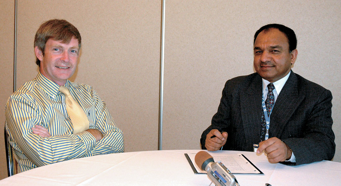
Dave Monk is the Director of Geophysics at Apache Corporation and is a familiar name for the Canadian geophysical community. He is an experienced and well-travelled geophysicist and has worked in responsible positions with different companies including GSI in England and U.S. (as area geophysicist), Halliburton Geophysical, Houston (as Manager of Processing Research and Development), and Energy Innovations Technical Services (as President). Dave was awarded the SEG’s Best Paper award in 1993, EAGE’s Hagedoorn Award for his contributions to Geophysics in 1994, and CSEG’s Best Paper award in 2002. He has been awarded 6 US patents and has published over 60 papers. Following are excerpts from the interview.
Dave, let’s begin by talking to you about your educational qualifications and your work experience.
Well, I went to the University in England of course, and took a degree in Physics, and enjoyed academic life so much that I took a Ph.D. So I actually stayed in Nottingham University and did my Ph.D. in Physics. I was working with very high frequency sound studying the low lying energy levels of very small samples. The sound was in the GigaHz range and samples about 1 cm, but the way I see it, I moved from high frequency and small samples to lower frequencies and very big samples when I moved into the seismic business.
But it was interesting, when I was in the University at Nottingham I had a choice about the subject matter that I would study for a Ph.D. and I chose acoustic relaxation. In the lab next door to me the pioneering work on MRI imaging was conducted at the same time. The very first MRI image was actually taken while I was there, and later a Nobel Prize was awarded for this work. I could have been in the MRI lab, but ended up in seismic.
Where did you work after that?
Well, I spent a long time in academia of course, and then I started work with a company called SSL, a small company in the U.K. They said they wanted me to be a researcher in a lab, but I was keen to go and see the front end of what this business was all about, so they sent me to Nigeria, where I worked for 2 years. At the time if you stayed in Nigeria for 2 years you got promoted a lot because the industry was in a “boom” phase, and not many people wanted to stay in West Africa. It was a really good grounding because I went through the jobs of Assistant Observer, Observer, Senior Observer. The company then discovered that I had taught electronics to undergraduates at University, and so I became a electrical engineer and responsible for all the recording systems in West Africa (seven crews at the time), but I soon decided I did not want to follow that career path, and so I became a party manager and then a party chief.
So in two years I saw pretty much every aspect of land and swamp work, but at the end of two years I didn’t want to stay in Nigeria any longer and so I moved back to England to work for GSI in Bedford, which was a great opportunity as well. They saw my land background and experience and they said – yes, we are going to make you a marine area geophysicist – which of course I knew very little about but I stayed there for a couple of years and then I was lucky enough to get picked to go on a training course in the States with them.
The “Area Geophysicists University” was a nine month course where you were supposed to do a lot of course work and tie down a real job in the afternoons. It was a great opportunity, and some really good people came out of that course who are now scattered all over the industry. I ended up never going back to England after that. I stayed in the States for a couple of years, and then worked in Norway for four years. Later I came back to Dallas and at that time was running the Seismic Research and Development Group in what was then HGS.
I did that for a few years and then decided it was time to go and do something different so I went out and formed a small, independent consulting company called Energy Innovations Technical Services (EITS). This grew to be quite a successful little business. Later an opportunity came up to merge EITS in with some other entities to develop what we thought was going to be the future of visualization in the Oil Business. Continuum Resources was formed, but unfortunately it was a company that bit off a little bit more than it could chew, so it didn’t quite work out. I was ready to change again after a year and an opportunity with Apache came up. The timing was perfect and so I ended up at Apache, where I have been for the last six and a half years.
How are you liking it at Apache now?
Apache is a great company to work for. It’s a company that’s in continual growth and yet it’s not yet got so big that it’s bogged down with bureaucracy. The company just isn’t like that. Individuals are still given responsibility for decisions and it’s been a very refreshing environment. I have never worked for a major oil company but I think it’s very different from everything I hear about working in a major. It has been great.
You did mention about your stay in West Africa for two years.
Two years in Nigeria.
And I was going to ask, if would you like to add anything to that, say about the seismic data you acquired on land and swamp environments?
Great experience! If you work in Nigeria for two years, one of the best things that you get is experience and lots of stories to tell over a beer when you come back! It is not a place that I would be keen to get back to again. One of the attractions at Apache was they didn’t have any operations in West Africa, nothing there. (laughter)
It is a difficult place to work. When I was there back in the 70’s, and we were recording 2D data, 3D really hadn’t got going. We were working with a Sercel 338HR, which was a modification of a 338, which was a 48 channel system and the HR was the 96 channel system which was a big deal on land at the time. At the time I could take the recording system apart and fix nearly anything. That might be a challenge with today’s systems. I ended up working on a quite technically challenging crew which was a swamp and shallow marine crew run from catamarans. It was a small crew working in the Delta region, logistically complicated but very technically innovative with lots of problems, but actually I really enjoyed the experience. I probably enjoyed my last three months in Nigeria more than the rest of the time there.
One of your responsibilities I believe was technical integrity of all operations. I was wondering if you could elaborate a little on how you did that?
Within GSI, which is where I went to after I worked in Nigeria and became the head of all of Area Geophysicists, once you were trained in that role, you are really the one person in the outlying office. I was the only area geophysicist in Norway in the office that we opened up and there was a side manager responsible for the business side, but as the area geophysicist, I was really responsible for all the technical aspects of everything that we did, from survey planning, if we were planning to do work, through to the processing and it was just a great opportunity. So the technical integrity you’d be responsible for was making sure that what was proffered out of the door at the end of the day was not geophysically challenged in some way. You hadn’t made a fundamental error. It was a good role, the area geophysicist role is a model that some companies, some service companies, are returning to now and it’s a good model.
You have been awarded 6 patents.
It is slightly more than that.
I was going to ask you, do you think patents are a good way of protecting your technology? Some think that once the patent is granted the details are on the web, and then people try work around patents and this has been done in our industry also.
Actually, it’s interesting. I am actually working on a patent right now and, there is a little bit of a dilemma because it’s an idea that once published will be very easy to circumvent, but there is real value in it and we are discussing whether or not we should actually keep it as a trade secret and just do what it is that we are doing. It is actually an idea in seismic processing and since we are not a seismic processing company, we will probably look for an arrangement with a seismic processing contractor to offer this capability and they may not want it to be in a public domain. In order to protect it, they may want to not have us patent the idea. As you say there is always the problem, that once the idea is out in the public domain, you can find some way to circumvent the patent – there’s a lot of smart people out there. Having said that, I’ve never made any money directly from any of the patents that I have, but the companies that I have worked for have. In fact one of the patents was licensed for a considerable amount of money, and I got a fruit basket! So there is personal value to patents. I don’t know how to put a number on the value.
What was your assignment as President with Energy Innovations Technical Services and the Chief Technology Officer at Continuum Resources?
Energy Innovations Technical Services was a consulting company, really working at the front end of survey planning and survey design. The business was interesting and we built it up as a real technical alternative, particularly for smaller oil companies who didn’t have those resources in-house, and for a while it was an extremely good business and I believe we did very good technical work. We surrounded ourselves with the right people and the right tools to do the work and we limited the company to about 8 or 9 people, specifically doing survey design and planning. It was a very successful company.
As I said, when Continuum Resources was formed we had a business opportunity to roll that company with a couple of other small companies into a new venture to try and build software for large scale visualization of seismic data. Of course the company that was most successful in this area of technology was Mike Zeitlin’s company, Magic Earth. At that time we were really competing directly with what he was trying to do in Texaco. He was very successful but he stayed really focused on what he wanted to develop. Continuum got a little distracted and decided that they were going to try and build software that was useful outside of the oil industry as well. We were looking at all sorts of different technologies and that, in the end, led to the demise of Continuum. They spread themselves too thin. I lost interest along the way because development was spreading outside of the geophysical industry. When you are looking at 3D renderings of architectural plans or medial imaging, that really wasn’t my interest and yet a lot of the software development that we were doing was in those areas. I decided that I wanted to get back to geophysics and shortly after the company was formed, Apache came to me and said they had an opportunity.
At Apache right now, do you have responsibility for worldwide seismic activity?
Actually we have activities all over the world in core areas. Of course the U.S. is still our dominant area. Up here, Canada, represents 25% of our reserves, so it is a big part of the company. Overseas we have a large presence in Egypt, in the North Sea and in Australia on the Northwest Shelf. We have recently expanded our interest in South America and Argentina as well and we hope this will develop into a core area for us. So we are quite focused in individual countries but we really span the globe. It’s been a great opportunity with Apache.
All of those areas have very different problems, but we have managed to move technology successes in one area and apply them in another. I can think of things that we have done in Egypt which we have been successfully applying here in Canada, areas where the seismic problems are fundamentally different. As a coordinating group out of the central office in Houston, we are really responsible for looking for those opportunities for cross region technology exchange.
I think it helps that a lot of them are…
It does. The regions, if you are (for example) living, working and breathing Egypt you are not worried about the problems collegues are having in Canada, and so it is a valuable role to try to see if technology exchange can be of real benefit.
Let’s talk about digital geophones. Are these being used effectively and what is your impression about their use in seismic data acquisition?
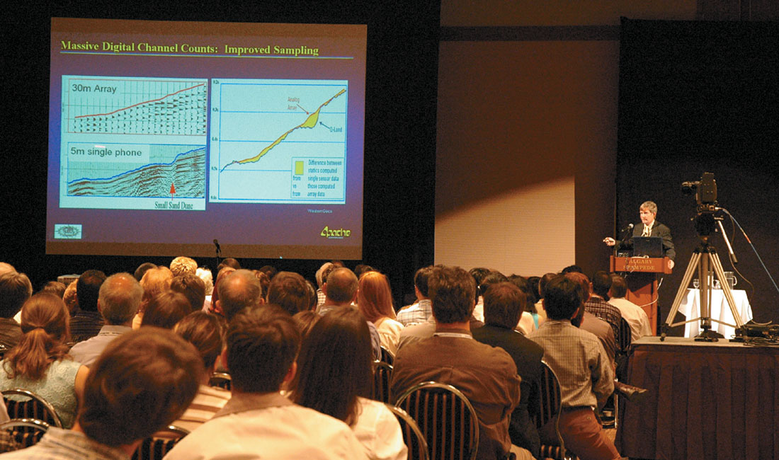
We have done a number of surveys with digital phones and some of them have been very successful, others haven’t quite worked out as well as we had hoped but not because it was digital phones. I think the future is digital for some reasons that I am actually going to talk about here at the CSEG convention. The industry will go to digital phones in the end. We are at the early stage but we are going to see some rapid development in that area in the next 5 years and ultimately I think we will all be using digital phones.
Do you have any idea about how much of the work is being done with digital phones today?
My guess and it really is a guess, probably between 5 and 10% of the land seismic acquisition is being conducted with digital geophones.
I understand. All I was wanting was to get is a feel for it. It is in that range 5 or 10% and in the next 5 years maybe it swells up to 40 – 50 – 60%, who knows?
Who knows, technology takes a long time in our industry to mature. 3D took 25 years to reach 50% penetration, so maybe we are looking at 25 years before 50% of the land crews will be digital phones. I’d like to think it would be shorter than that however.
What is the typical channel count we see being used these days and do you think this will increase and do you see any upper limits?
First of all, there is no upper limit. One of the things that I am going to talk about this afternoon is how some of the laws that apply to other industries, particularly Moore’s Law showing that things grow exponentially, fit with seismic acquisition technology. Channel count on land crew fits very well, and so you can make some predictions about how many channels you are going to be using in the future. Today, you can go and buy a hundred thousand channel system. I don’t think anybody is using a hundred thousand channel system today in the field but we are using twenty thousand channels. If you look at the rate at which those channels have been increasing on crews for the last few decades, you would predict that in five to ten years a quarter of a million active channels on a land crew would be the norm.
Oh, interesting.
I think there are some good reasons why this will happen. As we move to point receiver we are essentially going to replace our arrays with finely sampled individual phones, but they won’t be sparse. That will take us up by an order of magnitude, and if we move to three components that takes us up by a factor of three or four, and then if we want to do finer spatial sampling and acquire multi azimuth data, all of that leads you to think that 250 thousand channels is not going to be an unreasonable number in 5 to 10 years. It’s a lot of channels on the ground and there are some paradigm changes that are going to have to occur in the technology for that to become common.
What are the challenges facing us for getting good quality data these days? It’s an open ended question I know, but I was just wanting to get your mind on that.
Onshore, in most areas, signals – Co – noise ratio is the biggest issue. You solve the random noise with massive numbers of channels eventually, and the coherent noise, and specifically multiples, are also an issue as well. But I think the problem to getting good data in the end may not be related to signals and noise at all. It’s solving statics issues properly on land, which I still believe is an unsolved problem. We don’t know how to treat the near surface properly yet. By comparison, we know theoretically how to do 3D migration in depth, and development in this area is aimed at trying to make it affordable so that we can do it.
Statics is a different issue. We don’t really know how to solve this problem properly yet and there is still a need for continuing research. Once that is solved, it is really going to change the quality of our land 3D images, and ability to extract more information from the data. I hope I have answered your question.
I meant in the acquisition of seismic data.
Okay, so statics isn’t really an issue, although moving from arrays to individual sensors and being able to solve all those individual channel statics issues is part of that solution. You can start to address the small, short wave-length statics. I actually watched a presentation this morning about arrays and individual ‘phones, and one of the things that was missed was that within an array of geophones, if you have one really, really badly coupled geophone, essentially you lose the whole array. So if I replaced that with 24 individual phones and I still had one noisy one, I would have 23 good receivers… and so going to point receiver potentially improves the signal to noise ratio.
This question is out of my curiosity because I saw solid streamer introduced some years ago, so I was just wanting to know, what is the status on that, are people using it?
Yes, if you go to some of the vendors’ web sites you will see solid streamers “The future of the solid streamer is now.” Solid streamers are the future for two reasons. First of all, as we move to shorter and shorter groups or even individual hydrophones, you get a lot more noise, and in a streamer a lot of that noise is conducted within the fluid in the streamer. The pressure waves that propagate in the fluid are referred to as bulge waves, because the streamer actually bulges out. Solid streamers don’t have this problem. The solid material doesn’t conduct the bulge waves, and doesn’t conduct shear energy. So it is the way to go when you go from an array to a single receiver. The other issue is that the environment is going to become increasingly more and more important to acquisition and if you damage a fluid filled streamer, if you cut it, then the fluid leaks out. While this is a very, very small spill, it is of concern to environmentalists and if you damage a solid streamer nothing leaks. So there are environmental reasons for going solid streamer as well. Five to ten years from now all the streamers will be solid streamers.
Why has it taken so long? You know when the fluid streamers came in they took off in a big way; so from fluid streamers to solid streamers, why is it taking so long to be recognized for the obvious advantages that you mentioned?
It’s not cheap to develop and build a solid streamer, and unless the market drives the development it doesn’t happen. In this case, I think what we are trying to do with seismic has changed only recently. Until recently seismic data was fine with large groups, but higher resolution data has led to a shortening of the group. This hasn’t happened perhaps as quickly as you might have anticipated and while you can utilize a bigger array, then the noise is less of an issue, and fluid streamers are adequate.
What do you think about the multi-component seismic data, is it being used in a big way at Apache or how much is it being used and for what purpose?
Apache did a very interesting research exercise a couple of years ago. We decided we were very serious about looking at what multi-component might do for our exploration efforts. We looked at all of the geological and geophysical problems we had in the different places that we operate and tried to ask the question of whether multi-component would help. We came up with three very specific geophysical problems that we had, that we thought it would be worth looking at with multi-component data.
Two of them were up here in Canada where we trying to get better lithology information in channel structures, and trying to detect fracture orientation in reservoirs where fracture density and fracture orientation were important. We did a third test down in the U.S., again with a different objective. One of these programs has actually been very successful for us and we have done some more work subsequently.
So we think that there is a small set of geologic/geophysical problems when multi-component can really help us, but I don’t think it is going to help us everywhere at the present time. However, we are still looking, and we are about to start quite a large-scale multi-component survey in Egypt, where there are some real challenges for multi-component because seismic data is very, very noisy. The work is an area where signal to noise is poor because of scattered ground roll, and it is not clear yet to us whether the promise of multi-component will live up to the challenge in very low signal to noise environments, but we are looking at it.
I think realistically the mode conversion aspects of the data are going to help us in maybe 20% of our geophysical problems, but multi-component data may improve the P wave data everywhere. If we can use the horizontal components to better remove the noise of the vertical component we can actually get better data. So maybe the applicability of multi-component data is beyond 20%, even if the value of mode converted data is going to be limited to 20% of our problems.
What is required these days to record data with very high frequencies and wide bandwidth? I have seen some data sets which have frequency range greater than 200 Hertz.
Interesting. Clearly you’ve got to have a source that puts out 200 Hertz and so on land you may find that challenging unless you are using dynamite. There is no real intrinsic limit to the bandwidth of the detectors and so really it is the response of the earth.
This is actually an interesting question because the patent I mentioned earlier addresses this area of seismic processing, “How do you improve the signal to noise at those higher frequencies where you hope to recover data beyond the normal expected bandwidth?” We have found a way that certainly helps as a processing technique. If you want to go up to 200 Hertz you will probably not be using an array of geophones, it will probably be single sensor and it will probably be a point source. You are not going to have an array of vibrators out there for sure. On land it will probably be single hole dynamite. I don’t know whether that answers all of that question or not. Is the question really about the land source?
It is, yes, I should have clarified that. How do you address the challenge of shallow water data acquisition? You think we are able to do a good job acquiring data in these areas?
Apache hasn’t conducted many shallow water operations recently, although we are looking at some work in the northwest shelf of Australia at the moment. In this case it’s an area where I actually think the multi-component bottom cable would help us because of the geological problems we have in that area, but we haven’t a great deal of recent experience in acquisition of shallow water seismic.
Anything of interest in time lapse processing? Source signature repeatability? I was wondering if you, at Apache, have any case studies on time lapse and if you could share that with us?
There has been some great work done in time lapse, but Apache had not been involved until we moved into the North Sea a couple of years ago when we bought the Forties Field. Forties was BP’s poster child for time lapse and we drove an awful lot of wells on the Forties Field very shortly after we acquired it, so obviously we hadn’t had time to do our own time lapse work and those wells were all drilled on the time lapse work that BP had done previously. The drilling program was very successful, so time lapse worked. In fact it was successful despite the fact that BP appeared to have gone out of their way to acquire all of their surveys as differently as possible!
They acquired the first one with long streamers and long record lengths and not particularly dense source points and then they changed in the second survey to short record lengths and different shot point intervals. In the second survey the platform was undershot with bottom cables but when they shot the third survey this was undershot with marine streamers. So we “inherited” three surveys for time lapse which were acquired very differently and you would not expect this to be optimum for time lapse. But despite that, we found the data to be very robust. We have subsequently shot another survey and we are still waiting for the results. In this survey we really tried hard to mimic exactly what was done the last time that BP shot a survey because we think that we are going to be chasing things where the 4D signature is a little bit more difficult to find because all the big stuff has been found already. So we did a lot of measurements , calculations and modeling, trying to understand and predict what we needed to do, and so issues like source signature matching, source repeatability and trying to match receiver positions was key to what we tried to do there. I can’t tell you whether it worked because we are still waiting for the results.
Let’s hope they turn out to be good.
Yes, I think they will.
This question is a little general in nature. Do you think we need some revolutionary technology? You have alluded to this in a way, but do we need some revolutionary technique, just like the CDP came on the scene in the 50’s and then we had 3D come in the 80’s and it took off in a big way in the 90’s. Do you see it coming?
I can’t predict what it will be. But our industry always appears to evolve slowly and yet if you look back there has been some major jumps over the years and it’s quite possible that there are some major jumps coming. One of the things that I think is potentially going to have an impact is integration with other technologies. Integration of seismic with the CSEM work for example. I think we are seeing the beginning of that but EM today is where seismic was perhaps 25 or perhaps 50 years ago. So I do see a change there.
In seismic itself, the one thing that I think does have some potential is the development of parametric sources, the ability to actually steer a beam of acoustic energy so that you can examine particular points in the subsurface. As an analogy it’s like comparing a light bulb to a laser beam. People are doing research and development in academic institutions today specifically for oil and gas exploration. If this is successful it will enable us to get much better information in the sub surface at particular points. It will radically change the way that we acquire seismic, but this could be 25 or 50 years away.
That is very interesting. I hadn’t thought of focusing of the energy in a beam rather than let it go out in all directions.
It’s relatively easy to do in a homogenous medium so you can do it in air or water. In the marine environment there is some good work for actually mapping out what’s in the water layer for identifying fish and mammals. Interestingly, in the marine environment, you could actually use parametric sources to avoid marine life. First detecting where they are, and then directing energy away from them. The problem is of course in in homogenous media, how do you keep the beam focused, and with dispersion effects it’s much more difficult, but hopefully research and development will find a solution and that may be the way of the future.
What are your other interests apart from the science that you practice?
I am a squash player. I still manage to play squash 3 times a week when I’m in Houston, and I try to find a game when I travel. I’ve played in some strange places around the world.
That’s good, it gives you your exercise.
It gives me some exercise. Last year I was 50 and my children told me that the warranty had run out on my body, so that I needed to keep fit. They gave me a slalom water-ski and said, ” Here is a new sport, you need to go and do it.” Well that nearly killed me!. But now I have become a regular water skier, so I try and keep fit outside of work. Other than that I like life on the water and have an opportunity to get out on the week-ends, go water skiing. But Apache keeps me pretty busy.
Okay, so what would be your message for the geophysicists who just joined and are still young?
Well, first of all, before they join, I think this has been a great industry and I think it will continue to have a great future for students. It is one of the few industries where you can still travel to every part of the globe and see every aspect of the world. In my career, I have been lucky to travel to most places. I have been coming here to Canada at least once a year for the last 20 years. I have travelled to Egypt at least once a year for the last 20 years and I have travelled to most other parts of the world.
Technically we are an incredibly strong technical industry and if you have a technical mind there is always something to find out there that you can really lock onto and become interested in. I still think it is a great industry and a great career choice for young people. I wouldn’t swap it for anything else.
Dave, was there anything that you had expected me to ask and I didn’t?
Well I can’t think of anything else.
Thank you very much for giving us this opportunity and the time to sit down and talk.
Thanks a lot Satinder, that was good.


Editors' Picks
- Science Break: Heart Attacks – “From the Archives”
Oliver Kuhn - The New Reservoir Characterization
John Pendrel - AVO Modeling in Seismic Processing and Interpretation Part 1. Fundamentals
Yongyi Li, Jonathan Downton, and Yong Xu - Improved AVO fluid detection and lithology discrimination using Lamé petrophysical parameters: "λp", "µp", and "λ/µ fluid stack": from P and S inversions
Bill Goodway, T. Chen and J. Downton - The wedge model revisited
Joanna Cooper, Don Lawton and Gary Margrave - Seismic Attributes – a promising aid for geologic prediction
Satinder Chopra and Kurt Marfurt - Scanning Calgary's Water Towers: Applications of Hydrogeophysics in Challenging Mountain Terrain
Craig Christensen et al. - AVO analysis in the presence of NMO stretch and offset dependent tuning
Jonathan Downton


Share This Interview