
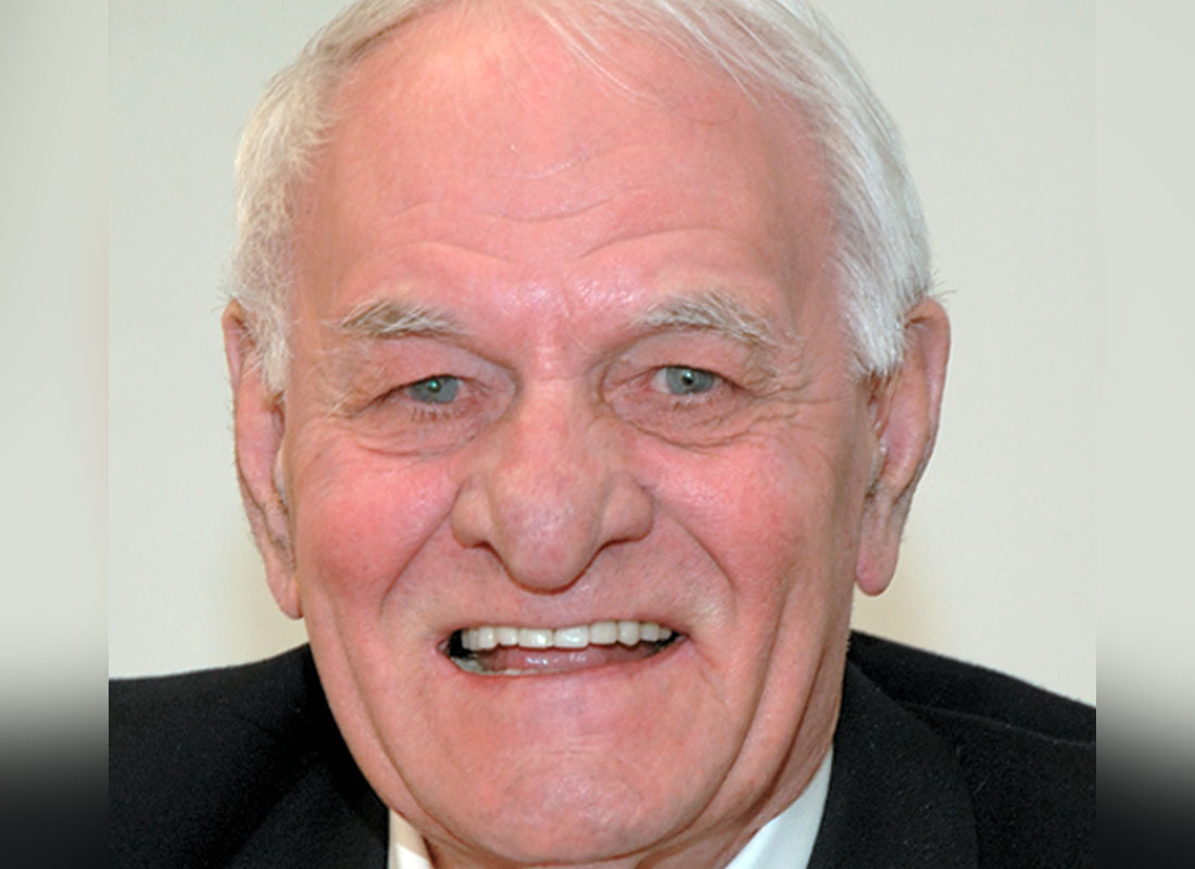
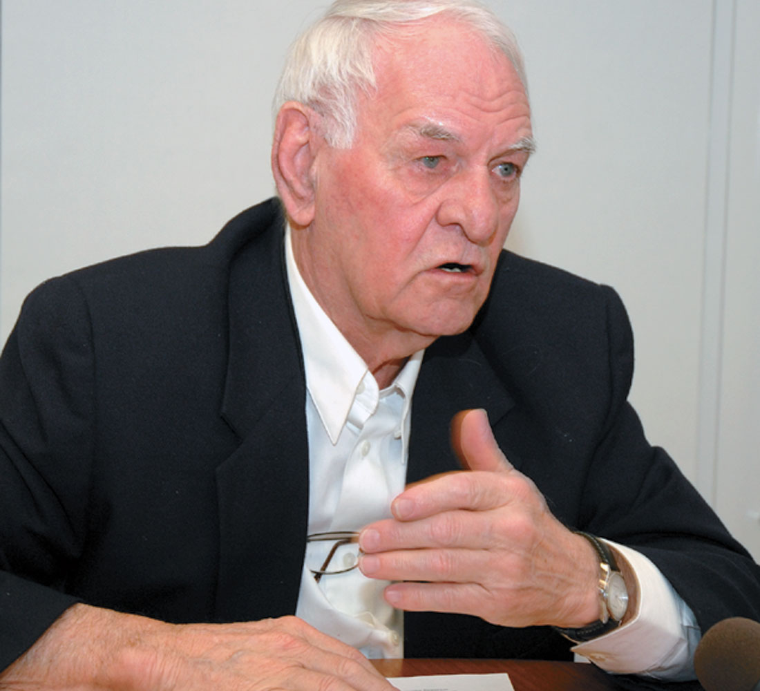
Davey Einarsson, Geoscientist, started his career in May 1956, after graduating from the University of Manitoba with a Bachelor of Science degree. Davey is a long time member of SEG, CSEG, EAGE, APEGGA and AAPG. In 2004 he was an Honorary Membership Recipient of the CSEG. Davey is celebrating his 52nd year in Geophysics and has worked in North Africa, Canada (including the East Coast, Beaufort, High Arctic), and in the US conducting worldwide Marine Operations and Processing for GSI. Mr. Einarsson is one of our industry’s pioneers in both technical and operational achievements – taking Geophysics where no one had gone before.
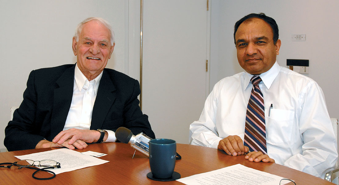
Satinder Chopra and Penny Colton invited Davey to relay these adventures for the RECORDER.
Davey, let’s begin by asking you about your early education and then your work experience.
Well, I was born and raised in Arborg, Manitoba. That’s in the Interlake about 70 miles north of Winnipeg – there were about 600 people in the town and when I graduated from High School there was about 10 in the class. In 1951, I went to the University of Manitoba and I played hockey and graduated in May 1956.
During High School I was the third on the Arborg Team and we won both the Manitoba and National High School Curling Championship for two years in a row. I played on the Science Hockey Team until I graduated and then never put skates on again. That’s not true – I did once or twice, but not in anger.
I was interviewed by GSI, Geophysical Service Incorporated out of Calgary. The man in charge was Charlie Moore, quite a dynamic fellow and a very good explorationist, one of the founders of the Calgary Petroleum Club. I started on May 14, 1956. I took the train to Moosejaw and hitch hiked to Willowbunch, Saskatchewan. I started work for GSI on a crew that was working for Imperial Oil, on a long-term contract, with Decker Stewart as the party chief. That summer there was an industry down turn, so there were a lot of experienced guys on the crew and the first thing I did was sweep the floor. Next I was a jug hustler, then a rod man and then a shooter’s helper. So I got a pretty broad education of the basics. In those days we didn’t have any tape recording mechanism. We just had paper records and we would just put them in an ammonia rack and then in a sun rack to develop. We printed our maps every week right from the field records.
During 1956, I worked in the Saskatchewan Plains till the end of the year. I went home for Christmas and then north to Fort St. John and I spent the winter out of Fort St. John and Fort Nelson working for Imperial Oil again. In those days you had long-term contracts, not like today. Decker Stewart was the party chief and during the winter we worked 204 hours a month. We would put two of them back to back and I came out of the bush and bought a new car. Then I worked in the Calgary Office doing the re- interpretation for Sinclair, as there wasn’t much field work in 1956/57. We were on 4th Avenue in a house that is gone now. There were about six or seven of us who used to do interpretation.
Does that mean you were making interpretive maps?
We were mapping horizon markers from field records. One of the guys who came in there from Hungary after the 1956 revolution was Joe Sefel. He was assigned to me and I taught him how to pick records. That was in 1957. Then I got a call from Dallas saying – come to Dallas right away because we are sending you foreign, we don’t know where.
That was still at GSI?
It was GSI. Bob Everett was a very famous personnel man from GSI who sent everybody foreign, told them what a good place it was regardless of whether it was good or not. I drove to Manitoba, left my car there and went on to Dallas. My first time in Dallas, I spent time getting oriented, then I was assigned to Indonesia – Sumatra with Caltex. I went to San Francisco, stayed at the St. Francis Hotel, got my visa which took about 3 days in those days, and I had a nice tour of San Francisco as well. At 26 years old you know you are pretty impressed. I hadn’t been outside of Canada before in my life. The flight was on an old Pan Am Strata Cruiser which had an upstairs, like the Boeing 747. We flew 1st class but it was at least 36 hours of flying because we were going 220 miles an hour. We landed in Honolulu and spent a few hours there, we landed in Guam, we landed in Saigon. There were French soldiers all over the place, as it was during the French Vietnam War and the French were being defeated at that time. We went on to Singapore and from Singapore I traveled by DC3 to Pakanbaru.
I spent two years over there in Sumatra working in the jungle – had some great times there actually. I was supposed to have “leave” every four months, two weeks leave in Singapore or Hong Kong. Well there was a revolution against Sukarno. We got stuck in the jungle for ten and a half months – straight. If you complained it didn’t do you any good. And then I got two weeks holiday and instead of having five holidays during that two year span, I got two and no compensation for it. In those days you didn’t expect it and you didn’t get it. I finished my two year stint there after exactly two years. I got there August 21, 1957 and I left August 21, 1959.
Why do you remember those dates?
I remember those dates because I was supposed to play baseball in Palangong – for the Caltex Team against a team from Palembang. Caltex had a refinery at Palembang on the Musi River – we used to fly back and forth. I was supposed to play baseball and they argued about who was going to pay my wages for the game. Dick Anderson was the supervisor and he was talking with Coach Walt, an accountant, and they decided neither could afford my pay for the extra time.
What was next in 1959?
I went on home leave for two months to Canada, went to Dallas and then went on to Europe and to Libya to work in our office in Benghazi. The contracts were for Oasis Oil Company which was a combination of Conoco, Amerada, Marathon, and Shell which came in later. It was the biggest oil company in Libya, even bigger than Exxon which was called Esso Libya at that time. Oasis had ten seismic crews working. Three were GSI dynamite crews; seven or eight were thumper crews. I took over as party chief of party 647 from Don Urick who was one of the first seismic party chiefs in Libya. We had great success. Our dynamite crews found most of the oil for Oasis – in concessions 59 and 71. There must have been 15 discoveries in concession 59 alone. All of them were found by Party 647. Esso Libya also made their first oil discovery that year.
So you started off in '59 and how long did this continue?
Libya, I stayed there until October 1970. There is a big story in between in addition to the oil finding success in Libya. That was at the beginning of the digital revolution. In 1961-62 we implemented Harry Mayne’s paper on CDP; we started the first digital crews there, and we put in a digital processing center in Tripoli, an old “TIAC” system.
Tripoli in 1961?
No, in '61, I was in Tripoli, but we didn’t bring in the centre until 1966. But we brought in some digital crews and revolutionized exploration there. It was definitely a technical breakthrough that allowed us to find a lot more oil in Libya because predominantly the thumper was a low frequency poor resolution source. We brought in “dynaseis” and digital recorders and that changed the whole picture.
You left Libya in 1970 – how did that happen?
While still in Libya, I went to work for Chappaqua Oil Company on September 1, 1969 – the same day that the revolution occurred. GSI was having a farewell party for me and at 4 o’clock in the morning Ghadafi’s tanks went down the street and they took over the Government with hardly a shot being fired. We had recorded about 600 linear kilometers of digital recording in 1969, and I had resigned from GSI and taken the job as Exploration Manager for Chappaqua Oil Company. That was owned by Chubby Burham who lived in Chappaqua New York, so he named his company Chappaqua. I had actually signed both sides of the contract because I signed the contract for GSI and then I signed the contract for Chappaqua. We were nationalized shortly after the revolution.
We had 750 people in the field and no supplies. No supply line, no nothing. I had nothing to do but try to talk to the Revolutionary Command Council – which Ghadafi was the Head of. Jallud was his Minister of Petroleum – my wife talked to him to get supplies. My wife is Italian-Egyptian – raised in Cairo, and she speaks perfect Arabic. She talked to Jallud. She was the first person to talk to the Revolutionary Command Council. She got a permit for us to supply planes and fuel and groceries to the crews by plane. So she was quite famous.
Did she ever talk to Ghadafi?
No, only Jallud, the number two man.
How long did that continue?
We continued like that until October 1970. That’s 13 months, I had the only phone at home other than offices and I could get through with great difficulty to the States and to London. I got a call from Ed Vetter, who was the President of GSI and he said, “Are you tired of that Ghadafi yet?” and I said, “Yes”, because Chappaqua was nationalized. Ed Vetter told me he wanted to talk to me about taking over the Arctic Operation. That’s Alaska and Canada.
That’s when you got into the off- shore business?
After that. I went to London and met with Dick Rainey the Executive Vice President and got a sweet offer which was the biggest raise I ever had with GSI, and I went back to Calgary. I got to Calgary in October of 1970. It was very depressed at that time as they were just doing land operations. I had Charlie Moore come up and visit with all the executives; I knew all the executives within a few months.
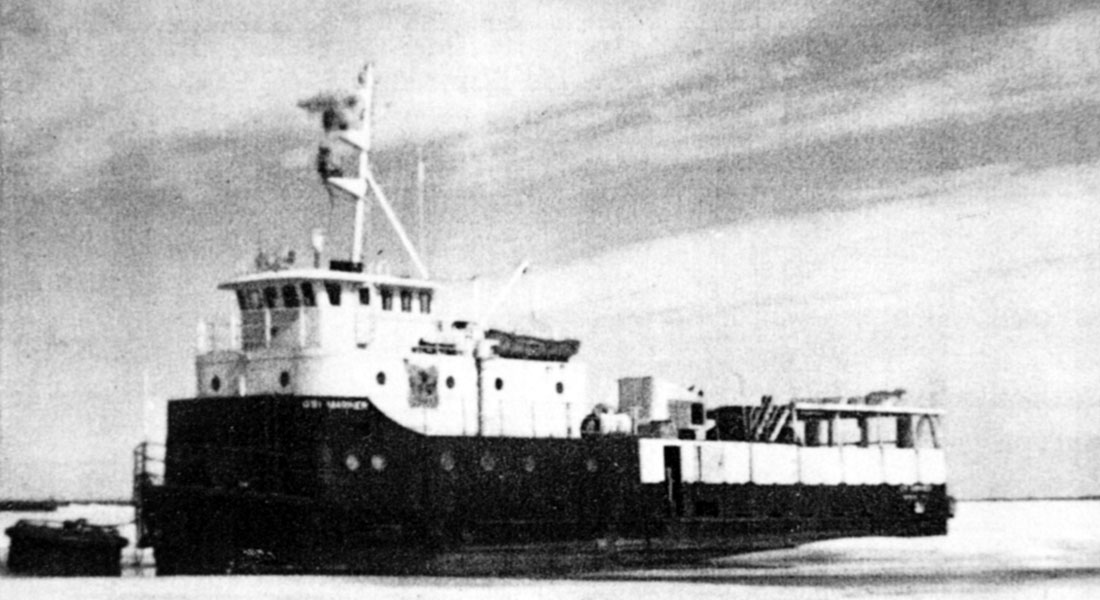
There was no marine done except a little bit of work in the Beaufort Sea with the MV Grebe. It was an old, wooden sub chaser that they used during World War II. We had it up in the Beaufort Sea and I used that for one year. During the winter we built a ship called the GSI Mariner in Edmonton at Alum Construction. They built that thing in pieces, put it on trucks, to Hay River, NWT. In the spring of ‘71 we welded it together on the banks of the river, had some roll logs, pushed it with cats into the Hay River and sailed it through Great Slave Lake, up North and down stream on the Mackenzie River to Inuvik. We recorded seismic data that year and it was very successful. It was a very innovative thing and one of many which we did in Canada – but I will save those war stories.
Okay, so you continued with Arctic Operations for how long?
I stayed here from 1970 to August 1975 – five years.
During 1971 in Canada I did a lot of marine work. I started the marine in East Canada. I worked with Dave Miles of Chevron and his group to form a big spec survey of East Canada, the data we still have today and it covers all the way around Newfoundland and the Scotia Shelf. But that was the first big modern survey where we were able to see below the base of the tertiary because of improved air guns and digital instruments. We didn’t have all that ringing, because we initiated a “de-water” program. It was very, very exciting because up until then Amoco drilled 15 holes on Jeanne d’Arc, all dry, but the rigs they had weren’t capable of going deep enough. They reached ten thousand feet but all the production was later at eleven plus. But you couldn’t see, you just couldn’t see, Hibernia on that old data. The new technology did it. That was again another technical revolution I was involved with which was great fun and satisfying.
Then I went to Dallas and was in marketing for Marine for about a year and then I became the Marine Manager world-wide.
So these marine activities continued?
Marine, I worked in marine from 1975 until 1985, and then I became Marketing Manager. From 1985 through 1991 I was the Marketing Manager, Digital Equipment Manager (DFS) and then Spec Data Manager. Then TI sold us out to Halliburton in 1989 and we joined Halliburton. Halliburton bought Gerhardt which owned Geosource and they put Geosource and GSI together. They re-named it Halliburton Geophysical in 1989/90. Unfortunately, Halliburton made some terrible decisions and put all the exGeosource guys, which was a bankrupt company, in charge. The President was exGeosource and the Chief Financial Officer was exGeosource, all the rest of us Vice Presidents were just jokers – the President and the CFO had all the say. So that was a very bad decision.
So what happened?
We went down the tubes. I was in charge of Spec and seismic instruments, the DFS side. They took me out of instruments and put in a Geosource man. We had the first distributed system already built well over a year ahead of I-O and they just cancelled it. So it was a bad decision but good decision for me because I still worked in the Spec business and it was the only profitable division of Halliburton Geophysical. I put a lot of data in the inventory and 50 million dollars worth of business and made about 10 million in profits. It’s the only division that made money. We had been neck and neck historically vs. Western, but during the 18 months where we operated as Halliburton Geophysical, we ended up with about 850 million dollars negative cash flow. Western had about 800 million positive cash flow. The only difference was management. I didn’t agree with one thing that management did during that 18 months and then I got fired in February of 1991.
I got fired on Friday afternoon and I was consulting on Monday for Fairfield and a little processing outfit called TLC. I worked for Fairfield as a consultant for about a year and during that time I was also working on getting GSI re-established. I had the opportunity to buy the Canadian Spec data because Halliburton was shutting down the Calgary Processing Center – so they wanted to get rid of the Spec seismic data. I put in a bid for the Spec – I won’t tell you exactly how I got it, and won the Canadian Spec data which was stored in Calgary. That was about 160 thousand linear kilometers of data that I collected when I was Marine Manager in Canada. So the data returned where it belonged.
So you re-started GSI now?
I started GSI in 1992 in Houston, registered it and then I bought the data set from Halliburton. Well I knew the data set and the person I dealt with was an accountant who didn’t know anything about seismic and they had a marketer who was just taking orders. We tripled the billings because we were pro-active. Spec doesn’t happen unless you work on it.
Let’s bring it up to date. In 1992 you formed GSI, and then?
On April 8, 1993, I formed GSI Incorporated which was a Canadian Company and because the data was in Canada, we put everything into the Canadian Company. From 1992 on we were enhancing the data, reprocessing it and marketing it. And then in 1998 I formed a joint venture with Rieber Shipping out of Norway, the people I had worked with before in the High Arctic – there is more to tell about the High Arctic.
So, in 1998 you formed that Alliance with them?
Yes, 1997/98 and we started operations in June 1998 on the Jeanne d’Arc basin off the East Coast.
That is when the new data acquisition began?
That’s when the new data acquisition began. We actually did a little work in –97, which I did – and we did some work with Western on land, but off- shore really began in June 1998.
And that’s continuing?
We did that till about 2000 and then the joint venture with Rieber terminated during a down-turn. We did nothing new for a while and then we hired a few boats from other contractors and then in 2002 we bought our own vessel, the GSI Admiral and started the marine operation.
Okay, let’s go back and ask you about your career – you graduated from the University of Manitoba, with a Geophysics degree?
No, in Science. We didn’t have Geophysics in those days. We had seismology, I took seismology but it was just basic …
When you look back at your career, what would be the main landmarks? Which do you think were the biggest?
Well, the most fun one was in 1961-62 when we took “Harry Mayne’s Paper” on CDP, and although he was with Robert Ray at the time, we had the right to use it. John Pfleguer who was Area Geophysicist out of London came to Libya and together we implemented the CDP recording. We didn’t have a get-along-board, we didn’t have CDP recorders, so what we did was we took the whole spread, we took every person, truck drivers, cooks, camp boys, everybody on the crew and put them out there and carried, moved it, physically moved it, and got 110 shot points in one day and did the first CDP work in Libya. That was kind of a fun deal. It was the first CDP shot in North Africa so it was a landmark.
Next?
One of the first digital (DFS-II) crews in Libya worked for Occidental Petroleum. Concession 103 was a block relinquished by Mobil Oil. Occidental laid a big “X” across the concession and we started on one line, a 12 fold CDP with a geoflex (type of Primacord) source. Before we were finished with the first line, we shipped data in for processing on GSI’s TIAC processing center (old loop 4K memory vintage). We discovered a feature that I first identified as a pinnacle reef. The reason we could identity this feature was because of the new digital recording and the digital deconvolution process. We took this one to Occidental’s office on Saturday morning and they almost immediately decided to move a drilling rig to that location. A rig was deployed on site and two weeks later a discovery called Idris-1 was made and announced as 70,000 barrels per day and a 1.9 billion barrel field.
That was a landmark!
I flew out to the Idris Discovery with cases of champagne on Dr. Armand Hammer’s plane, a dive bomber that he had converted as a personal plane. I took that out to the field crew and one of the guys commented, “Oil flows like champagne out here.”
So these were two, the first CDP in Libya and then the work that you did after that, anything later?
Oh yes, – the East Canada Survey, we did that out in the deep water, and in shallow water. I don’t know what we were doing out in 3000 meters of water in 1971, but we were there and I had two ships working continually on this thing. That was the beginning and we were able to see below the base of the tertiary on the Grand Banks where Amoco had drilled those holes. Well the rigs weren’t capable of going any deeper.
Three kilometers of water column?
Yes, on the Hibernia Field it’s only about 300 meters of water, but we got resolution in deeper water. We got rid of the water ringing and we were able to see clearly, the Avalon formation over the Hibernia Field and “that was the first time you saw it.” That was a major break- through that I was involved with. We developed it with Helmut Hofer, who was a Geophysicist here and Milo Backus in Dallas. We had some ideas about how to get rid of the hard water bottom bounce called “de water”. It was a process for getting rid of the ringing and it was the first time we could see things in marine that were really good and that was a break- through. That was another great fun thing.
So then, tell us about your work in Alaska?
Well, in 1975, in Alaska we were recording on the ice using dynamite through the ice and poking the holes into the mud. Well the environmentalists came up there and put cameras down the hole and saw lots of nothing, muck. They said well, it’s inconclusive so you can’t use dynamite. So I developed what we called the “thunder wagon”. I used to like to call it the powder puff because of the environmental issue, but the field guys called it the thunder wagon – of all things for the environmentalists. Anyway, we put this deal together, we designed it and we had meetings for the oil companies and I got nine oil companies to commit to a concept.
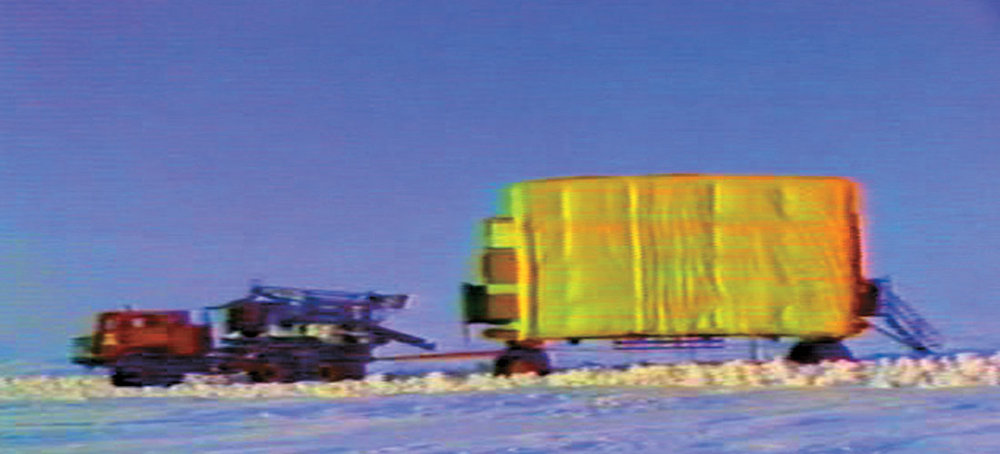
This was great fun. We just had the diagrams, we didn’t start building it – it was strictly a concept. Air guns through the ice, ten cubic inch air guns, four of them, forty cubic inches. We used that source along with a marine land streamer. We had gimbal phones on the streamer which was dragged behind the wagon. We built it all that first year. The thunder wagon had generators, compressors inside, and davits (there was a paper given on this). We drilled holes, at little markers surveyed on the ice. It took 30 seconds to drill through a meter of ice. So we drilled through the ice and recorded, and because they were all under the warm canopy, it was a “short sleeved” operation.
Anyway, we put this thing together with the gimbal phones and nobody had to go outside, only the surveyors and we used the first differential GPS. We recorded on the ice all through Alaska in 1976-1977. That was very successful. It served the need because the environmentalists stopped us from using dynamite. We had to come up with something else and this was another very innovative thing.
What about the High Arctic?
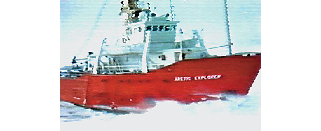
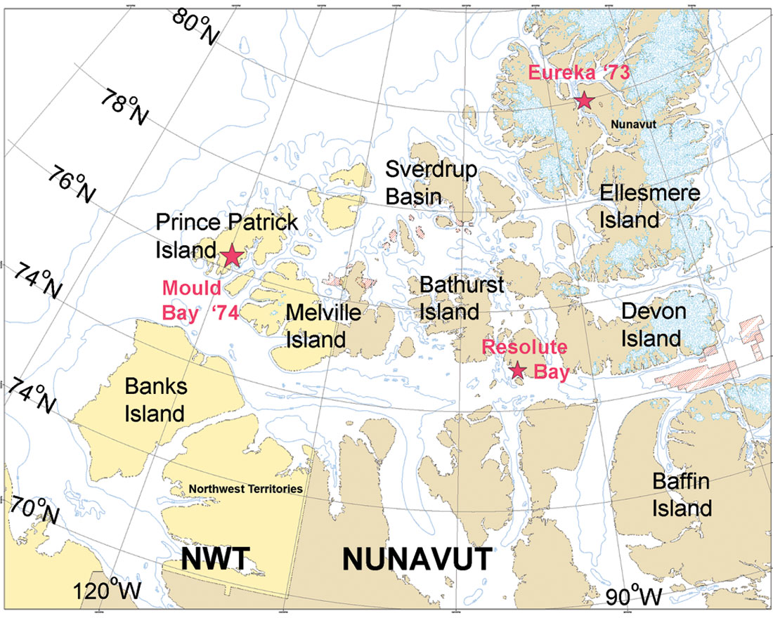
From 1972 to 1979 we leased two boats from Rieber Shipping out of Norway. They were used for sealing in the winter and we put compressors and seismic gear on them. One was an ice breaker – the Arctic Explorer – and we went up to the High Arctic. We collected thousands of kilometers up there in waters where no ship ever sailed before. We sailed to Eureka (80°N) in 1973 and to the west in 1974. In Mould Bay on Prince Patrick Island there was a Post Office at a Weather Station and we got a stamp saying “The first ship ever”, so we got it documented. We collected data all through the Arctic and that included fighting the way through the ice. I have a video of this, “Breaking the Ice Barrier.” I didn’t save many pictures but there is a video tape and I guess you can get pictures off that.
We continued on for the AIOG Group which was Arctic Island Offshore Group and headed by Sun Oil Company and Pan Arctic. We did work for them for about 5 years up in the Sverdrup Basin (north of 76°) which was the first offshore data ever recorded up there. Pan Arctic did work on the Arctic Islands and Drake Point. All that production up there is still good production – it’s just hard to get out, even with climate warming.
Had GSI done any on-ice surveys in the High Arctic?
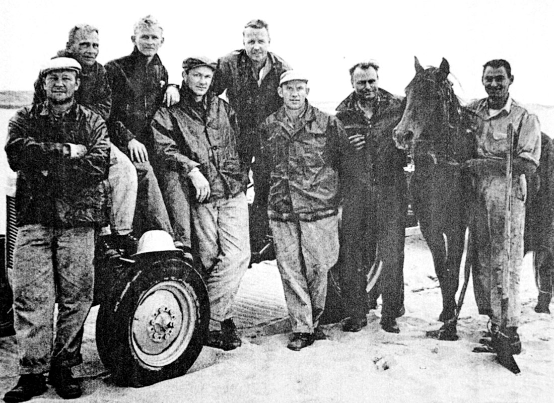
Yes, we did a survey across the Sverdrup Basin by putting maybe a quarter of a pound of dynamite down about 100 feet, and used the gimbal phone and the marine streamer adapted to go across the ice. We did that for a year up there across the Sverdrup Basin. You’d fire that little piece of dynamite and the ice would just vibrate. There were just so many things going on, so many new things – hard to keep up.
Were you up there on those surveys?
Oh, I made trips up there. We lost a cat that fell through the ice in one of the leads. It was tied to the camp so the cat driver just popped up, luckily. There were some innovative guys there. So many adventures, there was an adventure every day.
Davey, let’s ask you about some of your biggest disappointments, perhaps moving out of Libya could be one?
Well, being nationalized by Ghadafi was a traumatic experience to say the least. It was good in the end because I got out of Libya.
And another one would be leaving...
Leaving Halliburton was kind of a disappointment because I felt that I was doing good. Their strategy was so bad in my opinion that I was kind of relieved but I was also disappointed because I had been with the company 35 years. I felt I was a contributor to the very end. To say the least that was a disappointment. However, being resilient I felt sorry for myself Friday afternoon, Saturday and Sunday and went back to work Monday morning. So it was a short-lived disappointment.
Tell us about your experiences. You have mentioned a couple of stories in the Canadian Arctic; you might want to tell us a couple additional stories for our readers.
Yes, when we traversed west in 1974 through the North West Passage, further than the Manhattan had in 1968. That was the big oil tanker built by Sun Oil Company. They wanted to go to Prudhoe Bay to haul oil out through the North West Passage, but it never made it through the ice. They got as far as between Banks Island and Prince Patrick Island. They got stuck in ice and they had to be pulled out by the St. Laurent which was the Canadian Government Ice Breaker assigned to the North along with the John A. MacDonald.
Well, we went in there and I was flying in a Twin Otter and the M.V Carino and the Explorer were chugging along fighting their way through ice. We called a summit conference and we landed on Bathurst Island. It was right where Franklin sunk his boat, and his crew wintered. We landed there and we had two helicopters, one on the Carino and the other on the Arctic Explorer. John Clink and John Lovelock came in and they said, “ We were ten minutes away from open water.” I agreed let’s not abort the operation let’s keep going. It was my decision. We had landed on the ice. Twin Otters were amazing planes – they came down and they hit the ground and threw it in reverse and we just stopped, and then we had to take off which was even worse. We decided right there, they talked me into it, to keep going. And then I got back on the Twin Otter, we flew out and watched where they were and I think we flew further west for 13 minutes and there was still ice. So it was like two or three hours not 10 minutes by boat through the ice but, anyway they were a little bit crazy and they wanted to keep going. So we kept going and the Arctic Explorer broke the ice and the Carino followed on behind.
And then we went in there and collected all kinds of data when we got to open ice areas where no ship had ever sailed before – further west than the Manhattan, and then we went into Mould Bay. I flew up there to Mould Bay and spent the night there with the crew and then we went out and recorded 10 thousand kilometers in 1973 and 1974. So it was very successful. It was something that no one ever did before.
This is more like Star Trek language! Tell us about the GSI Company, what is its present standing and operations?
Well, we started on April 8, 1993 when we acquired the data from Halliburton which was a vintage GSI data base, consisting of 160 thousand kilometers of data including 40 thousand kilometers in the Beaufort Sea and Mackenzie Delta, some Crossfield land data, but mostly marine data. That 160,000 kilometers also included the Baffin Bay data, High Arctic data, and the East Coast data; Jeanne d’Arc and the Scotia Shelf. So we did quite a bit of re- processing on that until 1997. In 1998, we formed a joint venture with Rieber and conducted surveys through 2000.
Then we acquired our own ship in 2002, the GSI Admiral and went to work on the East Coast of Canada – mainly we were doing work in Canada. Then business dried up a little and we went to 3D capabilities on the Admiral, 4 streamers and 2 sources. Not to compete with Western or the big guys but to do niche work. Smaller surveys, twelve hundred square kilometers, we could do quite cost effectively. So this is what we have been doing.
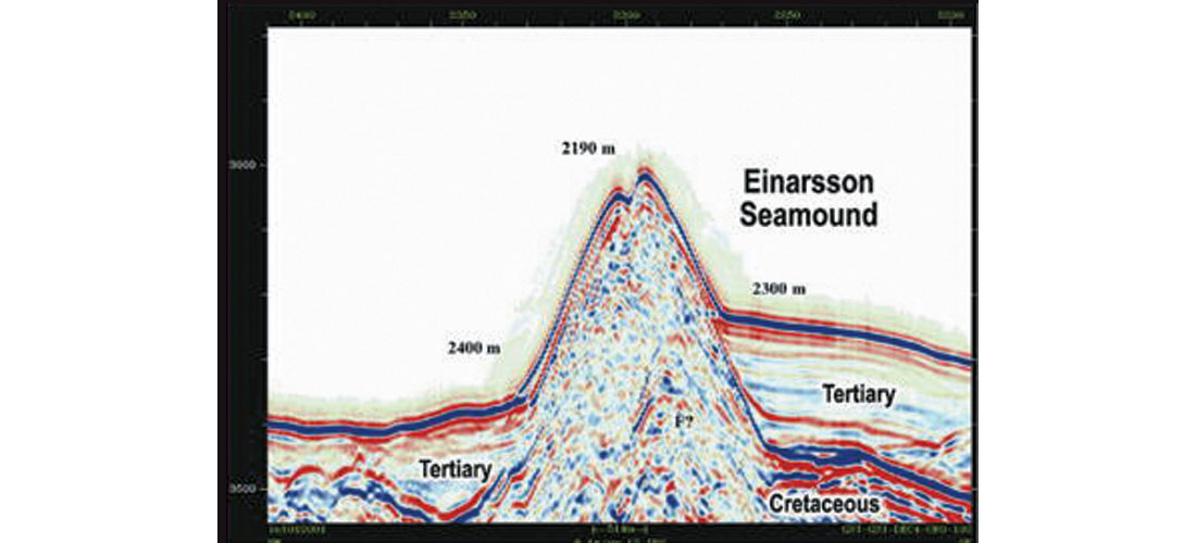
We acquired another ship, the GSI Pacific, two years ago and we went to work in Labrador and we have been working in Labrador on non-exclusive programs since 2003. We have collected 35 thousand kilometers of new data up there. That’s kind of an exciting thing. We have done a lot of work with Michael Enachescu, of Memorial University in St John’s (Newfoundland and Labrador), on that data which was donated to Memorial for student use. He is an expert on the area and he explains the geological setting for petroleum exploration basins. Michael named two seamounds in the Orphan Basin, one after Einarsson and one after Sam Nader – the Einarsson Seamound, the Nader Seamound. (R: See TLE, December 2004).
We have expanded. In 1992, the first year, we billed $8,000 and we have completely self financed everything since, until we bought the Admiral. We had to get some outside financing for the ship because it was such a big expenditure, but pretty much self-funded, family owned. I have two of my boys working with me. The one in Houston started at the very beginning of GSI.
Okay, I was going to ask you are any of your children also interested in geophysics?
Yes, they are in geophysics. Russell has been with me since 1992 and Paul, who is the Chairman here, has been with me since 1996. So we have made a family company.
Is most of the focus now on the East Coast?
No, since we got to the 3D and since business has changed, we are doing work around the world. Right now we are working off Chile, doing a 3D for ENAP, the Government Company of Chile and that’s going very well. During the last couple of years we worked in West Africa. The Admiral is a 3D vessel, the GSI Pacific is a 2D vessel. It was in dry dock in Shelburne Nova Scotia for three months and is going to West Africa to start work in Guinea. We’re doing a spec survey there in conjunction with Hyperdynamics, a company who has the concessions. We intend to do 6 thousand kilometers there, then on to our Labrador program which has been going on for five years. We are going gradually towards the North. We started in Hopedale Basin, then we went to Sagleg Basin this year, and then going further North. So we will be back in the Arctic again.
So, your competitors now are only three? PGS, CGGVeritas and Western...?
Well, there are quite a few new Norwegian companies like Scan, Fugro and Wavefield. The Norwegians get money, they buy new boats. They haven’t been self-funding like we were.

The background you have given shows you have been changing with the changing times, developing or assembling technology within your work so that you have a competitive edge. Is there anything you are working on at present?
We have not had a research group per se. We have been strictly doing operations. We have formed a Processing Center in Calgary which while not leading edge, is catching-up. Now we are doing depth migration and AVO and all that stuff. We bought a center called Precision Seismic Processing which was a land data processing center and then we converted it to marine because we are processing much of our own spec work. About 40% of the work we do in the Precision center is our own spec data. It is also doing 3D now. We’ve got one research geophysicist. We don’t have a research group, unfortunately. I would like to have but that costs money. We have tried some new techniques and we have a streamer factory where we are building a new streamer. We’ve done some work on the sources, no revolution in technology, all evolutionary, so not quite like I did before.
Yes, that’s why I ask the questions. Okay, let me ask you this, what advice would you have for someone who would want to start a data acquisition company?
Don’t! Especially in land. There are way too many liabilities involved. The balance between the liabilities vs. the rewards is not there. It is not there, and the small companies, in Canada, just seem to like to go to work to keep busy, they don’t have profit on their mind. But old boys, the old club, which I come from, are – let’s keep busy, let’s not make a profit attitude. If you can’t make a profit you can’t replace obsolete equipment. The name of the game is profit, and the land industry in Canada has never made good business.
How about off-shore?
Off- shore we have made money. We, GSI have made money
Can you tell us what will be your message?
The message is not to get more competition in marine, we don’t need it!
So don’t?
Well, it’s a tremendous amount of capital now-a-days. You know we will be putting a new streamer on one ship. We have to upgrade our MSX I-O streamer which we have been using. Talking about just the equipment, not all the peripherals and stuff, that’s 20 million dollars – it takes a long time to make 20 million dollars back. And then the vessels are 60 million dollars, so with the capital expenditure s involved, somebody small, forget it, unless you can get somebody to supply the boat and finance your very expensive equipment. We have not attempted to compete with PGS, CGGVeritas, or WesternGeco. We have had only 4 streamers and tried to do smaller 3D surveys where we are more efficient for us. Therefore we can charge less for small surveys, which there are many of, because people don’t want to do the whole world (although some of those boats are big enough to do the whole world). They want smaller surveys and we can do that more economically because of the faster turns, and we can do better on the mobilization fees.
Are you staying actively engaged in work?
Yes.
Has the idea of retirement ever crossed your mind?
Yes, it does, right lately.
What have you been thinking then?
Well I think, I have been gradually putting off a lot of the responsibilities, most of the financial stuff is done by Paul now, my son in Calgary, and most of the operational stuff is done by Russell. I act as a coach.
Okay, what other interests do you have, what keeps you busy?
Well, I do have a Model A Ford, 1928, eighty years old this year. I just drove it on Sunday about 10 miles, which is normal. Worked like a charm – that’s one of the things that isn’t for sale.
You also donated to a program at the University of Manitoba?
Yes, I donated an Annuity for the twelve volley ball girls because my grand nephew is the coach of the University of Manitoba Women’s Volleyball team. So we gave them all a $3,000 a year scholarship. I am looking to – hopefully with a good year this year – to do some more scholarships, seeing as I have no other desires to spend money.
The Admiral is a Canadian registered vessel. Has that made any difference to any of the Labrador programs?
It costs more. We have done very little in Labrador with the Admiral, we have done it mostly with the Pacific or we used a Chinese boat one year, we sub-contracted.
The Pacific is not registered in Canada?
Pacific is registered in Panama. The Canadian Registry has got problems. The DOT, Department of Transport, and the paperwork they have in the East is not desirable. It’s not desirable. Canada has got some of the worst bureaucracy in the world. It’s much better to work in the Ivory Coast than it is in Canada.
Another question about geoscience as a career – what would be your message for young entrants to geoscience, what are the most rewarding aspects of taking up a career in geoscience?
Well, I think geophysics is a great profession. I don’t know how much opportunity people have to travel today like I did. I have been moving my whole 52 years, the last 20 years have been the longest I have ever been in one place – in Houston – but I have come to Calgary up to 8 times a year for the last dozen years, though I am slowing down a bit now. I think geophysics is a wonderful profession. It’s got lots of room for development, take the marine 3D – which I was involved with by the way, I forgot to mention that. I was involved with starting 3D with Bob Graebner in Dallas and I got kicked out of a lot of client offices. They were telling us it was a GSI rip-off and we were charging too much. Now everybody has invented 3D. When I was a Marine Manager, we did 303 – 3D surveys in marine before the first competitor did their one. That was CGG in 1980. Three hundred and three.
That is a really big number.
[Penny]: What part of the world were those surveys in?
All over. Mainly in the Gulf of Mexico and the North Sea.
[Penny]: Did you have a Processing Center set up to handle that data?
Oh, yes, we always had the processing edge – GSI.
[Penny]: I’m guessing that’s from GSI’s links with TI (Texas Instruments)?
Oh, everything, everything was TI. If it wasn’t invented at TI then it was no good.
[Penny]: The TI website notes that GSI’s founders set up an instrument division in 1946 then broadened their base in 1951, by renaming the company as Texas Instruments Inc (TI), with GSI as subsidiary. The exploration spirit seemed to continue at TI, the website notes that Jack Kirby of TI invented the integrated circuit in 1958, and received the 2000 Nobel Prize in Physics.
Oh Yeah. They were very innovative. It was a shame they decided to get out of the geophysical business. A very great company to work with.
[Penny]: You met most of the GSI founders...
GSI was started by Clarence Karcher, Eugene McDermott, Cecil Green, and Eric Jonsson in 1930 – to find oil through geophysical operations. In 1932 they shut down pretty much because of the Spindletop oil discovery when everyone said they wouldn’t need any more oil. They formed a company and Dr. Peacock became the President which went on till December 6, 1941 when the four bought it from Amoco actually. They split that company between what became Amerada Hess the oil company and GSI the geophysical company – owned by McDermott, Cecil Green, and Jonsson. That stayed till 1951 and from the instrument division of GSI they formed Texas Instruments and went on the Stock Exchange. And then TI became so much bigger, we (GSI) were only 7% of the TI company. The old guys started dying off, getting too old, and the young bucks in the integrated circuits and stuff said – oh, we don’t want to bother with GSI they are a bunch of rebels anyway. So they sold us off to Halliburton. And that was in 1989.
[Penny]: Many of today’s generation of geoscientists won’t know that TI manufactured the DFS (Digital Field System) series of geophysical recording instruments in use around the world – since the early –60’s as you used in Libya.
Yes, they had the instrument division, the DFS service. I was in charge of that division (of TI) for a couple of years.
[Penny]: That included the digital computers that GSI used in processing those landmark 3D’s?
Yes. We were way ahead of everybody else. We were imaging 20 years ahead of the medical profession. The medical profession has their MRIs and their Scans… MRI is magnetic reflection, and Scans are acoustical, so they are just a higher frequency seismic.
[Penny]: Is there anything else you’d like to tell us?
Two notable developments were initiated and I was the primary driver in their development. First, the development of the sleeve gun as a marine seismic source. As Marine Vice President, I set the specifications to twice the energy output with half the air pressure input. Harry Harrison our Engineer made it work and the sleeve gun became the preferred marine seismic source in the early 1980’s. (Harrison received the 1998 SEG Fessenden Award for the sleeve gun.)
Second, the multiplex streamer developed with EPRCO (Exxon) was the first production distributed marine recording system. I worked with Jack Lane and Jim Spackman of GSI and Bob Newton of Exxon to develop that system.
My greatest award was being called “My favorite doodlebugger” by Cecil H. Green.
Thank you very much for giving us this opportunity, we appreciate finding out about all these achievements.
[Penny]: There are many in the CSEG readership that use the results of these developments today or were connected to those crews. We hope the next generation of geophysicists and geoscientists will follow these examples and boldly go where the science takes them.
I appreciate the opportunity of having a chance to talk to you.


Editors' Picks
- Science Break: Heart Attacks – “From the Archives”
Oliver Kuhn - The New Reservoir Characterization
John Pendrel - AVO Modeling in Seismic Processing and Interpretation Part 1. Fundamentals
Yongyi Li, Jonathan Downton, and Yong Xu - Improved AVO fluid detection and lithology discrimination using Lamé petrophysical parameters: "λp", "µp", and "λ/µ fluid stack": from P and S inversions
Bill Goodway, T. Chen and J. Downton - The wedge model revisited
Joanna Cooper, Don Lawton and Gary Margrave - Seismic Attributes – a promising aid for geologic prediction
Satinder Chopra and Kurt Marfurt - Scanning Calgary's Water Towers: Applications of Hydrogeophysics in Challenging Mountain Terrain
Craig Christensen et al. - AVO analysis in the presence of NMO stretch and offset dependent tuning
Jonathan Downton


Share This Interview