Introduction
A new, rich petroleum province is waiting to be explored. The sedimentary basins offshore western Canada are currently off limits to hydrocarbon exploration due to a continuing government moratorium. Yet, political developments at the provincial and federal levels give grounds for optimism that this moratorium may be lifted in the foreseeable future (Fogarassy, 2003; Cook, 2005). Lyatsky Geoscience has studied this region for almost 20 years, and this paper briefly summarizes and builds on our results reported in much greater detail elsewhere (Lyatsky and Haggart, 1993; Lyatsky, 1996, 2003).
Any conclusions about petroleum prospects are inevitably tentative in this under-explored frontier region. Without claiming the final word, we conclude that the best oil prospects probably exist in Cretaceous reservoirs in the Queen Charlotte Basin on the inner continental shelf, particularly in western Queen Charlotte Sound.
Fairly stable marine environments evidently existed in the Queen Charlotte Basin in Late Triassic to Early Jurassic time, and high-quality oil-source rocks were deposited. Known sections of other basins in the region developed later, in less stable tectonic settings. To our (very incomplete) knowledge, these basins lack good-quality source rocks, although they may contain some gas.
Geologic Setting
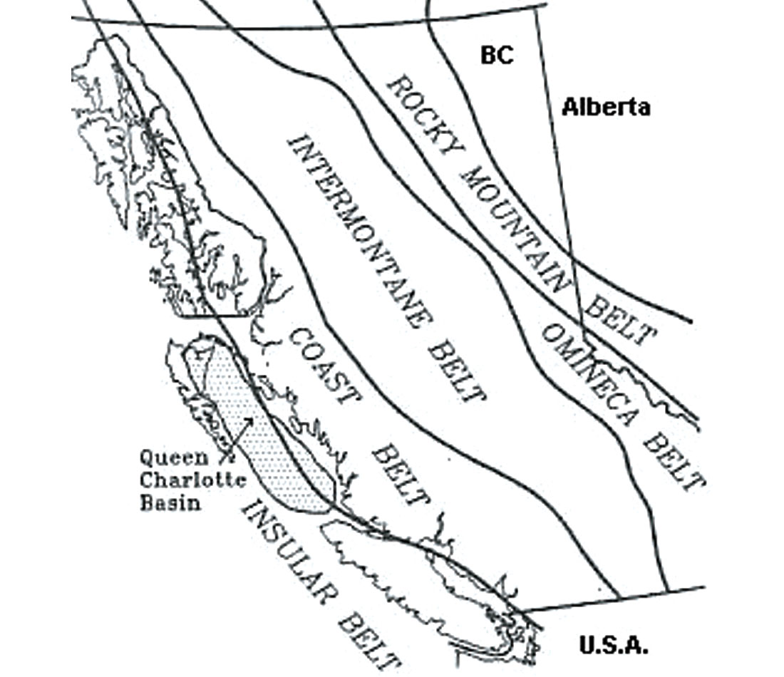
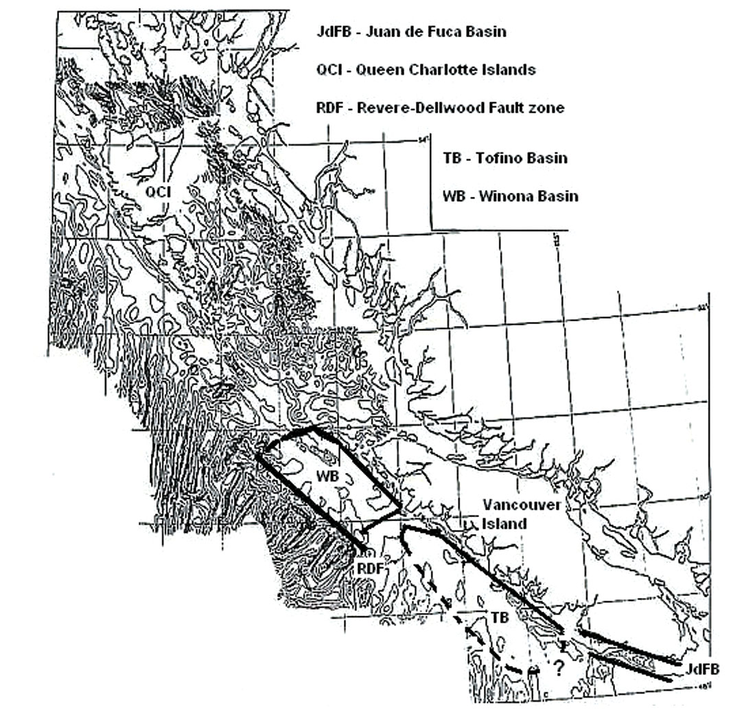
The Queen Charlotte Basin lies on the inner continental shelf within the Insular Belt of the Canadian Cordillera (Figure 1), surrounded on almost all sides by land areas where rocks and structures correlative to those in the basin are exposed. The other sedimentary basins on the west coast of Canada lie on the outer continental shelf or even the continental slope.
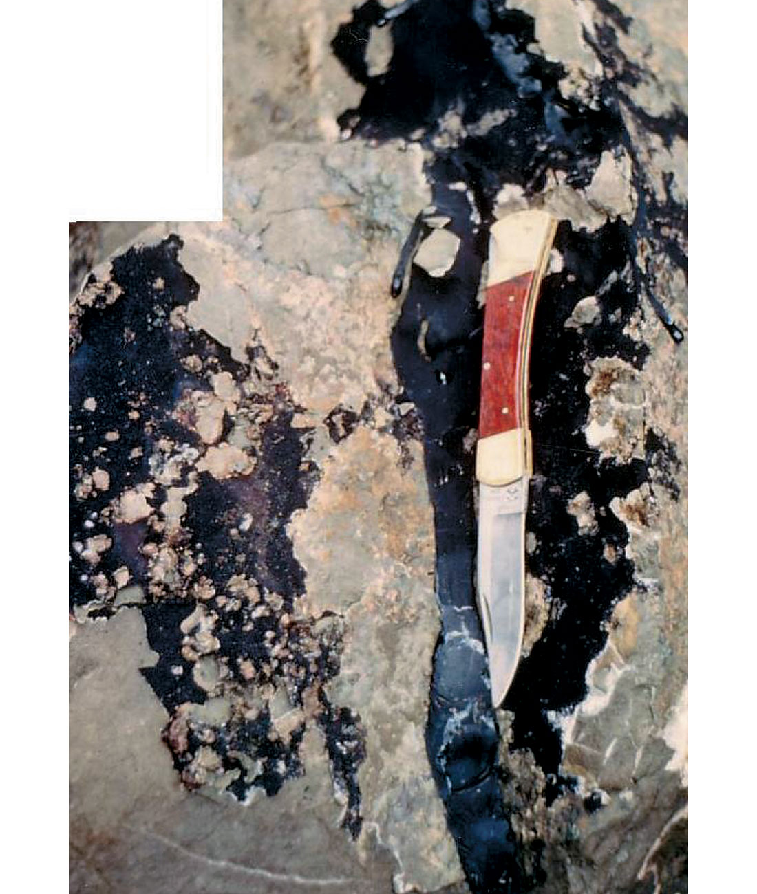
Oil seeps (Figure 2) from rocks of all ages have been known on the Queen Charlotte Islands for decades. Two dozen exploration wells were drilled without success in the Queen Charlotte and Tofino basin areas, mostly in the 1950s and 1960s. Eight of them are in the Queen Charlotte Basin offshore: six in Hecate Strait, but only two in Queen Charlotte Sound. Six offshore wells tested the Tofino Basin (Sutherland Brown, 1968; Shouldice, 1971). Some wells are on land in the Queen Charlotte Islands, which unfortunately mostly lack caprock. The rocks on the mainland are mostly crystalline, belonging to the massive igneous and metamorphic suites of the Coast Belt of the Cordillera.
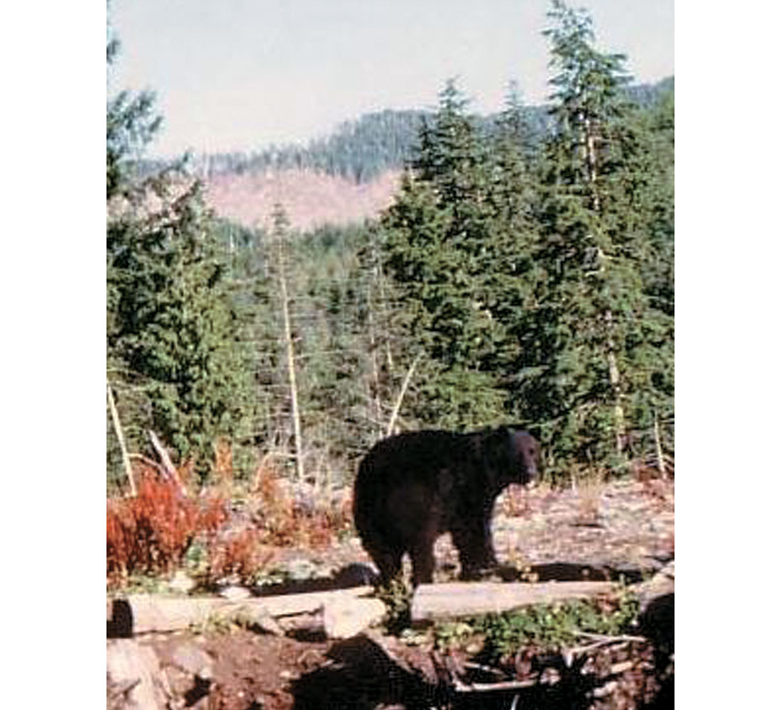
Since the imposition of the offshore-exploration moratorium in the early 1970s, geological and geophysical data have come largely from academic and government sources for whom natural-resource evaluation may or may not have been a significant objective. Usefully, petroleum-assessment needs did drive many of the government studies, particularly those of the Geological Survey of Canada, and a public-domain marine seismic survey was shot in the Queen Charlotte Basin in the late 1980s by Chevron (Woodsworth, ed., 1991; Hannigan et al., 1998). Besides the moratorium, other impediments to exploration arise from environmental concerns (Figure 3) and native claims. A Canada-U.S. maritime-boundary dispute persists in Dixon Entrance, between the Queen Charlotte Islands and islands in the Alaska panhandle to the north.
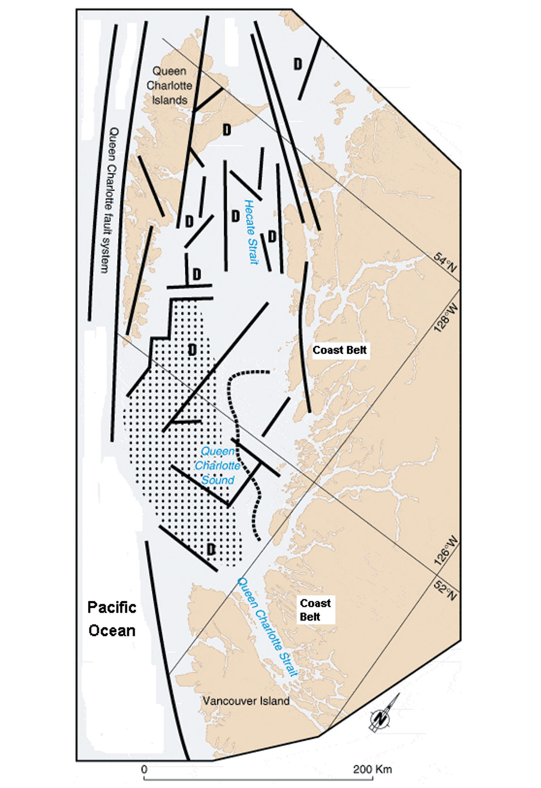
Proximity of the British Columbia offshore basins to North America’s continental margin has led to substantial underestimation of these basins’ essentially continental nature. This matters particularly for the basins on the outer continental shelf and slope, where oceanic crust has sometimes been postulated despite a deep Moho (base of the crust) and the absence of typically oceanic striped magnetic anomalies. Geological and geophysical evidence shows instead that the outer-shelf and slope basins lie on continental crust, probably also belonging to the Insular Belt, and some of them lie between strands of the broad Fairweather- Queen Charlotte-Wallowa fault system which forms the western boundary of the North American continent in this region.
Based on a combined analysis of reflection and deep refraction seismic data, potential-field data, and geological information offshore and onshore, it is found that the Cascadia subduction zone exists only in the U.S. and does not continue north into Canada, where no ongoing subduction is taking place. Instead, the continental margin in this region is marked by the Fairweather- Queen Charlotte-Wallowa fault system, which is tens of kilometers wide and runs from Alaska to Idaho, where it begins and ends inside the North American continent. Several offshore British Columbia basins lie within this large structural zone.
The Cascadia subduction zone off western North America is quite unusual in the Circum-Pacific region (e.g., McCrumb et al., 1989; Acharya, 1992), as it lacks some of the main geological and geophysical attributes from which subduction zones are typically identified. In some conventional tectonic models, this subduction zone runs from northern California to central British Columbia; the oceanic Juan de Fuca lithospheric plate is subducting along it beneath the North American continent. Remarkably, though, at the foot of the continental slope, this subduction zone has no deep-water bathymetric trench . Although this region is earthquake-prone, no thrust earthquakes are taking place: analysis of fault-plane solutions and young geologic structures suggests strike-slip and normal faulting, apparently with north-south compression in the continental crust and extension at deeper lithospheric levels. Along the western continental margin in the U.S. and Canada, the measured modern vertical movements of different continental crustal blocks differ greatly and fail to fit any simple two-dimensional flexural model as expected at subduction zones.
Instead, steep crustal-scale faults of Mesozoic and Cenozoic ages are seen from the geological and geophysical data to continue from the continental interior far outboard into the submerged continental-margin zone offshore western Canada. The diffuse plate boundary off western Canada seems to be marked by a zone of interlocked continental, transitional and oceanic crustal blocks, tens of kilometers wide, controlled by strands of the continental Fairweather-Queen Charlotte-Wallowa fault system.
Both the southern (Gorda, off northern California) and northern (off Vancouver Island) parts of the oceanic Juan de Fuca plate have contorted magnetic stripes and diffuse earthquake seismicity patterns. Reflection and refraction seismic data show the northern Juan de Fuca plate’s crust is strongly faulted and has variable thickness. But, whereas the Gorda segment of the Juan de Fuca plate is commonly recognized to be squishing and probably not subducting, oceanic-plate rigidity and normal subduction continue to be conventionally assumed for the Vancouver Island segment, where the evident oceanic-crust disruption is by far the greater.
Assuming lithospheric-plate rigidity, a plate-interaction model with right-lateral movements off Queen Charlotte Islands, a plate triple junction with sea-floor spreading off Queen Charlotte Sound, and subduction off Vancouver Island, has for three decades guided geophysical data interpretations and seismic-hazard assessments (e.g., Clowes et al., 1987; Hyndman et al., 1990). However, in the absence of solid geological constraints geophysical interpretations are often non-unique, and combining various types of data suggests an alternative (Lyatsky, 1996).
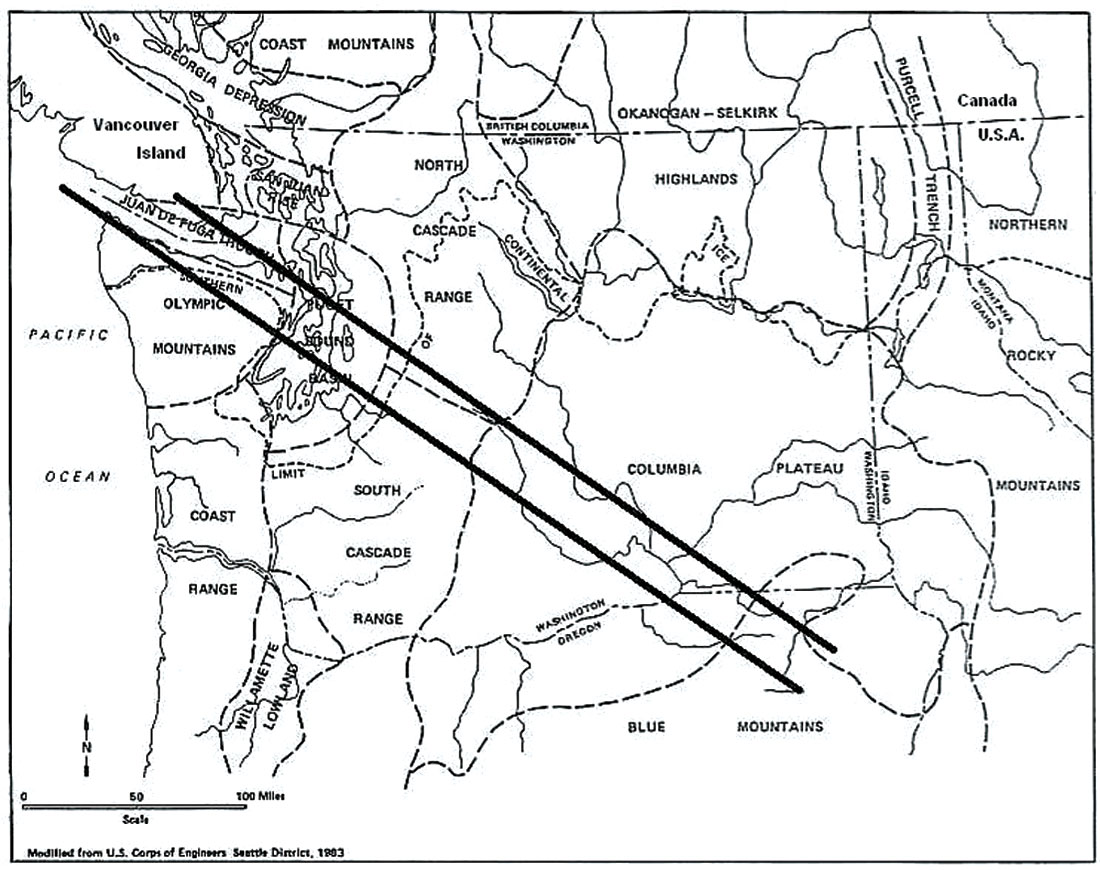
The WNW-ESE-trending Early Tertiary Olympic-Wallowa crustal weakness zone (Figure 4) is known from field mapping and geophysical studies to begin at least in Idaho and run diagonally across northeastern Oregon and the entire Washington state (Reidel and Hooper, eds., 1989). It is expressed on the ground as a well-known regional set of topographic lineaments and faults. From geophysical and geological studies, it seems to partly control the shallow and deep structure of the Columbia Plateau. Farther west, it separates the North and South Cascade geologic provinces. The Tertiary Juan de Fuca graben and today’s Juan de Fuca Strait, between the Olympic Peninsula and southern Vancouver Island, lie within this major structural zone; the graben contains a deep, elongated Tertiary sedimentary basin.
Fault strands of the Olympic-Wallowa structural zone are evident from geologic field mapping on the Olympic Peninsula and Vancouver Island, and they are seen from geophysical and geological evidence to continue into the Tofino Basin on the continental shelf west of Vancouver Island. Some of these deep, steep faults on the shelf controlled volcanic eruptions, as evidenced by known elongated Tertiary volcanic-rock bodies along them. These volcanic rocks are assigned to the Crescent Formation, which is thought from various lines of evidence to have been extruded in a rift setting (Babcock et al., 1992).
Unlike offshore Washington, no subduction-related accretionary mélange of pervasively sheared or ground-up rocks has been drilled off Vancouver Island. Poorly imaged quasi-compressional structures in seismic profiles on the continental slope off Vancouver Island are probably due to sediment slumping, and many well-resolved faults are steep (quite in contrast to the east-dipping thrusts with intra-sedimentary detachments clearly imaged in seismic profiles and drilled on the continental slope off Oregon).
The Cascadia zone’s subduction is often recognized to be decaying off Oregon and Washington state, and from our analysis it no longer seems to be occurring in Canada.
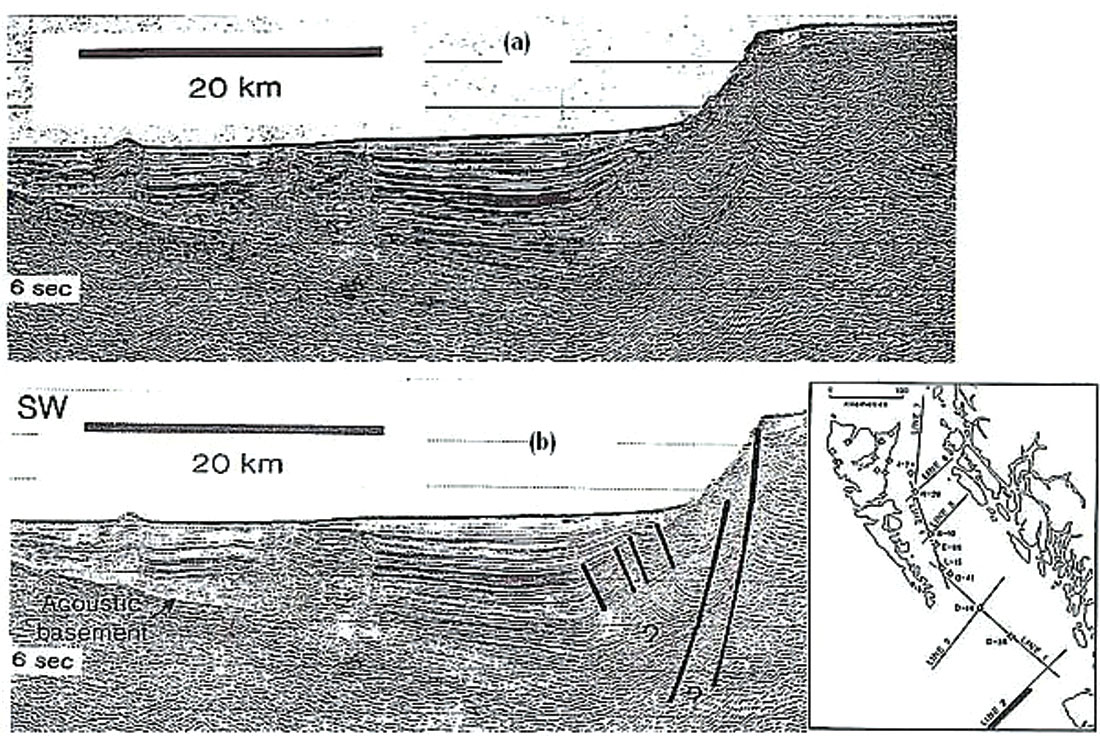
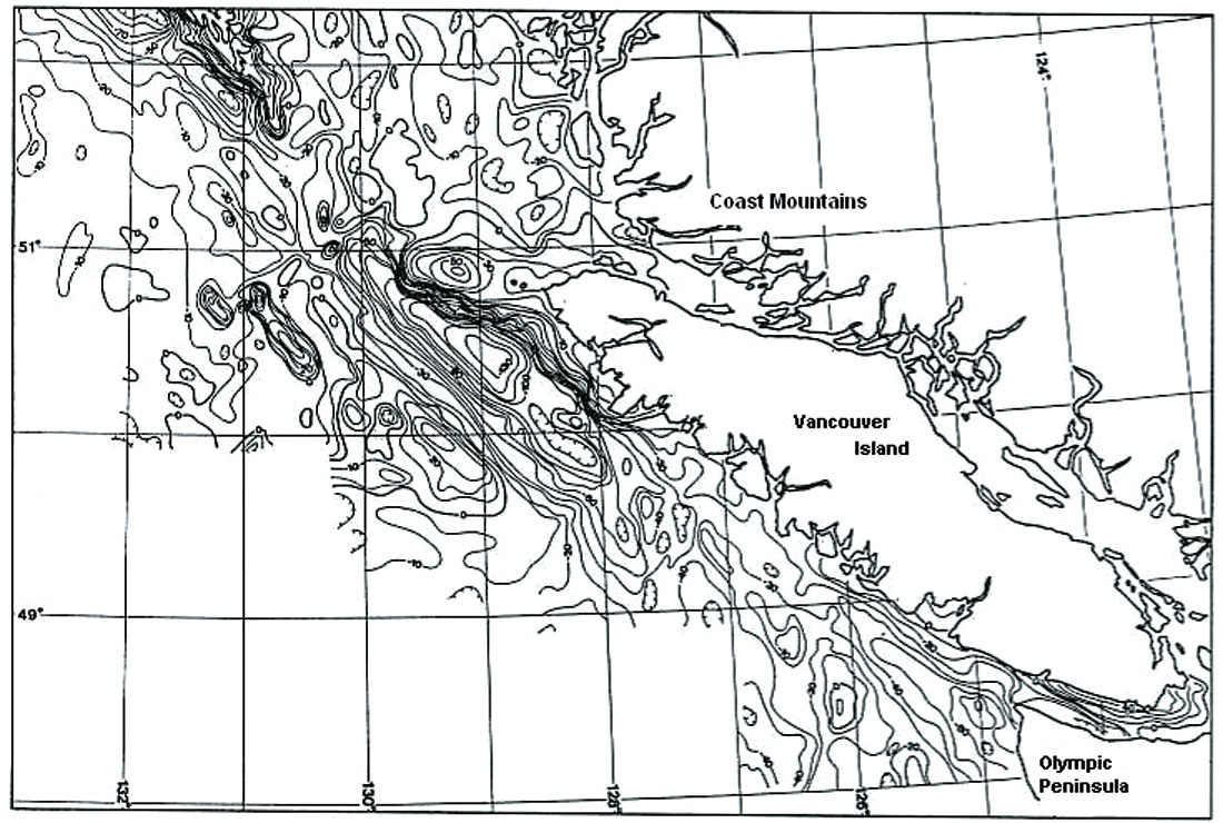
No significant young compressional structures are found in the rock record on Vancouver Island: big Tertiary faults, some inherited from the Mesozoic, are straight and steep; some of them disrupt seismic-reflection patterns at depth. Offshore to the west, thick crust (10 to >20 km in seismic refraction and gravity models) and the absence of magnetic stripes (Figure 5) in a broad zone along the continental margin suggest that the underlying crustal blocks in the Tofino and Winona basins are continental. Indicating an extensional tectonic regime, in seismic reflection sections (Figure 6) a huge, steep, listric, NNW-SSE-trending, west-dipping normal fault separates some of these foundered blocks from the continental shelf.
Several tens of kilometers outboard to the west, the outer edge of the Winona Basin is marked by the subparallel Revere-Dellwood fault, which truncates the magnetic stripes abruptly and west of which the crust is by all parameters oceanic.
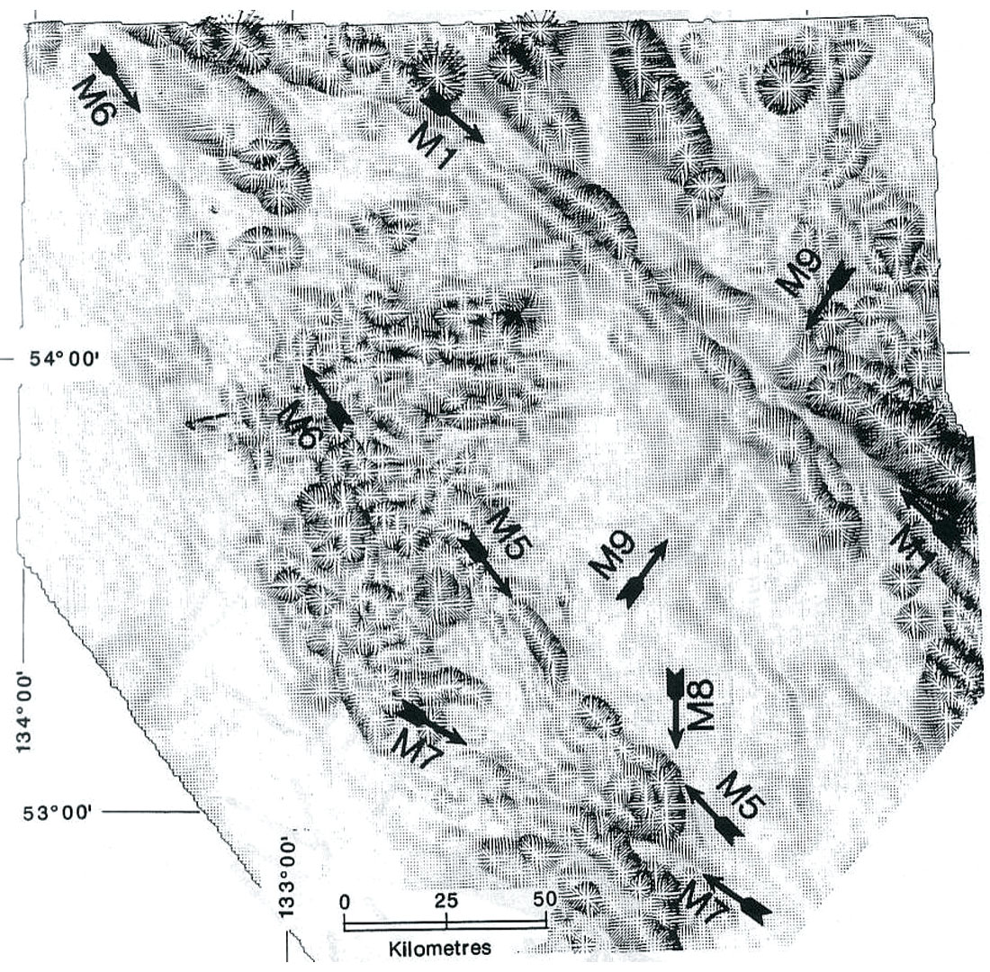
Likewise, no magnetic stripes are found in a zone several tens of kilometers wide at the base of the continental slope west of Queen Charlotte Sound. Ocean-floor volcanic mounds in that magnetically blank zone are small and scattered, their geochemistry is inconsistent with sea-floor spreading, and gravity anomalies in the free-air (Figure 7) and isostatic maps are minor. These observations rule out the commonly assumed existence in that area of sea-floor spreading and a plate triple junction.
The broad NW- SE- trending fault system, in which the Winona and Tofino basins lie, runs past Queen Charlotte Sound and Islands, where some of its strands bound the step-like Queen Charlotte bathymetric terrace formed by a foundered continental-crust block (with a Moho up to 20 km deep). Off the Alaska panhandle, this fault system merges with the well-known, broad Fairweather fault zone which forms the North American plate boundary offshore but begins in the north inside the Alaskan continental interior. It runs NNW-SEE for hundreds of kilometers, just west of southeastern Alaska. Subparallel and slightly anastomosing fault strands of the Fairweather system (also called by some workers Chichagof- Baranof), although they are partly covered by young sedimentary deposits on the ocean floor, are well imaged in seismic reflection profiles. Their southeastward continuations are the recognized strands of the Queen Charlotte fault system off British Columbia.
The Fairweather-Queen Charlotte fault zone meets the Olympic- Wallowa zone of crustal weakness on the continental shelf and slope off southern Vancouver Island.
Two practical conclusions for hydrocarbon exploration follow from this interpretation.
- Poorly studied sedimentary basins on British Columbia’s outer continental shelf and slope are essentially continental, which suggests the possibility of a longer and more variable geologic history than is sometimes assumed.
- No active subduction mega-thrust being present beneath Vancouver Island, the earthquake hazard in that region is substantial but nonetheless lower than conventionally estimated. This particular conclusion may be significant for the development of any oil and gas exploration and production infrastructure.
Petroleum Overview
Queen Charlotte Basin
The southwestern part of the Queen Charlotte Basin appears to contain a stack of source, reservoir, and caprock strata, largely at oil-window burial depths, as well as large block-fault trap structures.
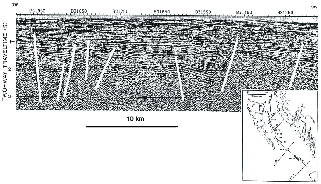
Only Tertiary rocks were penetrated by the offshore wells (Shouldice, 1971), but the underlying older rocks are exposed on the Queen Charlotte Islands, Vancouver Island and the mainland (Sutherland Brown, 1968; Woodsworth, ed., 1991). Field mapping suggests that a significant structural component of this region’s Mesozoic and Cenozoic evolution has been reactivation of high-angle blockbounding faults (Thompson et al., 1991), and high-angle block-bounding faults are imaged in marine seismic profiles in the Queen Charlotte Basin (Figure 8).
Economic basement in the Queen Charlotte Basin area is the widespread, massive, ~4-6-km-thick Upper Triassic flood basalts of the Karmutsen Formation, underlain onshore by partly metamorphosed older rocks. The Karmutsen basalts, and the rocks beneath, have long been thought to serve as a blockfaulted structural basement in this region (Jeletzky, 1976).
Above lies the ~1,000-m-thick Upper Triassic to Lower Jurassic sedimentary succession of the Kunga and Maude groups. Very good source rocks exist in this assemblage, with Type I and II kerogen and total organic carbon (TOC) values up to 11%. Geochemical studies point to these rocks as the principal source of Queen Charlotte Basin oil; a major regional pulse of oil generation and migration occurred in the Tertiary.
The overlying Upper Jurassic-Upper Cretaceous clastic succession, 2,000-3,000 m thick, has negligible source potential. The marine sandstones in it contain lithic arenite facies with high-quality reservoirs, sometimes with largely secondary porosity in the range of 5-15%. Above, mostly offshore, lie Tertiary mudstone, sandstone and volcanic deposits, up to 6,000 m thick in some fault-bounded depocenters.
Tertiary deposits have Type III and II kerogen, with 1.0-1.5% TOC on average and much higher locally. These variously consolidated deposits are regarded in some assessments as primary exploration targets in the Queen Charlotte Basin (Dietrich, 1995; Hannigan et al., 1998). Unfortunately, clay products of feldspar decomposition greatly degrade these Tertiary deposits’ permeability, especially at basal levels. Reservoir-quality sandstone facies lie mostly near the top of this unit, where oil-migration routes from below and the seal above may be inadequate. This suggests the Tertiary deposits serve predominantly as caprock, but quite possibly contain secondary exploration targets.
Stratigraphic and sedimentological studies indicate the Triassic- Jurassic source rocks were deposited in a broad shelfal basin covering this entire region and beyond (e.g., Tipper and Richards, 1976). However, the Cretaceous basin in this area was evidently confined to western Queen Charlotte Islands and northwestern Vancouver Island, with uplands to the east shedding detritus. Strandlines marking the boundary of this basin (Figure 9) have been identified from Cretaceous deposits onshore (Haggart, 1991). Western Queen Charlotte Sound was probably part of this basin, while eastern Queen Charlotte Sound and Hecate Strait largely lost their source rocks and received few Cretaceous deposits.
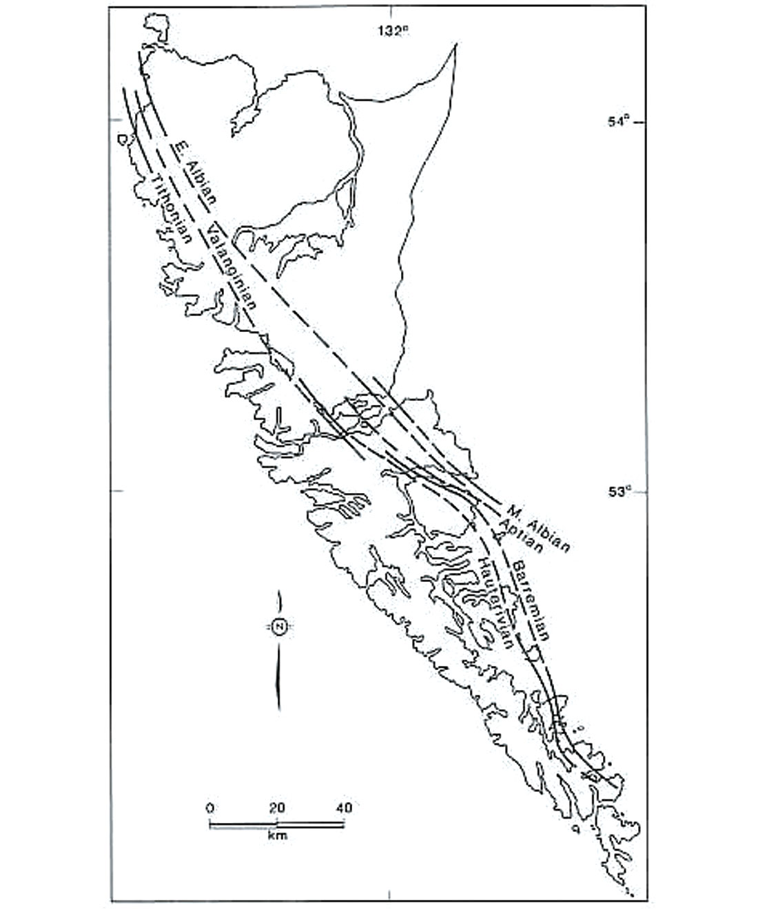
Tertiary caprock, with thickness varying block to block, then blanketed the area. It covers Hecate Strait, Queen Charlotte Sound and the northeastern part of Queen Charlotte Islands.
Western Queen Charlotte Sound, unlike other parts of the basin, could thus contain a favorable source-reservoir-seal stack (Figure 10).
Consistent with this picture, gravity data also indicate that a great thickness of low-density (sedimentary?) rocks is present beneath western Queen Charlotte Sound below the total depth of the existing wells, but not elsewhere in the basin (Stacey, 1973). Seismic imaging of the Queen Charlotte Basin is greatly complicated by the presence of many volcanic stringers in the Tertiary succession. Still, seismic reflection profiles, coupled with gravity and magnetic maps and land correlations, fairly clearly indicate the configuration of blocks and faults in the basin offshore (Figs. 5, 8, 11). Cross-cutting relationships of faults and dated dike swarms onshore and offshore rule out the possibility (favored, for example, by Rohr and Dietrich, 1992) of significant Neogene strike-slip displacements in Hecate Strait.
Caprock-breaching faults are generally sparser in Queen Charlotte Sound than in Hecate Strait (Figure 10). Regional geological and geophysical correlations, both onshore and offshore, suggest Cenozoic reactivation of major Mesozoic block-fault networks, and fault networks that define the block structure onshore continue also into the inner continental shelf. Seismic and gravity data show the faults to be comparatively sparse, and depocenters and raised blocks comparatively broad, in western Queen Charlotte Sound.
Some caution is still in order, as the caveats are many. In the absence of modern exploration, information about the basin is very sketchy. Cretaceous rocks, deposited near their provenance areas, tend to be petrologically immature, and secondary porosity in them may be hard to predict. Buried hydrocarbon- source rocks in the deepest Tertiary depocenters may be thermally overmature. Some oil and gas traps may be breached by Neogene faults; the offshore wells did not find the Queen Charlotte Basin to be overpressured (although most of these wells are in the comparatively heavily faulted Hecate Strait). Evidence of some trap failure is the oil staining in the Sockeye B-10 offshore well, suggesting oil passed through these Tertiary rocks and escaped.
From geologic field mapping and geochemical studies, a major local influence on hydrocarbon-maturation levels of rocks on the Queen Charlotte Islands is their proximity to the Jurassic and Tertiary igneous plutons (Bustin, 1997). Probably due to the high density of the country rocks (which include heavy Triassic- Jurassic volcanics and limestones), these mostly intermediate composition plutons lack significant gravity signatures but produce large anomalies in magnetic maps. Similar potential field anomalies suggest massive igneous bodies could be present beneath eastern Queen Charlotte Sound. These suspected bodies are aligned with the NE-trending Anahim Belt of igneous suites on the mainland, whose age progression suggests these suspected offshore plutons could be Miocene. Fortunately, the suspected pluton-related magnetic anomalies do not seem to significantly extend into western Queen Charlotte Sound, whose the source rocks may therefore have escaped damage from igneous heating and matured mostly by burial.
Tofino Basin
The Tofino Basin on the broad outer continental shelf and upper continental slope west of Vancouver Island also contains clastic Cenozoic rocks as well as volcanics. Below, undrilled Mesozoic or older rocks, possibly analogous to those on Vancouver Island, may also be present. Cretaceous clastic rocks have been dredged from the upper continental slope to the north (Tiffin et al., 1972).
The Tofino Basin is graben-like, with raised crustal blocks on its flanks. Seismic data show a buried basement ridge under the shelf edge in the west, and to the east lies the Vancouver Island. The gravity low at mid-shelf seems to mark the graben axis (Figure 7). The six deep offshore wells show the Tertiary intervals in the Tofino Basin to be overpressured, and big NW- SE- trending mud diapirs occasionally breaching the sea floor are imaged in seismic sections. The main structural trends seem to be NW-SE, parallel to the continental margin and the Olympic-Wallowa structural zone, as well as NE-SW in some faults continuing from Vancouver Island.
Very different Tertiary stratigraphy was encountered from one Tofino Basin well to another, suggesting dissimilar movement history of underlying basement blocks. The acoustic basement in seismic sections is uneven. Drillhole information and magnetic anomalies indicate local igneous bodies belonging to the Crescent Formation, which was extruded from discrete eruption centers in a rift setting (Babcock et al., 1992). Hydrocarbon prospects in this basin must be considered low, unless good older source rocks are identified at depth by future exploration.
Juan de Fuca Basin
The 8-km-thick Juan de Fuca Basin, lying in a remarkably straight WNE-ESE-oriented graben within the Olympic-Wallowa structural zone, likewise contains Tertiary clastic deposits. This corrects a mis-stated graben orientation Some of these rocks are exposed on land, particularly on the northern coast of the Olympic Peninsula (Niem and Snavely, 1991). Much of this basin lies in U.S. territorial waters. The modern Strait of Juan de Fuca is slightly offset laterally from the parallel but older graben in which the Tertiary basin formed, suggesting a complex and multi-stage history of fault movements.
This sedimentary package in the Juan de Fuca Basin is conformable, comprising siltstones, mudstones, sandstones and conglomerates. These deposits are marine, but the absence of good known hydrocarbon-source rocks is a problem.
Winona Basin
The Winona Basin on the continental slope off northern Vancouver Island may present considerable logistical challenges to exploration, and from existing evidence its prospectivity is anyway in doubt. The continental shelf here is narrow, and the Winona Basin lies in deep water west of the shelf edge. Like the Tofino and Juan de Fuca basins, it lies within the NW- SE- trending Fairweather-Queen Charlotte-Wallowa structural zone, and it is bounded on the east and west by this zone’s fault strands.
Seismic profiles show the Winona Basin contains layered deposits of unknown nature, some 8 km thick, with an uncertain basement (Figure 6). Scientific drilling at the DSDP site 177 at the Paul Revere Ridge (along the Revere-Dellwood fault) on the west flank of this basin encountered Lower Pliocene sediments underlain by non-magnetic basalt. Seismic velocities of rocks in the deeper parts of the basin’s layered section exceed 5,000 m/s, suggesting some older rocks might be present. Intriguingly, Lower Cretaceous sandstone and conglomerate similar to those on Vancouver Island have been dredged from the upper continental slope on the basin’s eastern flank (Tiffin et al., 1972; Couch and Chase, 1973; Kulm et al. 1973).
In seismic profiles, the Winona basement dips to the east from the Revere-Dellwood fault that marks this basin’s western boundary. In the north, the Winona Basin is a very asymmetric half-graben, with a fan-shaped pattern of east-dipping seismic reflections terminating at a steep, west-dipping listric normal fault at the edge of the continental shelf. Farther south, the basin becomes progressively deeper and more symmetric, as is evident in seismic refraction and gravity models. A pronounced gravity low marks this very deep basin (Figure 7).
Anticlines in the shallower, unconsolidated Winona Basin sediments, seen in seismic profiles, are similar to those typically caused by mud diapirism.
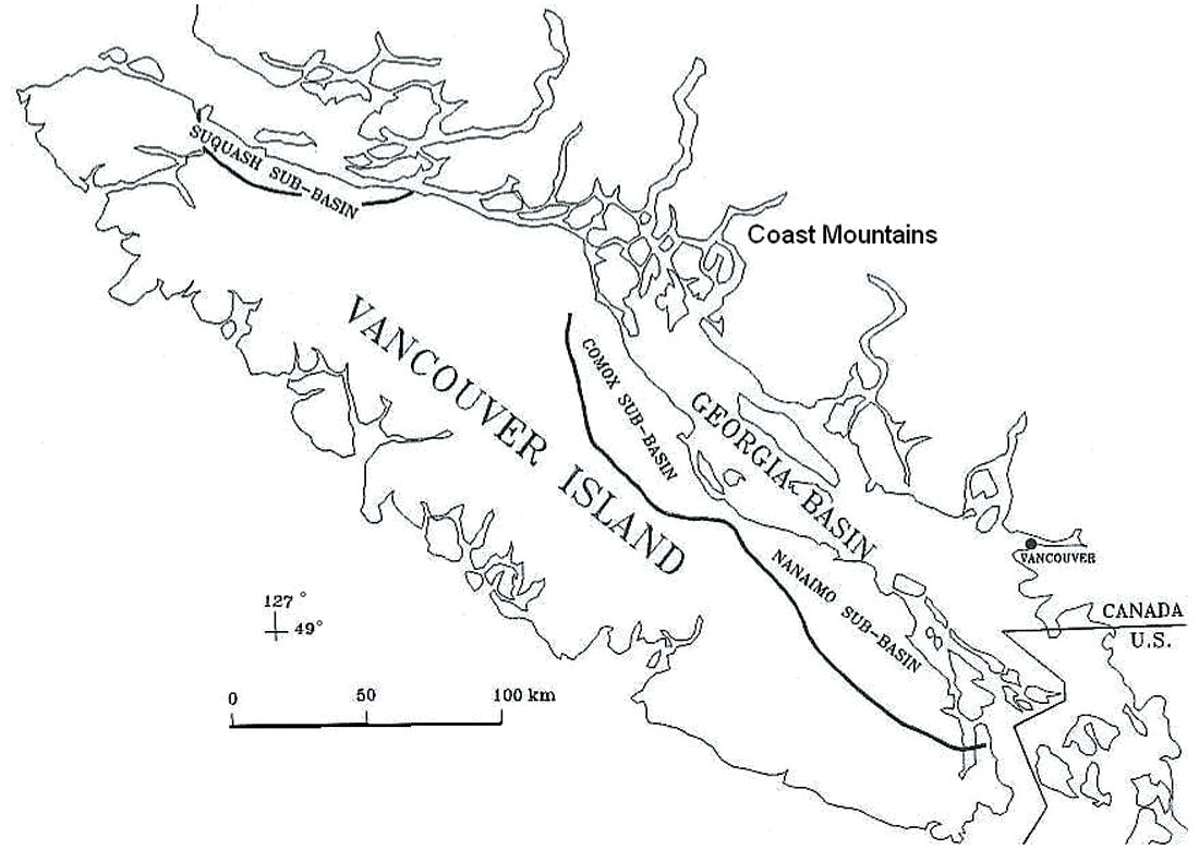
Georgia Basin
Long-lived Cretaceous basins existed along much of the Insular Belt. In Late Cretaceous time, separate Nanaimo and Comox basins, regarded sometimes as local sub-basins of a single larger basin, developed in the area from eastern Vancouver Island to the Gulf Islands (Figure 12). Formation of these and other intracontinental depressions was followed by marine incursions and the construction of delta and submarine fans, although presence of coals suggests non-marine environments also existed.
Up to 4,000 m of Turonian to Maastrichtian conglomerate, sandstone and mudstone, intercalated with coal, make up the Nanaimo Group (Bustin and England, 1991; Mustard, 1991; England and Hiscott, 1992). Clastic sediments derived from surrounding uplifted areas were laid down in fault-bounded depressions, according to Pacht (1984). Development of local horsts and grabens is suggested by the proximal sourcing of Nanaimo Group sediments from the Coast Belt on the mainland to the east and from Vancouver Island to the west. Abrupt thickness variations, lithofacies changes, and variations in coal rank and vitrinite reflectance are consistent with an evolution of these basins in subsiding grabens. On the Denman and Hornby islands in the northern part of the basin, on the other hand, Katnick (2001) did not find local evidence for such major deformation.
In the Early Tertiary, following a period of uplift and erosion, the southern part of the Georgia depression between the Coast Mountains and Vancouver Island renewed its subsidence and accumulated a mostly Paleocene to Eocene succession of conglomerate, sandstone, mudstone and coal up to 6 km thick. Marine incursions were minor, and fluvial sediments derived from the surrounding mountains accumulated in large deltaic complexes.
Despite the considerable subsidence, ready supply of sedimentary detritus ensured that non-marine conditions prevailed throughout the Tertiary. Hydrocarbon potential of the Georgia Basin is generally thought to be poor.
Summary
Conclusions such as these are inevitably preliminary, in the absence of modern exploration programs. These assessments are liable to be amended, perhaps significantly, from new information when exploration resumes. Particularly detailed examination is recommended for western Queen Charlotte Sound, which at present seems to be the only offshore area in British Columbia with a strong oil potential.
The wide variety of lithologies in the west-coast basins means that good reservoirs can sometimes be found. With extensive fault activity, the traps may be both stratigraphic and structural. Presence of unbreached caprock is always a concern, however, due in part to the large amount of structural deformation during the Cenozoic. Existence of coal deposits in some land areas suggests a possibility of coal-bed methane. The main key to hydrocarbon prospectivity of these basins, however, appears to be the presence or absence of source rocks.
Rather dynamic tectonic conditions seem to have prevailed in much of this region during Cretaceous and Tertiary time, not conducive to the deposition of oil-source rocks. With current knowledge, it is a matter of speculation if older rocks are present in the deeper parts of basins other than Queen Charlotte. The Tofino Basin could be a candidate, and maybe the Winona Basin if it is not too deep. If old deposits do exist there, these basins may contain yet unknown source rocks and petroleum systems.


Join the Conversation
Interested in starting, or contributing to a conversation about an article or issue of the RECORDER? Join our CSEG LinkedIn Group.
Share This Article