So how does a kid from Cape Cod end up spending his career in the oil patch in Calgary?
I spent summers in high school canoeing on long trips in the North Woods of Maine and decided that forestry would be a good career that would allow me to be outside a lot. When I talked with people in the forestry field, they suggested majoring in geology as an undergraduate and then going to grad school in forestry. I went to university at Dartmouth College in New Hampshire, majored in geology, and found it so interesting that I never looked at forestry again!
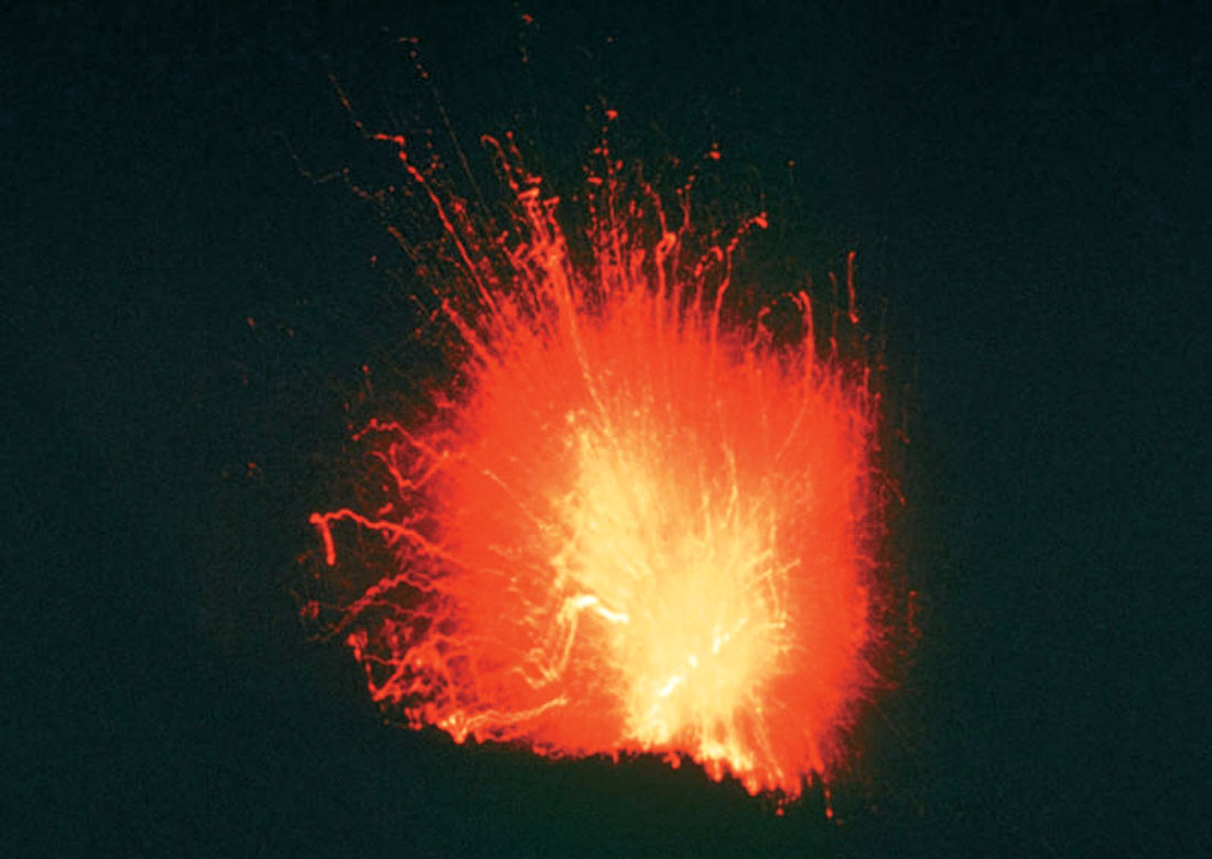
But I was lucky to go into the field at an exciting time and have great professors. For example, we spent three weeks in Central America researching volcanoes as part of our field training (Figure 1).
When I started in geology, plate tectonics was a theory “not suitable for publication in a serious scientific journal,” to quote a review of a paper of the time. I found the whole geosynclinal concept of mountain building rather hard to accept. Then along came plate tectonics and the Wilson Cycle, and suddenly things made sense.
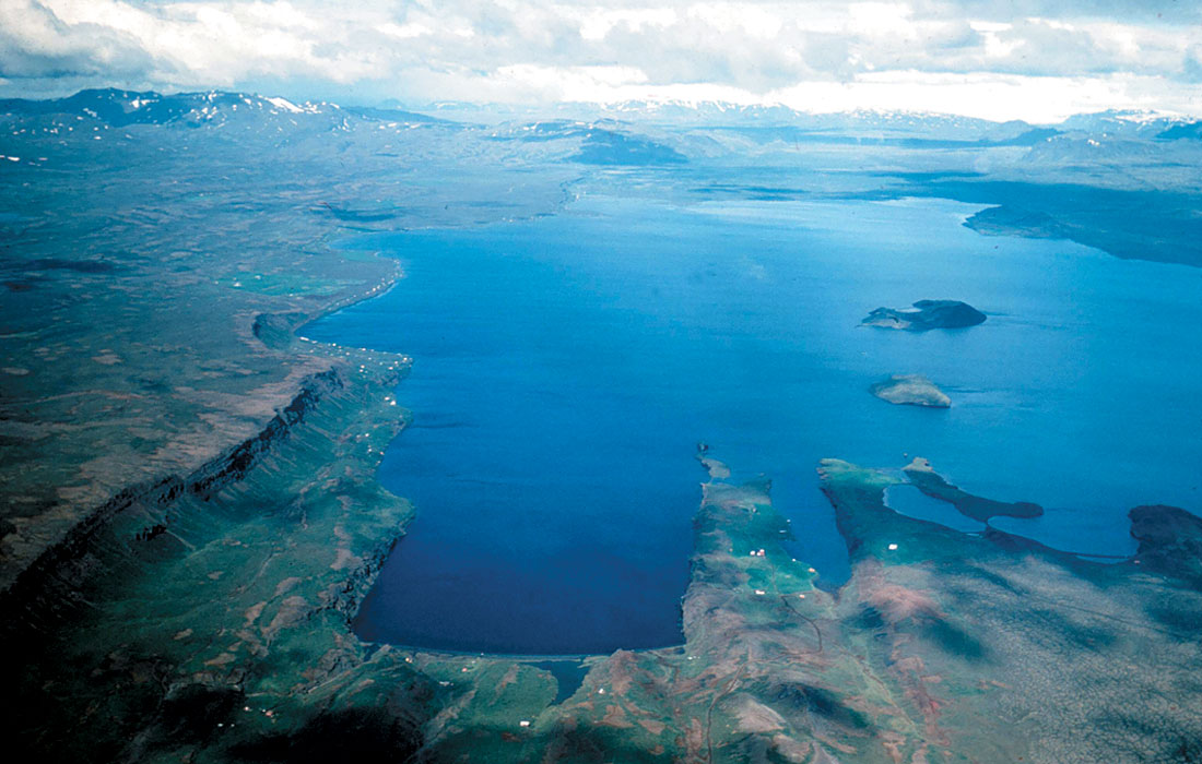
Plate tectonics as a working theory became widely accepted at the meeting of the American Geophysical Union in June of 1967 when the overwhelming magnetic evidence for sea floor spreading was presented in a series of landmark talks. I was lucky enough to be in Iceland at that time, working for my first geophysics professor, Bob Decker, setting up a survey line across the southern rift zone of Iceland (Figure 2) so we could measure spreading rates on the ground.
It was a fantastic experience to be on the cutting edge of plate tectonics research while still an undergraduate!
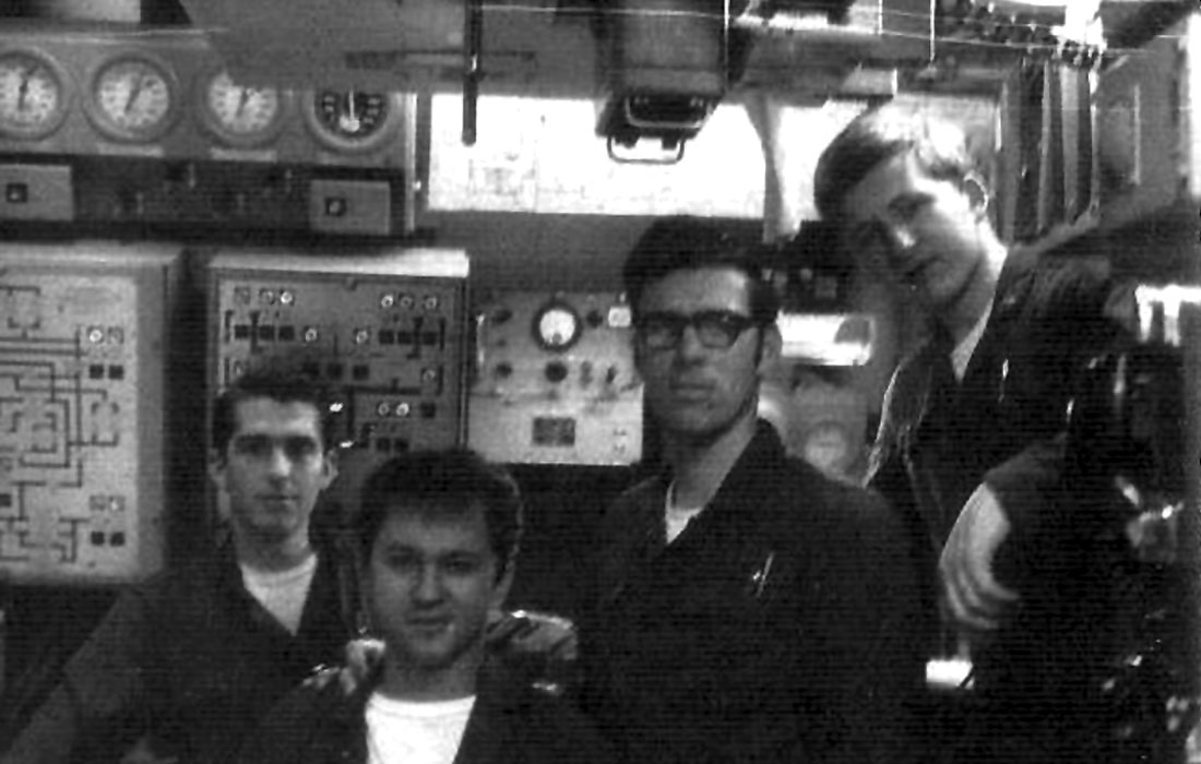
After Dartmouth, I joined the US Navy for four years and served as a nuclear engineer on a missile submarine (Figure 3). Looking back, it still seems strange to realize that at age 25, with only a few years of experience, I was one of the senior officers in the engineering department and knew more about operating the ship’s diving systems than almost anyone else on the ship. That experience taught me a lot about my personal limits – and helped me to decide what I did not want to do with my life!
I’d gone into the Navy partly because I’ve always been fascinated by the ocean. After the Navy the best way to combine that interest with the excitement of the new field of plate tectonics research was to go to grad school in marine geophysics. I was very fortunate to be accepted into the M.I.T.-Woods Hole Oceanographic Institution Joint Program in Oceanography as a Ph.D. candidate.
When I first arrived at M.I.T., both my advisors were at sea, so I met with Frank Press (arguably the most famous seismologist in the US at the time, and later a White House Science Advisor). He took one look at my transcript, which was weak on both math and physics, and blurted out “How the Hell did you ever get accepted here?!” He quickly apologized for his candor, and assigned me to a year of advanced calculus for engineers (which nearly killed me!) and a sophomore class on Physics of Waves, which turned out to be probably the best course I have ever taken anywhere.
The Joint Program was everything I could have asked for – great courses, the chance to work with leading scientists in plate tectonics, other students who have become lifelong friends, and the chance to go to sea. My most memorable cruise was two months at sea mapping the triple junction at the southern end of the Mid-Atlantic Ridge (Figure 4).
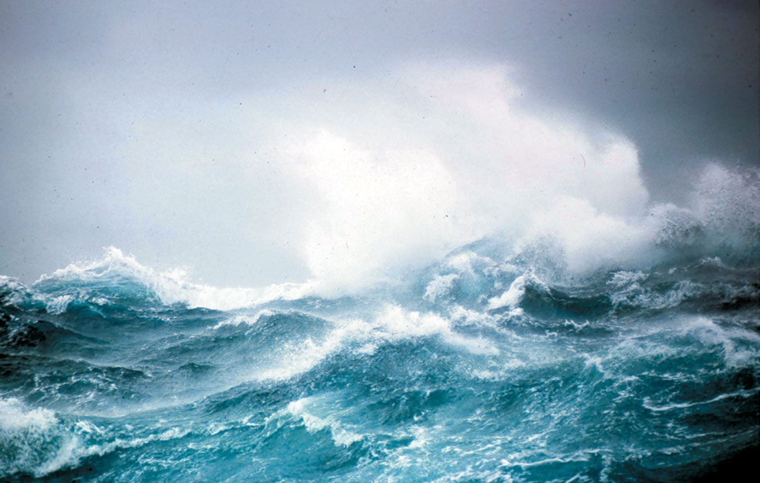
During this cruise we saw Bouvet Island, a glacier-covered volcanic island, which has the distinction of being that piece of land on Earth which is farthest from any other), once had more than 200 icebergs on radar, managed to inadvertently anchor ourselves in 5000 m of water when a core got stuck in the bottom, and experienced a magnitude 5.4 earthquake nearly right under the ship!
I did my thesis on the paleomagnetics of cores from the Deep Sea Drilling Project. The topic was measuring the northward motion of India from its separation from Antarctica through its collision with Asia. As I started looking for jobs, I was attracted to Dalhousie University in Halifax and Jim Hall’s paleomagnetics lab there. My wife, Nancy, who is from Vancouver, and I were starting our relationship then, and it was a lot easier for me to move north than for her to move south, so I ended up at Dalhousie as an Assistant Professor, teaching Introductory Geology and a graduate course in Marine Geology and Geophysics. During my second year at Dal, my long-time business partner, Andreas Cordsen, showed up in my graduate class, and a lifelong friendship began.
During my time at Dalhousie I had invited someone from Petro-Canada to come out to give some lectures to my class and show us some seismic data from the East Coast. Willys Reed got the assignment and we had an exciting few days together.
When it came time for me to look for a job the following year, I wrote to Willys asking about job opportunities and got back a very polite “Dear John” letter, so I was looking elsewhere. Two months later, Willys called unexpectedly, and much to my surprise, he offered me a job to start up a gravity and magnetics group at Petro-Canada in Calgary. “But I don’t know anything about the oil industry!” I stammered. To which he replied, “That’s OK – we’ll teach you!” Willys not only taught me a lot about the industry, but he also made sure that I had access to any course I wanted, and most importantly, he taught me a great deal about managing people by his example. He was one of the great mentors in my life.
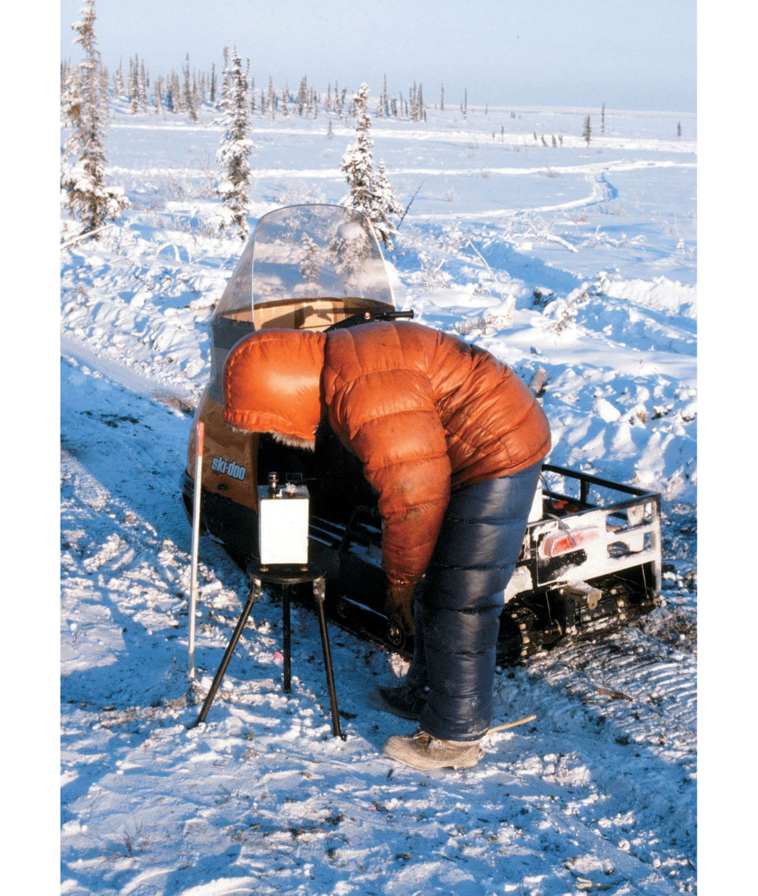
I clearly remember my first trip to the field to QC a gravity survey in the Colville Hills, 200 miles north of Great Bear Lake in the N.W.T. (Figures 5 and 6). Mike McCombe was the gravity operator, and I spent a couple of days riding around behind him on a snowmobile at -45°C. What a cold way to earn a living!

I clearly recall that the day I flew out from camp it was -56°C. I was the only one going out on the DC-3 at the end of the day. Because it was -40°C in the passenger compartment, as soon as we took off from the ice runway I went up to the cockpit. The oil pressure gauge was fluttering, and we promptly blew every oil ring in the port engine. With oil streaming off the wing, the pilot calmly feathered the prop as we lost 2000’ of altitude and 30 knots of speed.
When things were evidently under control, I leaned over to ask in my calmest possible voice, “What is our new ETA (estimated time of arrival) in Norman Wells at our reduced speed?” Without missing a beat, he answered “Don’t you mean ETI – estimated time of impact?!” After that comeback I didn’t have much to say for the rest of the flight!
Two projects that were particularly interesting during those first years at Petro-Canada were the first exploration of the South China Sea and a foreign aid project exploring the Rukwa Rift in Tanzania. The South China Sea involved four huge blocks with 33 companies vying for exploration licenses (Figure 7). The combination of the seismic data and the gravity/magnetic data allowed me to work out that the rifting in the South China Sea was caused by the extrusion of the SE Asia Block as India collided with Asia. The timing of this event in the South China Sea agreed exactly with the slowing down of India as the collision started, which I had documented in my thesis. It was a great feeling to use my thesis work in such a practical application.
Looking back, I still feel that this was some of the best work I have ever done. I really wanted to publish it, but I realized that with 33 companies involved, there was no chance. Consequently, I coined Peirce’s Law of Publication, which states that the chances of getting confidential information released for publication are proportional to 1/2N, where N is the number of companies involved. 1/233 is pretty close to zero, so I didn’t even ask for permission to publish!
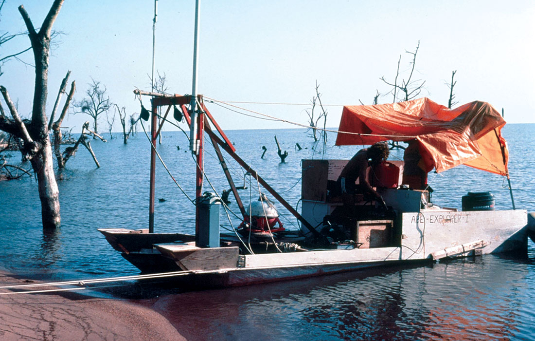
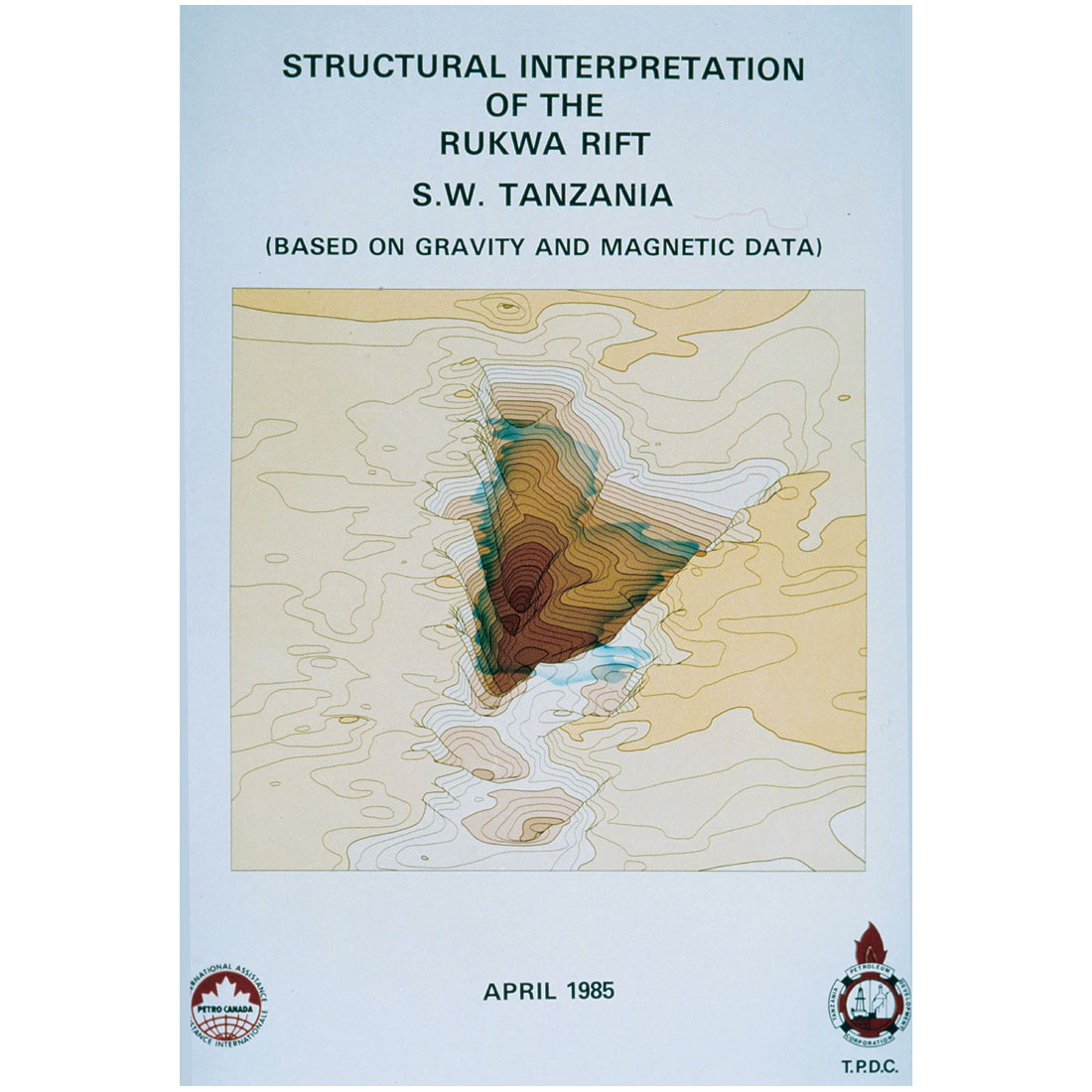
The Rukwa Rift project was done for Petro-Canada International Assistance Corporation (PCIAC). It was a huge gravity survey, covering 80,000 km2 in the East African Rift. Mike McCombe (the one who was driving the snowmobile at -45°C) was the chief gravity operator. The survey involved helicopters and a catamaran contraption (Figure 8) that supported the underwater gravity meter.
The results (Peirce and Lipkov, 1988; Figure 9) were excellent, and our models were borne out by later slim hole drilling by Shell. Unfortunately there was insufficient source rock, so exploration in the Rukwa area was short lived.
In 1984, Tom LaFehr, who was the first Chair of the Editorial Board of The Leading Edge, asked me to join the Board. It was a wonderful chance to get to know more geophysicsts from other parts of the world and the SEG staff in Tulsa, especially Dolores Proubasta and Dean Clark. I particularly remember hosting a TLE Board meeting in Calgary at the CSEG Convention in 1985, when we had a huge May blizzard. No one on the TLE Board ever let me forget that I live in the frozen north!
When I resigned from the TLE Board four years later, I persuaded Brian Russell to take my place, and ever since then there has been one Canadian on the TLE Board, up to and including Satinder Chopra today.
In 1986, the price of oil crashed and there was anguish all over Calgary as people suddenly found themselves out of a job. I was told to fire my entire gravity/magnetics group, but fortunately I was able to engineer some sort of a soft landing for everyone. Erwin Ebner was one of those – he became an independent consultant doing gravity and magnetics as needed with an office at Petro-Canada. I don’t think he still has the office, but he still does most of their gravity and magnetics work some 22 years later! And he does a lot of that work at GEDCO, where he still does have an office as an independent consultant.
After the 1986 debacle, I ended up as Supervisor of the World Basin Studies Group in a newly formed International Exploration Division at Petro-Canada.
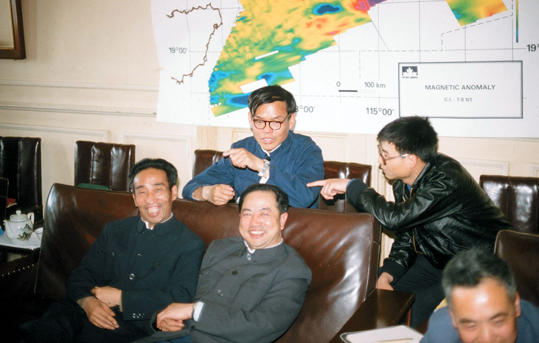
That was an exciting time technically as we worked all over the world. I had the privilege of working with people like Tony Tankard, Hugh Balkwill and Ian McIlreath. But my biggest challenge was when I was given only one hour to explain the geology of Western Canada Sedimentary Basin to a visiting group of Chinese geoscientists. I nearly choked at the enormity of the task until my boss, Dave Thomas, suggested that I approach it as though it were an international basin and explain it from a basin cycle analysis perspective. With that insight, not only did the job become manageable, but my understanding of the basin doubled overnight as I reviewed the geology with new eyes!
In 1988 I had the privilege to take a six month leave of absence to be Co-Chief Scientist with Dr. Jeff Weissel (an Aussie research scientist working in the U.S.) on Leg 121 of the Ocean Drilling Program in the Indian Ocean. We had 35 scientists from 23 countries speaking nine different languages on board the drill ship, ranging from graduate students to some very senior scientists. We drilled first on Broken Ridge, 1000 km west of Perth, Australia. We drilled through a phenomenal Cretaceous-Tertiary (K-T) boundary section that surprised us all because of the very high productivity and high sedimentation rates. It was as close to a religious experience as I have ever had to look at the core change from almost pure carbonate in the uppermost Cretaceous to 5 cm of black material at the K-T boundary. In that part of the ocean 95% of life, both surface and bottom dwelling planktonic plants and animals, died as the ocean became acidified (presumably because of the meteor impact 66 million years ago at Chicxulub in Mexico). The few species that survived were dwarfed because of the environmental stress, but within a few cm of core, these species grew in size during the lowermost Paleocene and diversified to fill the wide open ecological niches. I was incredibly grateful that I had taken a course in micropaleontology in grad school so that I could keep up with the five paleontologists on board as they developed these results. After the Broken Ridge drilling, we went on to drill along the Ninetyeast Ridge, the subject of my thesis. Twelve years after I defended my thesis, I finally got to visit my thesis area!
I returned to Petro-Canada and was assigned to work in Western Canada for the first time. I had the good fortune to work for Benoit St.-Hilaire and Thomas Chen, who taught me how to do prospect scale exploration in the complex business environment of Western Canada. I particularly remember having the chance to finally take a course in seismic processing. Pat McKenny (then at Veritas) took a few of us under his wing for a couple of weeks, and I learned skills that have stood me in good stead ever since.
But life at Petro-Canada was always life at a big company where one’s future depended more on others’ decisions than on one’s own abilities. The entrepreneurial spirit in me was pushing to be hatched. My longtime friend, Andreas Cordsen, then at Norcen, was finding much the same thing. At his suggestion, we investigated going into business together. When we compared our lists of contacts, we found there was very little overlap – a double network if you will. I clearly remember deciding to take the three leading geophysical consultants of the day out to lunch (separately). They were John Boyd, Sudhir Jain, and Ralph Lundberg. I said to each of them: “Andreas and I are thinking of going into the consulting business together, and we will probably end up competing with you, but notwithstanding that, do you have any advice for us?” Their generosity in offering support was amazing, and it really made me appreciate what a close fraternity we geophysicists share. Ralph Lundberg had the most cogent advice: “John, for 25 years as a consultant I’ve been 2 weeks away from unemployment. If you can’t stand the heat, don’t go in the kitchen!”
We made the rounds of some of our contacts, and received encouragement, but no promises of work. Anyhow, we made the jump with no firm work lined up and opened GEDCO’s doors in January of 1991. Frank van Humbeck was particularly encouraging, and he and Tai Ng at Can Hunter did give us a couple of projects early on, for which we were very grateful. Andreas and I had the good fortune to share the same value system. That has been a key factor that has made our partnership so successful.
When we started GEDCO, my wife, Nancy, insisted that we plan on the Peirces taking six months off in 1994 so that we could take our young kids to a developing country to do volunteer work and to see how the rest of the world lives. I protested that we couldn’t predict 6 months ahead, let alone 4 years, and we couldn’t possibly afford such a luxury, but she insisted “If you don’t have a vision, then it will never happen!” Well, four years later she had received a small inheritance and the business was going well, so off we four went to Nepal for four months (Figure 10). Our kids were 13 and 11 at the time. We found a contact with the Helen Keller Institute, and through them ended up working with a group of blind children at a high school on the rim of the Katmandhu valley. We all had a challenging and very memorable experience.
In early 1995, Peter Duncan, who was on the Continuing Education Committee at the Society of Exploration Geophysicists (SEG), asked Andreas and me to put together a course on planning land 3D surveys for the SEG. We thought – “This will be great, we’ll get to teach in all sorts of exotic locations around the world!” Well, that first year we taught the course four times in Texas. Eventually, we did go further afield.
Our course notes had depended heavily on Mike Galbraith’s experience from providing support for Seismic Image Software’s (SIS) OMNI 3D™ seismic design program. Eventually those notes matured into the book “Planning and Operating Land 3D Surveys” (Cordsen et al., 2000), published by the SEG in 2000, when the SEG convention was in Calgary. About then I retired from teaching the course because I was no longer doing that kind of work, and Peter Eick from Conoco Phillips took my place as Andreas’s teaching partner. Today, eight years later, they are still teaching the course together.
Interestingly, just as we were developing the 3D course, GPS navigation revolutionized the airborne magnetics business, and GEDCO’s business became mostly aeromag for a few years. The concept of High Resolution AeroMagnetic (HRAM) data was coined by Erwin Ebner, and we began our long-standing effort at trying to map intra-sedimentary faulting using magnetics. We h i red Bob Charters, Serguei Goussev and Hassan Hassan as magnetic interpreters and we had all the work we could handle flying and interpreting new airborne surveys.
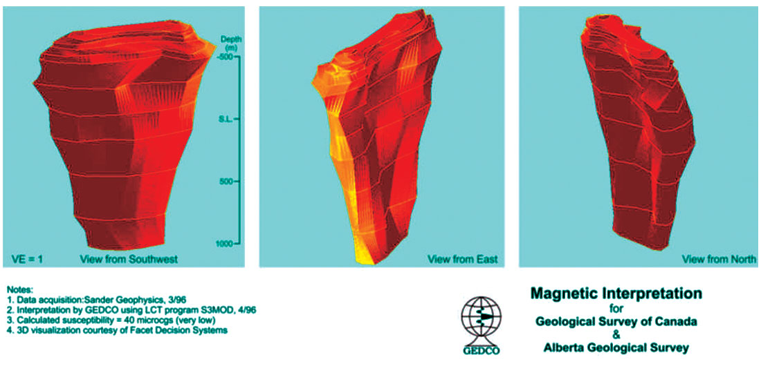
Somewhere early in this sequence, we were doing work for Rob Pryde of AEC near Loon Lake and found these strange magnetic anomalies that looked like big oil wells. We soon figured out that we had discovered a field of kimberlite pipes, and that eventually became the beginning of the Alberta diamond play (Figure 11). Unfortunately there were not enough diamonds to make these pipes economic. I regret not asking for a little vial of microdiamonds as a memento. Actually, there probably were not enough microdiamonds in total to make such mementos for all those involved.
In early 1997, Rob Stewart asked Ted Glenn and me to organize a special meeting on this new concept of High Resolution AeroMagnetics, which resulted in the 1997 CSEG HRAM Forum that was attended by people from all over the world. The papers from that meeting became the last issue of the CSEG Journal of Exploration Geophysics (Peirce et al., 1998), but it was a landmark volume.
About that time, John Rhodes and Bob Charters came up with the idea of translating magnetic depth solutions into SEGY format (MaFIC) so that we could put the magnetic results directly in the hands of the seismic interpreter. It was a brilliant example of lateral thinking.
In 2000 our friendship with Mike Galbraith led to GEDCO merging with Seismic Image Software, and GEDCO began its transformation from a consulting company to a geophysical software company. Not only did we instantly double in size, but the whole nature of our work began to change, with more and more of our consulting work becoming related to our two software packages, VISTA™ (2D/3D/VSP Seismic Data Processing) and OMNI 3D™ (Seismic Survey Design and Modeling).
About the same time our long-standing working relationship with Sander Geophysics in Ottawa led to our designing a test survey for their new AIRGRAV™ system for airborne gravity in 2001. The survey over Turner Valley still remains one of the best documented examples of the utility (and limitations) of airborne gravity (Peirce, et al., 2002). Recently the test line that we set up has been used by others to compare Sander’s AIRGRAV™ system to the Russian GT1-A airborne gravity system (Studinger et al., in press). It would be nice to get the new generation of airborne gradiometers to fly the same test range.
About 2004, the management at GEDCO started to get interested in working with Vertical Seismic Profiles (VSPs) as a way to get more involved with the development end of geophysics. We persuaded Rick Kuzmiski to join GEDCO, and he has built up a small group specializing in VSP design and processing. It’s been an interesting venture. We have learned a lot and greatly expanded the capability of our VISTA™ software to process VSP data. This eventually led to our planning and processing a large offshore 3D VSP for Pemex, which at some 30,000 shots and 83 levels remains the second largest 3D VSP survey ever done, so far as we know.
Volunteerism has been an important part of my professional and personal lives. I find it both a way of giving back to my profession, but more importantly, as a way to meet a wider circle of colleagues and to get to know them by working together on joint tasks. I have served on innumerable committees over the years for the CSEG, SEG, APEGGA and CSPG. The highlights for me were serving as Technical Co-Chair with Graham Millington for a CSEG/CGU Joint Convention ca 1985, being on the TLE Board in the late eighties as mentioned above, being a recent member of APEGGA Council, and continuing to serve as an Associate Editor for Geophysics. In a similar vein, with my training in basic research, giving papers and teaching courses has been a big part of my chosen career path as well. And I have been fortunate in that regard to be recognized several times by the CSEG – for Best Paper (1988) for my luncheon paper on my ODP experience, for Meritorious Service (1996), and most recently as co-recipient of Best Geophysical Poster at the 2007 CSPG/CSEG Convention. As I said above, we are part of a special and close-knit fraternity in the geosciences, and it is nice to be recognized by your peers for one’s contributions.
In 2000 I was diagnosed with chronic lymphocytic leukemia (CLL), which has been another unexpected, life-changing experience. Dealing with that has meant a lot of soul-searching about what’s important in life. I’ve been extremely fortunate that the disease has not progressed significantly, but I have had to learn to accept my own mortality. That has led to a careful planning of a gradual retirement and a gradual cutting back of time at work. I will be finally pulling the plug on working as an employee at GEDCO in the Fall of 2008.
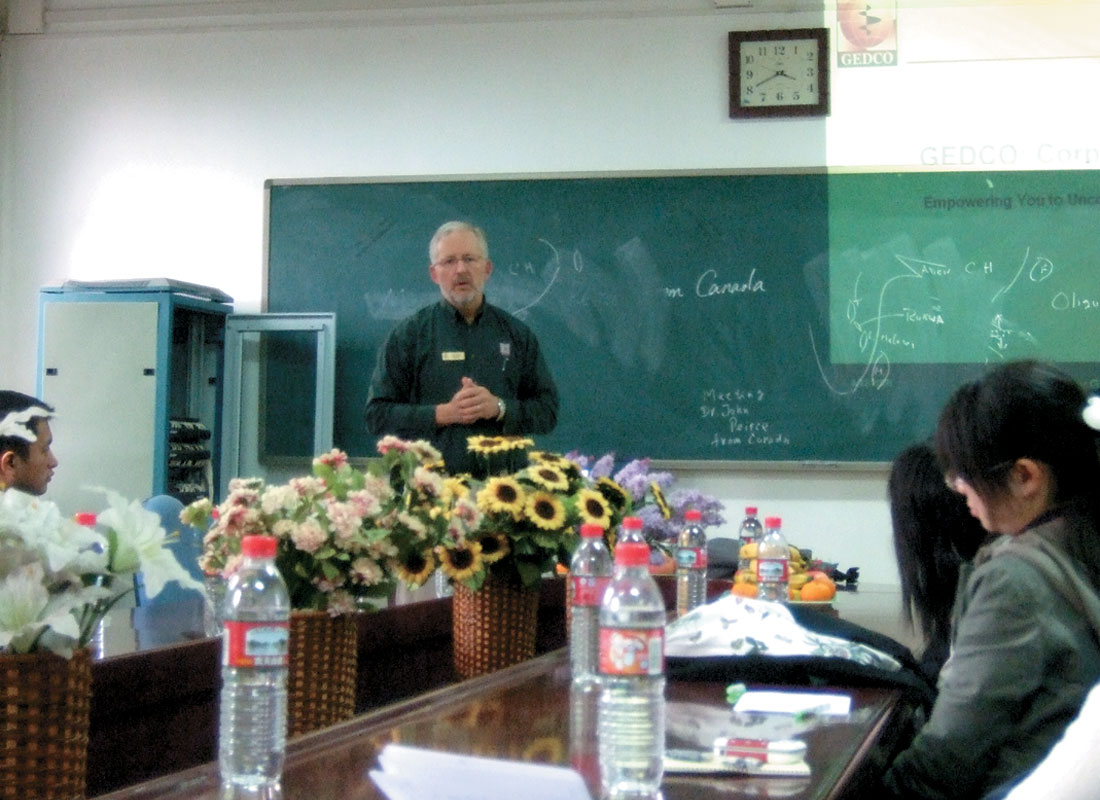
As I write this article, I am flying back from China, having given an invited paper at the first ever gathering of Chinese gravity magnetic specialists in Hangzhou. I have made many, many friends these past two weeks, but I am particularly struck by how much China has changed (Figure 12) since I last visited during my work on the South China Sea in the early 1980’s.
I am brimming with ideas about how GEDCO could make a much more significant penetration into the software market in China (the entrepreneurial spirit is irrepressible!), but I will have to pass those ideas on to Andreas and others to implement because my next challenge is to build Nancy’s and my retirement house on our property on Gabriola Island in B.C. When this article is published we will be in the midst of building a 22-sided, geothermally heated house, and the next phase of our life together will be beckoning.
In closing, I am reminded of the advice that a professor at Dartmouth gave me. He said: “John, the great thing about being in geology is that when you figure out where in the world you want to go, all you have to do is figure out how to get someone else to pay to send you there!” Looking back, I think I’ve lived up to that challenge pretty well.


Join the Conversation
Interested in starting, or contributing to a conversation about an article or issue of the RECORDER? Join our CSEG LinkedIn Group.
Share This Article