After over four years in radar with the Royal Canadian Air Force and obtaining a degree in Engineering, Physics, and post graduate training in semi-conductors at the University of British Columbia, I was hired by Gulf Research and Development Company (G.R.D.C.). My assignment was to report to Seismic Party 30 at Smoky Lake, Alberta on July 1, 1950. Gulf Research provided the geophysical support for Gulf Canada Limited. Gulf Canada had six company seismic crews and two gravity crews out of a total complement of some 20 or more seismic crews. Gulf was a pioneer in geophysical exploration based at a large laboratory in Harmarville, Pennsylvania. Gulf Research invented the airborne magnetometer for analyzing the earth’s crust. The application was preempted in W.W. II by the U.S. government who used it to detect enemy submarines. Gulf was a forerunner in gravity and the laboratory had departments in aeromagnetics, gravity and seismography as will as instrumentation.
My assignment to Party 30 was to spend an initial year in the field prior to a year at the laboratory for more technical training. The laboratory also made its own instruments and all of the company crews were so equipped. My year in the field embraced all the field activities of a seismic party including jug hustler. Also, I supervised the training of operators on two parties in regional proximity. My training in Harmarville was from July 1951 to March 1952 before I returned to Canada. At Harmarville, I was involved in seismic interpretation in several Gulf Canada operations in central and southern Alberta. Gulf had two independent interpretations of each project, one in the field, and one in the laboratory.
On my return, I was appointed Party Chief of Seismic Party 10; a bush crew on spring break-up at Mayerthorpe, Alberta. It was makeshift summer work while we renovated some primitive halftrack narrow-gauge Bombardier equipment for year-round work. The geophysical equipment was installed and the equipment was moved into the Virginia Hills Area of northwestern Alberta in late summer unfortunately showing very poor results because of vehicle instability.
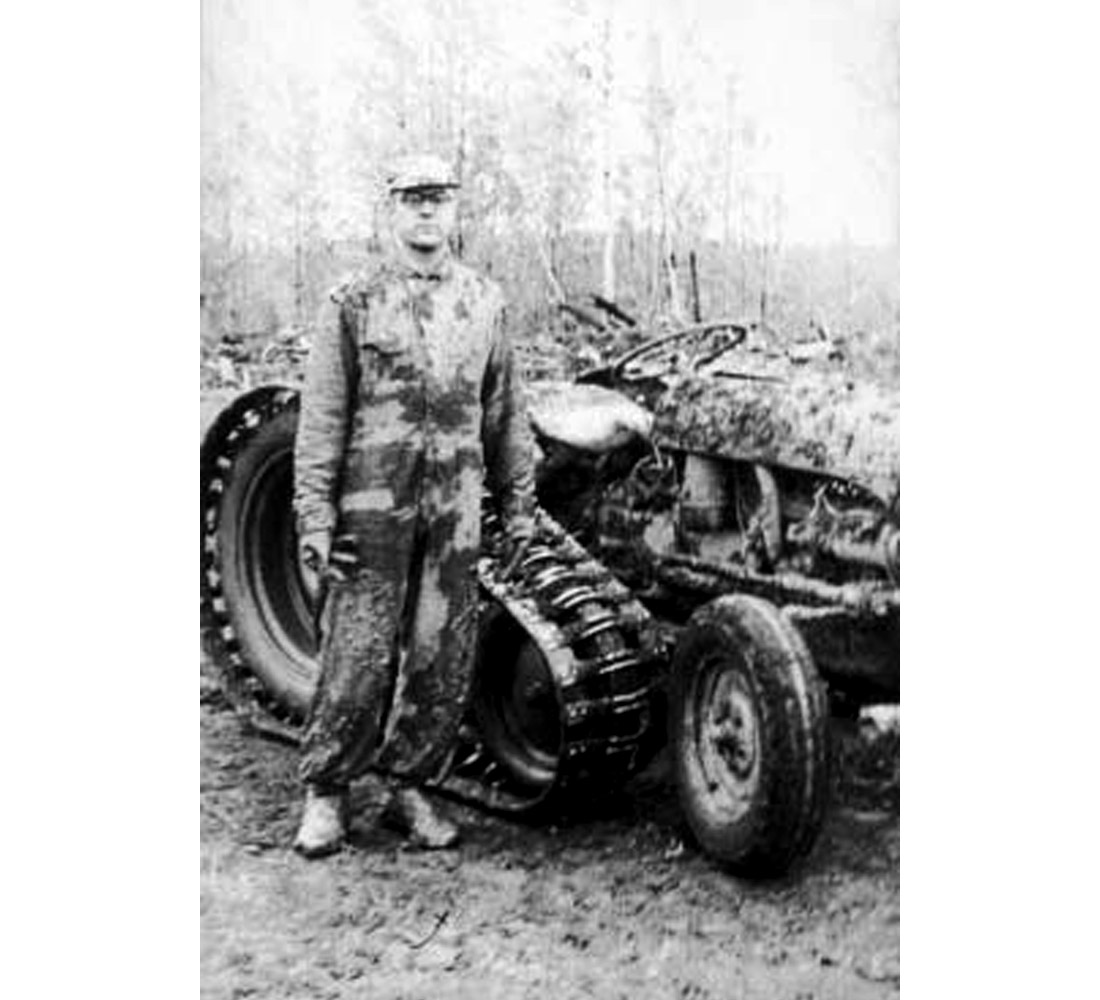
Gulf Research provided a controlled-ratio differential to Armand Bombardier, which permitted him to develop a doubletrack unit, which enabled Gulf to design a fully tracked seismic crew vehicle for bush operations. As a result two brush crews were so equipped.
After a year in the “bush”, I was promoted to Supervisor of Operations based in Peace River. This involved the company seismic crews as well as several contract crews. A Beaver aircraft was provided for transportation throughout northern Alberta with the occasional trip to Calgary and Edmonton. Visual Flying Rules (V.F.R.) applied. On one such occasion, on a trip to Calgary I was weathered in and I set off by car to Calgary at 4 am. About dawn, nearing Faust, on the muddy highway, I was interrupted by a herd of elephants on the road. An itinerant circus trailer had slid into the ditch and the elephants were unloaded to unditch the trailer. A giraffe in the ditched trailer observed the scene.
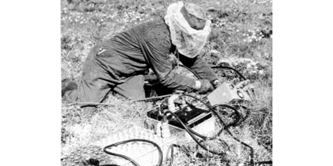
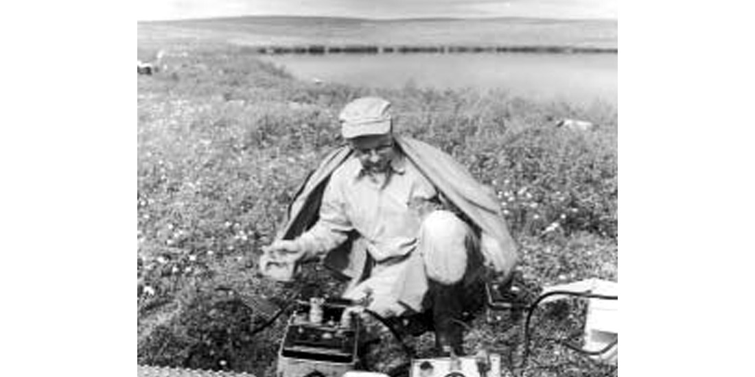
Subsequently I was based in Calgary as Field Supervisor. Our focus was to expand the role of Gulf’s operations into a broader based Western Canada operation as well as farther north. The Company’s exploration manager became interested in Delta exploration and four of us went to the Mackenzie Delta after which the company filed on three million acres mainly on the East Side of the Mackenzie River. This unexplored area gave us an opportunity to explore using the airborne magnetometer as a first approach followed by a helicopter borne gravity survey prior to a seismic survey. To determine the efficiency of a seismic survey we flew a portable seismograph to the area with a portable drill.
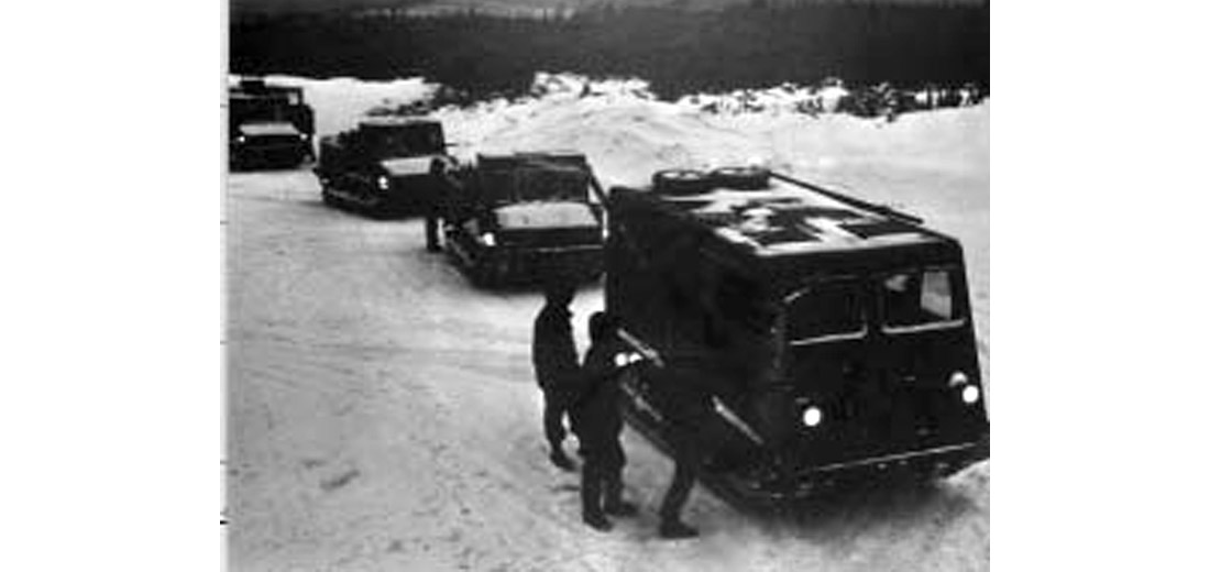
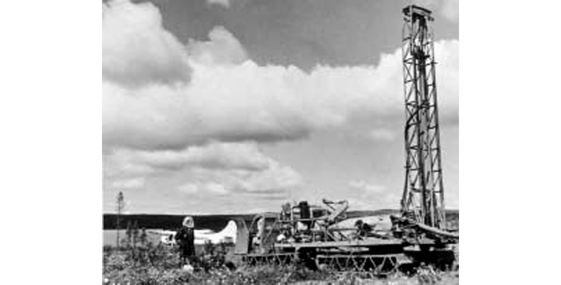
We determined as a consequence that air drilling was required to avoid damage to the permafrost. An articulated double muskeg tractor was designed in conjunction with Bombardier for this purpose.
Bombardier tracked vehicles were used for the operations to preserve the tundra. Subsequent drilling resulted in the discovery of the Parsons Lake field. As a consequence of Gulf’s filing industry activity subsequently increased, Gulf further filed on offshore acreage in the Beaufort Sea and undertook ice surveys and exploration and finally the establishment of Beaudril which had two drilling platforms designed for the icy area work, as well as four ice-strengthened support vessels. Significant discoveries have been made on the offshore in the Beaufort Sea.
While serving as Chief Geophysicist, the Company saw the opening of the Pincher Creek field first discovered in the forties. The plant was the initial source for the establishment of Trans Canada Pipe Lines, and was opened ceremoniously by Premier Manning in 1957.
In 1959, I was seconded to an Administrative Practice and Reports Team (A.P.A.R.T.) in Toronto. With the advent of computer technologies, Gulf subsequently had computerized credit cards. My role was to design the upstairs reporting structure for the president. In the spring of 1960 I returned to Calgary as Chief Geophysicist and was later appointed Zone Exploration Manager for southern Alberta and Saskatchewan. During this period, the Strachan Gas Field was discovered.
As Manager Frontier, a joint venture with Gulf Oil Corporation was formed and latterly wholly owned by Gulf Canada and encompassed northern Canada. The Arctic Islands and other offshore areas were explored. The East Coast areas included offshore Greenland, the Labrador Shelf, and the Grand Banks of Newfoundland. Discoveries occurred on the Labrador Shelf. With another group, Hybernia was discovered on a seismic anomaly on the Grand Banks, which was established through an extensive seismic survey conducted by Gulf to earn its interest in the acreage. Gulf participated in the farmin to increase its interest.
In 1977, I was promoted to Vice President, then Senior Vice President, and retired as President of Gulf Canada Resources Inc. Throughout the years I had many interesting associated activities starting in the mid-fifties as a member on the Associate Committee on Geodesy and Geophysics of the National Research Council. I was later elected President of the Canadian Society of Exploration Geophysics in 1963, during which term a group attended a joint meeting with the European Association in Belgium. The society organized a public meeting in the Calgary Jubilee Auditorium featuring Dr. J. Tuzo Wilson.
As chairman of the Board of Governors of the Canadian Petroleum Association several meetings were held with the Federal Government opposing the National Energy Program. Subsequently, I was appointed by the federal government to its “6-5” anti-inflation committee. I had the pleasure to serve on the board of the Calgary Chamber of Commerce as well as on the board of the Glenbow Museum as an Alberta government appointee. I also served on an A.P.E.G.G.A. committee one year as chairman of the Honors and Awards Committee. After retirement, I served on the boards of two oil companies ending a very satisfactory association in a wonderful era in Canada’s petroleum industry. In particular, the wonderful people in both Gulf as well as in the industry were my chief reward.


Join the Conversation
Interested in starting, or contributing to a conversation about an article or issue of the RECORDER? Join our CSEG LinkedIn Group.
Share This Article