I began by assembling the basics for my field trip to Antarctica and South Georgia: surface geology maps, topographic maps, hiking boots, wool socks, a back pack and two digital cameras. My gear list soon ballooned to include a hydrophone, an Iridium satellite phone, a lap top computer, an Arctic-rated dry suit (which doubles as a survival suit), flares, an underwater camera housing, long underwear, a parka, mitts, hats and knee-high rubber boots.
Three hundred and fifty pounds (of equipment) later, I was rigged for a modern-day geology and geophysics field trip to the Bottom of the World. I was ready to tackle one of the harshest climates on Earth.
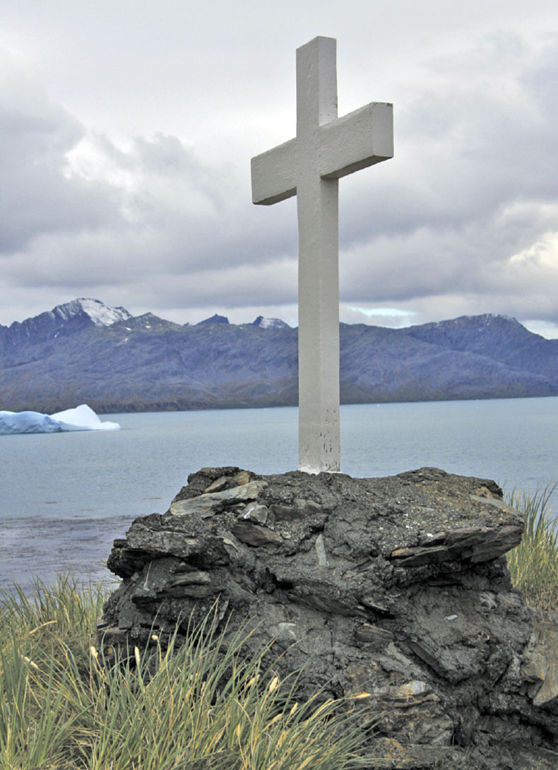
Photo Credit: Susan R. Eaton, P.Geol., P.Geoph.
In February and March 2010, I joined the scientific crew of the Elysium Visual Epic Expedition (the “Expedition”), participating in an historical voyage of exploration and discovery. For nineteen days , the Elysium Team — comprised of 57 Explorers from 19 nations — retraced the route of Sir Ernest Shackleton’s Imperial Trans-Antarctic Expedition of 1914-17, a journey that went horribly sideways when the Endurance was crushed by ice and sank, precipitating one of the greatest survival stories of the twentieth century.
Our mission was to undertake scientific studies and to document the impacts of accelerating climate change — both above and below the water — on the planet’s last remaining Frontier. During the past 50 years, the Antarctic Peninsula has increased in temperature by 3°C, or more than twice the world's average warming trend. Because the Antarctic Peninsula has experienced the greatest temperature increase of any place on the planet, it's an ideal outdoor laboratory to study climate change.
The Expedition’s deliverables — a feature film, a TV documentary, a photographic essay book, and a permanent photographic archive — will be rolled out in 2014, during the centennial celebrations of Shackleton’s epic journey. In the spring of 2011, the Maritime Museum in Greenwich, England, will host a photographic exhibit of the Expedition’s epic images of Antarctica and South Georgia.
A chance-of-a-lifetime opportunity, participation in the Expedition marked the confluence of my career and divergent life pathways — geology, geophysics, marine biology, journalism, photography, scuba diving, and environmental advocacy — which flowed seamlessly together amidst the backdrop of this mysterious, ice-clad continent and its frigid waters teeming with wildlife.
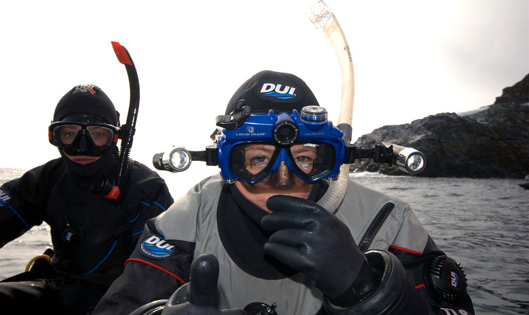
Photo Credit: Emory Kristof, USA.
During my audition for a coveted spot in the Expedition, I waxed poetically about the ground-breaking science conducted by geologists and geophysicists who had played key roles in Shackleton’s polar expeditions. And, I pitched my vision of recreating the role of the ship’s geoscientist, one hundred years later, providing an unique perspective to the discussions of climate change, glaciology, and oceanography. The Elysium Scientific Crew also included Dr. Toni Williamson, a Toronto-based, Australian geologist whose doctorate studies involved a paleo-environmental assessment of climate change during the Early Cretaceous System of Australia.
Just as in Shackleton’s era, mounting an expedition to Antarctica and South Georgia was an incredibly expensive undertaking. In fact, Shackleton continued to fundraise even after the Endurance had sailed from England. My vision to participate in the Expedition was widely supported through corporate partnerships and by generous individual donors. I also received crucial financial support from geoscience organizations, including the Canadian Society of Exploration Geophysicists (CSEG) Foundation, the American Association of Petroleum Geologists (AAPG) Foundation, the Association of Professional Engineers, Geologists and Geophysicists of Alberta (APEGGA), and the Canmore Museum and Geoscience Centre (CMAGS). My Antarctic dispatches were published by the Calgary Herald, the supporting geoscience associations, and the earth science departments of Dalhousie University (my alma mater) and the University of Calgary, enabling readers to explore Antarctica and South Georgia with me.
As a member of the Elysium Scientific Crew, I worked alongside the world’s preeminent scientists from the Australian Antarctic Division and the Woods Hole Oceanographic Institution, movie makers, photographers, artists, musicians, historians, scuba divers and explorers, including National Geographic’s Photographers-in- Residence Emory Kristof and David Doubilet. Kristof is famous for discovering the Titanic with National Geographic’s Explorer-in-Residence Robert Ballard. In 1977, Kristof was the first to document the existence of hot water volcanic vents off the Galapagos Rift, and the unique life forms that they support.
Kristof travelled to Antarctica to investigate the shipwreck of the Antarctic which sank in 1903, in 3,000 feet of water in the Weddell Sea. According to Kristof, remotely operated vehicles (ROVs) and autonomously operated vehicles (AOVs) would be needed to explore under the pack ice for the Antarctic. In other words, due to the harsh Antarctic environment, Kristof would not personally dive (in a submersible) and photograph the Antarctic, as he had the Titantic.
South of the Antarctic, situated in 10,000 feet of water, lies the Endurance, Shackleton’s threemasted barquentine. Discovery of the Antarctic, said Kristof, would provide the “proof of concept” for state-of-the-art technologies required to mount a multi-million-dollar expedition to find the Endurance.
Unusually heavy pack ice, however, prevented the MV Professor Molchanov — the Expedition’s oceanographic research vessel built by the Russian Institute of Science in 1982 — from entering the Weddell Sea near Paulet Island.
Kristof’s vision of exploration and discovery in Antarctica also included documenting the world’s most southerly hot water vent. Located in an oceanic spreading centre, the hydrothermal vent is geographically close to the Antarctic. The vent’s existence was documented in 2006, by David Mearns, a researcher and shipwreck hunter. Night after night, Kristof and I poured over seafloor maps and images — while sipping fine Argentine Malbecs in the Professor Molchanov’s well-appointed bar — that pinpointed the location of the deep sea vent, enthusiastically discussing how modern-day geophysical methods are used in ocean exploration.
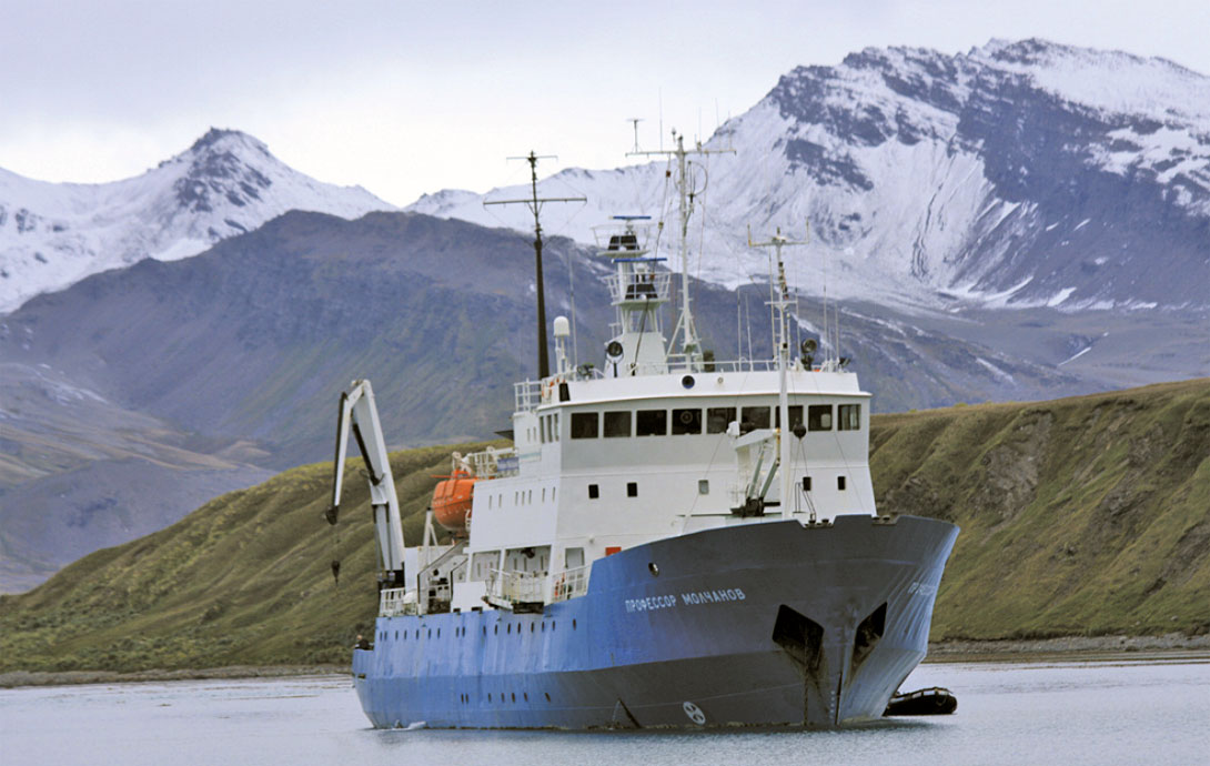
Photo Credit: Susan R. Eaton, P.Geol., P.Geoph.
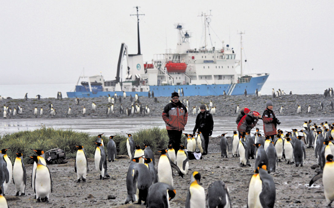
Photo Credit: Susan R. Eaton, P.Geol., P.Geoph.
An Honest Geophysicist in Antarctica
When contemplating a scientific expedition to Antarctica, every honest geophysicist needs to record the unique and diverse sounds of this polar region: glaciers calving into the ocean, and grinding ice (bergy bits, growlers and pack ice). The staff of Calgary-based CGGVeritas shared my vision of exploration and discovery of Antarctica, and generously purchased me a specialpurpose hydrophone — designed originally to record whale sounds — complete with a digital recording system, a waterproof headset, and a software interpretation package.
With grandiose aspirations of breaking into the film industry, I hoped to use my acoustic recordings to collaborate with Eric Bettens, the Expedition’s official musical composer from Belgium, and with Leandro Blanco, a Spanish movie maker and underwater sound expert.
Equipped with my new hydrophone and 100 metres of cable, I set out to investigate the acoustic signatures of Antarctica. The inaugural day for testing the hydrophone was grey and rainy — Dr. Steve Nicol, an oceanographer and krill expert from the Australian Antarctic Division, commented that in 25 years of visiting Antarctica, it was the first time that he’d ever encountered rain.
On this particular day, we were exploring the Antarctic Peninsula at Pleneau Bay, and travelling through a spectacular area called the “Iceberg Graveyard.” Originating in the Ross Sea, these icebergs were transported via the Circumpolar Current, eventually running aground in the shallows of Pleneau Bay. In addition to the trapped icebergs, Pleneau Bay featured massive glaciers cascading down to the ocean. Cruising the coastline by zodiac, we were dwarfed by towering fortresses of blue ice which were heavily dissected by deep crevasses. And, we were awestruck by the thunderous claps as ice calved off the glaciers, crashing into the ocean.
Dressed for extreme snorkelling — with the headset over my neoprene dive hood and a polar fleece hat over the hood for extra warmth — I began to record the otherworld sounds of capsizing ice bergs, the grinding of a gin-and-tonic pack ice concoction, and the mini-tsunami waves precipitated by glaciers collapsing into the ocean. I was keen, as well, to record the songs and growls of Humpback whales and Leopard seals that we had spotted earlier near the zodiac.
I was just getting used to operating the hydrophone with my cumbersome dive gloves when Murhpy’s law intervened...
Ironically, I recorded the hydrophone’s final sounds when it violently struck the zodiac’s propeller, an especially horrible sound because the hydrophone was worth about $800. I quickly hauled in the frayed remains and reassessed the equipment situation – by my estimate, I now had about 95 metres of cable, minus the hydrophone...
In hindsight, I had misjudged the importance of the English- Russian translation between me and the zodiac driver: the first time I lowered the hydrophone into the ocean, I’d waved my arms wildly, pointing at the hydrophone and then at the zodiac’s propeller. Apparently lost in translation, my attempts at universal body language had failed miserably, as the zodiac driver gunned the throttle without notice, abruptly ending my nascent experiment at recording the underwater sounds of Antarctica.
Pilgrimage to Shacklteon’s final resting place...
During our voyage of exploration and discovery, we visited Grytviken, an abandoned Norwegian whaling station in South Georgia that is littered with whale vertebrae and rusting rendering tanks. Home to the British Antarctic Survey research station, Grytviken is linked to the outside world by the Internet, and is populated by thirteen Britons and countless King penguins, Fur seals, and Elephant seals.
On January 5, 1922, shortly after the start of the Quest Expedition of 1921-22, Shackleton died in Grytviken of a heart attack. He was 47 years of age. We visited Shackleton’s gravesite — located in a small cemetery surrounded by a white picket fence and patrolled by King penguins — enthusiastically toasting this great Irishman’s accomplishments with Jameson Irish Whiskey. Respectfully, I poured the last dram of my whisky on his grave.
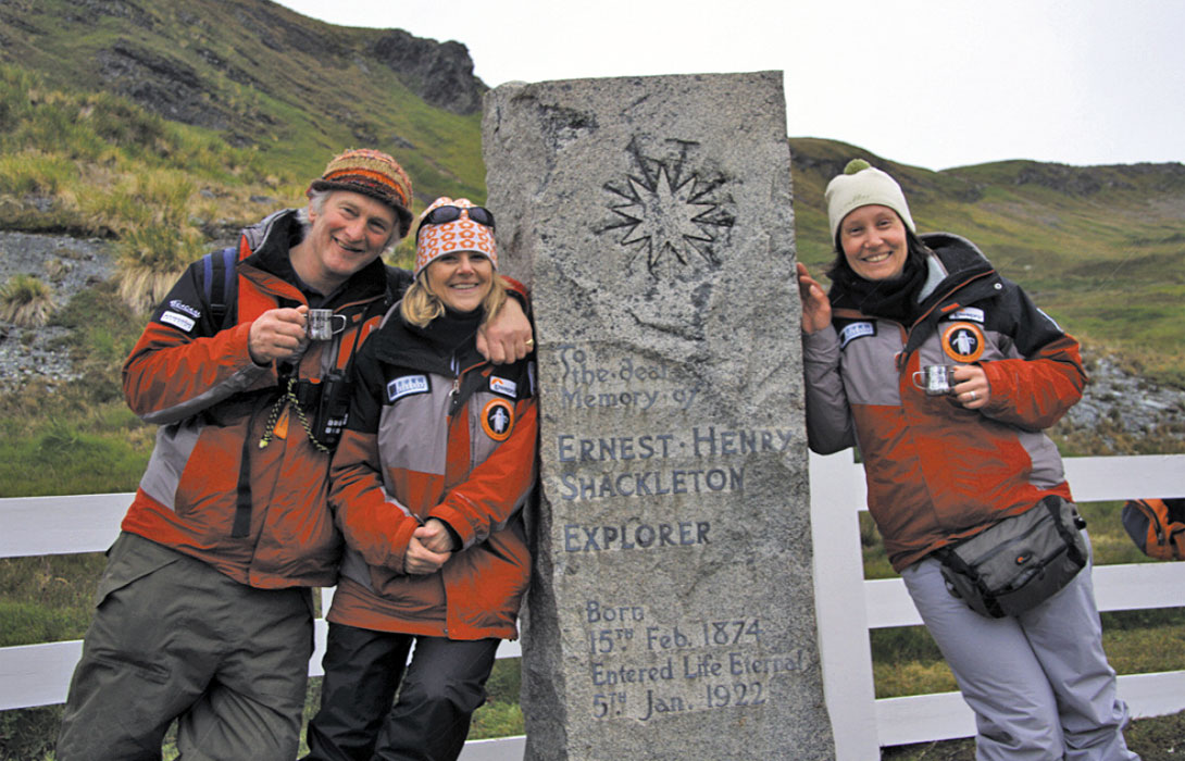
Photo Credit: Susan R. Eaton., P.Geol., P.Geoph.
Running the gauntlet of Antarctic Fur Seals who lunged at us from hiding places in hummocky grass tussocks, we made the pilgrimage to Shackleton’s memorial cairn and cross situated on an exposed hilltop at the entrance to Grytviken Harbour. In the lead was Jonathan Shackleton, an Irish organic farmer, author, and cousin to Sir Ernest. Erected in 1922 by George Vibert Douglas, a Canadian geologist and the Quest Expedition’s chief scientist, the memorial cross faces Magnetic South Pole which was discovered during Shackleton’s Nimrod Expedition of 1909.
Secreted inside the cairn was a scroll bearing the stamp of the Royal Geographical Society. Jonathan Shackleton unfurled the scroll and, with an historical sense of place and purpose, read aloud the names of the Quest Expedition’s crew to the Elysium Team of twenty-first century explorers who had been humbled by following in Shackleton’s footsteps, one hundred years later...
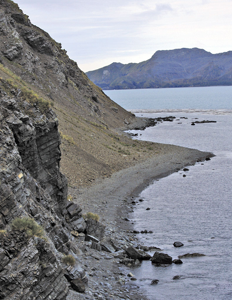
Photo Credit: Susan R. Eaton., P.Geol., P.Geoph.


Join the Conversation
Interested in starting, or contributing to a conversation about an article or issue of the RECORDER? Join our CSEG LinkedIn Group.
Share This Article